Hi Don,
In your case it’s perfectly reasonable to take some time (i.e. cruising years) to decide what you really need, what you really want, and to then decide on some compromise between the two. We’ve met many experienced, smart long distance cruisers and Loopers who navigate with just a big tablet and AquaMap. You also need a depth finder (a digital $79 unit is fine), and a ship VHF (25W) and HH (5w). Add a lot for cruising AK waters.
Once you download AquaMap or Navionics etc maps for your regions of planned travel, the tablet does not need or use a cell signal (just the downloaded map data and the tablet GPS chip). The maps will take up a bit of storage on the tablet, but not much. These tablet apps are so cheap (compared to Big Five display media) that it’s reasonable to use more than one app if you like for ‘redundancy.’
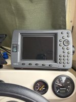
AI says your Garmin 2006C has a ‘built in world baseline’ map, so if that’s not popping up it’s a goner. No surprise.
If you decide you want radar, CHIRP/SONAR, video feeds, FLIR images or other moving images other than cartography, it will require buying the top of the line MFD series from whichever Big Five maker you choose. You can’t connect a Garmin display and a Raymarine radar etc. Each Big Five maker uses a proprietary protocol and ethernet plug. Tom has the Garmin GPSMAP series ($1,200) because it’s required to see his Garmin radar image. The same display size Garmin ECHOMAP is only $600, but won’t do radar etc as above. If you’ll never need radar and that other stuff, the GPSMAP series would be a waste of money for you.
The OTHER marine comm system between MFDs and sensors is the N2K backbone, a five-pin round plug than can transmit any information that is a digit….temp, depth, RPM, GPH, MPG, AIS data (CRUCIAL!), Time to Next Turn, etc. Garmin’s N2K backbone is $69. The system was engineered to be compatible with any other N2K sensor maker, but in practice not so much, so don’t even try to connect a Garmin MFD to a Garmin ducer with a $49 Raymarine N2k cable just to save $20 just because it should be compatible.
We are giving up radar after 15 years (SONAR/CHIRP images we still have but could do without). I gave our Garmin HDX24 radar to a dockmate for free. It interferes with removing the rooftop AC shroud to clean the coils, we are going up to do the Triangle Loop again and need an under 8 ft air draft, and we never really found radar nearly as useful as send/receive AIS as a practical matter in all our cruising. For us, radar mainly painted targets that were over three miles away and of no concern. MANY other experienced cruisers disagree with us on this option. YMMV as always.
We would choose send/rec AIS any day over radar for long range cruising or Looping (which means you might could choose a cheaper Garmin ECOMAP rather than any Garmin GPSMAP MFD). Many other experienced cruisers disagree with us on this. Unlike them, we can and do simply head for the nearest beach with knee deep water, drop the anchor, wade ashore, and know FOR A FACT that no 70 ft Viking or 1,000 foot barge string is going to hit and sink us there. We don’t think many CD22s in your neck of the woods need or want radar or that other fancy imaging.
I hope something here is helpful. PS we will be heading up to the C&D next month to complete our Loop and then cruise the Triangle Loop into Canada again. See us on NEBO Gold.
Safe Travels, and don’t rush your choices!
John