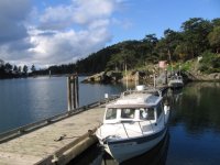
Winter in San Juans

jdower

New member
I am not from PNW area, but I am considering leaving a boat in dry storage at Cap Sante this winter (CD-22 with Wallas). On the assumption that there will be some brief periods in Jan, Feb and March that are suitable for trips out to San Juan Islands. Or should I just wait until the season starts in April/May.

I would appreciate any local knowledge on Winter weather there.
 
You should hear from several skippers on this. I boat all year long and cruise/fish the San Juan Islands often during winter months. Weather prediction in this area is very difficult, and as we have been in a warming trend for several years you should have many opportunities to go that direction.

Dusty
 
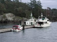
Check out our first birthday cruise on the CD22 Daydream in February 2004 and decide for yourself. Link is here. If the weather is good, this is a GREAT time to be there - no crowds, no competition for dock space, turn the Wallas up and enjoy! Here is a shot of Daydream at the dock at Sucia.

t_Sucia_Dock_1_First_Birthday_Cruise_2_14_04.sized.jpg


jdower":24vi8lxu said:
I am not from PNW area, but I am considering leaving a boat in dry storage at Cap Sante this winter (CD-22 with Wallas). On the assumption that there will be some brief periods in Jan, Feb and March that are suitable for trips out to San Juan Islands. Or should I just wait until the season starts in April/May.

I would appreciate any local knowledge on Winter weather there.
 
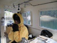
I'm with Pat and Dustry. We love the fall and winter in the San Juans. Like Dusty said the weather is hard to predict but the rewards are wonderful. There is very little boat traffic and the people you do meet are usually enjoying the area for the same reasons.

IMG_0207.sized.jpg

Sucia_31.sized.jpg
 
Our friends who live up there boat year around--and think that the winter is one of the better seasons--especially with a pilot house boat.
 
I have searched the Site, but found nothing that helps answer my question.

So here goes... I am planning to take Joy to Deer Harbor over Thanksgiving. I have charts, but have never cruised in this area. Plans currently are for my 9 yr old grandson and I to boat over and my wife and daughter will ferry over. Could someone with experience tell me the best route and what to look out for as I cross Rosario Strait, how best to get into Deer Harbor from the East. Should I just chase the Ferry?
Thanks Much
 
jdower":hdc73nrv said:
Randy - have you decided where you will be leaving from, or where you will launch ?

I plan to launch at the public launch in Anacortes and we have moorage at Deer Harbor on Orcas Island.
 
There are some excellent San Juan cruising guides (paperbacks) from West Marine that detail the exact spot in the channels, etc, via waypoints as well as discuss alternative routes, things to watch out for, etc..

I have some... Also, the waterproof chartbooks are pretty detailed of the area.

All the guidebooks warn not to chase the ferries and also, not to follow someone else. Best to know where you are, where you are going and to have some emergency sheltered spots in mind in case of a weather or repair surprise.

John
 
As far as Rosario Straight goes, one guide says:

Though only four miles across at its widest point, Roario Straight is a serious body of water. Hazards are well marked, but currents of up to 3 knots are common, the Coast Pilot warns of heavy tide rips and swirls off Black Rock, Obstruction Pass, Peapod Rocks, and Lawrence Point. Anywhere in Rosario, rough conditions result when wind opposes the current.

Rosario is a major shipping lane and more than 500 oil tankers pass through each year, bound to and from the refineries at Anacortes and Cherry Point. Use special caution in fog. The Vessel Traffic System operates the full length of the straight, and monitors Channel 5A.

John
 
Approaches to Deer Harbor, per Migael Sherer's guide:

"Pole Pass, the channel between Orcas island and Crane Island: The cleanest approach from the East is South of Bell Island, seems impassable at first glance. However, it is well marked and commonly used. The rocks on the north side of the pass are marked with a red "2". On the southwest is a jetty. The pass is only about 150 feet wide, but deep in mid channel. Expect current to be strong here. Once through the narrowest portion favor the Orcas island side.
...INside Deer Harbor, stay at least 300 yards off the east shore in order to avoid the shoals."

John
 
drjohn71a":3creqrfu said:
There are some excellent San Juan cruising guides (paperbacks) from West Marine that detail the exact spot in the channels, etc, via waypoints as well as discuss alternative routes, things to watch out for, etc..

I have some... Also, the waterproof chartbooks are pretty detailed of the area.

All the guidebooks warn not to chase the ferries and also, not to follow someone else. Best to know where you are, where you are going and to have some emergency sheltered spots in mind in case of a weather or repair surprise.

John

John
Thanks so much. I appreciate you doing the research for me. I read the same thing about Rosario St. and the ferries, but thought I would seek some c-dory experienced folk also.
Again thank you.
 
Randy, we winter cruise in the San Juans often. If you are going to launch at Washington Park or Skyline I would head across Rosario thru Thatcher Pass, Harney Channel, Pole Pass to Deer Harbor. I would not follow the ferry. In any kind of seas you will not be able to keep up with it.
If launching from Cap Sante or Twin Bridges I would go around the east side of Guemes Island, across the north side of Cypress Island, across Rosario thru Pevine Pass, Harney Channel, Pole Pass to Deer Harbor. By going this way you avoid the traffic and sloppy water of Guemes Channel.
I would avoid Rosario with the tide going out and the wind from the south, wait for the tide to turn. Hope this helps.

Fred
 
Ditto what Fred said. Especially the part about going up the east side of Guemes Island if you're coming from Twin Bridges. Guemes Channel can get pretty sloppy and then you have to contend with Rosario, which sometimes is very challenging. Fred gave us that tip this past summer and it made crossing Rosario much more bearable. Thanks Fred.

Deer Harbor is beautiful and don't worry, Pole Pass isn't as small as it looks :wink

Peter
 
John of "Joy" - The reason I have all those guidebooks is that I am planning on cruising up there between Dec 21 and Dec 30 this year. I am not certain exactly when Deer Harbor will be reached, but figure I'll run into a C-Brat or two on the way. I'd love to have a boat waiting up there in Deer Harbor for me.

John
 
Folks, It probably wouldn't take too much more promotion to make this a Deer Harbor/San Juan Islands Mini C-Brat Get Together! We're thinkin' Anybody else interested?
 
Dreamer":2xfrjjhd said:
Folks, It probably wouldn't take too much more promotion to make this a Deer Harbor/San Juan Islands Mini C-Brat Get Together! We're thinkin' Anybody else interested?

We will be at Deer Harbor on the Tuesday 21 Nov and return to Anacortes on the following Sat. I plan to cruise around (weather permitting) and go to Friday HArbor and hopefully find the whales. This is our first time in that part of the country so if anyone else wants to join us we would welcome it.
Randy
 
Joy... I, too, would like to see the Orcas up there. I read that the transient groups are mainly there in the Spring, that one group stays in the area, and that another group migrates 100 miles North of there in the winter. So, do any San Juan natives know what luck we may have in seeing some Orcas in Nov. and Dec.?

John
 
John, it looks like you have a Raymarine integrated system on Joy...get the free Raytech Planner, plot the course from Anacortes to Deer Harbor (I agree with Fred and Peter's recommendation on crossing Rosario) on your computer, transfer to your Raymarine chartplotter, and just follow your course. You can also enter waypoints and routes directly into the Raymarine, but using the computer is a LOT easier. Waypoints and routes on your chartplotter are great - you can see where you are and where you want to be going, as well as hazards to avoid. Have paper charts and compass too, but take advantage of modern technology.
 
Back
Top