Pat Anderson
New member
- Joined
- Nov 2, 2003
- Messages
- 8,562
- Reaction score
- 0
- C Dory Year
- 2005
- C Dory Model
- 25 Cruiser
- Vessel Name
- Daydream
OK, this is for our iPad-less friends. Those of you who already have your iPad know all this, but the more I use this app, the more amazed I am at just how capable it is.
We have a 16GB 3G original iPad 1. All these screen shots are from the $15 Navionics US & Canada iPhone app, which runs great on the iPad and renders charts nicely because they are vector charts.
This is all from my planning / dreaming for the Great Loop in 2014. We need to do the GL in chunks over a couple of years because we need to come home every couple of months to see our granddaughter. Leg 1 probably starts in Paducah, KY, and goes to Apalachicola, FL.
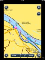
I started with a marker in Paducah, added to Favorites, so I can quickly get to that point on the charts no matter what else I am doing. The marker is the push pin.
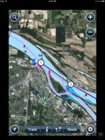
If you like, you can overlay the chart with the Google satellite view.
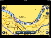
You can enter routes, and each route can have up to 99 waypoints. This route is from Paducah to Kentucky Lake via the Cumberland River. Here is the start...
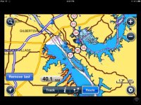
...and the end.
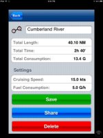
You can easily access route information.
Tapping the little i takes you to this screen
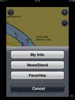
...and tapping Favorites takes you to this screen
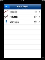
where you can quickly access all your markers and routes. As you can see, I have 75 markers and 27 routes entered here, all parts of the Great Loop.
I have not played with tracks yet.
Naturally, I have the same app and chart data on my iPhone!
We have a 16GB 3G original iPad 1. All these screen shots are from the $15 Navionics US & Canada iPhone app, which runs great on the iPad and renders charts nicely because they are vector charts.
This is all from my planning / dreaming for the Great Loop in 2014. We need to do the GL in chunks over a couple of years because we need to come home every couple of months to see our granddaughter. Leg 1 probably starts in Paducah, KY, and goes to Apalachicola, FL.
I started with a marker in Paducah, added to Favorites, so I can quickly get to that point on the charts no matter what else I am doing. The marker is the push pin.

If you like, you can overlay the chart with the Google satellite view.

You can enter routes, and each route can have up to 99 waypoints. This route is from Paducah to Kentucky Lake via the Cumberland River. Here is the start...

...and the end.

You can easily access route information.

Tapping the little i takes you to this screen

...and tapping Favorites takes you to this screen

where you can quickly access all your markers and routes. As you can see, I have 75 markers and 27 routes entered here, all parts of the Great Loop.
I have not played with tracks yet.
Naturally, I have the same app and chart data on my iPhone!
