You are using an out of date browser. It may not display this or other websites correctly.
You should upgrade or use an alternative browser.
You should upgrade or use an alternative browser.
Mae-C: Storm Dog's adventure
- Thread starter thataway
- Start date
thataway
Well-known member
- Joined
- Nov 2, 2003
- Messages
- 21,691
- Reaction score
- 63
- C Dory Year
- 2007
- C Dory Model
- 25 Cruiser
- Hull Identification Number
- DOR25652A707
- Vessel Name
- thataway
Glen is taking a day off--small craft warnings and winds with gusts to 27 knots on the Neuse River. He asked me to post his photos:
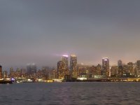
The Skyline of New York from near the Statue of Liberty:
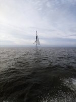
The sunken sailboat near anchorage:
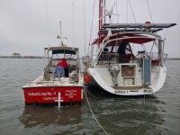
Boat US with Diver clearing the too close sailboat who fouled Glen's anchor rode!
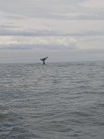
Whale tail!
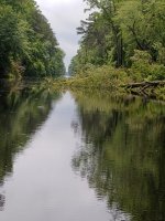
Tree across wateway:
Mayo Landing NC, where Glen is taking the day "Off".
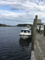
The Skyline of New York from near the Statue of Liberty:

The sunken sailboat near anchorage:

Boat US with Diver clearing the too close sailboat who fouled Glen's anchor rode!

Whale tail!

Tree across wateway:

Mayo Landing NC, where Glen is taking the day "Off".

Storm Dog
Member
- Joined
- Jan 6, 2020
- Messages
- 65
- Reaction score
- 1
- C Dory Year
- 2007
- C Dory Model
- 25 Cruiser
- Hull Identification Number
- CD025240H607
- Vessel Name
- Mae-C
Made it to Sloop Point last night, near Surf City, NC. using Skipper Bob guide to anchorages on the ICW. Really have to keep an eye out for spots if you want to anchor out mostly. I found the mileage markers in the guide useless. I have to find a place based on a name of area, community, or geographic feature. I had to wait around 3 hrs as Camp Lejuene closed the waterway due to live fire exercises. Amazing to look at all the destroyed armored personnel carriers on the banks and in the water, they were like swiss cheese for all the rounds they took. I'll head towards Cape Fear today, if I make it that far. I might be coming up this week for my motor's 100 hour service. What to do? what do folks do when traveling and that type of service is required? Any estimates on what it wil cost? I would do it myself, but with limited tools and being on the water. Any suggestions?
Glenn
Glenn
thataway
Well-known member
- Joined
- Nov 2, 2003
- Messages
- 21,691
- Reaction score
- 63
- C Dory Year
- 2007
- C Dory Model
- 25 Cruiser
- Hull Identification Number
- DOR25652A707
- Vessel Name
- thataway
My suggestion is to have ti pumped out in the water. West Marine, and internet have vacuum extractors which allow you to put a tube down into the oil sump. I used one of those on my last oil change on the 150, and less than a couple of oz was left, when I opened the drain plug. You can change oil filter every 200 hrs--same with the lower unit.
If you have to haul the boat on a travel lift, block it etc that is going to be pricey.
If there is a C Brat in the area with a 25' trailer who would volunteer to let you use it for a couple of hours, you could do a change in the parking lot--(and that would include a lower unit (but should have new o rings).
Typical is about $200 or a bit more. for a shop. If you have to use a lift, it may be closer to $500. There is a looper who I told could use my boat lift and we would do the oil change at my house, including the lower unit.
If you were running all at displacement mode, I would say skip the 100 hr, and go to 200 hrs. But you have been making tracks.
Quick internet search shows Carolina Beach Boat Yard & Marina. They have a travel lift and advertise outboard service: ( N34 2.533 W077 53.531) 910-707-1007.
BellHart Marine has a Cape Fear yard, and do Yamana and Mercury outboards. 910.452.7878
Give them of them a call.
Storm Dog
Member
- Joined
- Jan 6, 2020
- Messages
- 65
- Reaction score
- 1
- C Dory Year
- 2007
- C Dory Model
- 25 Cruiser
- Hull Identification Number
- CD025240H607
- Vessel Name
- Mae-C
3 Jun 20, Still at Carolina Beach NC. Waiting for the winds to die down or change direction. I'm unable to get out of the final 11 - 12 miles stretch of the Cape Fear river. Windblown waves and current too gnarly. I anchored near the beach yesterday, along with a few sailboats, the boat swinging 120 degrees for 24 hrs became too much. Left and went to Carolina beach state park. Felt like a pinball for a while coming into the marina with all the wind, but $34 for a slip and water, 30 amp. Hiked along Snow's Cut to the grocery store through a forest. Nice walk. I'll see if the weather gives me a green light tomorrow.
Glenn
Glenn
South of Heaven
New member
- Joined
- Aug 15, 2015
- Messages
- 1,459
- Reaction score
- 0
Wow! Just saw this thread now. What an adventure. Nice job Captain.
smckean (Tosca)
New member
- Joined
- Jan 18, 2014
- Messages
- 975
- Reaction score
- 0
- C Dory Year
- 2005
- C Dory Model
- 25 Cruiser
- Vessel Name
- Tosca
Makes me think of one of the most "fear" laden movies ever...."Cape Fear" from 1991 directed by Martin Scorsese and starring Robert De Niro. De Niro is chilling! The movie is unbelievably scary....without being overly overt about it. (The original was in 1962 with Robert Mitchum....I've seen both, but Scorsese's is a major cut above).
It you haven't seen it, you should :wink:. Kind of Scorsese meets Hitchcock.
It you haven't seen it, you should :wink:. Kind of Scorsese meets Hitchcock.
Storm Dog
Member
- Joined
- Jan 6, 2020
- Messages
- 65
- Reaction score
- 1
- C Dory Year
- 2007
- C Dory Model
- 25 Cruiser
- Hull Identification Number
- CD025240H607
- Vessel Name
- Mae-C
I made it to wacca watchee marina a couple hours ago. flew through most of Cape fear river, the last couple miles kicking up its heals, but made it with reduced speed. Stopped at Barefoot Landing for lunch and a walk about, decent tacos and walked some of their extensive little shop area. Impressive. Only servers and store employees wearing masks. Separation is practiced.
Going through Myrtle Beach area, discovered miles of ICW homes flooded by the river. Stopped by the sheriff's boat they told me to go slower, I was doing 5. I tried going 2 1/2 but current and breeze stalled my headway. So I compromised with 3 1/2. At least I didn't catch up with the stealth pace jonboat that ws 2-3 hundred yards in front of me. When I was well passed all the houses, the jonboat ducked into the trees to await another boat.
I was told N. Carolina opened the dam. Even the marina had 2-3 ft water in their parking lot. I had to pass on a couple anchorages as I didn't trust my 105' rode with 15" chain. 20' water was now 32', with a river current. Ill be uploading pics to my album eventually. My sister in Florida sternly warned me about the tropical depression in the gulf and insisted i make plans to store the boat and get a motel.
thataway
Well-known member
- Joined
- Nov 2, 2003
- Messages
- 21,691
- Reaction score
- 63
- C Dory Year
- 2007
- C Dory Model
- 25 Cruiser
- Hull Identification Number
- DOR25652A707
- Vessel Name
- thataway
At this point, the tropical depression does not seem to be a threat to you. The storm is still over the land in Mexico. Land fall is predicted Sunday late evening or early morning Monday near Morgan City/ Lafayette LA. The storm is projected to go up the Mississippi Valley, and not cross toward the East Coast.
At this point we are prepared for some more rain in Pensacola, but wind should be well below tropical storm force in our area. Never trust a hurricane however!
At this point we are prepared for some more rain in Pensacola, but wind should be well below tropical storm force in our area. Never trust a hurricane however!
Storm Dog
Member
- Joined
- Jan 6, 2020
- Messages
- 65
- Reaction score
- 1
- C Dory Year
- 2007
- C Dory Model
- 25 Cruiser
- Hull Identification Number
- CD025240H607
- Vessel Name
- Mae-C
Came to Charleston today and ate lunch on the water off Ft Sumpter, where the Civil War started. Neat historical area. Lots of recreational boats and families on the island having fun on the beach and swimming. Anchored in Church Creek, near Hollywood. About 3 hrs outside Charleston. I did get turned around in Charleston harbor and lost sight of the ICW. After taking pictures of Sumpter, a Confederate fort, and the carrier Intrepid, I finally found the exit at Ashley River.
Now I'm just sitting here waiting for a storm front to hit I've been tracking on Windy. 111 Miles today, 1111 total miles.
Storm Dog
Now I'm just sitting here waiting for a storm front to hit I've been tracking on Windy. 111 Miles today, 1111 total miles.
Storm Dog
hardee
New member
- Joined
- Oct 30, 2006
- Messages
- 12,637
- Reaction score
- 2
- C Dory Year
- 2005
- C Dory Model
- 22 Cruiser
- Hull Identification Number
- Brat # 2202
- Vessel Name
- Sleepy-C
Storm Dog
Member
- Joined
- Jan 6, 2020
- Messages
- 65
- Reaction score
- 1
- C Dory Year
- 2007
- C Dory Model
- 25 Cruiser
- Hull Identification Number
- CD025240H607
- Vessel Name
- Mae-C
I have a Garmin Echomap 54 dv. It's kind of dated (2016) but I do have Aqua Map on a 9.6 IPad pro. I was able to find the icw continuing by checking all rivers & such till I found it labeled to the west. This morning, I plainly found it in the 2019 ICW cruising guide by bob 423. Too bad I missed it yesterday.
Concerning Aqua Map, it drains the ipad of power in 3-4 hours. The ipad needs alot of current to charge up at any substantial rate. I'd have to start the generator and charge from a 2.4 amp usb power strip. By the way I happened to find icw mile markers every 5 miles in red on its zoomed in map. They're absent on the Garmin.
Breaking News!
Storm Dog and Mae-C no longer in a hurry to get to the Gulf!
Glenn
thataway
Well-known member
- Joined
- Nov 2, 2003
- Messages
- 21,691
- Reaction score
- 63
- C Dory Year
- 2007
- C Dory Model
- 25 Cruiser
- Hull Identification Number
- DOR25652A707
- Vessel Name
- thataway
The Ashley River entrance is hard to find. There is a great anchorage (or was in 1983 and 84) just after the bridge .
There are a number of cig lighter plug adaptors which will keep the I pad charged up as you go. We have 3 built in dual USB charging ports, which put out 2.4 amps each. There is a 2 hour timer (just push a button) for the entire USB charging circuit. Ports are at the helm, at navigator's station (on dash back splash) and top of hanging locker.
The Tropical storm should should not effect you at this time. Best to continue to make tracks, and get to Biloxi ASAP. The effects in the Gulf are going to be mostly Storm surge--this just means some waves, and higher than normal tides. Even in Pensacola, we don't expect any severe winds. We are already getting outer bands of rain.
Gulfcoast John
Active member
- Joined
- Dec 14, 2012
- Messages
- 1,147
- Reaction score
- 4
- C Dory Year
- 2010
- C Dory Model
- 255 Tomcat
- Vessel Name
- CAT 'O MINE
Hi Glenn!
Eileen and I think you likely have the roughest portions of your Adventure behind you. In June 2018, we had 7 weather SCA days in 6 weeks on the Chesapeake, 3 of them Gale Warnings. Last June we cruised from Jacksonville NAS to Wacca Weechee marina one-way. I concur the milage markers in Skipper Bob are pretty useless unless you reset your GPS odometer, do the math and note it in the book. Otherwise a pretty good guide.
I think navigation aids between the Ashley River and Cumberland Island were somewhat challenging (at 25-30 MPH). Lots of 90 to 270 degree surprising turns into what looks like a tiny creek (cuts between the large rivers) vs other nav aids leading out to sea. Granted the ICW aids have a small yellow marking on them, but it can be hard to see if it’s rough. Use extra care crossing the Savannah River and St John’s River...lots of giant freighters (and car carriers at Brunswick) and they can move surprisingly fast. Crossing Mobile Bay with a strong North wind can be ‘sporting’ but North winds are rare here in summer.
Georgia tides can be 10 vertical feet or more. We’re not used to that (we lived in Ocean Springs for 22 years before moving to Pensacola in 2017).
Keep your VHF vol up on CH16 way in advance of approaching Kings Bay Naval Sub Base south of Crab Island north of St Marys, GA. A nuclear sub coming or going to sea will be referred to as ‘A Navy Asset’ with patrol boats around it. All civilian marine traffic must clear the area. Max delay should be 30-60 minutes if it happens.
The Big Bend Gulf section is not protected ICW, but is often calm if there’s not a tropical storm to worry about. At Apalachicola you enter the protected Gulf ICW. The sea breeze often kicks in about 1130 with thunderstorms at max heating around 3pm, just like Biloxi.
If you like to anchor out, just west of Pensacola Pass is Sherman Cove marina where Cat O’ Mine is docked. A nice protected cove marked ‘spoil area’ is between Ft McCrae (McCree or McRee on some charts) and the tall white sand spoil island. Enter only from the west, between the No Wake signs. We’d be glad to give you a ride to WalMart or Publix if you need to re-provision and are still quarantining on a 25 foot boat 99 miles from the Biloxi Channel entrance. Base entry requires DoD ID or an escort. Sherman Cove has E-0 gas. PM sent with my cell number.
You’ve got this. Stay safe and well-rested enough that you don’t make unforced errors.
John
Storm Dog
Member
- Joined
- Jan 6, 2020
- Messages
- 65
- Reaction score
- 1
- C Dory Year
- 2007
- C Dory Model
- 25 Cruiser
- Hull Identification Number
- CD025240H607
- Vessel Name
- Mae-C
Thanks all for the great advice. Anchored New River just off Daufuski Island, SC. Crossed a couple of sounds today. Boy were they angry! They tossed my salad for me! Some slow going and Mae-C had a water baptism. Splashed and sprayed! Went to get a well deserved meal at Lucy Bells, but they were already closed. By 5pm. The rest of the island accessible by golf cart. I didn't have one. Oh well. Looks like ham & cheese tortilla tonight. By the way, these horse flies are impacting my screens to get at me! Like mosquitoes on steroids!
Glenn
Glenn
Gulfcoast John
Active member
- Joined
- Dec 14, 2012
- Messages
- 1,147
- Reaction score
- 4
- C Dory Year
- 2010
- C Dory Model
- 255 Tomcat
- Vessel Name
- CAT 'O MINE
Glenn,
You missed your chance on Dafuskie for a very nice $18 chili-dog, $4 bag of chips and a $6 single scoop of ice cream with a near mandatory $5 tip. So Sorry!
You can also get them at Hilton Head, Kiawah, St Simon, Little St Simon (you can get a very nice sea island camping experience for only $11,000 a week on this private island), Sapalo or 2 nights at Greyfield on Cumberland with meals for $1,000 plus tips (and $9 each for a Bud Lite). We really enjoyed 2 nights at the latter at half price one July, I must admit. Ancient plumbing and some shared bathrooms. But I digress.
If you are willing to have a marina night, I rec'd
https://brunswicklandingmarina.com/amenities/
They have a free wine and beer social every M/W/F night. If you drink enough...never mind. Superb wi-fi. Free laundry. Hurricane hole marina. Reasonalble prices, and GA generally has the least state gas tax around. Free bikes with basket to Winn Dixie. Brunswick is a fairly nitty gritty down on its luck town compared to Beaufort, and the prices reflect that, but the marina is well patrolled and safe.
Stay Safe,
John
hardee
New member
- Joined
- Oct 30, 2006
- Messages
- 12,637
- Reaction score
- 2
- C Dory Year
- 2005
- C Dory Model
- 22 Cruiser
- Hull Identification Number
- Brat # 2202
- Vessel Name
- Sleepy-C
thataway
Well-known member
- Joined
- Nov 2, 2003
- Messages
- 21,691
- Reaction score
- 63
- C Dory Year
- 2007
- C Dory Model
- 25 Cruiser
- Hull Identification Number
- DOR25652A707
- Vessel Name
- thataway
In our area we have about 1' storm surge, wind not over 20--Toronado warning across the bay in Baldwin CO. AL. We have been looking out and not seen any funnel clouds. Should be making landfall shortly and pass just to West of New Orleans.

