Ron-

The main body of the lake still looks pretty good, despite low water!
Please also view the several photos below the text!
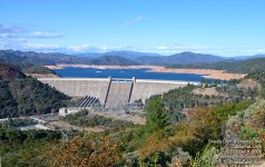
Lake Shasta is currently 155 feet down from the high water mark!
The launch ramp at Bridge Bay is ~300 yards long!
It has less than 1/3 of the volume of water in it than it does when it's full!
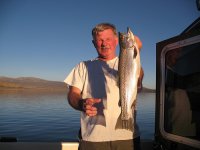
Still and all, the fish are concentrated, and the fishing is fair, depending on weather other variable factors.
The lake is still "cruiseable", but not nearly as nice as with more water.
The recent warm weather has made for nice 70+ degree days, with the nights in the mid 30's to mid 40's.
The major arms of the reservoir are still "cruiseable", but not nearly as pretty as with more water in them.
The shores are mostly muddy, and sandy beaches are scarce.
I can park my 4WD SUV half way down to the water level from the high water mark, but it still takes 10 minutes to walk to my two boats in Marina 1 by the Pit River Bridge.
If you're coming down I-5, get off at Bridge Bay Marina exit (not at the earlier Lakeshore/Lakehead exit on the Scacramento arm (no lake there, just the river), and look around and decide what you want to do.
Here's some more information on the lake I usually forward to folks inquiring about the lake:
The lake is shaped like your right hand, palm down, with the dam at the end of your thumb, and four major arms.
For the most part, it looks much the same no matter where you’re at, so there isn’t any need to throughly explore each and every arm and cranny unless you want to!
The McCloud Arm is the prettiest, though, because of the Gray Rocks (limestone) that surround it. A trip up to the McCloud Arm would give you an idea of what exists all over the lake.
The limestone rocks house “Shasta Caverns” on the McCloud arm about 3 miles up from the Pit River Bridge on I-5. They are much like Carlsbad Caverns, although much less developed. You can dock your boat at their dock below the caves on the East side of the lake, and ride up to the caverns in their bus. Takes 2-3 hours and costs about $20-25 per person.
The Pit River Arm was not cleared of trees when the lake was formed to provide fish with cover, so you will find it full of tree shanks and their limbs, although much of these are covered at very high water. Pretty in it’s own right, though!
The Sacramento Arm is also interesting and pretty, but really doesn’t offer anything unique you won’t see elsewhere on the lake.
Cruising down to the main body by the dam is a nice trip, too.
I launch at Bridge Bay, where I have two slips. The launching is $10 and parking is $5/day.
Let me know if you have questions!
Joe. :teeth :thup
We're three times lower than this right now!
Dropping water levels expose non-so-pretty shores!
We see a lot of this type of exposure right now up the side canyons and arms!
Houseboating is different with less water!
We're back to the 1992 level, again, right now!
This is the water level in the Fall of 1977, when it was at it's lowest ever since originally filling.
A 1977 photo again, and this may be where we're heading if the two year drought continues another year!


