Lake Shasta

Ron on Meander

New member
Hey Joe,
Tell us a little about Lake Shasta. It looks interesting from Google and its not too far off our bearing south. Is it worth cruising at this time of year?
Thanks
Ron
 
Ron-

shasta-lake-oct-9-2008-med.jpg
The main body of the lake still looks pretty good, despite low water!
Please also view the several photos below the text!

Lake Shasta is currently 155 feet down from the high water mark!

The launch ramp at Bridge Bay is ~300 yards long!

It has less than 1/3 of the volume of water in it than it does when it's full!

Still and all, the fish are concentrated, and the fishing is fair, depending on weather other variable factors.

The lake is still "cruiseable", but not nearly as nice as with more water.

The recent warm weather has made for nice 70+ degree days, with the nights in the mid 30's to mid 40's.

The major arms of the reservoir are still "cruiseable", but not nearly as pretty as with more water in them.

The shores are mostly muddy, and sandy beaches are scarce.

I can park my 4WD SUV half way down to the water level from the high water mark, but it still takes 10 minutes to walk to my two boats in Marina 1 by the Pit River Bridge.

If you're coming down I-5, get off at Bridge Bay Marina exit (not at the earlier Lakeshore/Lakehead exit on the Scacramento arm (no lake there, just the river), and look around and decide what you want to do.

Here's some more information on the lake I usually forward to folks inquiring about the lake:

The lake is shaped like your right hand, palm down, with the dam at the end of your thumb, and four major arms.

For the most part, it looks much the same no matter where you’re at, so there isn’t any need to throughly explore each and every arm and cranny unless you want to!

The McCloud Arm is the prettiest, though, because of the Gray Rocks (limestone) that surround it. A trip up to the McCloud Arm would give you an idea of what exists all over the lake.

The limestone rocks house “Shasta Caverns” on the McCloud arm about 3 miles up from the Pit River Bridge on I-5. They are much like Carlsbad Caverns, although much less developed. You can dock your boat at their dock below the caves on the East side of the lake, and ride up to the caverns in their bus. Takes 2-3 hours and costs about $20-25 per person.

The Pit River Arm was not cleared of trees when the lake was formed to provide fish with cover, so you will find it full of tree shanks and their limbs, although much of these are covered at very high water. Pretty in it’s own right, though!

The Sacramento Arm is also interesting and pretty, but really doesn’t offer anything unique you won’t see elsewhere on the lake.

Cruising down to the main body by the dam is a nice trip, too.

I launch at Bridge Bay, where I have two slips. The launching is $10 and parking is $5/day.

Let me know if you have questions!


Joe. :teeth :thup

lake05b-01.jpg

We're three times lower than this right now!

lake05a-01.jpg

Dropping water levels expose non-so-pretty shores!

lake_shasta01.jpg

We see a lot of this type of exposure right now up the side canyons and arms!

lake_shasta05.jpg

Houseboating is different with less water!

DAMLEVEL.jpg

We're back to the 1992 level, again, right now!

lake_shasta07.jpg

This is the water level in the Fall of 1977, when it was at it's lowest ever since originally filling.

lake_shasta04.jpg

A 1977 photo again, and this may be where we're heading if the two year drought continues another year!
 
What did you do with all the water, Joe?

Lake Shasta is currently 155 feet down from the high water mark!

So what you're saying is that at high water those docks are going to be 155 feet further straight up? I don't see any pilings, so what holds them in place?
 
MIke - Joe knows where all the water went. Through the turbines to generate electricity. Now if the good folks in Oregon allowed a big ditch to divert water from the Columbia to cross the state to California, Shasta might fluctuate less. Just kidding Oregonians!

When Shasta is near full pool, it is a very nice boating destination. Folks who boat salt water contend with tides. See both of you hombres this coming week in Seattle. John
 
TyBoo":17urqi0w said:
What did you do with all the water, Joe?

Lake Shasta is currently 155 feet down from the high water mark!

So what you're saying is that at high water those docks are going to be 155 feet further straight up? I don't see any pilings, so what holds them in place?

Mike-

They're held in place by a a web of 5/8" steel cables attached to many 5,000-10,000 concrete blocks on the bottom and shore and tensioned by winches.

Adjusting the cable lengths through the winch blocks that are holding the loads is a constant job, requiring 4-5 men and a large custom floating crane/barge that can also pick up and reposition the blocks.

There are five marinas that make up the Bridge bay Marina along with the rest of the resort (motel, restraunt, store, snack bar, houseboat rental facility, etc.).

Two of the marinas are covered for boats, and three are uncovered for houseboats. There are about 450 slips total.

Both my boats are in Marina 1, by the Pit River Bridge, which is shown in the photos.

My C-Dory is in the middle of the third row, and my Sea Ray is in the slip at the "top" corner of the marina in the slip closest to the bridge. I don't mind the boat, car, and train traffic. Kind of interesting, in many ways.

I can either stay there and see everything that passes by on the lake and bridge, or pull out and go fishing or cruise and get away from everything and anchor out with either boat.

In the summer (May through October, really) we pull the C-Dory and put our 24' pontoon boat in that slip as it's a better water sports platform on a lake with daytime air temperatures of 95-110 degrees. We take the jet ski up there and out with us on the pontoon boat a lot. During that time, the C-Dory does mountain lake duty, like up at Eagle Lake in Lassen County, about 20 miles North of Susanville.

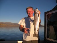
1579845069_e2d2947f70_001.jpg
Eagle Lake Trout. Many more fish and lake photos in my album on the left margin.

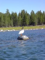
IM001442_Zoomed.sized.jpg
I'm hoping to be reincarnated as a pelican at Eagle Lake someday.

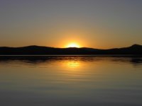
IM000511.sized.jpg
Sunset at Eagle Lake.

Joe.:teeth :thup
 
John-

Actually a 200 foot diameter tube/canal from the junction of the Columbia and Wilamette Rivers to the Mexican Boarder in San Diego would really generate some revenue!

How would you like to be able to sell that much water in Southern California and along the way? (Chris <Rana Verde> could give us an idea of what it's worth per acre foot, and how much 'the ditch" could carry.)

Might be as big or bigger "gold mine' as the Alaskan Pipeline!

Would be interesting to do do a cost analysis!

Send enough water south (and charge for it), and all Oregon and Washington might be very prosperous, indeed. Use the income to eliminate all taxation in the two states!

Plus, many of the Californians might just stay home instead of migrating to the PNW when they retire!
*************************************************

Just kidding, of course! But....

When you think of that pipeline coming over the Siskyous, you get the same feelings we do when we think of all our Northern California water going down to the San Joaquin Valley and to Southern California!

I can hear the tube sucking right now...............

Save the water! Save the salmon! Save the PNW!


Joe. :shock: :amgry
 
Joe - As you already know, much of the water in the Columbia originates in Canada, Montana, Idaho, and Wyoming. Maybe the Californians would be willing to pay a little more for that up stream water. Come to think about it, California with over 35 million people and growing (Montana hasn't increased 100,000 people in the last 50 years) is eventually going to be the 600 pound gorilla in the political wars involving water.
John
 
Joe,
Thanks for the info on Shasta. I think we'll maybe wait until she gets a bit more water and puts on her prettier face before we visit her. Its incredible that the lake is 155ft lower. Wow! Must be one heck of a high dam.
Thanks again
Ron
 
Ron,

We houseboated a week on Shasta in 1977 when the water was down 230'! We still had a great time with three 46' houseboats lashed together, 4 ski boats and 45 cases of Bud!

There was a tower used to mount a crane near the dam. When the dam was completed they cut the tower off and filled the lake. The tower was never to be seen again, they thought. In 1977 it was sticking about 50' above the water level. They estimated it would take 3 years to refill the lake. The next Winter was a wild one and filled it to the top.

I have fond memories of the seven years we spent there houseboating every Summer. Re-reading this, it's amazing I can remember them! :beer :beer :roll:
 
Ron on Meander":wjd1utjt said:
Joe,
Thanks for the info on Shasta. I think we'll maybe wait until she gets a bit more water and puts on her prettier face before we visit her. Its incredible that the lake is 155ft lower. Wow! Must be one heck of a high dam.
Thanks again
Ron

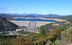
602 feet high of concrete

3,460 feet wide at the top

543 feet thick at the base

30 feet thick at the top

6,270,000 cubic yards of concrete

522.5 feet of water height at full water level

crest elevation when full: 1,077.5 feet

catch basin = 6,665 square miles

shore line = 365 miles

volume when full = 4,266,000 acre feet

currently waiting for winter rains...... :sad

Joe. :teeth :thup

shasta.gif

Better days at Shatsa Lake
Mt. Shasta in background
 
He Dreamer
My wife and i took a drive up to Shasta dam about 3 weeks age.

The relic you are talking about that helped build the dm is very visable now and quite a few feet above the water level.

The ride aroud the lake is worth the trip to see what was and what to be

Joe sure showed us some beautiful picturs. Maby he can post some more for us

Arnie
 
Roger - you are forgiven (I guess) for drinking 45 cases of Bud. I assume you have learned your lesson. We are bringing a keg of Snoqualmie Haystack Hefeweizen to the factory party.

Ron - boy, if I was within shouting distance of Shasta, with no particular place I had to be by any particular time, I would sure pop over and visit Joe and cruise the best spots for a few days - or longer, if it caught my fancy - regardless of the water levels! P.S. - you have a PM from me to pick up.
 
What a difference 6 weeks can make, Shasta Lake looks to be up over 55 feet already at 969 feet. With inflows as high as 42,000 cfs (that level is equivalent to plus or minus 6 feet a day). Hope it keeps coming.

Chris

http://cdec.water.ca.gov/cgi-progs/queryF?SHA

By my calculations a net inflow of 42,000 CFS for a full day is roughly 24.14 billion gallons of water. Numbers like that are simply mind boggling to me, but a pittance, I guess, when compared to......well..........Congressional spending.
 
YES...YES..YES !!! I was looking yesterday...and it appears that Lake Shasta is only 100' down from the top...Yazoo... Gonna be good on the water this summer... and we still have some winter ahead ..... more rain to come....

I am really looking forward to some water in Lake Almanor this year...

Joel
SEA3PO
 
With all the snow this year all the lakes should be up to full and spilling over by April. I remember the 70's at lake Orville. 400 ft down from full and a 200 foot drop of the edge of the boat ramp. Some of the towns that were flooded by the dam were starting to show. My bother and me fished it with both of our grandfathers. Glad to see the lakes getting full again.
 
SEA3PO":s5ilejla said:
YES...YES..YES !!! I was looking yesterday...and it appears that Lake Shasta is only 100' down from the top...Yazoo... Gonna be good on the water this summer... and we still have some winter ahead ..... more rain to come....

I am really looking forward to some water in Lake Almanor this year...

Joel
SEA3PO

Joel, don't let the Governator send it to SoCal....
 
Here's some of the latest data on Shasta Lake:

California Lake Condiions

and

Shasta Lake Conditions

(Look this second website over throughly, lots of good infomatiion!)

Not too bad, considering we were 160 feet down a couple of months ago.

We've got another month or month and a half of mixed rain and sun, and the runoff continues well into the summer.

I'm guessing we'll be 40-50 feet down when the serious drawdown starts for the summer.

Joe. :teeth :thup
 
An Update: (From the Redding Record-Searchlight, 4/1/09)

March weather was wild, but didn't deliver miracle to end drought

By Scott Mobley (Contact)
Wednesday, April 1, 2009


March produced nickel- sized hail and a deadly deluge.

But on the whole, the month delivered only average precipitation when Northern California needed a miracle to escape a third straight year of drought.

Some of the wettest spots around Lake Shasta sopped up nearly 15 inches of precipitation, state Department of Water Resources figures show. Those totals were a welcome contrast to March 2008, when virtually no rain fell.

That rainfall around the lake pushed water levels up 47 feet last month and added 910,000 acre-feet to storage - nearly a quarter of the lake's capacity.

The lake stood 64.84 feet below its rim Tuesday afternoon, with 2.87 million acre-feet of water packed away behind Shasta Dam.

Yet Lake Shasta still held 111,850 fewer acre-feet of water at the end of March than it did one year ago, state Department of Water Resources figures show. The lake was still about five feet lower Tuesday afternoon than it was a year ago.

Lake Shasta slumped to near historic lows last fall after the rains almost shut off last spring, the driest on record in Northern California.

A repeat of that drastic dry spell seems unlikely this year. Indeed, the lake soon could surpass its 2008 high point if April delivers even a few showers - as forecasts for this weekend suggest - and should rainfall continue into May, as it does most years.

Last month started with a powerful polar cyclone that dropped down the coast, tapped steamy subtropical air from near Hawaii, brewed it up and wrung it out over the mountains of Northern California.

**********

So we're getting back to a "not too awfully bad" situation, but won't be full next month when they start summer draw-down for irrigation in the Sacramento and Central Valley down state.

Joe. :teeth :thup
 
Back
Top