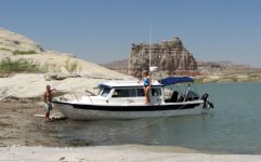
Lake Powell September Cruise

Denny, There is a lot of "eyeball" navigation on Powell--look for light colored water. The level can change from day to day, and you may have 3 feet over a shoal one day, and only a foot a day or so later.

We had the Jones map, but also like the Fish-n-map and the KingFisher Topo maps. We find that the Lowrance Create a Map gives decent navigation on Powell, by naming the various canyons. As the Lake goes up and down, the channel changes, but you can always get up the lake by fallowing the channel markers and the deep river bed.

For us, the fun is in the canyou exploration. There are also a number of books on the history of Powell and are worth reading when you are in the area. Some pretty tough people who settled and came across this area!

I don't know what the group plans are as to where they will be on the 25th. VHF radio is marginal. Cell phones are rarely good. We will have a satellite radio and probably ham radio, both of which work well in Lake Powell for communciation for the outside world. We usually get in touch with our friends via ham radio.
 
Hi, Chris,

Karen and I went there and took the Rainbow Bridge boat cruise on our wedding anniversary in May, and thoroughly enjoyed it. She loved it, and was very impressed. We took the Miata (our C-Dory 22 replacement), and did Moab and the Arches and Dead Horse Canyon parks, went to Ouray, CO, and ended up at the Wahweap lodge. Wonderful trip.
The water level was pretty well up, so we only had to hike about 1/2 mile to the Rainbow Bridge.

I was really impressed with how the Captain slowed down any time smaller craft were nearby. That 80 footer makes one heckuva wake.

Glad to see you are going in September. Weather seems to be a lot more stable that time of year. I thoroughly enjoyed the three times I (we) cruised the lake.

Have a great cruise!!!!!

Ken
 
Hey Ken...bet that Miata is a little easier on fuel than the Vivien C ...eh? When I was thinking about fishing lures yesterday I thought of you and that hard to get...high dollar lure you had...a trout if I remember correctly. Did that thing ever produce for you?
 
We bought the Navionics card that has all the western US lakes on it for use on our Raymarine system and it worked very well. We had to adjust for the current lake level by comparing what our depthsounder said to what the chart said.

But if you follow Chris, you will have a blast with minimal worries. I know we did (thanks again Chris! We'll be back!)

Warren
 
With my work and with lobster season opening 9/29, I will be a few days behind you all. Maybe there will be some stragglers left at the beginning of Oct? Or maybe I can talk with some of you at the end of your trip for hotspots or interesting locations to visit?

Bob, you can see the 'ol C-pelican again....

If I am lucky, I will bring lobster with me....

Jeff
 
Warren, does the navionics show all of the way up the main Colorado above Bull Frog, and the San Juan arm? I was not clear reading their info on the web site. Does it show depth contours? What would be really great would be a way to set the lake level.
 
thataway":2n47o69l said:
Warren, does the navionics show all of the way up the main Colorado above Bull Frog, and the San Juan arm? I was not clear reading their info on the web site. Does it show depth contours? What would be really great would be a way to set the lake level.

It definitely shows depth contours and it covered all the areas that Chris took us to. The Navionics website is very confusing when it comes to these lake maps. I had to work hard to get the right one, the '07 Hotmaps Premium which covers all the west. I see now that they have Hotmaps Platinum with 3-D, in which the west is broken into two separate chips. Most of the stores at the time I was buying (March/April) only had the '06 chips.

Warren
 
Warren, Thanks,

I have an older Lowrance 3300, which we use create a map on--use for road and boat, as well as the topo for lakes. It will take the Hot Lakes premium. We have been to Powell 5 times and love it. We have done about 50 miles above Bull Frog, and all the area below Bull Frog--about 30 miles up the San Juan--where we ran into so much debris that it plugged up the water intake....and we had to back flush the cooling system. We prefer the mid section--around the Oak Canyou area.
 
I have a Garmin 4212 and I bought their western inland lakes and rivers (western states as far east as New Mexico) cartridge and last night I was checking out Lake Powell. There's a lot of detail. I have a paper chart around here somewhere and I'll bring it along, too, but the chartplotter and cartridge look like they'll do a fine job.

I also have the west coast (ocean) visual cartridge and it's simply AWESOME. Like having Google satellite view online in your boat. Roads, landmarks, local businesses, picture views of harbors and facilities (fuel docks, yacht clubs, etc). Very nice. The special detail photos look like they're taken from a helicopter. Nice way to see what a harbor or facility looks like before you get there. You can see the approaches and what's nearby and what it will look like so you can find it. (The lakes cartridge doesn't have all that.)

A 12" chartplotter screen might seem big on a 22' boat, but it's going to be my only screen (GPS, sonar, charts, radar), so it actually saves a lot of clutter. I have it right above the steering wheel and it doesn't block my outside view. (It blocks my view of about 1 sq foot of foredeck, but I think I can live without that.....)

I've owned several GPS systems and I've used many others. This one is the nicest I've ever seen. (I can think of a few little things they could easily add to their software, and I bet they will.) It's easy to use, it does the usual GPS and chartplotter stuff, and it looks beautiful. I guess I like it.

Jeff
 
Hi, Chris,
You wrote:

Hey Ken...bet that Miata is a little easier on fuel than the Vivien C ...eh? When I was thinking about fishing lures yesterday I thought of you and that hard to get...high dollar lure you had...a trout if I remember correctly. Did that thing ever produce for you?

Yeah, that lure was a little pricey - $20. I only fished it once on Lake Mohave, and it never produced. But I painted one of them white, and tried it on Elephant Butte Lake, and did catch some reasonably good stripers. Sold the boat at a good time, because there's nowhere near the water we used to have here in N.M., and it doesn't look like it's coming back anytime soon.

Gas sure goes a long way with the Miata (32 MPG), but if one wants a powerboat, paying for gas goes with the territory.

I probasbly won't get another C-Dory until I have a place on the water, with a dock, where I can walk out of the house, climb aboard, and go out for the day. That's not even a remote possibility, until the grandkids reach their early teens and even Karen finds them unbearable!!!

Again, have a great cruise on Lake Powell.

Ken
 
Chris,

We've been to the mountain the last few days in the 5th wheel, parked in the hunting area. We have spotted several trophy elk, but haven't been able to tie one up so Brent can shoot it opening morning. I will encourage him to get one close to the road so we can expedite the process-- don't want to miss Lake Powell. It will be so cool to meet new C-Brats and see you and Bob and Marie again. I sure hope everything works out to meet you at Oak on Sept. 23rd. Will bring meat if possible.

Dixie
 
Hi Chris,
It is possiable that we will see you at launch--we are probably going to get there on the 19th or 20th. If it has been a hard drive, we may not launch until the AM..

I E mailed my cousins who do clean up on Lake Powell in Sept--and they are going to BullFrog on the 23rd--and then on the lake on the 24th (don't have an itiniary for them yet--hoping that they come on down toward Oak Canyon. Plus several friends, who include Eric and Susan on E ticket, are also going to be on the Lake starting around the 22 or 23rd--but maybe not with the C brats....

So other than the 23rd--what in general are your plans (if you have formulated any), so that if we happen to miss the "group" on Sunday, we can hookup before or later? We are hoping that our cousins are flexiable and we can meet with them on the 25 or so--sure don't want to run up to Bull Frog just for one evening--and miss the "goings on" at Oak Canyon on the 23rd.

Looking foreward to seeing you all,

Bob and Marie,

"Frequent Sea"--
 
Bob...really don't have plans...as usual. I'm thinking I might run up the San Juan...probably before the 23rd. After the 23rd...maybe up the Escalante...see all the sights up there...maybe stay in Fiftymile. Then on up lake. Tough to make plans as you know...sometimes you pull into a canyon with your mind set on a nice sand bar you know...only to find it already occupied. Then it's off to find another canyon...another sand bar. Makes it tough if you've made plans to meet. That's why I suggested Oak for the meet...it's big enough that you are likely to always find a spot.
 
Wish we could join you again for the September gathering. We are on Lake Powell right now, and it is spectacular. I expected big crowds and melting heat, but we've had no problem finding great places to stay for the night. And picking a good spot with the boat facing west has provided great shade in the late afternoon.

By the time you gather, we will be back in Texas... but we'll be thinking of you!

Best wishes,
Jim & Joan

USWB2e.jpg

For anyone considering this gathering who has not done Lake Powell before, do your best to make it. The lake is like no other we've cruised... simply breath-taking. And Chris, Brent and Dixie know the lake and will make your first time here easy and memorable.
 
Bob (from Thataway),

I notice you're a HAM and you mentioned using it at Powell. I'm an inactive HAM (AC6QI) and I have an HT lying around, plus a 2meter car unit or two in a closet somewhere. What works at Powell? Are there repeaters? Anyone else in the group likely to be a HAM? I dabbled in HF and CW some, but now it's all just one more past hobby, more or less.

I was there a couple times years ago on houseboats and wakeboarding, but now I'm really looking forward to the C-Dory there. Should be MUCH better for exploring and camping.

I believe I'll show up around Sunday or Monday the 24th and head up the lake from the Page area. I think I can spend pretty much the entire week there and leave Friday or Saturday. Probably I'll aim for the Oak Canyon gathering idea that seems to be forming.

Jeff
 
I haven't been to Powell in years. I've gone out of Wahweap in the past and stayed there the night before launching. Is Antelope a better choice if you're just going to drive into town, buy some supplies, launch and head up the lake?

Any considerations for current lake conditions or parking or other ideas that would favor one over the the other these days?

Thanks for any tips or recent knowledge.

Jeff
 
jlastofka,
I haven't done a ground system on the CD 25 and am not bringing a dipole, so I am probably going to skip the Ham on the C D 25 this time. (We will have it for our Alaska trip next summer)--time is just running out on us and we will be on the road in a couple of days. I am not sure we will even take our radio (Icom 7000). We will have a 2 meter rig aboard.

There are several repeators on Navajo mountain: 146.960 Mhz Glen Canyon Wireless Association, 224.98 Mhz is supsosed to be active. 448.750 Mhz and 449.925 Mhz have been listed in the past, but at last report were not active.

I have worked 40 meters out of Lake Powell.

Chris, the reason I asked about plans, is because there appears to be the general gathering on Sunday the 23rd at Oak Canyon--but there are folks who are launching on the 24 and 25th and still want to "hook up" with the group. I suggest that we all moniter Channel 16 on the VHF and listen for any general calls to "C Dory". Unfortunaely once one goes up any of the canyons, VHF radio is gone.

Regards,
 
Two ideas:

1) Perhaps there's a bulletin board at Dangling rope, or perhaps they'd keep a piece of paper at the office where we could leave and read short messages, like "C-Dories going to Oak Canyon on ......, and then ....."

2) Or we can spot a C-Dory wandering about and stop them to ask if they've heard anything. (Or try VHF 16 when you have them in sight.)

I might wander as far up as Hall's Crossing myself, depending. Maybe even a little further. There's a cliff dweller site a ways up there, right?

Jeff
 
Why not have someone from the group drive out to the nearest pumpout station at a predetermined time toward the end of each day? That could help narrow down the options...

Warren
 
Back
Top