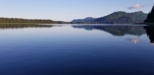
Intuition to Alaska - 2021

Friday and Saturday, July 16-17
Haines

On Friday, we grabbed a few groceries, had a good sandwich lunch at the Rusty Compass Coffee Shop, and worked on blogs/bills. While Kel engaged in some retail exploration, Les visited the Sheldon Museum. It includes lots of late 18th and early 19th century artifacts collected by a local mercantile owner. The museum’s displays narrate the tensions and changes among the local Tlingit clans with the influx of settlers, missionaries, and gold-seekers from outside Alaska.

We had dinner at the Lighthouse Restaurant adjacent to the harbor – their halibut fish and chips were as good as any we’ve had to date.

Despondence, disappointment, disillusionment – these are my emotions when faced with the reality that the Hammer Museum was closed during our time in Haines.

We had planned to depart Haines for Skagway on Saturday morning, but the forecast included a small craft advisory for the Northern Lynn Canal. After walking up the hill above the harbor and looking east beyond Portage Cove, I could see whitecaps and feel the strong northerly breeze. We stayed the extra day in Haines to wait for better weather. Kel visited the farmers market on Saturday while Les continued to sulk about the Hammer Museum being closed.

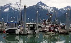
We liked Haines a lot. The harbor staff worked with us to ensure we’d have a space despite lots of fishing boats using the transient dock. There are a handful of good eateries and two well-stocked groceries. The only issue with Haines for small boat owners is that the public shower is located at the Moose Laundry, which is a (good) mile west of the harbor.

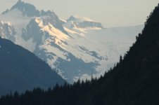
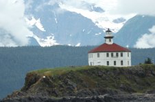
Eldred Rock Light - Lynn Canal
Eldred_Rock.sized.jpg

Davidson Glacier
Davidson_Glacier_Lynn_Channel.sized.jpg

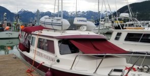
Intuition_Haines_Harbor_slip.sized.jpg
 
Sunday, July 18
Haines to Skagway

Miles today: 17
Total Miles: 1391

Motor hours today: 2.8
Motor hours total: 1046.1

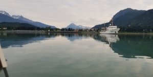
We turned out of the Haines Harbor at 5:30 am to get to Skagway before the wind and waves. The NOAA ship Fairweather was anchored just off Haines in Portage Cove. This 231-foot hydrographic survey vessel uses side-scan sonar to accurately map the ocean floor. Data it provides to NOAA cartographers are used to update nautical charts. We motored slowly past her and turned north into Taiya Inlet.

Fairweather_Haines.sized.jpg

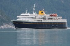
Taiya Inlet is only half as wide as the rest of Lynn Canal, so when we met the southbound Alaska Ferry Matanuska, we got the amusement park treatment from its wake. The wake itself caused 3-4-foot waves, and we were bounced around for another 20 minutes as those waves ricocheted off the narrow canyon walls back into the channel.

Matanuska.sized.jpg

Our 17-mile excursion was otherwise smooth, and we arrived at the Skagway Harbor about 8:00am. After settling in and getting showers, we enjoyed a very nice brunch at the adjacent Skagway Fish Company. Later we wandered about the town. Skagway is an interesting place, even more so in these interesting times. With a very small year-around population, it seems to exist as an historical monument (Klondike Gold Rush National Historical Park) and as a theme-parkish destination for cruise passengers. With no significant cruise ship arrivals (yet), the place is something of a ghost town. It’s also the most “masked-up” place we’ve been since leaving Everett. Nearly all store and restaurant employees are wearing masks, and the IGA requires everyone (friends of Gulfcoast John or not) to wear a mask to enter.
 
Monday, July 19
Skagway

Skagway has a very nice small craft harbor. Showers are close by at Harbormaster building, the docks are in excellent shape, and there are water spigots at each slip. It’s about half empty right now – I’m told this is a destination for Canadians, given its proximity to Whitehorse.

I walked the docks early this morning and watched the local gang of river otters cruising around the harbor looking for trouble. They hopped into the back of the Skagway Public Security boat but left before I could get a picture. The harbormaster yesterday said one of her primary responsibilities is spraying otter poop from the docks.

There seemed to be a little more activity in town today. We caught up on laundry and restocked groceries from the rather sparse IGA. One exciting find there – they had beef tri-tip roasts, so we snagged one to grill tomorrow night. We also did our best to support the open restaurants – great sandwiches at the Glacial Coffee House and excellent pizza at the Northern Lights Pizzeria.

We filled the boat with gas this morning and water this evening. As we head south, we’ll call Glacier Bay to check availability of short-notice permits. During the summer months Glacier Bay National Park allows only 25 private vessels in the primary bay on a given day. Of these, 13 are Advance Permits (60 days out) and 12 are short-notice and made available 48 hours ahead of entry. Since most permits are for multiple days, only a few new boats are allowed to enter Glacier Bay each day.

Intuition_Skagway.sized.jpg

Les and Kel Rohlf

More photos at https://www.facebook.com/kel.rohlf
Blog: https://souldare.com/intuition-diaries/
 
Tuesday, July 20, 2021
Skagway to Boat Harbor

Miles today: 58
Total Miles: 1449

Motor hours today: 6.6
Motor hours total: 1052.7

We passed the breakwall on our way out of the Skagway Harbor at 5:25 this morning and motored slowly out the Taiya Inlet toward Haines. As we digested this morning’s weather forecast, it sounds as if things are due to get ugly on the Lynn Canal this afternoon and tomorrow. Crossing to the west side of the canal immediately after passing the end of the Chilkat Peninsula, we pushed up the power and cruised at 15 mph for a couple hours, which allowed us to arrive at the entrance to Boat Harbor shortly after high slack at 11:05.

Boat Harbor was my original plan for today and will work well if the wind comes up tonight and tomorrow. The channel is narrow with a couple bends, and the harbor is well protected from all directions. We saw 18 feet of depth in the entrance on a 12 foot high tide, so we’ll want to carefully follow our track back out if we leave during tomorrow’s -1 foot low tide. Our experience corresponds to the guide that said we should expect a fathom of water at a 0 tide.

boat_harbor_skyline.sized.jpg

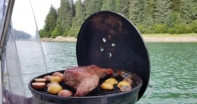
We’re anchored in 50 feet at the southeast corner of the bay near a small beach. It seems that this is one of the last areas still open to salmon gillnetters, so there are about 25 boats within 10 miles and 5 fishing within the harbor proper. We grilled a tri-tip roast and potatoes this evening – yum. At home I normally smoke it for 60-90 minutes and then sear it. Tonight, I just cooked it on our little charcoal grill for 45 minutes. The horseflies arrived in force and wanted their share. They seemed content with a bit of my flesh instead.

tri_tip_on_grill.sized.jpg

I had pulled into the harbor today assuming we might be here for a couple nights. The wind was still a little out of the north when we first anchored and has shifted to the south by late afternoon.

Wednesday, July 21, 2021
Boat Harbor

At 4:00 am the winds were already gusting to 25 knots at Eldred Rock, and there was a brisk south breeze whistling through our very protected anchorage, so we went back to bed. Looks like tomorrow will be better, and this is a comfortable place to wait out a choppy Lynn Canal.

I ran the generator for about an hour late this morning to charge the house batteries. My two group-27 batteries need to be recharged after 24 hours of use to keep them at 12.2 volts or higher. For reference, they power the refrigerator, (LED) lights, and one chartplotter when I’m not moving. I also keep one radio on while we’re awake.

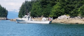
Part of our entertainment for the day was watching the gillnetters work. There were 6-8 boats working in this harbor of little more than a half mile across.

boat_harbor_gillnetter.sized.jpg


Les and Kel Rohlf

More photos at https://www.facebook.com/kel.rohlf
Blog: https://souldare.com/intuition-diaries/
 
A couple additional notes from Haines and Skagway

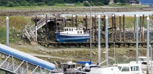
If the dealer who did our engine service in Juneau had not power washed our hull, I was planning to use one of the grid systems available at most of the harbors we’ve visited. One of the nicer setups is at Haines, as they have a convenient stairway leading down from the upper platform. Most others just have the tall, straight, and probably slippery ladders for access.

Haines_Harbor_Grid_001.sized.jpg

In Skagway we would have liked to ride the White Pass and Yukon Route Railway, but they’re not running excursions until the first cruise ships show up at the end of July.

Gary (Daybreak), I don’t think I responded to your earlier question about topping off water during our Canadian transit. We were able to fill water at the fuel docks in Port McNeill (Day 4) and Prince Rupert on Day 8 without issue. We could have added water at the other two stops in Campbell River and Shearwater, but chose not to. We don’t generally drink from the boat’s water tank, but keep a separate 5-gallon jug for drinking water in the cabin. I’m also carrying a 5-gallon Jerry-can style water container in the cockpit to use if we run out of water In either of the primary containers.

Les
 
Thursday, July 22, 2021
Boat Harbor to Hoonah

Miles today: 54
Total Miles: 1503

Motor hours today: 9.9
Motor hours total: 1062.6

It was perfectly calm within Boat Harbor this morning – much better than what we felt yesterday. We crawled out of bed at 4:30 am and left anchorage by 5:00. Low slack was at 6:40 (-2.3 feet) and I didn’t want to transit the harbor entrance below “0” level, which would correspond to 5:00 am. My @*&! chartplotter didn’t save my track through the entrance from 42 hours earlier (I must have a setting wrong), so that added to the challenge. In the flat early morning light we had a sporty exit from the harbor. There was a pretty strong current running in the same direction we were going, with some waves through one of the turns. I saw 5.9 feet at the lowest point through the passage, so thankfully I didn’t wait until low slack and lose another 2 or more feet.

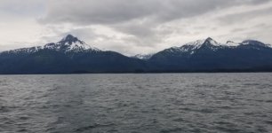
South-southeast winds and he outgoing tide generated fairly uncomfortable waves for the first several miles. We slogged and pounded our way south at 6-7 mph until we got some relief behind Lincoln and Shelter Islands. We thought we might have been lucky when seas became relatively calm approaching Couverden Island and the turn into Icy Strait. No such luck - the waves rose again from the southeast as we made the turn, so we had waves mostly abeam as we turned west. The worst of the waves abated the farther we got into Icy Strait, but it was a tedious ride for several miles.

Gray and choppy morning on South Lynn Canal
Gray_morning_S_Lynn_Canal.sized.jpg

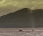
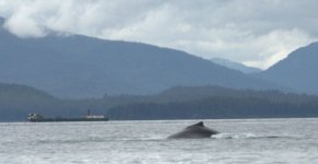
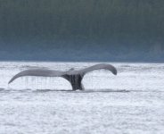
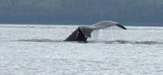
Approaching The Sisters, we saw a couple whales feeding just east of the islands so detoured and stopped for a while to enjoy the moment and take photos. As we made the turn into Port Frederick there were several purse seiners fishing. One was pulling in his net while a whale was feeding within just a few yards of the boat – seems both were competing for the same school of fish.

whale_spout_colorized.sized.jpg

whale_and_barge.sized.jpg

whale_tale_1.sized.jpg

whale_tale_2.sized.jpg


We finally pulled into Hoonah about 2:00 pm. It was a long day of slow going against waves that were near our limit for fun, but very satisfying to have watched the whales up close. We enjoyed an excellent dinner at the Fisherman’s Daughter and walked to the Hoonah Trading Post to gather a few groceries. It’s getting cloudier and cooler – evidently rain is on the way for tomorrow.

Les and Kel Rohlf

More photos at https://www.facebook.com/kel.rohlf
Blog: https://souldare.com/intuition-diaries/
 
Les and Kel,

Nice to know that water is available at the fuel stops along the way. Thanks. Sorry to hear about the trouble you are having with Horse Flies/Moose Flies. Hopefully the Alaska Pest season will be over soon. Maybe the wind is helping a bit.

Thank you for sharing in your many photos and the details in your day, especially with all of the places to eat out.

Stay safe! Gary and Colleen.
 
WOW, those humpbacks are amazing. Fun and surprisingly huge. I believe they average about 1 ton per foot of length. The adults are generally longer than your boat. For me it is always fun to watch the commercial fish boats. I shared a remote dock with one, one night, and he offered me a whole fish. It looked really good but I had to turn him down. Didn't know how or have the capability of cooking it. I gave him some pretty fresh blueberries, for his pancakes. It was a fair trade.

Harvey
SleepyC :moon

24_2016_Sept_Canon_Pix_Vancouver_Is_070_Copy.thumb.jpg
 
Friday, July 23
Hoonah to Flynn Cove

Miles today: 13
Total Miles: 1516

Motor hours today: 1.9
Motor hours total: 1064.5

We left Hoonah late this morning, given that we were planning for a short day. I originally considered anchoring somewhere back in Port Frederick but decided on Flynn Cove. We’re heading toward Elfin Cove and Pelican, so it’s both on the way and likely to have slightly better cell/internet connectivity.

Each day since leaving Boat Harbor we’ve submitted requests for a short-notice permit to Glacier Bay, and we’ve not been successful to date. We’ve heard several opinions of Glacier Bay ranging from “Not to be missed” to “Overhyped and not worth the hassle”. Since we’re in the area, we figured we’d at least try, though we’re not going to wait around too long at the expense of visiting other areas.

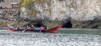
On the way out of Port Frederick, we saw these folks in a native style canoe.
Hoonah_native_boat.sized.jpg

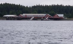
Hoonah renovated the old cannery near town - it's now a cruise ship stop named Icy Strait Point
Icy_Strait_Point.sized.jpg

Icy Strait was rather choppy and uncomfortable, so we stayed as close to the south shore as possible. We arrived at Flynn Cove by 2:00 pm and dropped the anchor in 45 feet as far east as we could get in the cove. Icy Strait was pretty breezy, and Flynn Cove is well-protected from any winds with an eastern component. One other smaller cruiser anchored in the cove later in the afternoon.

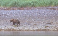
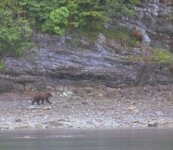
There were light rain showers off and on during the afternoon, and we relaxed and caught up on some reading. At about 8:30 we saw our first bear walking along the south shore of the cove. While watching the first bear, we saw two smaller (I assume juvenile) bears walking on the eastern shoreline in the direction of the first bear. At some point they got wind of each other – the smaller two ran around to the south shore and headed west, while the first ran east into the tall grass. Perhaps realizing he (or she) was larger, the first bear stopped, stood up, and watched the two smaller bears run away. He then came back toward the shore and munched on grass as he continued around to the eastern shore from whence the smaller two had appeared.

bear_one.sized.jpg

bears.sized.jpg

Saturday, July 24
Flynn Cove to Hoonah

Miles today: 12
Total Miles: 1528

Motor hours today: 3.1
Motor hours total: 1067.6

Sometimes the schedule changes for weather; sometimes schedules change for mechanical issues, and sometimes… other things happen to adjust the schedule.

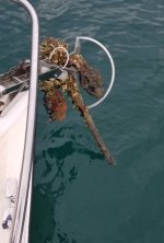
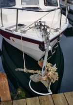
We slept in a little this morning, ate breakfast, and I hit <enter> at 7:59:58 am to submit today’s Glacier Bay permit request. Following our normal process, I (Les) stood on the bow, untied the separate snubber line that connects the rode to the bow eye, then unwound the rode from the center bow cleat. I watched the chain come up as Kel ran the windlass from the helm. I noticed it looked kind of funny as it neared the surface. We stopped the windlass as the anchor broke the surface and saw this:
:shock:
Old_Anchor2.sized.jpg

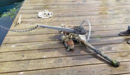
Our anchor had snagged an (old) anchor from the bottom of Flynn Cove. I tried unsuccessfully to dislodge it with a boat hook. The anchor was larger (and heavier) than ours and was tightly wedged around the shank of ours. Standing over the end of the bow is a little precarious to begin with, and I didn’t have enough leverage to either untangle them or pull the entire mess onto the bow.

After fiddling for a while, I managed to lasso the long shank of our feral anchor with a dock line, ran the line through a chock, and tied it to the center bow cleat. This would at least keep the heavy mess from swinging around and smashing all the gelcoat off the bow. I then got a hook onto the chain and tied it around the bow rail to hopefully relieve some of the stress on the windlass.

Our plan for today had been to go the Elfin Cove. If no dock space were available there, we’d continue on toward Pelican. Given the extra (marginally secured) weight dangling from my bow roller, I really didn’t like the idea of running another 20 miles west on a lumpy Icy Strait, followed by potentially higher waves in the section of Cross Sound we’d pass en route to Elfin Cove. The easy answer was to slowly limp back the 12 miles to Hoonah, where we could dock on a finger and work on the bow from a stable platform. Fortunately, Icy Strait was a little less boisterous than yesterday. We made our way back at 5-6 mph and pulled into the same slip we left yesterday morning.

Old_Anchor_at_dock.sized.jpg

Once we secured the boat and untied the lines that secured the anchors, we could let out rode via the windlass and perform an anchor-ectomy on the dock. The anchor was indeed bigger and heavier than ours – I’m guessing 35+ lbs. The good news – we managed to get back here and separate everything without hurting ourselves or Intuition. The windlass and anchor roller hauled up the 60 or so pounds of anchor (and 50’ of chain) without complaint, and are apparently no worse for wear after separating everything on the dock.

Old_Anchor_on_dock.sized.jpg

I deposited the old anchor and all its attached marine organisms at the top of the marina walkway next to the dumpsters. Kel mentioned it to the dockmaster and a lady at the souvenir shop across the street – the anchor was gone within an hour.

After settling in, we received notice from Glacier Bay that we have a permit for 7/26-7/29. Our plan now is to prepare and provision here in Hoonah through tomorrow, and head to Elfin Cove and Pelican after our time in Glacier Bay.
Les and Kel Rohlf

More photos at https://www.facebook.com/kel.rohlf
Blog: https://souldare.com/intuition-diaries/
 
Les and Kel, Congratulations, You are now members of the elite boating community who, like in the motorcycle world have either dumped their bikes or will, in the boating world have either fished up one of Neptune's trinkets, or will. Always unplanned, but then have you ever know anyone to do a planadent? Nope, they are accidents, (not planned), so surprise, You got an anchor. Some things are worse, like if the windlass can't pull it up and just pulls your bow down and down and then you make that tough decision. Dive, cut and run, or . . . ?

In my case it was a huge, 8 x 10 foot (at the base) tapered to a 6 x 8 tuna tower appearing THING about 10 feet tall. It changed my day plan too, but, I wasn't in a hurry anyway. I'm sure there are tons of other stories about other crunchy, scrappy treasures of the deep. Just another memory for your "book".

One option would be to secure the "new" anchor, via cleats or bow rail so that you can lower the windlass, and maybe drop from the new one. Then get your active anchor up past the new one and into the bow roller and then do whatever works with that "new" treasure.

WOW, Hoonah does not look like the TV show. Sorry to hear the cruise industry is chipping away at the real (not that that show was real) Alaska.

Waiting to hear and see more about Glacier Bay.
Harvey
SleepyC :moon

0_God_s_Pocket_Anchorage.thumb.jpg
 
Les, I’m looking forward to your sharing of experiences in Glacier Bay. We waited to our 7th SE Alaska cruise to explore there & then only because we were in the area in late April & had no restrictions on travel & caught a good weather pattern for a 6 day & 325 mile cruise. We saw no other people or boats. The scenery is striking, but to me, no more so than many other SE Alaska locations. Also we have seen much more wildlife in other areas, especially whales & bears. The area is quite large & open for cruising, making for likely iffy conditions for small boats such as a 22 or 25 C-Dory, when you can’t preplan for the weather. It appears you are fortunately getting good weather for your stint there.
I would return, but only again in the off season, when I could plan around the weather, no restrictions on where we could go & no other boats to compete with for anchorages.

You & Kel are doing a wonderful job of documenting your adventure. The part here on the the C-Brats is great, but also really enhanced & made even more enjoyable by the link to your blog & additional photos.

Jay
 
I didn’t recognize this until I saw the pix on Kel’s blog. Wonder if your anchor drug a bit before it set? It looks like there was only room for the chain to slip into that notch, so apparently the new anchor was collected as you backed and set your anchor. Again, always so fun to find new treasures. AND that Fisherman’s Daughter sounds like a good place to keep on my list. Enjoy Glacier Bay.
Harvey
SleepyC:moon

IMGP1872.thumb.jpg
 
Monday, July 26, 2021
Hoonah to Shag Cove

Miles today: 65
Total Miles: 1593

We left slip in Hoonah’s harbor at 6:30 to head toward Glacier Bay. My plan was to stop at the Visitor Center in Bartlett Cove at around 10:00 am. After spending an hour or two we could take advantage of the flood tide for most of our run up the bay to the planned anchorage at Shag Cove.
We got a little later start than planned, so ran on plane after entering Icy Strait. We cruised at 15-16mph until a few miles short of the Glacier Bay boundary when the motor’s overheat warning came on. We stopped and bobbed around in the thankfully calm Icy Strait while we accomplished some rudimentary troubleshooting. There was no obvious obstruction on the cooling intakes; I also re-checked the oil and prop and saw no immediate issues. We restarted the motor, noted a good tell-tale from the cooling system. We continued for a while at slower speed, then at 15 mph for a few more miles without incident until slowing for the Glacier Bay entrance call. Glacier Bay requires everyone entering or exiting the park boundary (a line between Point Gustavus and Point Carolus) to inform them via radio. Glacier Bay then provides the latest speed and operating restrictions for the whale protection areas in the south bay.
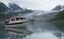
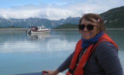
We arrived at the Bartlett Cove public dock at 10:45. We checked in with the rangers at the Visitor Information Station (orientations for boat operators – 2 15- to 20-minute videos – are done remotely this year). Kel found out that Ryan, the ranger on duty is from St, Charles, MO.

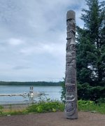
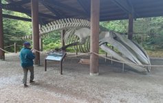
We checked out the Healing Pole, Tlingit Community House, and whale skeleton outdoor exhibits. We then walked to the visitor center in Glacier Bay Lodge; and went through their well-coordinated displays. We left Bartlett Cove at 12:15 and enjoyed the peak of the flood tide as we went through Sitakaday Narrows. With a throttle setting that normally gives us 6-7 mph, we saw 13-14.

The Healing Pole
Healing_Pole.sized.jpg

Humpback Whale Skeleton
Whale_skeleton.sized.jpg

Northbound in Glacier Bay
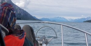
Glacier_Bay_Kel_on_front.sized.jpg

As we continued north we saw numerous whales north of the “Whale protection zone”. We arrived at Shag Cove by 5:00, and were challenged to find a good place to drop the anchor, get enough scope, and keep a reasonable swing radius. We had to retry after the first drop.

Shag Cove doesn’t seem (to me) as bomb-proof as Don Douglass describes. Tonight, there’s a light NW wind, and we’ve got an annoying wave action hitting us on the beam as we swing with the tide at anchor. I imagine a strong north wind would make things uncomfortable. I can’t complain too much, as the scenery is spectacular.

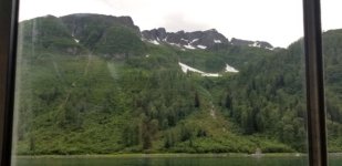
Shag Cove from the Kitchen Window
Shag_Cove_kitchen_window.sized.jpg
 
Tuesday, July 27, 2021
Shag Cove to Reid Inlet

Miles today: 68
Total Miles: 1661

Glaciers, glaciers, and more glaciers

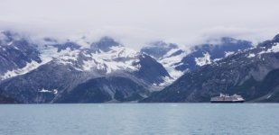
It was perfectly calm when we left Shag Cove at 6:00 am. As we headed north in the main bay, I looked up and saw an AIS contact behind us going 18 knots. Toggling to get information, the boat name was “Nieuw Amsterdam”. Looking over my right shoulder, it was clear from 7 miles away that this was a big cruise ship (Holland America Line). They passed us at a distance of 1.5 miles as we approached Blue Mouse Cove. At least at 1.5 miles, the wake involved only big slow rollers.

Nieuw_Amsterdam_leaving_Johns_Hopkins_Inlet.sized.jpg

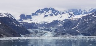
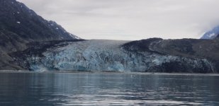
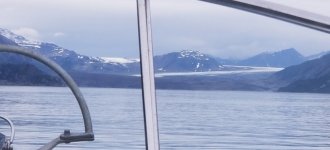
We continued up the Johns Hopkins Inlet. They don’t allow cruise ships into the inner part of the inlet, so the big cruise ship and two smaller Nat Geo ships were on their way out by the time we got there. The Johns Hopkins Glacier is impressive – you see it as you turn the corner into the inner section of the outlet from about 5 miles. We weren’t able to get any closer than about 3 mi due to ice. None of the bergs are like the very big ones we saw at the Endicott Arm or Le Conte Bay; the largest are several feet across, but not house size. Carte Blanche, a large 160 -foot yacht, wasn’t able to get any closer than we were, so turned and exited the inlet.

Johns Hopkins Glacier
Johns_Hopkins_Glacier.sized.jpg

Lamplugh Glacier
Lamplugh_Glacier.sized.jpg

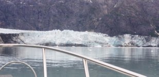
We headed out of Johns Hopkins Inlet and decided to go ahead and run up the Tarr Inlet today, rather than waiting until tomorrow. Our timing was good, as the Holland America ship was departing the inlet as we approached, along with one of the Nat Geo ships. By the time we got to the head of the inlet, it was just us and Carte Blanche. We got within about a mile of the face before we started getting hemmed in by the ice as the flood tide started.

Grand Pacific Glacier
Grand_Pacific_Glacier.sized.jpg

Margerie Glacier
Margerie_Glacier.sized.jpg


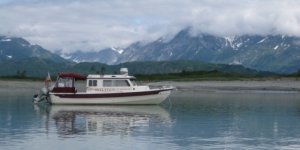
We found a decent anchoring spot in 65 feet (high tide) in the northwest corner of Reid Inlet beside two sailboats. This is a fairly unique and stunning anchorage with the face of a glacier just a couple miles away.

Reid Inlet looking out (north)
Intuition_Reid_Inlet.sized.jpg

Reid Glacier
Intuition_Reid_Glacier.sized.jpg

We grilled chicken for dinner, then at about 9:00 pm, a moose emerged from the brush at the point just north of our anchorage. She wandered around for a short while before becoming spooked and running back into the thicket.
 
Wednesday, July 28, 2021
Reid Inlet to Berg Bay

Miles today: 41
Total Miles: 1702

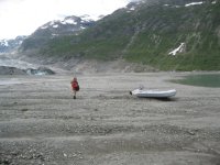
We slept in and pulled the dinghy off the roof about 8:30 this morning. We loaded everything and headed for the glacier to see how close we could get. As we headed up the inlet, a large inflatable from “Kruzof Explorer” entered the inlet. They sped up the bay and unloaded a dozen people on the southwest corner of the inlet, and we crossed to the other side and beached our tender on the southeast corner. Low tide was a couple hours away, so we pulled the dinghy out of the water and tied an extra line to a rock a little higher up.

Reid_Inlet_Kel_and_Intuition.sized.jpg

Reid_Glacier_Dinghy.sized.jpg

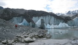
The Reid Glacier is not a tidewater glacier and ends on a rocky, silty flat short of the water. It was a good half mile walk at low tide across the rocky flat to near the glacier face. Two fast and high streams kept us and the other group from being able to walk up to the face itself, but I think we were within a hundred yards or so. We took a bunch of pictures and marveled at how big it is close up.

Approaching Reid Glacier
Reid_Glacier_Face_w_Kel1.sized.jpg

Reid_Glacier_selfie.sized.jpg

I wrestled the dinghy back on top of the boat, and we departed Reid Inlet toward the south at 1:30 pm. Today there was ice in the channel for a few miles south of Reid iInlet, while yesterday we had to travel several miles farther north up the Johns Hopkins and Tarr Inlets before we saw any significant ice. We took our time going south and enjoyed watching several whales, porpoises, and sea others.

We needed to enter Berg Bay at around high slack, as the narrow entrance is shallow with strong currents. Berg Bay is where John Muir first setup shop during his exploration of Glacier Bay in 1879. We arrived a few minutes early, waited a moment for the whale transiting across the entrance, and entered Berg Bay to find… river otter haven. There must have been 100 otters in the bay, all of whom seemed slightly curious as we motored toward the north end of the bay looking for a good anchorage. They seemed less interested once we dropped the anchor.

I grilled burgers for dinner, while Kel made fried mac and cheese balls. It’s very calm here, and the sea state has been effectively calm for our three days in Glacier Bay. The otters have quieted down and there are a couple porpoises making regular circuits of the bay. Tomorrow’s the last day on our permit here, so we’ll be heading back to Hoonah. I had wanted to see Dundas Bay, Elfin cove, and Pelican; however, we’re at a point where we need to make some choices about where to visit during our remaining time in Alaska. We want time to explore Sitka and several bays along the east side of Baranof Island, so we’ll stock up again in Hoonah tomorrow and start toward Sitka.

Berg_Bay.sized.jpg
 
The glaciers have receded significantly since 1993 when we visited them in our Cal 46. We had a one week pass, and were able to extend it to a second week.

One of my college classmates was the naturalist aboard several of the Lindblad/National Geographic vessels in the 2005 to 2008 era, and we gave a talk comparing our slides depicting the recession of glaciers a couple of months ago.

When John Muir visited the area in 1879 Icy straits was filled with ice, and Glacier bay was also filled with ice.

Thanks for the excellent photos and narrative.
 
Les and Kel,
You have seen so much in these last three days in GB. The scenery there is spectacular and your photography is amazing. Looks like it is getting colder at this time. Are the bug issues lessening? Is 65 ft. (Reid Inlet) at high tide the deepest you have anchored so far?

Thanks guys. Continue to have a safe and wonderful time in your travel!

P.S. Les or Kel, just short of entering Glacier Bay on Monday, July 26th, did you ever figure out why the motor’s overheat warning came on?
 
We have had similar mystery overheating several times. May be that a leaf of kelp blocked the intakes. Try a shot of reverse to dislodge the kelp - often took care of us.
 
Back
Top