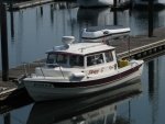
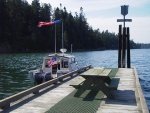
I bought a nice new Garmin echoMAP 74DV for my 22 to replace the Garmin 498 that quit working.
The new chartplotter has all kinds of fancy things including DownVU sonar.
The box clearly says Preloaded BlueChart g2 but somewhere it noted that lakes were not included. I asked the West Marine guy if my g2 charts for the 498 would work and he said, "Absolutely. Just plug it in."
Before i could just plug it in, I had to go back to WM and buy a $150 transducer that the WM guy had said WAS included.
I finally got the boat on the water today, popped open the card slot and there ain't no way my old card would fit. Ok, fine, maybe the hardware technology has advanced. Fortunately, I had downloaded the charts from Garmin so all I had to do was figure out what type of memory device was needed, transfer the data and go on my way.
I chatted with Garmin and, of course, found out the chart packages are not compatible and I need to buy the new one for another $150. SO now I'm $300 more in the hole on an already expensive chartplotter - and I don't think I'm done yet because the slot sure didn't look like a standard microSD adapter slot - but the Garmin guy says it is so I guess I have to trek out to the boat again and try it.
On top of all this, I must say that the fancy DownVU sonar was not at all impressive. It did not show me any higher resolution than the standard sonar (which you can put on a split screen).
I don't mind if a WM guy doesn't know the details about what he is selling but I mind it a LOT when he pretends to know.
I suppose I should have spent hours researching all of this. Actually, I should have bought a cheap depthsounder and called it a day.
At least I got out on the water! Took my son along but he was bored until I pushed the throttle to the stops and set a new personal record of 30.1 knots! (I won't do that much but I had to impress the kid once) We then anchored out and he got cozy in the v-berth and commented that this would be cool "if we had wifi" I explained that I could use my phone as a hotspot and then he could play his games at anchor. He suddenly developed a keen interest in navigation as we scoured the lake for high cellphone signal strength spots
Weather is going to keep us shorebound for a couple of days but then we will be back afloat, hopefully with electronic charts.
(I did use the Navionics app on my iPhone at one point. It was quite impressive)


