I bought it now what do I do?

Dwilly

New member
I am the new owner of a 1989 22 C-Dory Cruiser. I bought it to run the length (Canada to Astoria) of the Columbia river, crab the small bays on the Oregon Coast, and do longer trips in the San Juan's with my family (2 large, 2 small humans and 1 small dog).

Before investing a bunch of money I want to use it for a year and see what makes sense for me to spend the money on. But maybe you all have some must haves/opinion of what I should get?

It currently has a depth/fish finder, an old radio, and an older Garmin unit for navigation. I plan to upgrade the radio, but don't know if I should spend the money yet for a new navigation equipment?

The motor is decent 218Hrs on a 70HP Suzuki 4 stroke. I do have a 9.9 Mercury 4 stroke that I plan to install for a backup motor, but wondering what kicker mount I should go with?

Lastly any opinions on a fuel filter/water separator system that is economical to install?

If all goes well this next summer I plan to install a full Bimini off the back.

Thanks,
 
Dwilly":2jsvbapu said:
I am the new owner of a 1989 22 C-Dory Cruiser. I bought it to run the length (Canada to Astoria) of the Columbia river, crab the small bays on the Oregon Coast, and do longer trips in the San Juan's with my family (2 large, 2 small humans and 1 small dog).

Before investing a bunch of money I want to use it for a year and see what makes sense for me to spend the money on. But maybe you all have some must haves/opinion of what I should get?

It currently has a depth/fish finder, an old radio, and an older Garmin unit for navigation. I plan to upgrade the radio, but don't know if I should spend the money yet for a new navigation equipment?

The motor is decent 218Hrs on a 70HP Suzuki 4 stroke. I do have a 9.9 Mercury 4 stroke that I plan to install for a backup motor, but wondering what kicker mount I should go with?

Lastly any opinions on a fuel filter/water separator system that is economical to install?

If all goes well this next summer I plan to install a full Bimini off the back.

Thanks,
Opinions will vary for sure, but having done the Great Loop in 2017, 5,428 miles over eight months in waters I had never cruised before, it is my belief that all one really NEEDS is an iPad with Navionics or Aquamap mounted on a RAM mount at the helm, a depth sounder, and a VHF radio, with handheld backups like an iPhone with the same software for navigation and a handheld VHF as backups. The iPad has to be cellular capable to have a GPS but no cell plan is necessary.

Of course, we did not encounter any fog on the Great Loop. If you boat much in the foggy season, that changes things. But we have had radar since 2005, and since we try to avoid boating in the fog, we have only used it twice in 16 years, preferring to cruise close to shore and ducking into the nearest place of refuge if we encounter fog!
 
I agree with Pat on the iPad with Navionics but when fishing off-shore out of Newport in the fog, I like to know where the boats are and how fast they are moving when they are around me. For me, having Radar offshore when the thick fog comes in is an absolute necessity for added safety and greater peace of mind.
 
Pat, two thumbs up! I’ve accumulated much more over the last 19 seasons, due to the type of boating we enjoy, but I totally agree that is all you really need with the present advancement in gps ect, except if boating where fog is likely, then radar too as suggested. From there, the additional costly items, such as auto pilot, windless, dry heat, cockpit covers, window covers & the list goes on, mainly increase the pleasure factor & can be added & spread out over time if desired.

Jay
 
If your boat doesn't have it already, I would think about investing in a canvas cockpit cover. Conversely, if you and your family are going to be camping IN the boat, a full camper-back might be a good option too.
 
I am going to disagree with several of my good friends here. Although one can do the "Great Loop" and multiple other areas, it is not that much more expensive, if any, to have a multi function display, which is a depth sounder, plus a chart plotter. This gets around having a mount, bright enough screen, and the proper charts. I use an I pad as a supplement (and my boat allowed viewing the chart plotter, sounder and radar on the I pad as well as MFD.

There are good MFD by Garmin (and others) which are not that expensive, have charts for both rivers and coastal waters. $500 will buy:
Garmin® ECHOMAP™ UHD 63cv Fish Finder/Chartplotter Combo with a bright, sunlight-readable 6" display. The included GT24 transducer provides Ultra High-Definition ClearVü scanning sonar for crystal-clear images of what's below your boat, along with Garmin high wide CHIRP traditional sonar for remarkable target separation. Preloaded LakeVü g3 inland maps with integrated Navionics® data cover more than 17,000 lakes with up to 1' contours
.

Only a hundred or so dollars more, you can find a larger MFD with both inland and coastal waters.

Can you voyage the entire Columbia in a C Dory? Dams, restricted parts, too shoal? I would want to have all of the information.

There are several types of cockpit covers. One is a mooring cover/slant back. That I consider essential for all boats, unless they are left inside. It goes from the back of the cabin to both sides and into the spashwell. It prevents leaves and rain/snow from getting into the cockpit.

There is the Bimini top, which gives shade and some rain protection.

Finally the "Camper back" which will have both screens and windows for total waterproof enclosure.

I recommend a Racor filter.

Also with that age motor, be sure that all of the fuel lines have been upgraded, including the squeeze bulb. Also invest in an extra propeller just in case.

I prefer one of the kicker mounts which allows the motor to be moved up when not in use, then lowered when necessary. Get one which will be solid for at least 120# motor. Put in an auxiliary fuel tank, as well as a manifold off the built in tanks. It is nice to have a kicker which has a battery charging circuit.

Enjoy!
 
Bob, I too like the dedicated chart plotters & have two aboard. I really like the new Axiom 9 as it’s faster than my iPad, but if one already has an iPad & iPhone, their navigation ability will well suffice. If money was tight & I had to start over on navigational items to travel the areas we’ve been, I wouldn’t hesitate to do so with just a IPad & IPhone for navigation.

Presently my iPad & Iphone are used as Garmin In Reach, Gias topography, night vision & radar screen, area viewing in different Navionics chart resolution route planning & back up chart plotter, weather apps & the usual internet, phone & other usage.. In the boat cabin, I’ve never had a problem viewing items on the screen, outside when using the dinghy it can be a problem in direct sunlight,

Jay
 
Yes, Jay, it is very easy to navigate without a chart plotter or I pad. I spent 8 years cruising thru out the World before any chart plotter was available, All of my 4 trips from April thru October in our Cal 46 to AK were without chart plotters. So one can easily say, no chart plotter or even an I pad is necessary. Of course I carried about 200 full size paper charts of the Inland passage and AK. The shoal draft of the C Dory is another positive feature when cruising areas like AK.

I always remind people that Captain Cook didn't have charts or accurate navigation gear.. Many paper charts which I have used had the soundings only along the track of sailing ships which tacked up the coast of N. America.

But to get the best of a modern depth sounder, with down scan, CHIRP etc it is about the same cost as a full MFD. Is this necessary? Certainly not, A lead line with armed lead works very well for depths--not so well for structure and fish finding.

I pads with GPS (or blue tooth added GPS) are going to cost about the same as a MFD, if the boater does not have an I pad. Add in the cost of charts.
 
I REALLY wanted to use an ipad with navionics as a primary navigation tool. Last summer I tried it in the San Juans and it failed multiple times. The gps was slow to respond or showed us at a location or heading that was inaccurate enough that following it would have put us in a bad place. The old c80 was dead on every time. In the fog I could not trust the ipad. In fair conditions I use it until it fails, because its so easy to plot and change a course. To plan and have a birds eye view of a route it’s great. When I want to know precisely where I am, I personally will not trust my life to the tiny gps receiver in an ipad. Awesome tool, but just one in the box. As for radios, we have two handhelds and a fixed vhf and have had them all in use simultaneously. As for radar: on a bluebird day in summer we left the dock at a leisurely pace and an hour later were trucking up satatoga passage in fog so thick we could have spread it on toast. We could have gone back to a dock and waited for the fog to clear in a few days. That’s about what it took😛
 
Don't be afraid to get used electronics. Lots of people upgrade and that creates a market of used devices.

Last year I got a Humminbird 959DI for less than US$500. It was an upgrade to the Humminbird unit I had and fixed a problem with the display I had on the old unit.

Additionally, the 959 runs the Navionics map chip that I already had and I knew how to use it.

I spent a lot of time looking at new units, but could not find one I cared for to replace the existing Humminbird plotter I had. A good used unit that was a fancier model than the one I already had was the perfect solution.
 
Bob, I hear you on the ease of navigation with a chart plotter or IPad. As I started boating late in life, my experience with navigation was solely land & some minor air related, but does have similarities in use with compass & maps with main difference being most land travels was on foot or horses in relatively small areas compared to the sea. There is enough difference that without gps & chart plotter, I probably would not have attempted my ocean type explorations even if all relatively close to land & instead stuck to rivers & lakes. I would still be pretty good at navigating in mountain wilderness areas, but a rank amateur on the open sea.

Snow Texan, I started using an IPad in 2010 along with chart plotters. Then & for several years after I found the iPad very inaccurate most everywhere. In the more remote places by 2012 in SE Alaska it had improved considerably, but still not dependable, though in those more remote areas neither were the chart plotters. At times I had the 2 Garmin chart plotters & the IPad all showing the boat in different locations & none correctly. They all would have me on the rocks & only careful evaluation of the charts with what my eyes were viewing, allowed for save navigation through some of these narrow areas. By our 2015 SE Alaska cruise the IPad was only slightly less dependable then the chart plotters & by our 2018 cruise, with a couple months observation with both IPad & the two Garmin chart plotters run continuously, they had reached parity with each other & very accurate except in a couple of the remote areas & then about equal there in reliability also. With the new Axiom Navionics chart plotter, I see very little accuracy or reliability difference over the Navionics on the IPad. The difference I do see is the faster updates of course changes on the Axiom over the IPad, but the IPad fast enough for me to reliably navigate. In 2014, I cruised the San Juan’s then the Gulf Islands from Victoria to Nanaimo. I didn’t have workable charts for Canada in the Garmin chart plotters, so relied solely on the Navionics on the IPad for several weeks. It was totally reliable for the six week period we cruised there that year. I can’t say why yours was unreliable, but can say our was reliable. Perhaps the mounting or some other blockage of gps signal or IPad year & type is the culprit.

Jay
 
Hunkydory":cto07epx said:
... Then & for several years after I found the iPad very inaccurate most everywhere. In the more remote places by 2012 in SE Alaska it had improved considerably, but still not dependable, though in those more remote areas neither were the chart plotters. At times I had the 2 Garmin chart plotters & the IPad all showing the boat in different locations & none correctly. They all would have me on the rocks & only careful evaluation of the charts with what my eyes were viewing, allowed for save navigation through some of these narrow areas. By our 2015 SE Alaska cruise the IPad was only slightly less dependable then the chart plotters & by our 2018 cruise, with a couple months observation with both IPad & the two Garmin chart plotters run continuously, they had reached parity with each other & very accurate except in a couple of the remote areas & then about equal there in reliability also. With the new Axiom Navionics chart plotter, I see very little accuracy or reliability difference over the Navionics on the IPad. ...

Yes, there can be inaccuracies with the GPS position determination because of signal interference, strength, etc. But don't blame position errors solely on the GPS. There can be inaccuracies in the chart data itself or in how the map/chart software developer implements them.

In some areas, the NOAA charts have not been updated for a very long time.
 
Jay

The ipad we use is one year old now and a dedicated boat tablet for us. I believe its shortcomings are in the gps receiver size and location (inside the boat). Maybe I should clarify that I WOULD leave the dock with an ipad as my primary navigation, but expect to do as you have done and know always where I am in relation to danger. It became clear to me quickly that all gps locations on chartplotters are aids to navigating and no substitute for situational awareness and knowing where you actually are on the chart. In other words, if you follow the arrow blindly you are going to end up on someones youtube video waiting for high tide or worse. Sounds like you always had redundancy when it was available and used your skills where it wasn’t, which is the most anyone can do! I am also a mountain and desert goat arriving late to the big water. Hope to meet you one of these days on the water or otherwise!

Nigel
 
My impression is that the I pad Pro, (mine is a couple of years old) is quite accurate GPS.

Some DMA charts are still based on surveys done in the 1800's...Surprisingly accurate--but occasionally major features are not on the chart. We found a sea mount off the coast of Panama with out depth sounder. We sailed back and forth over it, to get some extent of the area--got a fairly good position, and turned it over to NOAA. They did include it on later edition charts.

We "found" another "peak" in the Med--boat's keel was on it for a fairly brief period of time (7 foot draft)--in 2 to 3' seas with white caps. It was not on DMA (Defense Mapping Agency), but was on British Admarility Charts. Why DMA didn't have a feature that was on BAC is beyond me...

There was one DMA chart available in the 80's (haven't checked recently) which had some sketches and embellishments by the artist Whistler on it.
 
thataway":ujck7lt2 said:
My impression is that the I pad Pro, (mine is a couple of years old) is quite accurate GPS.

Some DMA charts are still based on surveys done in the 1800's...Surprisingly accurate--but occasionally major features are not on the chart. We found a sea mount off the coast of Panama with out depth sounder. We sailed back and forth over it, to get some extent of the area--got a fairly good position, and turned it over to NOAA. They did include it on later edition charts.

We "found" another "peak" in the Med--boat's keel was on it for a fairly brief period of time (7 foot draft)--in 2 to 3' seas with white caps. It was not on DMA (Defense Mapping Agency), but was on British Admarility Charts. Why DMA didn't have a feature that was on BAC is beyond me...

There was one DMA chart available in the 80's (haven't checked recently) which had some sketches and embellishments by the artist Whistler on it.

The problem we have had is not in overall accuracy but in signal reception. The ipad is usually fine but from time to time lags in fixing a position and often shows us facing the wrong direction. It just seems to struggle sometimes to hit those satellites. No issues with the charts or accuracy when it is working. Sometimes I want to check my position RIGHT NOW and it puts me on hold. Maybe I just get impatient! It usually corrects itself in less time than it would take to pull out a paper chart and compass and check a position, so in that regard it may also be my generational expectations of gps systems (read: lack of experience 😂)
 
thataway":fwwx19vk said:
My impression is that the I pad Pro, (mine is a couple of years old) is quite accurate GPS.

Some DMA charts are still based on surveys done in the 1800's...Surprisingly accurate--but occasionally major features are not on the chart. We found a sea mount off the coast of Panama with out depth sounder. We sailed back and forth over it, to get some extent of the area--got a fairly good position, and turned it over to NOAA. They did include it on later edition charts.

We "found" another "peak" in the Med--boat's keel was on it for a fairly brief period of time (7 foot draft)--in 2 to 3' seas with white caps. It was not on DMA (Defense Mapping Agency), but was on British Admarility Charts. Why DMA didn't have a feature that was on BAC is beyond me...

There was one DMA chart available in the 80's (haven't checked recently) which had some sketches and embellishments by the artist Whistler on it.

The problem we have had is not in overall accuracy but in signal reception. The ipad is usually fine but from time to time lags in fixing a position and often shows us facing the wrong direction. It just seems to struggle sometimes to hit those satellites. No issues with the charts or accuracy when it is working. Sometimes I want to check my position RIGHT NOW and it puts me on hold. Maybe I just get impatient! It usually corrects itself in less time than it would take to pull out a paper chart and compass and check a position, so in that regard it may also be my generational expectations of gps systems (read: lack of experience 😂)
 
just my two cents. The plotter you have is fine. Mine is a c80 from 2005? or so as is my radar. I would not buy new until you use the boat a year and see what you need or like. There is always a better faster cooler unit on the market. And really the chart plotter part is my lease concern. Depth finder and radar are far more important in the area you are going to be boating in. A chart plotter, at best, is a resemblance of reality ( stored info of questionable accuracy) . Where a deep finder and radar is reality and far more useful.

Of More importance is the ability to communicate when in trouble. Old radios are great as long as the connections and antennae is working properly and clean connection. Take apart all your connections and clean them. a hand held is a great safety item on any boat.

How you getting to shore? start thinking about it. kayaks are great ( which we have) but for a dog ( depending on size and breed) a dinghy is better. I much prefer the dinghies with a blow up floor and keel. Far easier to row then any flat floor unit. I have had both and you could not give me the latter.

as for the Water fuel separator. buy this You want one that you can drain the fuel at the bottom, mount where you can get to it but not in the motor well as it will rust. buy extra filters and keep one on the boat. Change it every year whether you want to or not and you will never have a problem. You can get shorter ones also if space is a problem.

Well I hope that is useful and puts the thread back on track and away from the paper chart( dont go there) mfd ( Yes) and Ipad/anypad (only as a backup and not your primary) debate. Which i just answered any way. Many new MFDs have wifi or bluetooth so a phone or pad can be used as a second station. Helps cut cost if you want a unit on the back deck for fishing as I have.

See you on the water I hope.
 
I'm going to echo what Tom said. My C-120 (now called a Classic :disgust Hummm, wonder if RayMarine had that planned all along when they just used the letter C in that series,) Works just fine with rare issues, and so far, nothing that has been insurmountable to get it returned to normal operating status. With Tom, my radar and sounder are the same age as my plotter and all work together just fine. (All my other electronics, VHF's, AP, and AIS are all newer, and all continue to work as expected.)

I have thought about updating, but somewhere down the road, I am going to sell my boat (NO,NOT NOW :) and if I change the electronics to Simrad, for instance, or whatever brand, and the list the boat, I just eliminated the prospective buyers that don't want Simrad or whatever else I chose to put in. So, Will I take a hit for old electronics, maybe some, If the boat is turn key to cruise, not so much, and I still have working electronics. Might be the same deal with the outboards, with the same response. So . . . .

Use what you have, until you get a chance to decide what you like and don't like, and then search for the best deal on your choice electronics. I totally agree with Tom, the VHFs (note plural there) need to be high quality, and high performance. The VHF was the first thing I changed on my boat. The PO was a primarily a fisherman and so had little to no use for a noise box disturbing his quality time on the end of a rod. SO he put in the smallest, cheapest, (and almost worthless) VHF on the market. It qualified as a VHF radio because it said VHF on the front. I added a second fully functional (Auto fog and hailer) VHF and then replaced that little worthless piece soon after that, giving me 2 VHF's one with AIS receive which was brand new at that time.

Priorities. Base on safety first, function next and feel good somewhere after that.

Harvey
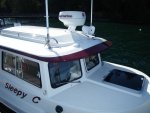
SleepyC :moon

January_2010_346.thumb.jpg
 
Lots of good advice on equipment but what surprises me about the thread is that not more attention is being paid to the “coziness” that 2 adults, 2 kids, a dog and all the necessities will result in. V berth for 2, dinette for 2 and sole for the dog maybe? Even with cockpit space I would think that crabbing gear, dog food, cooler, pots, maybe the porta potty, would take up a little space and the roof night have a dinghy on it now. One thing about the interior size limitations is the need to move somebody or something to accomplish most tasks. I did about 5 or 6 long weekends with just my wife over 11 years and that was plenty for me. She was running the hair dryer while I needed the coffee maker plugged in but she was sitting on the compartment it was in. I suppose some of you will know the secret to comfortable coexistence but in the morning my boat always looked like burglars had ransacked it during the night. Don’t step on Fido in the dark and you kids quit that fighting! I think you’re going to need a bigger boat, lol. Now I’ll sit back and prepare to be convinced otherwise. More power to ya if you get it done.
 
Fairbro":304922ck said:
. I suppose some of you will know the secret to comfortable coexistence but in the morning my boat always looked like burglars had ransacked it during the night. Don’t step on Fido in the dark and you kids quit that fighting! I think you’re going to need a bigger boat, lol. Now I’ll sit back and prepare to be convinced otherwise. More power to ya if you get it done.

Well, my secret was marrying a woman who spent the first 18 years of her life living aboard a boat with two parents, two brothers and a dog. When we bought our first boat she only had two demands, the only wood could be a flag staff, and the cleats had to be beefy. We've been married over 60 years and still miss our 16 footers.
 
Back
Top