Chips & charts for Alaska

Andrew":s1ozfxvm said:
If you wish to borrow this chip, just let me know. Its a CF card( the big size). It may be older but might be useful if you can't find anything more suitable.
Andrew, Matt has special-ordered the 914 chip for me, so I have what I need. Thanks so much for the offer, though. Maybe others going that way could use it.

Warren
 
centerisland,

try this one on charts:-

http://www.charts.gc.ca/help-aide/faq-eng.asp#cq1

Quote:-

Customer Questions
Am I required by law to carry CHS charts? What are the Charts and Nautical Publications Regulations of the Canada Shipping Act?
Most vessels of any kind in Canada have an obligation to carry and use official charts and publications and to keep them up to date. The chart carriage requirements are listed in the Charts and Nautical Publications Regulations, 1995 of the Canada Shipping Act.

CHS paper charts meet the requirements of the chart carriage regulations. CHS digital charts meet the requirements of the chart carriage regulations under certain circumstances. CHS Electronic Navigational Charts (ENCs) meet the requirements provided they are used with an Electronic Chart Display and Information System (ECDIS). CHS raster charts meet the requirements only if paper charts are carried and used as a backup.

For further information on which charts meet the official requirements, please see our CHS Official Products and CHS Licensed Manufacturers.


I agree it's not specific about what "most vessels" are but it's good common sense anyway.

M
 
Regulation regarding carriage of charts

CARRIAGE OF CHARTS, DOCUMENTS AND PUBLICATIONS

4. (1) Subject to subsection (2), the master and owner of every ship shall have on board, in respect of each area in which the ship is to be navigated, the most recent editions of the charts, documents and publications that are required to be used under sections 5 and 6.
(2) The master and owner of a ship of less than 100 tons are not required to have on board the charts, documents and publications referred to in subsection (1) if the person in charge of navigation has sufficient knowledge of the following information, such that safe and efficient navigation in the area where the ship is to be navigated is not compromised:
(a) the location and character of charted
(i) shipping routes,
(ii) lights, buoys and marks, and
(iii) navigational hazards; and
(b) the prevailing navigational conditions, taking into account such factors as tides, currents, ice and weather patterns.
(3) If a ship, other than a pleasure craft of less than 150 tons, is making a foreign voyage, a home-trade voyage, Class I, II or III, or an inland voyage, Class I, the master and the owner of the ship shall have on board and make readily available to the person in charge of the navigation of the ship an illustrated table of life-saving signals for use by ships and persons in distress when communicating with life-saving stations, maritime rescue units or aircraft engaged in search and rescue operations.
(4) If a Canadian ship is of 150 tons or more, the master and the owner of the ship shall have on board and make readily available to the person in charge of the navigation of the ship the International Aeronautical and Maritime Search and Rescue Manual, Volume III, Mobile Facilities, published by the IMO.
SOR/2005-135, s. 2.


i would think one would say the digital charts would allow you to say you meet the requirements of subsection 2
 
I agree as long as your digital chartplotter(s) is (are) working and I don't think anyone is going to ticket you for not having paper copies but it makes sense to have at least one of the books of charts with you.

As always, it probably makes no difference unless you have an accident and then the ambulance chasers would have a fine time.

M
 
We made 4 trips in the Cal 46 with hundreds of charts of both CHS and NOAA--not enough room in the C Dory to easily carry these charts. But at that time chart plotters were not affordable and I bought a tug boat's "last years" charts, fully annotated. More recently we have made several trips to BC and one to AK using just our chart plotter, and the two Marine Atlas chart books. Today I would probably just use the I pad's Navoinics HD charts for BC--since they cover all of BC as well as Alaska and the US areas you will need. There are other options, including the free NOAA charts via iNavX and the "charts and tides" for the West Coast and AK--but again based on NOAA charts--the advantage of these are that Active Captain is available interfaced with these charts.

Be sure and have Douglas-Hemmingway's books on AK and BC aboard by Fine Edge publications. They are essentials. We also use a planing map for the route by Fine Edge which helps with the overview. Pacific Northwest Boating book for the year--and the "Mile Post" Alaska Guide are also handy.

In 7 trips into BC we have never been asked if we had current copies of CHS charts.
 
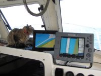
I know I posted something like this a while back, but here's a shot from the boat today with the iPad just behind the E-80, so you can get some size perspective. A lot more real estate there than on a smart phone. Oh, and that's a 7 pound cat up there for more perspective.

IzzyGPSe.jpg
 
Jim,

That is impressive (the :cat as well ) but just as a matter of interest why do you have different orientation on the I-pad vs the Raymachine?

I must admit I tend to do the same with my Garmin vs Ray with one on close up/heading up so it looks like what I see out of the window and the other on wide scale N.up just for orientation in the same way I would look at a chart 'cos that's what my brain remembers when driving around islands etc.
(I hope that doesn't restart the old argument)
Just wondering if you use the same logic??

BTW that is where our new 30lb pup sits so I need all the visibility I can get :lol:

M
 
Hi Merv,

Ah, the one drawback (my perspective) of the iPad/Navionics set-up is the North Up orientation. If using just one chartplotter, I prefer Course Up; when using two plotters, I set one each way. Not a deal-breaker, considering price and convenience. I know the iNavX app allows either orientation, but Navionics was out there first and that's what I have on the iPad. I have no hands-on experience with the iNavX app.

Having a :cat or a :dog up there is also helpful. :wink:

Best wishes,
Jim
 
Jim,
I assume you have the more expensive i-pad with the gps. That is approaching the cost of a cheap laptop and separate LCD screen. At least for now.
Might change when droid seriously gets after them this year. :shock:

Hope you guys make it up here again someday.

Take care.

M & K
 
Grumpy":1t8stjzo said:

Interesting - the complete regs are here:
http://laws.justice.gc.ca/eng/SOR-95-149/page-1.html

You can use ENC charts, if you have "back-up arrangements". It even goes into the what scale is required! The only saving grace for us small boat owners is this:
(2) The master and owner of a ship of less than 100 tons are not required to have on board the charts, documents and publications referred to in subsection (1) if the person in charge of navigation has sufficient knowledge of the following information, such that safe and efficient navigation in the area where the ship is to be navigated is not compromised:
(a) the location and character of charted
(i) shipping routes,
(ii) lights, buoys and marks, and
(iii) navigational hazards; and
(b) the prevailing navigational conditions, taking into account such factors as tides, currents, ice and weather patterns.

As the holder of a USCG 100 ton Master License (who's boated in Canada for 30 years) I'm a bit embarassed that I wasn't aware of these regs.
 
Grumpy":19dnr2w2 said:
Jim,
I assume you have the more expensive i-pad with the gps. That is approaching the cost of a cheap laptop and separate LCD screen. At least for now.
Might change when droid seriously gets after them this year. :shock:

Hope you guys make it up here again someday.

Take care.

M & K

Hi Merv,

For anyone who wants a true GPS function, the 3G version iPad is the way to go. The wifi only model does not have an internal GPS chip. That was the deciding factor for me in choosing the 3G model. I have not used and have no intention of using the AT&T connection, but it was worth the additional $ to get the GPS function.

No doubt, based on the success of the iPad, there will be many tablet options this year. The Samsung Galaxy is being sold through Verizon, but I have no need for another phone base device (and fee). As it is, we use the Mifi with the iPad (and did so long before that was an option with Verizon). Beyond the GPS functions, the iPad is an information and entertainment device. It doesn't replace our laptops, since it doesn't have full-featured software programs such as Photoshop... but, you can download photos and have basic imaging apps. What it does SO much better than a laptop: portability. You can hand it back and forth. I can sit in a chair, lounge on the couch, or even comfortable read with it in bed... I don't need to be in a "laptop position" to use it. The apps are the icing on the cake, with fast weather, eReader, internet, e-mail, etc, etc. I've not been able to get comfortable with nav software on a laptop on the boat... finding the right position, access (needing a mouse to control the software), etc.; with the iPad, you just pick it up and use it... hand it to the first mate... take it out in the cockpit... no wires. Easy.

I don't recommend one of these for everyone, but if you see the above usage fits your style, why put it off? Yes, they will likely get cheaper and gain features... just like every electronic device. Wait, and in the meantime, you don't get to use it.

Did you give up your 8-track, yet? :mrgreen:

Best wishes,
Jim
 
8 Track? Yup but I bet there are still some tapes lying around in that trash dump area full of "stuff" that we laughingly call a Garage. Along with piles of printed photographs and 35mm film negatives and stoopid 8 film.........


It's cabin fever time up here as you can tell by some of the posts :lol:

M
 
Jim,

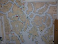
I know nearly everything in Texas is bigger but I have just posted a picture in the Kingfisher album of 1/2 of the display I am currently using to plan one of this year's adventures. It is a work in progress but Dragons are Red, Marina's are Green, Anchorages will be yellow etc etc.
I will try to insert it below but if the cyberglue does not work you know where to find it.
modules.php


M
 
To answer the question about two chart plotters and scale--I use one a a longer range--about 6 miles and one at 1 or so mile; Both plotters will be heading up.

When I do planing, then I do North up, but not underway.
 
Back
Top