Upper Tennessee River, October 2024

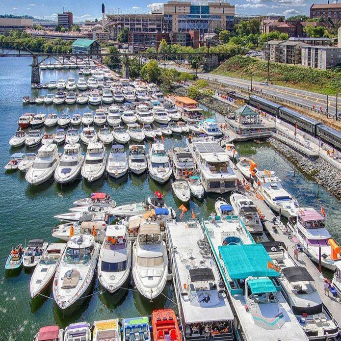
So here's the deal. As I've said from the beginning, anyone is always welcome to join me on my trips. However, you are responsible for your crew and ship and have to decide for yourself what you are comfortable with and capable of. That being said, I've talked to Bill (Mystery Girl) who is on the water and launched at Harrison Bay State Park yesterday. This morning he was upstream at the Hiwasse River. He said the water appears to be a little higher judging by the shoreline, and has seen some floating vegetation and going against a 1mph current. And is not as clear today as it was yesterday. And only a few sticks in the water. I also just spoke with Ranger Matthew at Harrison, and he said they are still actually down about a foot there due to lowering of the river earlier in preparation for the incoming storms. Most the flooding and damage we are hearing about in the news is east of Knoxville and the Tennessee River. There are several rivers that flow into the Tennessee and why the Fort Houdoun Dam is closed to traffic and open letting out a lot of water. Downstream, the gorge is narrow and that incoming water is going to flow at a much faster rate. The Ranger didn't foresee any problems at Harrison Bay. The Bay is on Chickamauga Lake, a rather large impoundment. For now, my plans are to still launch at Harrison Bay State Park tomorrow afternoon. Take it day by day and be flexible. I think we will head upstream, heading out Thursday morning between 9-9:30am Eastern Time. Depending on what the locks are doing and current, we can follow the main channel upstream, or we'll just circumnavigate exploring the smaller channels and coves along the way. With out any flooding, I would expect marinas and fuel will still be available, but again, we can check along the way. Worse case scenario, we could probably spend three weeks just on Chickamauga Lake and it's coves and tributaries. With mostly anchoring at night, we will need to be cognizant of depths. Even with normal conditions, the levels can change a foot or two over a couple hours depending upon dam generation. Hope to see you all tomorrow, but if you decide not to come, i respect that and understand.
Colby
 
One last reminder. Be sure to check in at the office before launching. They will want your rig and boat info I believe. And they will be having us park in the overflo lot. Also, we'll use Ch 72 for the common frequency amongst us. I'm looking forward to the cruise, and seeing every one. Colby
 
We're currently at the Fort Loudon Marina above the Fort Loudon lock and put in here yesterday. There's a fair amount of debris in the water, and we heard second hand from a local that the docks in Knoxville were under water. While that dire description may not be true, we're going to forego a trip to Knoxville and explore the Little Tennessee on Lake Tellico for a few days before heading south. The Fort Loudon Lockmaster said their latest estimates for re-opening were Thursday or Friday - we'll plan to head downriver no earlier than Saturday.

Our current plans are to take out above Chattanooga on the 10th or 11th, so we may see you if you're still on Chickamauga or Watts Bar Lake during the next week.

It feels kind of like flood season on the Mississippi - go slow to avoid large debris and minimize impacts of the smaller stuff. Looks like nice weather for the next week. Continuing prayers for those in the devasted areas just east of us.
 
Hey Colby,
People plan… and God laughs. Best approach is what you said, be flexible and take it day at a time.

Earlier this afternoon I spoke with Joel Clark at the Fort Louden dam. He said they are blocked by debris and have a tug trying to use prop wash to get it moving. He went on to say that a huge debris field was heading down and would probably accumulate before the present one could be cleared. So, Good Call on postponing the Knoxville section. Joel did say that the Gorge below Chattanooga is closed as the flow rate reaches 100,000 GPM but thing should be regulating by next week.

My brother supposed to be driving up with me next Tuesday for a few days on the water: conditions permitting. We’ll keep checking in… Joel suggested the TVA app for individual dam reports and he also said that they really like hearing from boaters on the phone. 865/986-2762

Nobody could have seen this coming… we had a hurricane pass here just two weeks ago… but Nothing like This one. So sorry for those folks.
 
Hi Dale,
Thanks for that report. There are four of us here at Harrison Bay State Park now. We will head up stream leaving at 10am EST tomorrow morning. Our plans are to just mosey upstream and see how it goes. Bill on Mystery Girl is upstream a few miles at Eldridge Slough. He reports no problems, and it looks good here at Harrison. I'm sure we'll see debris as it makes its way downstream. There is plenty of shoreline right here on Chickamauga Lake, so even if we are unable to proceed through any locks, we have enough water here to enjoy. Colby
 
Got underway from Harrison Bay State Park this morning around 10:30a with four boats, C-Traveler, Sea Spray, C-Play, and Sunbeam. (All four boats C-Dorys. My 25, two 22's and a Tomcat 24.) Caught up with our fifth boat, Mystery Girl (Ranger Tug 23). Slow and pleasant cruise 30 miles upstream to Mud Creek. Only about a knot of current on the bow, and not much debris. Mostly vegetation, and a few tree limbs. Passed by TVA's Sequoyan Nuclear Plant. Anchored in Mud Creek around 4pm. Got our kayaks down and paddled or peddled (I have a Hobie Pedal Kayak) around the creek. Tomorrow we plan to go through the Watts Bar Lock, about 23 miles upstream.

To see some photos, go to my blog at FindPenquins: https://findpenguins.com/77ono0cdqci52/ ... ssee-river
 
Colby, great photos! Make sure you submit some of the photos of your trip for
the 2025 C-Dory C-Brats calendar. Have fun and be safe.
 
Again, photos posted in my FindPenquins Blog.

A good day for cruising the Tennessee River. Again. Warm, sunny, and only a few fishing boats on the River with us. It was a nice night in Mud Creek. When we left, I checked the current in the main River channel by just drifting and seeing what the GPS showed. 1.7 kts. 15 miles farther up stream, the current was at 2.2 kts. Still very little debris. Until, we got to Watts Bar Nuclear Power Plant, or just before at mile 527. There were several debris fields of limbs and logs. Then as we approached the Watts Bar Lock and Dam is where we really ran into a bunch of debris. Picked our way through it and entered the lock. The other side of the lock in Watts Bar lake, still on the Tennessee River, it was clear again. Didn't notice any current but some turned immediately into Meigs County Park on the east side to dump trash and use real toilets, while Bill and I headed to the cove on the west side with an old abandoned Watts Bar Resort. There are some old free docks there one could tie up over night, but we chose to anchor out instead. The other three boats came over to join us later, anchoring in the area as well. It was uneventful in the lock, even with two newbies to locking. Only four bollards to hang on to, so Sunbeam rafted on C-Play. Nice to see that the lock tender had taken some good photos of our boats in the lock and posted on their facebook page. (Watts Bar Lock) After supper I went for a kayak ride to check in with the other boats. Tomorrow we'll head up to the Cinch River and stop at Kingston. Oh, btw, the trees growing in the water I wasn't sure if they were Cedar or Cypress, I think Rosanne's uncle answered the question. "I think the trees are Bald Cypress. They grow in swamps and shallow water areas. To get oxygen for the roots, they send up what we call Cypress knees. The knees are irregular in size but usually about 12 in circumference. They are smooth and brown and taper in as they get farther up from the water."
Colby

P.s,Gary, I sent 8 photos to Juli today. None from the trip, but I may send in a few more later.
 
Colby, glad to hear things are going OK for you and the folks traveling with you. We came back to Fort Loudon Marina on Thursday to fix an electrical gremlin, and yesterday I saw info from Waterway Guide that Watts Bar Lock was closed due to high water. My hunch is that they must have closed right after you went through or re-opened just prior. Given that information and seeing the very high river levels just downstream, we chose to punt on the idea of heading downriver, and headed back up the Little Tennessee (Tellico Lake) for this week.

Tellico is clear and clean - totally unlike the chocolate-milk-colored Tennessee. We'll probably pull out and head home Wednesday or Thursday of next week.

Fort Loudon Lock is open again, and there's a manageable debris field spanning about half a mile above the lock and before the canal that cuts across to Tellico.

Best wishes for the remainder of your journey!
 
Thanks Les, I was wondering how you guys were doing. I think we've probably been the only ones thru the Watts Bar Lock in the past couple of days. We had no problems. I think the highest current we have seen was downstream of the lock with shy of 3kts. We didn't start seeing hardly any debris until around the Watts Bar Nuclear Plant. There was a lot of debris just below the dam, but it was navigable. We are in the Clinch River tonight and I'll be posting an update soon. But very little current today. We stayed in the Watts Bar Resort cove just above the dam on the port side. A few more limbs and logs here and there and a few debris fields, but again nothing much. (I dodged more debris on the Sacramento River and the Columbia River during past trips with Jim Gibson on Pounder.) I keep hearing about how hazardous Watts Bar lake and down stream is, and not sure why. I'm assuming it's a warning to the fast boats. I did see a picture of the Fort Loudoun Lock approach on their webpage, and definitely more debris that what we've seen on our way. So I'm wondering if we will be able to make Knoxville. We are planning to spend a couple days here on the Clinch River, and will probably go thru it's lock on Monday, and back on Tuesday or Wednesday, then maybe push on to the Fort Loudoun Lock. I've also been watching the weather and formation of another hurricane. We're taking it day by day. Sounds like the dams upstream have reduced their output. We did definitely get in some darker water today. However, it's cleaner here in the Clinch River. I think if you can get locked down at Fort Loudoun, you won't have any problems continuing. At least not from what we are seeing. Oh, also I'm not really seeing very high water levels either. Water may be up some now, but when we left Harrison, it was a foot low still. At least nothing appears to be flooding. I guess it's all relative. Colby
 
It was a nice quiet night in the cove just upstream of Watts Bar Lock and next to the old abandoned Watts Bar Resort. Woke up this morning to some fog, but it dissipated quickly. (By the time I took a photo, it was clearing up.) Another nice warm day with a slow cruise to the Clinch River and Kingston. (I finally read the charts closer, and learned there is an L in Clinch. lol). Very little current today, probably 1/2 kt. Did see a few more limbs and logs in the water, and passed through a few more small debris fields. Stopped at a marina early in the day for one of our fleet to take on some fuel. The Tennessee River did turn a lot darker as we continued upstream. Much more muddy in color. This area of the Tennessee River is called Watts Bar Lake. Seems to be a little more developed with more homes along the shore. This afternoon we turned into the Clinch River, and you could see where the clearer water of the Clinch was entering the muddy water of the Tennessee. Was even a very noticeable difference downstream where the water changed colors. I suspect that is where the "flooded" water has advanced to coming from the dams up river. We pulled into a quiet cove, shaped like Bullwinkle the Moose's antlers. We are in the left antler, lol, just across from the Kingston Fossil Plant. In fact, I'm not too sure the fleet is happy with my anchorage choice tonight. We are literally anchored between I40 and a power plant! Tomorrow we plan to go explore the Clinch River a little more. Probably spend a couple days on it before continuing upstream on the Tennessee River. Photos can be seen at my blog: https://findpenguins.com/77ono0cdqci52/ ... ssee-river
 
Even being between a power plant and Interstate 40 last night, we slept well. It has been pretty warm this past week. Mid 80's during the day, and low to mid 60's by early morning. And humid. Mostly sunny with some clouds part of the day. Colors haven't really started turning yet, but I would expect them to towards the end of the month. We departed the little bay next to the Kingston Fossil Plant, going a few miles up the Clinch River, then turning up the Emory River. Very scenic and peaceful, fairly narrow river. Minimal current. We cruised 12 miles up to Harriman. stopping at a very nice and new public dock. Room for three of us. Mystery Girl has been heading out an hour earlier than the rest of us int he morning, cruising a little slower. But today we also cruised a little slower, so didn't catch him until we turned around at Harriman. We discussed going up the Clinch River, but two of the boats would need to gas up somewhere up the Clinch River after the Milton Hill lock, and the only marina we knew of was not answering their phone, and the voice mail box was full. Not a good sign. So we decided to return to the Tennessee River and stopped at Long Island Marina to fuel up. Sea Spray stayed at the marina, while the rest of us went behind Long Island to anchor. The water in the Clinch and Emory Rivers was fairly clear in color, while back on the Tennessee River, the water is very muddy colored. Speaking with the lock tender up at the Fort Loudoun Lock, it appears that they have reduced the outflow more, and they don't believe we will have a problem getting thru some of the debris below the lock and dam. So we will continue up the Tennessee River tomorrow, planning to go through the lock in the afternoon. There was very little debris on the Clinch river and almost nothing on the Emory River. Back on the Tennessee River for 4 miles, wasn't much either. Most of it has probably flushed downstream, and will hopefully be gone before we start back. I did my good deed today, when a disable boater waved us down. Two older couples on an open bow runabout that engine had stopped and would not restart. We took them in tow for the two miles back to their home next to the Long Island Marina.
 
It was a quiet night behind Long Island, and surprisingly, the current seemed to stop for a while. Woke up to a nice sunrise, but the water was rather gross. Not just muddy in color, but a lot of foam. Got underway and the closer we got to the Fort Loudoun Lock and Dam, the current increased. Jeff on C-Play checked it with drift, at 3mph. Not a lot of debris today, but the dam had increased its output some from yesterday, and it was a rough ride into the lock. 3-4 ft standing waves coming off the dam as we entered the lock wall. And a bit of debris to dodge at the same time. Definitely more exciting than the water we experienced below the Watts Bar Dam as we entered that lock a few days ago. Other than that, enjoyed the scenery between Long Island and the Fort Loudoun Lock. Some nice homes, the Malibu Boat factory, and quite a bit of river front industry in Loudoun. As we came around Blair Bend, the entire point seemed to smell like Hops. The smell I remember from my truck driving days hauling Schlitz Beer. I suspected some production from corn. Nothing on my charts showed the name of the industry, but googling I found AE Staley, which produces quite a bit from corn. Entered the lock, which wasn’t completely calm due to the rough water outside. Once the gates shut, things smoothed out. The lift was 72’ I believe. Out on top, water just had a bit of chop from the breeze, with no noticeable current. Mystery Girl and Sunbeam went around a cove to anchor, while SeaSpray, C-Play and C-Traveler went out to dinner at Calhouns Restaurant. Manager is making an exception and allowing us to stay at their docks tonight. The lockmaster said that debris is starting to clear out. We did notice that water was much higher today than what we’ve seen previously.
 
Today was a little breezy, so not quite so hot as it has been. Cruised from Fort Loudoun Calhouns Restaurant to Knoxville Calhouns Restaurant, lol! There are some very nice large homes along the Fort Loudoun Lake portion of the Tennessee River! So most the day was just spent admiring them as we cruised along. We also passed the Nina replica ship. And one of the largest sailboat marina's I've seen. We had planned to dock on the Knoxville free city dock, but it was filled with boats here for the UT football game this weekend. So the next choice was the Calhoun's restaurant free dock. We plan to stay here two nights, taking a rest day tomorrow to explore Knoxville. We didn't see much debris today, although the water is still pretty brown. Wasn't much current leaving Fort Loudoun, but as we proceeded upriver, we did start seeing about a knot of current. Water is still high here, but judging by tree debris along the shore, looks like it's dropped 3 feet from it's high point. The dams are still dumping a lot of water downstream.
(Photos at https://findpenguins.com/77ono0cdqci52/ ... ssee-river)
 
I had to laugh--we liked Calhouns Restaurants so much we ate there three nights in a row--two at Fort Loudoun and then the next night at Knoxville with our relatives there.

Fortunately for all, this next Storm: Milton is not going to affect your trip or flood any more up there--unfortunately for those who live in the Peninsula of Florida--and we have a number of C Dory owners there-This storm is catastrophic--right now one of the most destructive in my lifetime.
 
We are thinking of you Bob & Marie, and all our other C-Brat Florida friends. Prayers for safety!!!

Today the crews of C-Traveler, Sea Spray and C-Play explored downtown Knoxville, while Mystery Girl and Sunbeam explored more on the water. Mystery Girl and Sunbeam are anchored in Knob Creek this evening, while the rest of us are spending one more night on the dock here at Calhouns. We’ll get back together tomorrow or the next day, as we start heading back downstream. We had a great time exploring Knoxville. So many interesting murals around town, part of the Art in Public Places Mural Program. Several alleys that are filled completely with Murals. Many more than what was on a Mural Map, and way too many to upload photos of all! We also visited the East Tennessee History Center. So much history of the area, and of the Civil War. The one thing that really stuck with me with our current political situation is the bitterness that existed between the Unionists and the Confederates long after the war. We vote in less than a month. Please please please, become informed on the issues and on the candidates. Personally, I see this having to do so much more with our democracy and little to do with conservatism or liberalism. We also enjoyed walking through the farmer’s market in Market Square, and did some shopping with all the fresh produce available. We enjoyed lunch at the Tupelo Honey Restaurant, then went up in the Sunsphere. While up there, we saw four people on the roof of the Tennesseean Hotel climb over the edge and thinking WTH as we watched them repel down the side of the building. Not just repelling, but doing acrobatics as well. Come to find out it was Solastalgia practicing for a show they are putting on later this week. After walking 6.16 miles around downtown Knoxville, we couldn’t go back to the boats without stopping for ice cream at Kilwins!
Ok, question for my readers. You come back to your boats, find one moved so that its stern is hanging out from the edge of the dock, with another big boat that has taken slip space in front of you. And our other two boats which are close together on the dock now having a large Gibson house boat rafted to both? How would you react or handle it?
This weekend is a big UofT Vols football game. It’s common for the docks to be crowded with boats. And I guess that means several days in advance! We were told when we docked last night, to register with Calhouns if spending the night, which we did. Apparently the big boats didn’t, or they could have gotten my phone number to call and see what could be arranged. Jeff had got back before us as he skipped the ice cream stop. He texted us what was going on to give us a heads up so we wouldn’t walk in to the situation cold. I had some strong words with the owner of the Gibson. Man, you just don’t raft on another boat without their permission. I won’t go into detail with all that was said, but while stern, I felt it was appropriate and not obscene. I did call law enforcement as the other boat owner refused to move, although he said he would unraft from us when we were ready to leave. My concern is with wakes on the main river here, having a much larger boat rafted against us. In the end, there did happen to be some smaller spaces on both sides of the dock at the other end where we could just fit, so we ended up moving. Jeff also decided to come up and was able to fit around a pontoon boat and get behind him on the inside of the dock, but had to fit under the overhang of Calhouns. Just not a great way to end the day!
(Photos at https://findpenguins.com/77ono0cdqci52/ ... ssee-river)
 
The rafting is a difficult subject. We paid for a slip in the Knoxville marina slightly upstream from Calhouns, and the cost was minimal. We got to meet some very interesting people, purchased a nice piece of local art from one. One of the "neighbors" loaned us a large golf cart to drive down to Calhouns. I don't know about the protocol at Calhouns, but many restaurant docks have certain limits, especially a busy place like Calhouns. At busy times, the establishment may allow docking only when eating--and not overnight. I realize that you checked in and left phone numbers. Even if the skippers had gone to the restaurant to "register", they would have had to raft to get a person ashore. As I recollect the area around the marinas and waterfront is a no wake zone. That is to protect the boats in the marina.

We have rafted and been rafted too. Many times if you are an outer boat, and the inner boat has to leave, then they will have to move your boat and / or untie some lines let you drift out by a single line, until they are clear--and then someone at the dock has to retie the outer boat. At a public dock, every one is entitled to moorage. My only conflict was in Holland when another large boat rafted, (and I always put plenty of fenders on the outside of my boat just in case.) The crew had on "hob Nail Boots"--Maybe they were foresters?? That would damage my teak decks if they didn't take them off (as they did on their own boat). That did get me PO, not the rafting. So I did confront them, that led to them complaining to the dock master. (We paid and so did the rafting boat. They had an inside track, being a Dutch boat. The Dockmaster said if there was a continuing conflict that both boats would have to leave. We sucked it up--and put some spare carpet on the deck where they crossed. We were a flush deck forward of the pilot house, which was pretty well aft, so it was an easy on and off for them, except they had to get over our lifelines--and the gates were back by the pilothouse. On other occasions we have been asked to move, especially when the inner boats were smaller boats. I understood their concerns, and left--in several cases I had to moor next to large yachts. Which made getting ashore a challenge because of the higher freeboard of the yacht. Our freeboard was about 5' amidships--the yachts might be 10 feet or over. We were 62' LOA, and about35 tons displacement.

So all have to make compromises. No boats were damaged or you didn't mention it. I suspect that the larger boats were not real happy with having to walk across your boat for land access. Also it is very possible that later in the week, that more boats would have rafted outside of them--which may have been the tradition there during Volunteer Navy's events--there can be hundreds of boats off the stadium and in the river.

If your boat was damaged, or if there was a threat of damage--such as a rough hull and no fenders etc--then there is a complain. I don't believe that you have any "rights" in the eyes of the law as long as your boat was not damaged--What did the cops say when they arrived?
 
Good morning Bob. Hope you guys are safely through most of the hurricane.

I think the bottom line is that you never raft on another vessel without the captain's permission. In this case, they could have made a phone call to the restaurant. But since he was saying that no registration with the restaurant that owns the dock was necessary, which was wrong, I guess he wasn't going to do that anyway. Definitely an attitude of I'm a big boat I can do whatever I please. We had already resolved the issue by reluctantly agreeing to move to another location before the officer showed up. I made the call to law enforcement to remove any tendency I had to resolve the issue by just untying his lines and letting his boat float away, or retying them on another big boat behind us that he could just as easily rafted on. It was pretty apparent they weren't happy with some small boats on "their" dock. In the end the issue was resolved. I informed the officer of what was going up and thanked him for his time. We probably should have just anchored out last night. At 4am we were awoken by a couple that decided to have their smoke and chat about their sexual issues while sitting between SeaSpray and us here on the end of the dock, and then the 4:15am garbage trucks just above us in the parking lot emptying garbage... :amgry
 
I think the bottom line is that you never raft on another vessel without the captain's permission

Where did you get that disinformation? Boaters raft up in the spirit of co-operation with other mariners. If a boat rafting puts your boat at some substantial risk, then it is a point of discussion, not something to call law enforcement about! I suspect that the boats you were upset with have been coming to Calhouns dock for many years, and never had encountered an issue rafting when necessary. If you have to leave and no one aboard the outer rafted vessel, then take a line from the outer rafted vessel to the dock, Back out and be sure the boat's bow and stern line is well secured. In the PNW we have had large fishing boats raft next to us, and we have rafted next to them. They often leave in the wee hours, and are used to slipping off the dock and being sure that the outer boat is secure to the dock.

When rafted it is courtesy to ask the boats inboard where they would like your crew to cross their boat when going ashore. Also to take off any shoes or boots which might mar the finish or deck on the boats you have to cross.

We have had boats raft to us hundreds of times thru the years, and have made some really great friends.

You worried about one boat? Below is a photo taken of the Volunteer Navy game day. I count 16 boats rafted out. Sure you can say that is a tradition. So is rafting to the Calhoun docks.

volnavy6.jpg


Calhoun's does not own this dock, It is public property. The owner of Calhouns put about $40,000 into the $270,000 it took to replace the dock when damaged some years ago. He likes to keep them open to smaller boats who come to eat meals, and then leave--this enhances the business. It has been a point of contention and law suits in the past.

If you had cast off or cut lines of any vessel moored there you would be in a heap of trouble.
 
Back
Top