Tomato, Tomatoe, Coke, Pepsi...

garyf

New member
I'm starting with a clean slate on electronics, and driving myself batty with all of the choices - and my lack of knowledge in the area!

I don't want to rush the decision, but I also don't want to ruminate on this forever, either. I do have an 'event' on Labor Day weekend that I'd like to be up and running for.

Salespeople haven't been particularly helpful... they just seem to peddle what they have available, or what their boss told them to peddle, or what will get them the best bonus. I've dug through the forums here - I've watched some review-type YouTube videos... a lot of the info is dated.

Do any of you keep abreast of the latest and greatest - perhaps a continuous "wish list" of how you would re-do things if/when you re-do them?

I've looked at the marketing info for Humminbird, Garmin, Lowrance and SimRad (so far) and I'm having a tough time sorting out the important differences. They all seem to have networked boat concept, high res side-scanning sonar, potential integration with radar, etc.

I'm thinking / hoping someone out there might be able to say something that turns the lightbulb on for me. I'm very much a newbie in the boat ownership world - but I don't want to buy something that I end up replacing in a year.

I don't plan to add radar yet, but it's a real possibility to add in the next year or two. I do like the newer high-res sonar. So far, I'd have to say I'm leaning towards Humminbird or Garmin... but that could just be because I've seen better sales presentations of each of those.

I'm not overly constrained by $$ - but I am not a "shovel money overboard" type person either... if that makes sense. If I can justify the expense as being worth it, I'll spend it. But if I can find good compromises by going with last year's hot model over this year's model or a 10" screen over a 12" screen, I'm fine with that.

Hopefully that gives someone enough info to give me a few tips that might point me in a good direction? Even if you've seen a particularly good YouTube video or blog post lately that might help, I'd appreciate it.

I *do* like the idea of having a portable wireless screen (iPad of whatever) available in the cockpit... I have more than one tablet device sitting around waiting to be used.
 
Gary,
I like Panbo.com as a reliable marine electronics site.

Over 45 years and 13 trailer boats I have become a Garmin guy. Marine electronics are MUCH more likely to ‘play nicely’ together if all the same brand. I like that I can touch an AIS target on my plotter, and it brings up a list of options including “Call target bridge MMSI” with one touch (but only with a Garmin VHF 300, but not 100 or 200, and Garmin AIS) as an example. Whatever sensor or item you want, from a fuel-flow sensor to a camera, Garmin is more likely to make a compatible one than any other marine electronics brand in my experience.

Their equipment is more ‘intuitive’ to install and operate without opening the manual (my bad).

I believe Garmin tech support is the best. I especially like their tech ‘chat’ function for efficient support without holds or phone calls.

They make good gear. I have a 2016 vintage HDX 24 radar dome (old style spinner/magenetron, not solid state) that was mounted on a starboard platform with an anchor light and hailer under. My home made PVC mount broke off at the base while trailering a rough section of I-65, so the whole contraption fell over, hanging over the side of the boat, bouncing along over the shoulder, held on by only the Garmin power and RJ45 cables for 120 miles or so (all the other wires parted). With a new Seaview aluminum mount, that unit spun right up and still works perfectly. N of 1. Tom on C-Otter ordered one that was DOA out of the box and had an adventure trying to get Garmin to pay return shipping under warranty. N of 2. On the other hand, he may be still running the 2009 vintage 741 display I sold him 5 years ago.

Garmin does not advertise this, but will often replace registered out of warranty gear with a ‘refurbished’ one for 50% of list price (if not discontinued). First you must run their tech support checklist with them. My replacements have been brand new, but with only a 90 day warranty, which is more than fair.

Think of all this as ‘computer gear’ which it basically is. There comes a time when you can no longer find 5” floppy discs, it runs slow and crashes a lot and isn’t compatible with anything anymore. That’s life. The Garmin GPSMAP MFD line is their best and most flexible (according to the Garmin rep for FL at a Ranger Tugs gathering). Don’t get the ‘bleeding edge’ gear, one or two generations old may be half the price. Example, I got both my 8212 units for $1500 each, not $4995 each.

I got them at BOEmarine.com. Free shipping, 90 day returns, free tech support for life, very knowledgeable sales staff.

Todays deal:

https://www.boemarine.com/garmin-gpsmap ... radar.html

Call ‘em with your desires. I bet they will sell that unit without the radar for a lower price, and if you don’t need a 12 inch screen I bet they have alternatives.

A N2K backbone is nice, and Garmin’s is the best and cheapest and even includes the fuse. Depending on the sensor, some signals do not require power to the backbone to work, but others require both backbone power and and their own independent 12v DC source. N2K can not transmit images (CHIRP, side-view sonar, radar, camera, FLIR). That requires a proprietary connector usually of the same brand. Garmin’s looks like a RJ45 cable but isn’t. Don’t expect a Furuno radar to work with a Garmin MFD.

N2K protocols are smart enough that (ex) the fuel flow data from my two Garmin flow meters are over-written by the fuel flow N2K data from the engines (added later). I replaced or installed all the electronics on the boat (except the Lewmar remote wireless windlass control fob). If I can do it by following the instructions, any idiot can.

I don’t think that currently any one maker has a corner on any technology that’s significant. I do advocate sticking to one maker for all items and therefore dealing with one tech support shop. Some captains prefer buttons on the MFD over touchscreen in rough waters. We just don’t go out then.

I don’t own Garmin stock (but I do own some Disney, unfortunately). I hope this is helpful, and that I’ve fairly presented my reasons for my current opinion. Best of luck in your search.

Cheers,
John
 
I agree with John. I've been very happy with Garmin. (Although that's really all I've ever had, except for a Raymarine B&W radar which worked great, and a cheap autopilot that didn't work so great. I will say Garmin only works best with Garmin. And their chart chips are expensive. But get past that, they do have great technical support. As an example, after moving my GPSMAP 840 from my now sold 22, to my newer 25, my transducer wasn't working anymore. Garmin tech sent me a new extension cable for free, thinking that perhaps that was the problem. (It wasn't. It ended up being in the main cable where some mice ate lunch earlier.) But long time ago, they sent me a new transducer free when I was having some issues with poor sonar. Over the years I have had need a few times for technical support. They've always been there, and more than willing to help. Colby
 
Unless you have some specific reason for one of the other manufactures, I would recommend Garmin. I feel it I the most intuitive to use. I had Simrad/Lowrance from 2007 to 2011, Garmin from 2011 to 2018, Since 2018 I have used the latest RayMarine units (the boat came with a year old MDF and I added solid state Radar and a second display. On my large cruising boat I ran Furuno.

You may want to decide what radar you want now, with Garmin, since there are two lines of Radar--the magnetron and solid state--they were using different MFD (Multi Function Displays)

I also believe in more than one display: If you try and put 4 views on even a 10" screen each one is often too small to be of good value. I like to have large scale map, small scale map, bottom (fish finder or down scan) and radar on screens if in night or fog. Fortunately with the RayMarine you can mirror the display on an I pad, so I can assign the radar to my wife, who also has years of experience reading radar.

John likes the higher end chart plotters, and I go with the Garmin lower end with charts Built in. I like to. have at least a 7'" display and have up to 10" displays. Currently I have one 9" all touch and 7" hybrid touch and dial/button. unit. They are about the same overall size. I will put the radar on the 10" half screen, and the fish finder on the other half. The 7" witl have two displays of the chart. If I want AIS that will also be on one of the displays. On my last 22, I had an older 4" I used just for AIS, and a 7" and 10" for the Radar and fish finder. Garmin also has the Panoptic forward scan, and a combination of side and down scans.

I have not had much use for side scan, but RayMarine has "Realvision" which combines side and down scans. Also it is best to have the same brand auto pilot for best interface as the MFD.

For example if I was looking now at Garmin I would choose the 1042xsv for about $1500 with a down scan.chirp and fish finder transducer. It appears that this is also compatible with the Garmin Fantom solid state radar. I am using the solid state currently, and the resolution (separation of objects and near object identification RayMarine Axiom plus solid state ). The 24" radar will have better discrimination than an 18"--because of the narrower beam width of the larger scanner. Pairing this, if you want a second display, would be the 740xv with a down scan and CHIRP.transducer. The 1042 can also be fitted with the same transducer for depth and down view.

If you can make your way to a West Marine or boat show, and look at the units all in "demo mode" side by side.
 
I’m probably going to get new electronics next year to replace my 15-20 yr old Garmin which has been great but is discontinued and there is no longer any updates to be had :(
I have had positive experiences with Garmin customer support ( only called twice ). And my current Garmin unit is very user friendly. A friend of mine just outfitted his boat with Garmin and couldn’t be happier. Still researching and look forward to more comments as well :thup
 
thataway":2slt2bhb said:
You may want to decide what radar you want now, with Garmin, since there are two lines of Radar--the magnetron and solid state--they were using different MFD (Multi Function Displays)

Do you happen to have any compare/contrast wisdom on the pros and cons with magnetron vs. solid state radars at the tip of your fingertips? I worked on magnetron systems years ago in the Navy... but we didn't have any solid state gear back then. I'm assuming lower power requirements, more compact, etc - though you point out the resolution difference with size, which makes sense.

My radar use will probably be occasional at best - although it's tough to predict the future. There's a lot of beautiful fresh water in my area - but I'm sure I'll venture out into the delta and san francisco bay - and there's often a potential for fog.

Thanks everyone for the input so far. I've been pretty happy with my smaller portable Garmin devices as well.

If someone wants to make a pitch for other brands, please do!
 
Nothing specific* but some general considerations, that at least work for me.
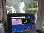
--> I like as large a plotter display as affordable. I always run it in a split screen mode, (2 only, most; occasionally (rarely), 3 panels). I do have a separate small screen for total redundant backup.
--> I would add the radar at the same time. Insures compatibility. Digital for lower power consumption, faster acquisition time. Also, I would run the radar Always. Multiple reasons. Ask if you don't understand them.
--> I would add a VHF with AIS receive, even if you add an AIS transponder. For redundancy and rapid VHF contact without having to have a Garmin top line VHF. (* One exception) --- Personal recommendation, the ICOM M-506 with AIS receive. The ICOM VHF has the easiest function menu and the largest screen for independent AIS use.

Hope that helps give somethings to consider.

Harvey
SleepyC:moon

PLI_and_SB_CBGT_2_147.highlight.jpg 1_Jan_From_Inside_the_Electronics.thumb.jpg
 

Attachments

  • PLI_and_SB_CBGT_2_147.highlight.jpg
    PLI_and_SB_CBGT_2_147.highlight.jpg
    9.9 KB · Views: 0
hardee":30ubs1ke said:
Also, I would run the radar Always. Multiple reasons. Ask if you don't understand them.

Feel free to expand your thoughts on this when you get the chance, I'd appreciate it. For now, I'm not assuming I fully understand anything. :D
 
Bob/thataway,

You said you have one MFD devoted to the radar. I've found out that having radar as an overlay on the chart display is most helpful when navigating in fog. I use that on my Lowrance and OpenCpn. I would assume that Garmin had such an overlay. Do they? Have you tried it?

And for a general comment. Solid state radar is the future. The power is low, so there isn't the danger of high power, as there is with a magnetron. The processing is improved so that near targets are clearer and close in is where most of us navigate. The latest generation of SS radars has improved processing using pulse compression.

Boris
 
Boris,
I have been running radar since the 1970's, long before chart plotters, so I do the overlay in my mind. I find that in some areas it is easy to confuse marks for boats or other objects. I understand that new users want to overlay, (and I suspect that you have also been using radar for some time). But I think they need to learn to look at the radar and then the chart for best understanding.

I have overlaid the Garmin radar on their charts--works fine.

I also run my radar often just so I.know what that specific radar does.--and how to adjust it. Rarely is "auto" the best mode to be on.

The latest radars give relative motion (if a boat is coming toward you or away, closest point of approach, warnings of potential collisions. Yes the power is a fraction of the power of a magnetron. A magnetron has a finite life, the solid state don't seem to. Less of a health hazard, far less power draw from the system.

The digital units are better at seeing items like kayaks and very small boats. The echo seems to be more consistent on these objects. For example a few years back we were going out of a Mexican port at about 3 AM--and I was picking up a consistent echo just off our Stb bow on about every 3rd sweep. I had Marie go forward with our hand held search light--and she was able to spot the 20' panga with the Mexical sleeping in it as we neared the boat. With the newer digital radars, you would pick this target up consistently and in far better detail.

The discrimination is the ability to separate two objects--such as two kayaks or two pilings next to each other. Two ways to do that--wider scanner, and narrower beam width, and with better resolution from the digital radars.

The weakness of the solid state units was the range beyond 6 to 9 miles. I find my RayMarine does fine out to 12 miles which is about as far as I would ever want to go. Most of my radars were 24 miles and the only time you used the longer range was to verify Islands a long distance away. Ships you pick up in the 12 mile range, depending on size.

For the Delta and SF bay--definitely have Radar. I sailed up there a few times before radar and chart plotters--spooky with the amount of traffic. I am sticking to solid state Radar in the future.

There are some good bundles, I got the Axiom + radar and a 7" hybrid MFD for just under $2,000. Garmin also has some bundles. Just be sure that what the bundle offers is what you want/need.
 
Gary,
Harvey implies (I think) that all Captains are required to use all means at their disposal to avoid collisions. This includes the radar being turned on if working. Also, the more you use it the better you become at interpreting different color smudges when you end up in poor visibility conditions. Unfortunately, magnetrons have a limited life expectancy (I believe Bob once mentioned 3,000 hours?).

I would have bought a Fantom but it wasn’t available back then except in the 6 ft array. Notice the BIG price spread though between Garmin solid state and magnetron radars, but also for the competing brands:

https://www.boemarine.com/catalogsearch ... rmin+radar

Because of the curvature of the earth equation, neither our eyes nor our radar can see more than say 3-4 miles at at a height of 6 feet. Pro fisherpersons with very high masts may prefer the higher power magnetron radars to see birds diving on baitfish 12-24 miles away. But none of us C-Dorys need that, I think it is fair to claim. A small dome (even cheap magnetron tech) is all we need to pick up Nav aids and rocks in the fog.

https://www.westmarine.com/WestAdvisor/ ... rine-Radar

I concur with Bob’s suggestion in picking your possible future radar to be compatible with your MFD choice now. In the chart it states compatible with ‘Garmin radar’; may be worth verifying including Fantom 18 or 24 should you choose that.

https://www.boemarine.com/garmin-gpsmap ... ducer.html

Colby, I agree the previous gen Garmin G2 Vision charts were pricey and covered relatively small areas (like mid-atlantic), but you had to pay for Vision to get auto-guidance. That plots a route from your boat to your one-touch destination without putting in waypoints. Just set your air height and minimum desired depth for a safe route. I REALLY like that feature and was willing to pay extra for it. The new Garmin G3 (non-Vision) chips includes Auto-guidance for only $178 for the whole entire US and West Canada! What a deal! The Vision card for the Gulf Coast is $500 but I no longer need it with the new US and Lakes G3 US card. You should get one!

https://www.hodgesmarine.com/gar010-c10 ... re-us.html

I recently got an offer from Garmin for that plus Lakes G3 download for $99 and took it. Now the only reason to pay extra for Vision cards is satellite photos of your surroundings and photos of harbors etc.

I hope this is helpful to new owners and Gary.

Is the BOEmarine.com 1042 that includes G3 and transducer for $1799 a better deal for Gary? Will he have time to install it all by Labor Day?

Only Time and Gary’s credit card will tell!

Cheers on spending Gary’s money!
John
 
Colby, I agree the previous gen Garmin G2 Vision charts were pricey and covered relatively small areas (like mid-atlantic), but you had to pay for Vision to get auto-guidance. That plots a route from your boat to your one-touch destination without putting in waypoints. Just set your air height and minimum desired depth for a safe route. I REALLY like that feature and was willing to pay extra for it. The new Garmin G3 (non-Vision) chips includes Auto-guidance for only $178 for the whole entire US and West Canada! What a deal! The Vision card for the Gulf Coast is $500 but I no longer need it with the new US and Lakes G3 US card. You should get one!

https://www.hodgesmarine.com/gar010-c10 ... re-us.html

Thanks for that link John. I've been looking at getting autoguidance on the inland lakes. I've used it frequently on the Great Lakes, and on my west coast trips.

Regarding radar in the rest of the thread, I somewhat miss my old RayMarine B&W. I could pick up a flock of birds on the water with it. The newer color one I have with my Garmin MFD package is probably fine, just different technology. I usually run it in overlay mode, unless I really want to pick something out, then I switch to double window mode with just the radar in one screen.

Colby
 
John gives an excellent summary! One item I didn't mention was the "instant on" feature of the soldi state (digital) radar vs warm up period of the magnatron of 1 to 2 minutes. As far as hours for the magnetron--it depends on the usage. The average recreational boater turns it on and off frequency, and shortens the life span by this. In normal recreational use, I would say that 3000 hours was good time--some only get 500 to 1000 hours if not running longer periods of times. In commercial or long voyaging use, 10,000 hour or more is not uncommon. On our European trip I ran a Raytheon 24" radar more than 4,000 hours and it was still working fine when I sold the boat. Only problem was you had to stick your head into a hood to peer at a cathode ray tube--the modern radars are so much better.

Price: I just checked the RayMarine line--the cheapest is the basic quantum, then the 24" color and next the 18" quantum 2 or +. All below $1900. The Garmin Fantom are a little more than the HD, but not a lot. IN the Lowrance, Simrad, again the low end 18" "Halo" is in the $1400 to $1600 on up range,The G3 starts at about $1300 and the G4 in the $1600 range. They don't seem to carry recreational magnetron radar any more...probably for good reasons.

Furuno starts with the wireless in the sub $900 range, 1623 (monochrome with display) in the sub $1200 area, the The Furuno DRS4D-NXT Solid-State Doppler Radar for $2200, The 19" dome color with an 8.4" display and then jumps to the color magnetron in the Furuno 1935 4kW 3.5' Open Array 10.4" Color LCD Radar Display for about $4K. Each of these is stand alone with display, except the one which uses the I pad.
 
garyf":1tlsriqe said:
hardee":1tlsriqe said:
Also, I would run the radar Always. Multiple reasons. Ask if you don't understand them.

Feel free to expand your thoughts on this when you get the chance, I'd appreciate it. For now, I'm not assuming I fully understand anything. :D

Gary, John hit it pretty close here:

"Harvey implies (I think) that all Captains are required to use all means at their disposal to avoid collisions (Does not mean licensed Captains but anyone in control of a power or sail vessel). This includes the radar being turned on if working. Also, the more you use it the better you become at interpreting different color smudges when you end up in poor visibility conditions...."
If you have radar on board, and are involved in an accident, and are not using the radar, you will be considered at fault. It is a navigational adjunct, and if it is there, available, you should be using it.

Also, the more you use it the more familiar you become with what you see. Yes, I use mine in overlay mode, but in using it I learned how to use the distance variations, and resolution. I have seen kayaks at a quarter mile away, bird groups, and 900 foot ships at 12 miles, all in fog where visibility was less than 50 - 100 feet.

The new digitals have instant on, low power, target direction ID, (so you can see if they are moving toward or away from you), much better definition, and are lighter weight and easier to wire in. Make the investment now and you will appreciate it on the Delta for sure. (AIS down there was also very helpful.)

Harvey
SleepyC:moon

January_2010_344.thumb.jpg
 
If you have radar on board, and are involved in an accident, and are not using the radar, you will be considered at fault. It is a navigational adjunct, and if it is there, available, you should be using it.

Hi Harvey,
Hey I know this has come up before. But can you provide a source for this. I think in the past here it was pointed out that while this may be true for commercial vessels, it's not quite the same with private small vessels. Colby
 
Colby, I will have to look, but I believe it is in the USCG Col Regs. I need to start checking this before bed time. :oops: I know it has been around here on the site, and there are quotes available.

Harvey
SleepyC :moon

January_2010_344.thumb.jpg
 
The "Rules of Navigation" are only required on larger vessels, But we should all have either an electronic or paper copy aboard.

The rules are very clear:

RULE 5 Look-out
Every vessel shall at all times maintain a proper look-out by sight and hearing as well as by all available means appropriate in the prevailing circumstances and conditions so as to make a full appraisal of the situation and of the risk of collision

RULE 7 Risk of Collision
(a) Every vessel shall use all available means appropriate to the prevailing circumstances and conditions to determine if risk of collision exists. If there is any doubt such risk shall be deemed to exist.
(b) Proper use shall be made of radar equipment if fitted and operational, including long-range scanning to obtain early warning of risk of collision and radar plotting or equivalent systematic observation of detected objects.
(c) Assumptions shall not be made on the basis of scanty information, especially scanty radar information.

(d) In determining if risk of collision exists the following considerations shall be among those taken into account:
(i) such risk shall be deemed to exist if the compass bearing of an approaching vessel does not appreciably change;
(ii) such risk may sometimes exist even when an appreciable bearing change is evident, particularly when approaching a very large vessel or a tow or when approaching a vessel at close range.
 
Thank for posting that Bob.
I have heard some discussion regarding the application of the "larger vessels " term and that where some of us are boating in areas where there are larger vessels, (commercial, for instance container ships, Tug an tows, ferries, etc) especially where we are intersecting with established shipping lanes, that the Rules of Navigation are applicable to those who are boating in those areas.

There was also some discussion as to whether AIS falls into the category of "all available means appropriate in the prevailing circumstances and conditions so as to make a full appraisal of the situation and of the risk of collision."

If it is on board, it is appropriate to use it was the jest of the discussion. This was at a conference presentation session at the Seattle Boot Show University, 2 years ago.

Harvey
SleepyC:moon

10_Freighter_on_Radar_2009_122.sized.jpg
 
Back
Top