You are using an out of date browser. It may not display this or other websites correctly.
You should upgrade or use an alternative browser.
You should upgrade or use an alternative browser.
The 2010 Hunkydory adventures of Jay & Jo-Lee
- Thread starter Hunkydory
- Start date
Hunkydory
Active member
- Joined
- Mar 28, 2005
- Messages
- 2,745
- Reaction score
- 15
- C Dory Year
- 2000
- C Dory Model
- 22 Cruiser
- Hull Identification Number
- DOR22916I000
- Vessel Name
- Hunkydory
Dave S, Pleased you are enjoying the telling & looking and appreciate your appreciation
AND NOW BACK TO THE TALE
Part 4
8-5-10
A very pleasant day spent in Pleasant Bay. As I write this tonight we can hear whales whooshing out air by the islands at the bay. Have been asked if we have a sound system aboard the boat and what kind if we do. The answer is "yes we do and in the clearest enhanced stereo" only its definitely not electronic. In the places like this and most others we care to be either the stillness or what nature offers up is the sounds we prefer.
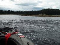
Caught and released salmon again today until my arms finally had to rest. Mokai rides around the bay and Island entrance. Walks along the shore and again saw a bear chasing fish. Photo of fish wave in front of Mokai.
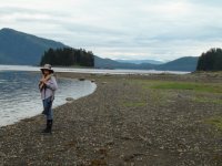
Jo-Lee being the gun barer while walking with Hunkydory at anchorage behind. Boat hard to see.
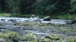
Bear chasing fish at small river entrance
Yes, altogether a very pleasant day in Pleasant Bay.
8-6-10
Exited the Pleasant Bay entrance a 4:15 AM to catch the last of the ebb and lack tide down Seymore Canal to Huges Point then the flood all the way up Stephens Passage then through Holkham Bay and up Endicott Arm hitting the slack just right with no wait to cross the Fords Terror bar into the arm. Checked out Sanford Cove on the way by for possible future anchorage. Its the only anchorage on Endicott Arm other than Fords Terror. Sanford Cove is a poor anchorage due to very quick drop to deep water from shore. Would do in an emergency especially if the winds were from the south though I think a better choice would be the nook just inside the south side of the south entrance to Holkham Arm from a southern blow. The Sumdum clan of the Tlingit Indians helped guide John Muir in his explorations from Sanford Cove in 1897.
More icebergs to thread through in Endicott Arm than in past years. Ice chest again running low so netted more bergy bits. Heavy rain all day which has now turned to a light drizzle. As I write this while glancing out through the foggy windows at the mama bear and her cubs on shore makes me yearn for the Wallas Stove. Have been getting along surprisingly well with out it, but on days and especially evenings like this would love to have the dry heat and clear windows. Rain gear all wet from Mokai ride in the rain adding to moisture in the boat cabin.
The four black bears we have seen here in Fords Terror are the only black bears we've seen this cruise. All others have been the big brown kind. In the past have seen both grizzly and black bears in Ford's Terror, but only grizzly on Admiralty and Chichagof. Believe both are on Baranof with the grizzly being much more prevalent. The ABC Islands, that's Admiralty, Baranof and Chichagof are even called by many the Brown Bear Islands. This is one of the main reasons that have compelled my to try and circumnavigate them all. Yakobi Is some times included in this group and in the future hope to add that to our list of seeing all shores.
First time here in 2004 was one of our more memorable bad events it being our wild ride through the ebb tide rapids which cost us our computer, two cameras and a fish finder. We've come along way in experience since then but still feel capable of making a bad decision in the right or should I say wrong condition. Actually I've been very good at getting us or myself out of trouble its the decision that gets us there in the first place that with Jo-Lee's help we try to avoid.
57 miles today and 1140 for the trip
8-7-10
As happened both times before when pulling anchor to leave Fords Terror there was a bear on the shore to see us off. Could tell this one had been living well by hes fat belly almost dragging the ground. Wished the photo taken in the early morning light would have turned out.
Didn't know for sure when the ebb tide slack would be so showed up at the head of the rapid at 5:40AM which was Juneau slack tide time. Waited exactly 90 minutes for it to quit running, but better early then to miss. Flood slack was dead on to Juneau time.
Very dense fog going through the ice on Endicott Arm. Fortunately there was much less ice to navigate through then yesterday. Wind must have moved it to one side or other of the channel. Fog photo
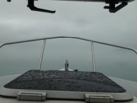
Coming out of the fog
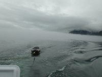
Decided to stop for the rest of day and night at Taku Harbor. Pretty little bay with a good free state dock. We were only the 3rd boat in but being its Saturday night its now pretty well filled by the mostly Juneau boats.
We walked to shore and looked over the old cannery and visited with others on the dock.. Met Ron Antaya who is here with a friend in his older 25 foot Nordic Tug. Was surprised to find out he worked for Casey in Katmai when C-Brat Casey was Chief Ranger there.
We especially enjoyed talking to Amelie and Yan from Quebec who came into the dock in a double Kayak loaded with more stuff then I'd ever seen on or in one. They had just came over from Admiralty Island where his back had gone out, then their cooking stove had quit and they had been laid up for in a tent for ten days. Bears had become more aggressive actually sniffing and touching the tent and with his back somewhat better and their food supply dwindling had headed here today hoping for tools to repair stove and food to purchase to continue on to Prince Rupert with Petersburg the short term goal. They had already this year kayaked Prince William Sound from Seward to Cordova. Many interesting stories like close call with oil tanker the fog crossing Hinchinbrook Entrance and Orcas jumping close by and looking them over very closely. Between us having tools to fix the stove and Ron's extra food and some from us if Yan's back holds up they're set to try again for Petersburg tomorrow.
This spirited young couple are a living lesson in carrying on a arduous adventure and still enjoying it in spite of severe adversity. Our time shared with them made us very glad to have decided to stop here in Taku Harbor tonight. The combination of it being so late in the season to reach Prince Rupert, a heavy somewhat overloaded Kayak and Yon's back and deep cough raises concerns in our minds for their safety, but they no what there up against and have chosen to continue on, so we can only wish the spirits to be kind and admire their courage and fortitude. Photo of Ron's Nordic Tug and Amelie and Yan's kayak and all the stuff they have to fit aboard. Regret not getting a photo of them with it.
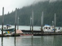
This is a web blog on their adventures. Wished I could read french
http://projetkayak2010.blogspot.com/
55 miles today and 1195 total
8-8-10
Out of Taku Harbor with the flood tide headed for Auke Bay and made a slight detour out toward Point Retreat watching for whales. Didn't see any and that was the first time we didn't in that area.
Shortly after docking in Auke Bay There was a hail and knock on the boat and to our delight it was Richard of "New Moon" standing there. Had a wonderful through the evening time sharing knowledge and experiences. Richard is the author of the small cruising boat guide "Cruising in a big Way" which is an excellent small boat guide for anyone who is thinking about doing a Inland Passage cruise especially those with limited experience. Just as I thought it would be, we found Richard to be a great source of information and extremely enjoyable to be around.
Had planned on heading back up the Lynn Canal when weather aloud , but with some of the areas Richard shared with us we're thinking of heading back to Hoonah and exploring more in that area. Right now there is small craft warning on the Lynn Calal but OK in Icy Straight and the Northern Chatham Straight, so thinking of heading out in the morning and doing our grocery shopping there instead of here. The next four days have the largest tides of the year with Wednesday being 24 feet, so must be careful with the wind direction were ever we go.
8-9-10
To our surprise Blaine of the sailboat "Oystercatcher" whom along with Monique we had shared several very good days on Lisianski Straight at the forest service dock and shelter came walking up the dock while we were preparing to get fuel. Great catching up on where we both had been in the last almost four weeks.
Topped off the fuel tanks and extra containers and it took 74.7 gallons. Being we had traveled a hard to believe 405 miles since last fueling in Sitka we averaged 5.4 mpg on this leg. Still had enough to have gone another 100 miles plus. The slower paced displacement speed cruising really pays off in many ways.
Lots of whales around Point Retreat this time and only two foot chop on Icy Strait. Had good cellphone signal on Icy Strait so gave Casey a call and this time we connected. He had planned on seeing Port Alexander before all his pick up troubles, so was good to fill him in on the town and some of the highlights of the cruise so far. Says he still is thinking about this area next year, so we'll have some good discussions next time we meet.
Shopped in Hoonah for groceries. This is when we took the photo of the Hunkydory and the Tootsie Cat that I posted earlier in this thread. There is an extremely well stocked hardware and grocery store right by the fuel dock with a separate small dock to stop for supplies so very convenient. Instead of staying in Hoonah for the night decided to continue on up Port Fredrick and sure glad we did. While still with in sight of Hoonah we saw on the west side of the bay 32 eagles and two bears on a stream by the shore. While watching the bears and eagles with the binoculars Jo-Lee looked out the other direction and there was a male Orca going by not far from us. What a complete surprise. In over 5100 miles cruising the Inland Passage of which most where in out of the main route places this is the first orca we have seen. Many times the most delightful things happen on a cruise just like in every day life when you least expect it.
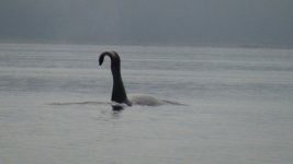
This photo of the Orca is in front of the same Chimney Rocks I photographed the Hunkydory in front of a month ago.
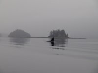
We tied up to a forest service dock near the head of Port Fredrick very near dark after going to the end of the arm that ends only a few hundred yard from the head of Tenakee Inlet. Many fish in the streams and am looking forward to bear watching tomorrow.
71 miles today and 1266 total
8-10-10
twenty plus miles exploring Neka Bay, Port Fredrick today in the Mokai. All the crab pots and a cabin turned us off to the bay when we were here 32 days ago. Should have given it the benefit of the doubt and explored more then. The river and open valley with meadows beyond the head of North Neka Bay is one of the most beautiful places I've seen. The fish are running and starting to die in the upper end of the river where I finally turned around. This photo taken mid way up this river. Stopped at the trees in the back ground.
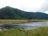
Once I got up above the tide water and into flowing river water the banks raised and started closing in with trees and brush close by. Though I only saw one bear the grass along the river banks was flat and there's trails going in all directions from the bears. I was very wide eyed and trying to see in all directions while going up and down and to shore on the river. Plan on doing more exploring there tomorrow. Also hope to come back here another year in late May when the bears are more out in the meadows eating the sedge grass and it is not high enough to prevent me from surprising one. Being in the river or walking in the meadow with the fish running knowing the bears are very near but not exactly where is very unnerving.
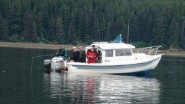
During the day saw four guys from Hoonah fishing from the cockpit of a unnamed 22' C-Dory and it looked like it was working OK for them. Photo of them
41 miles today and 1307 total
8-11-10
7AM met a guy who was coming down to the forest service dock we were tied up to for the night to get into his small Boston Whaler to go across the bay to work. He has lived out here for six years year around in a camp by himself and is a contract worker for the Forest Service thinning new growth in the logged areas. He had a big bore pistol in holster strapped to his chest and also a large caliber rifle. Was wearing rubber hob nailed boots and other logging cloths. I heard him coming from his camp to the dock on a ATV from where he is camped year around in a tent. Had a very interesting conversation about living and working mostly alone in this extreme bear country. He advised me to be very careful or preferably not to walk in the meadow areas where there is many small stream branches with fish running. The grass is chest high and the bears cannot be seen until very close. I have been careful as possible but decided not to push my luck anymore in these areas. I had been giving myself the same warning signals so good to see my self preservation system is still working well. Would have loved to learn more from him but he had to start work. Jo-Lee and I then sat in our chairs at the dock drinking our morning coffee and enjoying the music of the eagles and ravens.
Photo of me taking early morning coffee on the forest service dock where we spent several nights. Photos taken the morning before we met the Logger.
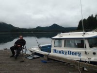
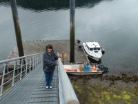
And of Jo-lee on the dock ramp which would go from almost vertical to horizontal with the extreme tides. The loggers Boston whaler is about to be grounded
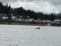
Then a slow cruise to Hoonah. Right in front of the town two whales were feeding when we arrived. Shut off the motor and watched them about the boat doing their thing. Tried my best to get photos, but thats a tricky proposition with whales. The sights and sounds you see just don't transfer very well. I try with the camera to capture that moment in time we're experiencing, but there is hardly a single moment that does the experience justice enough so others not there can get a since of the wonder.
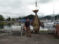
In Hoonah got our laundry done and was planning on a night at the dock, but when the Harbor Master wanted an addional ten dollars for the Mokai that doesn't take up additional space on a long dock I told him we would find a place to anchor instead. This is the Harbor Master with a 405 lb halibut caught by a charter boat. Was very interesting to see a halibut that large but was more unhappy with it being kept then with the Harbor Master wanting to charge more for the Mokai.
So at 6PM off accros Icy Strait to Swanson Harbor which along with Couverdon Cove is located at the north junction of Icy Straight and Chatham Straight.
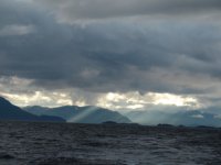
Photo of the Hoonah Port Fredrick area while crossing Icy straight.
We had anchored there before and knew just wher we wanted to go. Has been blowing hard on the Lynn Canal for a week now and tonight its calling for 25 knots with maybe a small break tomarrow morning that we hope to take advantage of for a run to Haines.
39 miles today and 1346 total
AND NOW BACK TO THE TALE
Part 4
8-5-10
A very pleasant day spent in Pleasant Bay. As I write this tonight we can hear whales whooshing out air by the islands at the bay. Have been asked if we have a sound system aboard the boat and what kind if we do. The answer is "yes we do and in the clearest enhanced stereo" only its definitely not electronic. In the places like this and most others we care to be either the stillness or what nature offers up is the sounds we prefer.
Caught and released salmon again today until my arms finally had to rest. Mokai rides around the bay and Island entrance. Walks along the shore and again saw a bear chasing fish. Photo of fish wave in front of Mokai.

Jo-Lee being the gun barer while walking with Hunkydory at anchorage behind. Boat hard to see.

Bear chasing fish at small river entrance

Yes, altogether a very pleasant day in Pleasant Bay.
8-6-10
Exited the Pleasant Bay entrance a 4:15 AM to catch the last of the ebb and lack tide down Seymore Canal to Huges Point then the flood all the way up Stephens Passage then through Holkham Bay and up Endicott Arm hitting the slack just right with no wait to cross the Fords Terror bar into the arm. Checked out Sanford Cove on the way by for possible future anchorage. Its the only anchorage on Endicott Arm other than Fords Terror. Sanford Cove is a poor anchorage due to very quick drop to deep water from shore. Would do in an emergency especially if the winds were from the south though I think a better choice would be the nook just inside the south side of the south entrance to Holkham Arm from a southern blow. The Sumdum clan of the Tlingit Indians helped guide John Muir in his explorations from Sanford Cove in 1897.
More icebergs to thread through in Endicott Arm than in past years. Ice chest again running low so netted more bergy bits. Heavy rain all day which has now turned to a light drizzle. As I write this while glancing out through the foggy windows at the mama bear and her cubs on shore makes me yearn for the Wallas Stove. Have been getting along surprisingly well with out it, but on days and especially evenings like this would love to have the dry heat and clear windows. Rain gear all wet from Mokai ride in the rain adding to moisture in the boat cabin.
The four black bears we have seen here in Fords Terror are the only black bears we've seen this cruise. All others have been the big brown kind. In the past have seen both grizzly and black bears in Ford's Terror, but only grizzly on Admiralty and Chichagof. Believe both are on Baranof with the grizzly being much more prevalent. The ABC Islands, that's Admiralty, Baranof and Chichagof are even called by many the Brown Bear Islands. This is one of the main reasons that have compelled my to try and circumnavigate them all. Yakobi Is some times included in this group and in the future hope to add that to our list of seeing all shores.
First time here in 2004 was one of our more memorable bad events it being our wild ride through the ebb tide rapids which cost us our computer, two cameras and a fish finder. We've come along way in experience since then but still feel capable of making a bad decision in the right or should I say wrong condition. Actually I've been very good at getting us or myself out of trouble its the decision that gets us there in the first place that with Jo-Lee's help we try to avoid.
57 miles today and 1140 for the trip
8-7-10
As happened both times before when pulling anchor to leave Fords Terror there was a bear on the shore to see us off. Could tell this one had been living well by hes fat belly almost dragging the ground. Wished the photo taken in the early morning light would have turned out.
Didn't know for sure when the ebb tide slack would be so showed up at the head of the rapid at 5:40AM which was Juneau slack tide time. Waited exactly 90 minutes for it to quit running, but better early then to miss. Flood slack was dead on to Juneau time.
Very dense fog going through the ice on Endicott Arm. Fortunately there was much less ice to navigate through then yesterday. Wind must have moved it to one side or other of the channel. Fog photo

Coming out of the fog

Decided to stop for the rest of day and night at Taku Harbor. Pretty little bay with a good free state dock. We were only the 3rd boat in but being its Saturday night its now pretty well filled by the mostly Juneau boats.
We walked to shore and looked over the old cannery and visited with others on the dock.. Met Ron Antaya who is here with a friend in his older 25 foot Nordic Tug. Was surprised to find out he worked for Casey in Katmai when C-Brat Casey was Chief Ranger there.
We especially enjoyed talking to Amelie and Yan from Quebec who came into the dock in a double Kayak loaded with more stuff then I'd ever seen on or in one. They had just came over from Admiralty Island where his back had gone out, then their cooking stove had quit and they had been laid up for in a tent for ten days. Bears had become more aggressive actually sniffing and touching the tent and with his back somewhat better and their food supply dwindling had headed here today hoping for tools to repair stove and food to purchase to continue on to Prince Rupert with Petersburg the short term goal. They had already this year kayaked Prince William Sound from Seward to Cordova. Many interesting stories like close call with oil tanker the fog crossing Hinchinbrook Entrance and Orcas jumping close by and looking them over very closely. Between us having tools to fix the stove and Ron's extra food and some from us if Yan's back holds up they're set to try again for Petersburg tomorrow.
This spirited young couple are a living lesson in carrying on a arduous adventure and still enjoying it in spite of severe adversity. Our time shared with them made us very glad to have decided to stop here in Taku Harbor tonight. The combination of it being so late in the season to reach Prince Rupert, a heavy somewhat overloaded Kayak and Yon's back and deep cough raises concerns in our minds for their safety, but they no what there up against and have chosen to continue on, so we can only wish the spirits to be kind and admire their courage and fortitude. Photo of Ron's Nordic Tug and Amelie and Yan's kayak and all the stuff they have to fit aboard. Regret not getting a photo of them with it.

This is a web blog on their adventures. Wished I could read french
http://projetkayak2010.blogspot.com/
55 miles today and 1195 total
8-8-10
Out of Taku Harbor with the flood tide headed for Auke Bay and made a slight detour out toward Point Retreat watching for whales. Didn't see any and that was the first time we didn't in that area.
Shortly after docking in Auke Bay There was a hail and knock on the boat and to our delight it was Richard of "New Moon" standing there. Had a wonderful through the evening time sharing knowledge and experiences. Richard is the author of the small cruising boat guide "Cruising in a big Way" which is an excellent small boat guide for anyone who is thinking about doing a Inland Passage cruise especially those with limited experience. Just as I thought it would be, we found Richard to be a great source of information and extremely enjoyable to be around.
Had planned on heading back up the Lynn Canal when weather aloud , but with some of the areas Richard shared with us we're thinking of heading back to Hoonah and exploring more in that area. Right now there is small craft warning on the Lynn Calal but OK in Icy Straight and the Northern Chatham Straight, so thinking of heading out in the morning and doing our grocery shopping there instead of here. The next four days have the largest tides of the year with Wednesday being 24 feet, so must be careful with the wind direction were ever we go.
8-9-10
To our surprise Blaine of the sailboat "Oystercatcher" whom along with Monique we had shared several very good days on Lisianski Straight at the forest service dock and shelter came walking up the dock while we were preparing to get fuel. Great catching up on where we both had been in the last almost four weeks.
Topped off the fuel tanks and extra containers and it took 74.7 gallons. Being we had traveled a hard to believe 405 miles since last fueling in Sitka we averaged 5.4 mpg on this leg. Still had enough to have gone another 100 miles plus. The slower paced displacement speed cruising really pays off in many ways.
Lots of whales around Point Retreat this time and only two foot chop on Icy Strait. Had good cellphone signal on Icy Strait so gave Casey a call and this time we connected. He had planned on seeing Port Alexander before all his pick up troubles, so was good to fill him in on the town and some of the highlights of the cruise so far. Says he still is thinking about this area next year, so we'll have some good discussions next time we meet.
Shopped in Hoonah for groceries. This is when we took the photo of the Hunkydory and the Tootsie Cat that I posted earlier in this thread. There is an extremely well stocked hardware and grocery store right by the fuel dock with a separate small dock to stop for supplies so very convenient. Instead of staying in Hoonah for the night decided to continue on up Port Fredrick and sure glad we did. While still with in sight of Hoonah we saw on the west side of the bay 32 eagles and two bears on a stream by the shore. While watching the bears and eagles with the binoculars Jo-Lee looked out the other direction and there was a male Orca going by not far from us. What a complete surprise. In over 5100 miles cruising the Inland Passage of which most where in out of the main route places this is the first orca we have seen. Many times the most delightful things happen on a cruise just like in every day life when you least expect it.

This photo of the Orca is in front of the same Chimney Rocks I photographed the Hunkydory in front of a month ago.

We tied up to a forest service dock near the head of Port Fredrick very near dark after going to the end of the arm that ends only a few hundred yard from the head of Tenakee Inlet. Many fish in the streams and am looking forward to bear watching tomorrow.
71 miles today and 1266 total
8-10-10
twenty plus miles exploring Neka Bay, Port Fredrick today in the Mokai. All the crab pots and a cabin turned us off to the bay when we were here 32 days ago. Should have given it the benefit of the doubt and explored more then. The river and open valley with meadows beyond the head of North Neka Bay is one of the most beautiful places I've seen. The fish are running and starting to die in the upper end of the river where I finally turned around. This photo taken mid way up this river. Stopped at the trees in the back ground.

Once I got up above the tide water and into flowing river water the banks raised and started closing in with trees and brush close by. Though I only saw one bear the grass along the river banks was flat and there's trails going in all directions from the bears. I was very wide eyed and trying to see in all directions while going up and down and to shore on the river. Plan on doing more exploring there tomorrow. Also hope to come back here another year in late May when the bears are more out in the meadows eating the sedge grass and it is not high enough to prevent me from surprising one. Being in the river or walking in the meadow with the fish running knowing the bears are very near but not exactly where is very unnerving.
During the day saw four guys from Hoonah fishing from the cockpit of a unnamed 22' C-Dory and it looked like it was working OK for them. Photo of them

41 miles today and 1307 total
8-11-10
7AM met a guy who was coming down to the forest service dock we were tied up to for the night to get into his small Boston Whaler to go across the bay to work. He has lived out here for six years year around in a camp by himself and is a contract worker for the Forest Service thinning new growth in the logged areas. He had a big bore pistol in holster strapped to his chest and also a large caliber rifle. Was wearing rubber hob nailed boots and other logging cloths. I heard him coming from his camp to the dock on a ATV from where he is camped year around in a tent. Had a very interesting conversation about living and working mostly alone in this extreme bear country. He advised me to be very careful or preferably not to walk in the meadow areas where there is many small stream branches with fish running. The grass is chest high and the bears cannot be seen until very close. I have been careful as possible but decided not to push my luck anymore in these areas. I had been giving myself the same warning signals so good to see my self preservation system is still working well. Would have loved to learn more from him but he had to start work. Jo-Lee and I then sat in our chairs at the dock drinking our morning coffee and enjoying the music of the eagles and ravens.
Photo of me taking early morning coffee on the forest service dock where we spent several nights. Photos taken the morning before we met the Logger.

And of Jo-lee on the dock ramp which would go from almost vertical to horizontal with the extreme tides. The loggers Boston whaler is about to be grounded

Then a slow cruise to Hoonah. Right in front of the town two whales were feeding when we arrived. Shut off the motor and watched them about the boat doing their thing. Tried my best to get photos, but thats a tricky proposition with whales. The sights and sounds you see just don't transfer very well. I try with the camera to capture that moment in time we're experiencing, but there is hardly a single moment that does the experience justice enough so others not there can get a since of the wonder.

In Hoonah got our laundry done and was planning on a night at the dock, but when the Harbor Master wanted an addional ten dollars for the Mokai that doesn't take up additional space on a long dock I told him we would find a place to anchor instead. This is the Harbor Master with a 405 lb halibut caught by a charter boat. Was very interesting to see a halibut that large but was more unhappy with it being kept then with the Harbor Master wanting to charge more for the Mokai.

So at 6PM off accros Icy Strait to Swanson Harbor which along with Couverdon Cove is located at the north junction of Icy Straight and Chatham Straight.
Photo of the Hoonah Port Fredrick area while crossing Icy straight.

We had anchored there before and knew just wher we wanted to go. Has been blowing hard on the Lynn Canal for a week now and tonight its calling for 25 knots with maybe a small break tomarrow morning that we hope to take advantage of for a run to Haines.
39 miles today and 1346 total
Hunkydory
Active member
- Joined
- Mar 28, 2005
- Messages
- 2,745
- Reaction score
- 15
- C Dory Year
- 2000
- C Dory Model
- 22 Cruiser
- Hull Identification Number
- DOR22916I000
- Vessel Name
- Hunkydory
Jody, I see what you mean about the Orca photo. Now we know how they faked the photo :lol:
Part 5 the last part
8-12-10
Up very early to catch as much high tide as possible for very tricky maneuvering from Swanson Harbor to Couverdon Cove to save run around Couverdon point which separates the northern Chatham Straight from Icy Straight. High tide was 3 AM and had just enough light by 4:20 to head out. The pass is marked with 6 inch poles set in three two pole sets of only 30 feet width. Then if going west to east like we were there is a single pole almost bent over that marks the northern shallows into Couverdon Cove. What isn't marked and I had to trust the map drawn in the Douglass cruising guide is coming out of the last set of poles were rocks awash in the current dead ahead with more only about forty feet to the left. My instinct was to go around them both but the map showed going directly toward the last pole and then curving to the right into couverdon Cove with the two rocks widely spaced to go between, so didn't know if the two rocks we saw were actually one rock with another further south just under the water. Anyway we went right between them very slow after idling between the last set of poles in the current and near dark while trying to made sure we were following the directions correctly. This early morning pass crossing turned into one of the most dicey events of the cruise. A good thing we found the water up the Lynn Canal calm for we thought the excitement quota for the day already topped off. Love a challenge, but looking back it was poor judgement on my part to attempt this without checking the area out during low tide conditions. That way even with the low morning light I would have known for sure the right course and it would have just been a case of tight boat maneuvering. Think it was a case of over confidence gained by what we had accomplished so far and letting down our guard when close to the finish line. I would not go through this pass again even though we made it through OK this time without now checking it at low tide first.
Anchored in Lutek Inlet by Haines to take Mokai up river hoping to see bears if the fish were running. Well the fish were running but all I seen on the banks were fisherman, so I wished I could say up anchor and off to Haines, but it was blooper time for us. Seems like at least once each cruise we have to pull something really dumb and this on the next to our last day on the ocean this year was it. Yes off we went and then a sudden hard tug and power loss. At least the prop just cleanly cut the rode, but our 22 lb Bruce style anchor with chain, swivels ect is another contribution of ours to Ole King Neptune. Now with chain ect bought in Haines have to make do with the eleven lb spare.
The wind came up behind us about 20 knots the last few miles into Skagway. Enjoy following seas of 15 to 20 knots if the swells aren't to big, but that combined with the huge cruise ship wake coming toward us made for a few seconds of very rough seas. Have passed many large boats and ships in different conditions and distance from us and this was the first that actually gave us some real concern. Didn't try to quarter the wake like normal instead just turned directly into it and slowed down enough to just power over the waves while trying not to fall off them and bury the bow. Can't say it worked totally.
Have been out for six weeks and Skagway is a much quieter place then when we left near the 4Th of July. Still busy in town with the cruise ships but even though its a weekend the docks are quiet. Skagway sure looks the same to me in this photo as when we were there in 2007
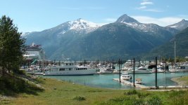
119 miles today and a grand total of 1565. Used a total of 313 gallons so averaged 5 mpg on ocean cruise with a very heavily loaded boat.
8-13-10
Quiet restful morning and early afternoon waiting for the tide to come up enough to load the boat on trailer. Have had four extreme tide days of over 20 foot range.
Weather has turned warm and clear so beautiful drive the 126 miles to the Atlin road where we spent the first night out of the boat in six weeks. Actually felt weird and made me a little sick sleeping in the camper. The longer we were in the boat the better we adapted to it and the bigger instead of smaller it seemed to be. If we make it back up next year and we plan to think we will leave the camper behind. It lowers our fuel mileage from almost 15 mpg to ll.5mpg and the small added comfort I don't think is worth the heavier feel and cost.
8-14-10
Total of 156 miles from Skagway, Alaska into the Yukon Territory and then about 30 miles down into British Columbia to the small town of Atlin located on one of the premier lakes for beauty in the world. It is a 90 mile long glacier carved lake with many channels and islands with the Juneau ice fields directly to the west and the Llewellyn glacier coming out of it to a point only five miles from the lake. Many other glacier streams feeding into the lake giving it a beautiful turquoise green color near the streams then changing to different crystal clear hues further out into the lake body.
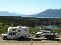
Drove south out of Atlin thirteen miles to Warm springs Bay hoping to launch the boat there and leave the pick-up in a camp site. It was full up so long dusty road trip for nothing. We had explored the lake ten years ago in a small RIB out of Warm Springs Bay and was hoping for a repeat with the Hunkydory. In town found we could launch the boat and store the pick up and trailer for no charge in what looked to a secure spot. So after one day back in the water again. This photo is taken on the road between Atlin and Warm Spring Bay and looks to the west across Atlin lake to the white area of Llewellyn Glacier.
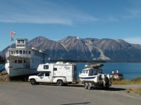
This is the rig by a restored lake boat that was used to ferry passengers to Atlin when it was a destination for the very wealthy early in the last century.
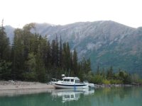
Walked on shore and several hours in the Mokai. Night spent at the head of Williston Inlet. Hunkydory bow on the beach Williston Inlet.
29 miles today
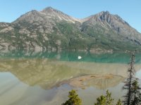
More walking and Mokai riding on and near the shore of Williston Inlet then slow cruised most of way to Llewellyn Inlet. Photo of glacier silt mixing with Atlin Lake.
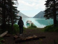
Tied the boat up to a buoy there in front of the trail head to Llewellyn Glacier.
Then made two attempts with the Mokai to go up the Llewellyn River to the lake and the calving glacier. Thwarted both times by the glacier silt, rocks and fast water. River so thick with silt that rocks and shallows can't be seen just under the surface. Mokai jet intake would plug if it contacted the shallow silt then I would lose power and drift back or sideways into the fast deep water with rocks. Would have to paddle furiously trying to maintain control while either attempting to make shore or restart the motor.
Starting up the river
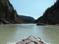
looking up stream after stalling between last large rock and shore on right in shallow silt
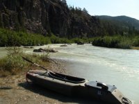
Down stream view
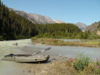
Tried again and made it another half mile taking the outside route through the rocks then again grounded, drifted back got turned around and then grounded again with dead motor going down stream. Looking to left while grounded which led over a several feet drop.
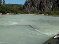
And right with bad rapid and very sharp turn and overhanging alders just out of view. Pondered my options while just sitting here. Decided on the straight ahead or slightly right route and rocked the Mokai forward thinking two quick pulls on the starter rope and if that doesn't work use the paddle. It started on the second pull.
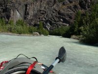
Gave it my best but just to risky to continue trying. Am just about back to the lake here
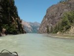
Later talked to a guy who had a plane fly him and some friends into the lake and they had come down the river in inflatable kayaks, but had to portage the area that was stopping me going up. Had seen their tracks on the bar I had stopped at and wondered who could have left them. From his description I stopped only a 100 yards from where I could have continued on will little trouble. Still glad I stopped cause it could well have been a 100 yards to far. This photo is of lake and hard to see good part of the river I was attempting to make.
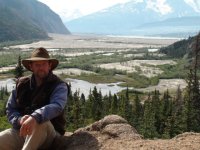
Gently swinging on the anchor tied to the buoy tonight. The weather is still clear and good but views tonight are being obstructed from the huge forest fires in the Yukon. Yesterday talked to a person in Atlin who said that Highway 37 in the Yukon which is called the Cazziar Highway has been and maybe still is closed. This is the west section one can take through Canada to reach Alaska and is the way we came up.
18 miles today 47 total on the lake
8-17-10
Cruised up to the head of the lake. Glacier rivers from the warm weather are running to much water to attempt going up in the mokai. Beautiful vistas around the lake, but no animals and very few birds so boat back on trailer to head south.
61 miles today 108 total on the lake
8-17-10----9-2-10
Cazziar Highway was being opened some days only from 9PM to 6AM and traffic had to go in a convoy. Didn't want any part of convoying through the dusty rocky construction areas so make going back the regular Alaska Highway an easy choice. At least 400 miles of driving through thick smoke. Was planning on stopping and seeing Marty and other folks in the Washington Puget Sound area, but the shock after being on the water and mostly wilderness highways to the Seattle traffic was just to much. Couldn't get out of there quick enough. Some good time spent with Jo-Lee's relatives in southern Washington and then with mine in Northern California and then back home on September 2ND. Only truck or trailer problem on trip was a blown trailer tire near Salem. Made a quick change and only had to drive less then 4 miles and the first exit off the freeway to buy a new tire. In fact the price was so good I bought two.
Part 5 the last part
8-12-10
Up very early to catch as much high tide as possible for very tricky maneuvering from Swanson Harbor to Couverdon Cove to save run around Couverdon point which separates the northern Chatham Straight from Icy Straight. High tide was 3 AM and had just enough light by 4:20 to head out. The pass is marked with 6 inch poles set in three two pole sets of only 30 feet width. Then if going west to east like we were there is a single pole almost bent over that marks the northern shallows into Couverdon Cove. What isn't marked and I had to trust the map drawn in the Douglass cruising guide is coming out of the last set of poles were rocks awash in the current dead ahead with more only about forty feet to the left. My instinct was to go around them both but the map showed going directly toward the last pole and then curving to the right into couverdon Cove with the two rocks widely spaced to go between, so didn't know if the two rocks we saw were actually one rock with another further south just under the water. Anyway we went right between them very slow after idling between the last set of poles in the current and near dark while trying to made sure we were following the directions correctly. This early morning pass crossing turned into one of the most dicey events of the cruise. A good thing we found the water up the Lynn Canal calm for we thought the excitement quota for the day already topped off. Love a challenge, but looking back it was poor judgement on my part to attempt this without checking the area out during low tide conditions. That way even with the low morning light I would have known for sure the right course and it would have just been a case of tight boat maneuvering. Think it was a case of over confidence gained by what we had accomplished so far and letting down our guard when close to the finish line. I would not go through this pass again even though we made it through OK this time without now checking it at low tide first.
Anchored in Lutek Inlet by Haines to take Mokai up river hoping to see bears if the fish were running. Well the fish were running but all I seen on the banks were fisherman, so I wished I could say up anchor and off to Haines, but it was blooper time for us. Seems like at least once each cruise we have to pull something really dumb and this on the next to our last day on the ocean this year was it. Yes off we went and then a sudden hard tug and power loss. At least the prop just cleanly cut the rode, but our 22 lb Bruce style anchor with chain, swivels ect is another contribution of ours to Ole King Neptune. Now with chain ect bought in Haines have to make do with the eleven lb spare.
The wind came up behind us about 20 knots the last few miles into Skagway. Enjoy following seas of 15 to 20 knots if the swells aren't to big, but that combined with the huge cruise ship wake coming toward us made for a few seconds of very rough seas. Have passed many large boats and ships in different conditions and distance from us and this was the first that actually gave us some real concern. Didn't try to quarter the wake like normal instead just turned directly into it and slowed down enough to just power over the waves while trying not to fall off them and bury the bow. Can't say it worked totally.
Have been out for six weeks and Skagway is a much quieter place then when we left near the 4Th of July. Still busy in town with the cruise ships but even though its a weekend the docks are quiet. Skagway sure looks the same to me in this photo as when we were there in 2007

119 miles today and a grand total of 1565. Used a total of 313 gallons so averaged 5 mpg on ocean cruise with a very heavily loaded boat.
8-13-10
Quiet restful morning and early afternoon waiting for the tide to come up enough to load the boat on trailer. Have had four extreme tide days of over 20 foot range.
Weather has turned warm and clear so beautiful drive the 126 miles to the Atlin road where we spent the first night out of the boat in six weeks. Actually felt weird and made me a little sick sleeping in the camper. The longer we were in the boat the better we adapted to it and the bigger instead of smaller it seemed to be. If we make it back up next year and we plan to think we will leave the camper behind. It lowers our fuel mileage from almost 15 mpg to ll.5mpg and the small added comfort I don't think is worth the heavier feel and cost.
8-14-10
Total of 156 miles from Skagway, Alaska into the Yukon Territory and then about 30 miles down into British Columbia to the small town of Atlin located on one of the premier lakes for beauty in the world. It is a 90 mile long glacier carved lake with many channels and islands with the Juneau ice fields directly to the west and the Llewellyn glacier coming out of it to a point only five miles from the lake. Many other glacier streams feeding into the lake giving it a beautiful turquoise green color near the streams then changing to different crystal clear hues further out into the lake body.
Drove south out of Atlin thirteen miles to Warm springs Bay hoping to launch the boat there and leave the pick-up in a camp site. It was full up so long dusty road trip for nothing. We had explored the lake ten years ago in a small RIB out of Warm Springs Bay and was hoping for a repeat with the Hunkydory. In town found we could launch the boat and store the pick up and trailer for no charge in what looked to a secure spot. So after one day back in the water again. This photo is taken on the road between Atlin and Warm Spring Bay and looks to the west across Atlin lake to the white area of Llewellyn Glacier.

This is the rig by a restored lake boat that was used to ferry passengers to Atlin when it was a destination for the very wealthy early in the last century.

Walked on shore and several hours in the Mokai. Night spent at the head of Williston Inlet. Hunkydory bow on the beach Williston Inlet.

29 miles today
More walking and Mokai riding on and near the shore of Williston Inlet then slow cruised most of way to Llewellyn Inlet. Photo of glacier silt mixing with Atlin Lake.

Tied the boat up to a buoy there in front of the trail head to Llewellyn Glacier.

Then made two attempts with the Mokai to go up the Llewellyn River to the lake and the calving glacier. Thwarted both times by the glacier silt, rocks and fast water. River so thick with silt that rocks and shallows can't be seen just under the surface. Mokai jet intake would plug if it contacted the shallow silt then I would lose power and drift back or sideways into the fast deep water with rocks. Would have to paddle furiously trying to maintain control while either attempting to make shore or restart the motor.
Starting up the river

looking up stream after stalling between last large rock and shore on right in shallow silt

Down stream view

Tried again and made it another half mile taking the outside route through the rocks then again grounded, drifted back got turned around and then grounded again with dead motor going down stream. Looking to left while grounded which led over a several feet drop.

And right with bad rapid and very sharp turn and overhanging alders just out of view. Pondered my options while just sitting here. Decided on the straight ahead or slightly right route and rocked the Mokai forward thinking two quick pulls on the starter rope and if that doesn't work use the paddle. It started on the second pull.

Gave it my best but just to risky to continue trying. Am just about back to the lake here

Later talked to a guy who had a plane fly him and some friends into the lake and they had come down the river in inflatable kayaks, but had to portage the area that was stopping me going up. Had seen their tracks on the bar I had stopped at and wondered who could have left them. From his description I stopped only a 100 yards from where I could have continued on will little trouble. Still glad I stopped cause it could well have been a 100 yards to far. This photo is of lake and hard to see good part of the river I was attempting to make.

Gently swinging on the anchor tied to the buoy tonight. The weather is still clear and good but views tonight are being obstructed from the huge forest fires in the Yukon. Yesterday talked to a person in Atlin who said that Highway 37 in the Yukon which is called the Cazziar Highway has been and maybe still is closed. This is the west section one can take through Canada to reach Alaska and is the way we came up.
18 miles today 47 total on the lake
8-17-10
Cruised up to the head of the lake. Glacier rivers from the warm weather are running to much water to attempt going up in the mokai. Beautiful vistas around the lake, but no animals and very few birds so boat back on trailer to head south.
61 miles today 108 total on the lake
8-17-10----9-2-10
Cazziar Highway was being opened some days only from 9PM to 6AM and traffic had to go in a convoy. Didn't want any part of convoying through the dusty rocky construction areas so make going back the regular Alaska Highway an easy choice. At least 400 miles of driving through thick smoke. Was planning on stopping and seeing Marty and other folks in the Washington Puget Sound area, but the shock after being on the water and mostly wilderness highways to the Seattle traffic was just to much. Couldn't get out of there quick enough. Some good time spent with Jo-Lee's relatives in southern Washington and then with mine in Northern California and then back home on September 2ND. Only truck or trailer problem on trip was a blown trailer tire near Salem. Made a quick change and only had to drive less then 4 miles and the first exit off the freeway to buy a new tire. In fact the price was so good I bought two.
Hunkydory
Active member
- Joined
- Mar 28, 2005
- Messages
- 2,745
- Reaction score
- 15
- C Dory Year
- 2000
- C Dory Model
- 22 Cruiser
- Hull Identification Number
- DOR22916I000
- Vessel Name
- Hunkydory
While waiting at Port Alexander to round Cape Ommaney to go up the west open ocean coast of Baranof Island the folks connected to "Laughing Raven Inn" were extremely friendly and helpful to us. Providing weather advice, local knowledge of how best to transit the Cape and just great camaraderie while sharing free beer with me.
Their web site http://www.portalexander.com/gallery.htm has a fantastic slide show of the Community, Lodge, Lodge Kitchen, fishing and fishing vessels.
The photos as good as they are still don't do the unique beautiful lodge and setting justice. For any wanting a experience such as what they have to offer I think this Lodge to be unbeatable. Much more impressive to me than what I seen at Pelican or Elfin Cove.
Jay
dotnmarty
Active member
- Joined
- Nov 3, 2003
- Messages
- 4,209
- Reaction score
- 0
- C Dory Year
- 1993
- C Dory Model
- user_field_choice.c_dory_model_16_Angler
- Hull Identification Number
- DOR15295C393
- Vessel Name
- LIZZIE II
Jay-I enjoyed every word and every picture. Thank you so very much for sharing your adventure. It's greatly appreciated.
Hunkydory
Active member
- Joined
- Mar 28, 2005
- Messages
- 2,745
- Reaction score
- 15
- C Dory Year
- 2000
- C Dory Model
- 22 Cruiser
- Hull Identification Number
- DOR22916I000
- Vessel Name
- Hunkydory
Hunkydory
Active member
- Joined
- Mar 28, 2005
- Messages
- 2,745
- Reaction score
- 15
- C Dory Year
- 2000
- C Dory Model
- 22 Cruiser
- Hull Identification Number
- DOR22916I000
- Vessel Name
- Hunkydory
Roger
On a previous post you made on this thread you mentioned along with several others that you too would like to make it up there someday. Getting to and cruising the area in the Inland Passage we did is a big undertaking by most any one's standards, but the rewards are well worth it, so hope you do. Think it would make for a fantastic cruise in that new "Cat" coming your way.
We have now made four cruises there and to me this years accomplishments other then another wonderful long remote cruise in a 22' C-Dory was making 405 miles on one fill up of fuel and the voyage along the outside of Chichagof and Baranof Islands with rounding Cape Ommaney the highest point of all.
Thanks again for showing your appreciation.
Jay
Hunkydory
Active member
- Joined
- Mar 28, 2005
- Messages
- 2,745
- Reaction score
- 15
- C Dory Year
- 2000
- C Dory Model
- 22 Cruiser
- Hull Identification Number
- DOR22916I000
- Vessel Name
- Hunkydory
"The Catch-22 went to Alaska part 8
From Sitka we maneuvered through a cluster of small islands and west past Long Island, turning south near Vasilief Bank. About 15:00 hours we anchored in a large bay on the north end of Biorka Island for the night. As Kathy would say the sunset here was gorgeous. The next morning we picked our way through the Necker Islands heading south running from three to five miles out depending on the shore line. The wind gods lets us know finding protected anchorage would be a good thing. We pulled into Whale Bay for the night and used an area inside what is called Rakovoi Bay, great place to hang out when the wind is blowing. The next day we pulled anchor when the fog cleared enough to see. We needed to get going while the wind is calm. We know Cape Ommaney can be rough and don’t need the afternoon wind kicking in making it worse.
You have good days and days like the one we were about to have. The starboard engine high temperature alarm comes on and so I shut it down. Now the wind picks up, were about ten miles north of Cape Ommaney and two miles outside of Redfish Cape. On our way into Redfish Cape I tried to make a radio check, with no return check. Seems in some areas your radio might as well be a paper weight, we already knew our cell phone was useless.
Redfish Cape is looking very good to us at this time. We set anchor and from what I can tell the starboard engine has a lose wire in the alarm system and will be alright. With the wind calm and the cape only ten miles out we go for it. Just around the cape would be Port Alexander our next overnight anchorage. I wanted to swing wide around the cape expecting to find calmer water wrong. The wind kicked up bad from the north and now were on top of waves from twelve to eighteen feet. To make things more exciting through the waves you can see these logs shooting past every so often like a torpedo. Next the starboard engine high temperature alarm comes on again. My comment to my wife was “sit down and read your book” (like that‘s going to happen.) -- things are not going good
Just to add a little entertainment to the entire situation screaming between the waves were these puffin birds. I set the starboard engine at one speed and adjust speed only with the port engine. We got a little side ways once when a larger wave grabbed us for a while, that one really got my attention.
We got around Cape Ommaney and turned north looking for Port Alexander which is five or six miles up. With a little luck, a trusting wife, and answered prayers we made Port Alexander mid afternoon."
The quote above came from the Grand Adventure Forum and is part 8 of Rooster 27509's thread "The Catch-22 went to Alaska". A story along with Casey's "Naknek in Alaska, 2004" that became the focal point for us having the Grand Adventure Forum to share our adventures now.
Recently while going back through this forum I reread Rooster's account of his 2003 Alaska adventure part 8 and was shocked when I read the above quote. Did remember the part about 12 to 18 foot waves, but not the area He and his wife found them. Like many others who read these stories when I read it several years ago I didn't bother to check the map and see where he encounters these waves, but do remember thinking it an exaggeration, because without checking the map I thought Cape Ommanney to be a cape located like Fenshaw, Baker and many others somewhere in the actual protected inland waters not a Cape exposed directly to the Gulf of Alaska with rip tides said to be the worst in Southeast Alaska. Well Rooster, where ever you are "I sincerely apologize". Not only do I think the conditions to be just as described, you were also the first to adventure down and around the outside of Baranof Island in a C-Dory 22, so to you and your 1st Mate a belated congratulations :thup :cigar .
Any who haven't already read this adventure or its been some time since you did, think its worth a read and reread. thttp://www.c-brats.com/viewtopic.php?t=429hink
Jay
Knotty C
New member
- Joined
- Mar 23, 2005
- Messages
- 485
- Reaction score
- 0
- C Dory Year
- 2005
- C Dory Model
- 25 Cruiser
- Hull Identification Number
- CD025118D505
- Vessel Name
- Knotty C
Jay and Jolee,
What a trip! The map with your route tells quite the story. I am looking at the same map of our first trip in my office here at work except it doesn't have nearly the "route doodles" on it. :wink: Very inspiring. Dee and I have been planning our next trip and are thinking of trailering to Skagway and at least going from Elfin cove to Sitka on the outside. Just concentrating on a smaller area to explore around Baranof I. Thanks for sharing.
Don and Dee
Hunkydory
Active member
- Joined
- Mar 28, 2005
- Messages
- 2,745
- Reaction score
- 15
- C Dory Year
- 2000
- C Dory Model
- 22 Cruiser
- Hull Identification Number
- DOR22916I000
- Vessel Name
- Hunkydory
Don and Dee,
As also communicated in exchange of PM's your very welcome. Would be great to meet up in the ABC Islands area sometime. Wouldn't be surprised to see more brats take the road trip to Skagway and explore south. Wonderful drive and sure makes for a shorter cruise to Juneau, Hoonah, Elfin Cove, Pelican and Sitka, which encompass the area in Southeast Alaska we prefer to cruise.
Jay

