Sandys counterclockwise circumnavigation Vancouver Island

smckean (Tosca)

New member
I hinted in a previous post about an upcoming long trip. Well, I left Guemes Island (just north of Anacortes, WA) at 10am on July 6th. For safety and exploring, I wanted a slow trip....and I'm taking 10 weeks (be back mid September). I am doing the trip solo, so decision making is simple.

I've had a few minor "early trip" breakdowns including a windlass failure that took me backwards to Sucia Island in order to have secure flat water on which to do repairs. Having time is a luxury worth having. I can wait on weather too. At the moment, I'm sitting in Nanaimo....my first marina. I'm carrying a lot of food, gear, and tools (lots of DVDs too). I plan to be on anchor most of the time....my new ARB freezer helps with that. You should see the water line of the boat. I replaced the v-berth cushions with rubber matting, and am storing 100s of pounds up there in 7 large containers (yes, the boat "tips" forward....I look like a whale about to dive).

Anyway, if you'd like to see where I am at the moment, and to see the track I took to get there, go to this link which is the result of my Garmin Inreach:

https://share.garmin.com/SandyVITrip
 
smckean (Tosca)":xr48enx5 said:
the boat "tips" forward....I look like a whale about to dive.

That never bothered me too much. In fact, I think it might help when travelling at hull speed. With a heavy bow, my 16 doesn't squat until 4.5 knots. Woohoo, another .2 knots on hull speed!

One problem with a heavy bow is bow steer when on plane. If I'm fully loaded and slap something (like a wake at 45 degrees), the bow gets punched to the side more violently than with a light bow. The other problem is heading into steep seas (of which you will likely see plenty). Goletas Channel might be your first test. Disconcerting when the bow doesn't pop back up per usual. Same with following seas, but you're unlikely to see any. Have a safe trip.

Mark
 
Marco,

My experience is about the same as you describe. I haven't hit steep seas yet, but the bow steer is sure there. Also, as you say it's not all bad. The boat is far more loaded than usual, and it seems to have changed from a VW to a Cadillac :wink:. At first I was dismayed, but now I'm getting used to it, and I rather like the "solid" feel. OTOH, if the boat starts doing something "off", it is way more sluggish when I attempt to correct it.
 
HI Sandy, PM sent.
Watch for a blue strip 22 with a camperback, Osprey, with Andy on board. Should be in the neighborhood.

What is your boat name, and color, Pix in album show a different name. I thought I knew it but . . . :roll:

Have a safe trip.

Harvey
SleepyC :moon

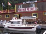
7_SleepyC_at_Port_Harvey_001.thumb.jpg
 
What is your boat name, and color, Pix in album show a different name.
Yeah, I never thought of that. The boat was named Anna Leigh when I bought her from C-Brat David McKibben in 2014. I renamed her to a better known passionate woman (if you know your opera :wink:). She is still white with burgundy trim.
 
DON'T SEE THE WHOLE TRACK??

I've been asked about this. You have to click on the "View All Tracks" button near the upper right corner to see the whole track (otherwise you only see today's track).

P.S. My guess is this is required because I turn the Inreach off at night thus creating what Garmin thinks is a new track.
 
Those inReach devices are wonderful. I have another boat I'm tracking now, Andy on Osprey, and it is great to be able to see where he is in relation to questions about where he is headed.

And for single handing, next to the MOB+ device, it is probably one of the higher priority safety devices on the boat, especially when out of cell service areas, which is much of where your intended trip is going to range.

Harvey
SleepyC :moon

Randy's parking lot
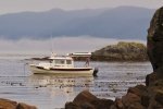
0_God_s_Pocket_Anchorage.thumb.jpg
 
Hi Sandy, I’m in the process of attempting the same trip. I may be a few days ahead of you. I’m at Telegraph Cove tonight; then back out into the Broughtons for a couple more days of kayaking with a friend. Picking up supplies in Port McNeill, dropping off my friend, and doing some maintenance, July 13-15, then will try to round Cape Scott, solo, to Winter Harbour. My inReach track is here:

https://osprey-alaska.org/home/track-us/

It would be fun if we could connect. Just sent you an inReach message. (Thanks Harvey Hochstetter for letting me know about Sandy’s trip!)

Bon voyage!
 
Andy and I did connect via some Inreach messages (which is really nice way to touch base since you don't need cell or other signals; Inreach works every where, all the time). Unfortunately, we did not connect in person. Andy was way ahead of me and moving faster. Eventually he had to abort his VI westside return given the weather and his limit time schedule.
 
Well, I finally hit Desolation Sound....the "real" start of the trip. It took me nearly 2 weeks to get here, but that's right on time since I have 10 weeks to do this trip.

I did have some boat issues that slowed me down. I had problems with cockpit canvas and the windlass, but I repaired those. It also became clear that I needed to replace my 5 year old batteries....which I did in Powell River while at the dock.

I spend a couple of spectacular days at Chatterbox Falls in Princess Louisa Inlet. That "cost" a few days, but it sure was worth it. PLI is the most beautiful place I've ever been to by boat (didn't hurt to have had perfect weather/conditions....felt like an LA beach!). Also my first rapids of the trip -- Malibu Rapids (never did one before other than Deception Pass).

Just hanging out today in a very small cove just inside the Malaspina Inlet north of Lund. Need a day to relax; organize things; refill my 1 pound propane bottles from the 20 pound propane tank I strapped to the roof; and to make some bread (without an oven :wink: ). Very quiet here....not another boat in sight.

P.S. In these first 2 weeks I've only eaten out once (Trollers in Nanaimo for fish & chips....both Harvey and I fully agree that this is a must); so my heavy provisioning is working out...especially now that I moved the weight around for far superior boat trim. (Yes, moving things made a big difference in boat handling).
 
Slow and easy is the right way to do it. I agree that PLI is one of those very special places. But you are just coming to some of the best on the East side of Vancouver Island. Then after Desolation there are the Broughton's. There used to be some very good eating spreads by the day of the week at different camps.
 
Sandy, thank you for sharing your trip. Your trip is one I'd love to do in the future and I look forward to hearing all about your experience.

I agree with everyone who's mentioned the utility of the inreach devices. Having a means of communication can be extremely valuable when out of cell and VHF range. The realtime route tracking is a really nice bonus as well.
 
smckean (Tosca)":1s5f505s said:
... Andy was way ahead of me and moving faster. Eventually he had to abort his VI westside return given the weather and his limit time schedule.

Yup, I took too long admiring the Broughtons and ran out of time. Actually this week's snotty weather alone would have kept me pinned down at Bull Harbour for at least several days. I pulled the plug Saturday morning; it's still blowing gale force on the west side tonight; expected to continue at least through Friday. As Harvey said in classic understatement, sharing Sunday's forecast, "Icky."

https://marineweather.net/coastal/west- ... e-forecast

I may try again next year (after we hear more about Sandy's trip), but I get the sense that I'd better add at least an extra month to my schedule and bring a lot of reading material. (Incidentally, the bugs in Desolation Sound and the Broughtons this year were the worst I've ever seen. Particularly the no-seeums—the little blood suckers pop right through my mosquito netting!)

Some details on my not entirely unsuccessful trip, and pictures, here:

https://osprey-alaska.org/

Break a leg, Sandy!
 
Pandion":1sk9q3l8 said:
Incidentally, the bugs in Desolation Sound and the Broughtons this year were the worst I've ever seen. Particularly the no-seeums—the little blood suckers pop right through my mosquito netting!

I've had really good luck deploying mosquito coils in the little stainless holders below. Put it out on the swim step or in the splash well immediately upon dropping anchor. When I was on Lake Ozette, I would light it before I even dropped the anchor.

I have no-see-um netting on the windows. Something I learned was that I could make Velcro "els" for each corner of a window using the stick-on Velcro "hook" material and simply stretch and attach an approximately-sized piece of material over the window opening. No sewing, no accurate measuring, no complex fasteners, cheap, and they last for several seasons before the netting gets too many "runs" from being removed from the Velcro.

https://www.amazon.com/dp/B07F43CVY3?ps ... ct_details
 
Sounds like an amazing trip. We’ll be in Tofino in 15-22nd doing some fishing and hope to get to hot springs cove. We will have the boat on the trailer so might fish out of Ukulet, but it would be great to try and meet up! If you need any fishing tips happy to walk you through. Great time for all species and there will likely be tuna and squid on the west coast, although heading offshore solo for tuna is bold!

Glad your mechanicals are sorted. I am going to stop dragging my feet and order a new starting battery thanks to your reminder.
 
Been a while!

I knew the internet was spotty up here in Desolation and surrounds, but in truth it is basically non-existent. So I have been unable to access C-Brats. At the moment, I am at Blind Channel Marina....an out-of-the-way marina in northern Desolation Sound. Frankly, I came here, one of my rare marina stops, primarily to get Internet. But I have found Internet flakely in marinas....yes, they have it, but you can't connect half the time, and when you do connect, you often lose the internet connection (like I just did now). This marina is a bit up scale and nicely done. I just had my second meal off the boat in 3 weeks (Schnitzel). Mostly I have been hanging on the hook....sometimes in popular places such a Prideaux Haven, but mostly I hang out in little coves only a C-Dory would attempt.....and I usually have them to myself.

The last couple of days I spent at Octopus Islands...it was like camping at a mountain lake. You're so landlocked that the water is flat calm always. As I progress among these endless channels, one thing I've been loving to do is to stop the boat in the middle of one of these huge channels, if the wind is clam, and just float around....maybe have lunch. Sometimes I can't even see another boat for miles in any direction, but at the same time there are usually snow capped mountains everywhere I look.

I'm having a great time, but I do have my downer days.....you just have to power though the doubts that creep up at such times and move forward. My provisioning scheme has worked out well. I am near totally self-sufficient. This ARB freezer is a godsend. The trip the way I'm doing it would not be possible without it. I have stopped in a few marina stores and gotten goodies and fresh veggies, but primarily I live out of the freezer, dried goods, cans, and the bread I am able to bake with my clever Swedish gizmo that turns my single burner stove into an oven of sorts. I've made some pretty nice meals out of my larder if I do say so myself. OTOH, I have to say that I've not be able to live "out of the sea" as much as I had hoped, but I did catch a pink today which I filleted and will have for dinner tomorrow night.

Now I head up the Johnstone Strait (a section where there is no place to hide), and into the Broughtons. I'll have to watch the forecast carefully before I make this last dash. I will hang out in the Broughtons for a week or so, before I cross the southern part of the Queen Charlotte Strait, into Port Hardy, and then up to Balaclava Island where I will visit C-Brats Chris and Randy Shuman (of Raven) before pushing over the top of Vancouver Island at Cape Scott to start down the other side.
 
Sandy,
You are doing the trip the way it should be done. What a great time!

I found Port McNeill to be more cruiser friendly than Port Hardy. Laundry and grocery stores are close by.

With the 25 you should do well in the Straits-watch wind against current. That is were I have seen the more difficult sea conditions in Johnstone Straits.

Thanks for keep us all posted.
 
I am enjoying your account of your grand voyage. I would second Bob's comments about Port McNeil.

And that Blind Channel schnitzel is a real treat, isn't it!
 
Hey Sandy, Here's a third for Port Mack as some call it. Way more friendly than Port Hardy. It you need to get fuel at Pt Hardy at the first station near the ferry landing, not way inside. Also, the government dock across from that is OK, IF things aren't bouncy. otherwise it is a rocknroll party.

I have been home from the island for a week, but hadto go to Portland so this is my first check in for a while. AS said, You are doing it right. Take your time, and get Randys local info on going around the corner. Best I can say is Nawhitti (sp) is due full attention. Stay closer to the Vanc Isl side. Much better. Keep up the safe cruising. And, if you think I-net was scarce in Desolation, it is shades less in Broughtons and that is way better than most of the West side. Keep that tracker on.

There are a few places to duck in out of the weather on Johnstone. Look em up and have an idea where and how far. That can go from decent to terrible in minutes.

Harvey
SleepyC :moon

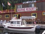
7_SleepyC_at_Port_Harvey_001.thumb.jpg
 
Back
Top