Gulfcoast John
Active member
- Joined
- Dec 14, 2012
- Messages
- 1,147
- Reaction score
- 4
- C Dory Year
- 2010
- C Dory Model
- 255 Tomcat
- Vessel Name
- CAT 'O MINE
Clearwater Beach to Steinhatchee River, FL…142 miles across the Gulf of Mexico
Our good luck continued with good weather and calm seas. We planned to stop at Crystal River, but Three Rivers Marine had no transient slips and Pete’s Pier no longer takes transients. We chose pressing on to Steinhatchee (142 miles of open Gulf) rather than the short run to Tarpon Springs, which is only 15 miles away…too short of a day for a TC255.
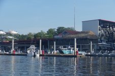
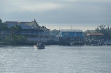
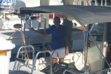
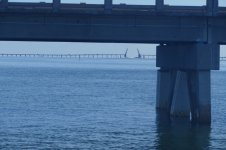
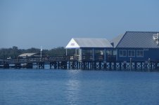
Steinhatchee is commonly used by Loopers as a jumping off point for the northern Gulf of Mexico crossing. That's another quaint Florida town with lots of flats boats. The entrance is long and zigzags like so many of the Northern Gulf Coastal rivers. Some of the marinas appear a little more rustic than others.
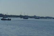
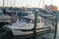
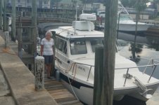
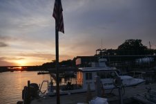
Last pic of Clearwater Beach City Marina
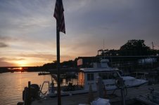
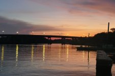
A lot of preparation is required to plan and prepare to cross the Gulf safely. For marine forecasting we use the Tallahassee office which covers the Big Bend. There are pay for advice weather forecasters who cater to Loopers for free (Eddie’s Weather WAG) or a $25 or so fee. Pay great attention to your favorite wind protection app, ours is windy.com. Get the cabin prepared for a pounding like you've never had before including securing drawers, cupboards and all loose items. Rearrange your refrigerator so you won't have a big mess or broken eggs at the end of your crossing. Anything in the cockpit that can fly out will enthusiastically try to do so, in hopes of distracting you from the cresting rollers. Research your backup and bail out plan in the event a safe weather window never opens in the time frame you need. Plan to take your C- Dory to a marina with a nearby ramp so you can return to go fetch your rig and load up where you are. The worst time for a small craft to attempt the northern Gulf Crossing is Winter, just when Loopers want to be heading for South Florida. Incidentally, we both thought it would be a good idea to attend church services the Sunday before our Monday attempt. I like to think that helped.
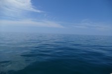
The marine forecast was for 5 MPH N breezes, but just out of Clearwater Pass we encountered some really sloppy 2-3 foot spots with a lot of slamming and banging. We opted to head N and stay closer to shore, and that helped a lot, although a longer route. Nothing broke and we felt safe. Around here, you can’t always stay ‘in sight of land’ because the ‘land’ is a ‘low swampy area’ that you can’t see from three miles out, and due to the curvature of the earth, you can’t see more than three miles out anyway. But you can see that 3 mile line on your MFD and follow it or the 10 foot depth contour line. 142 miles is a LONG way in the Gulf, unless she is in a good mood. We were lucky and blessed. Beautiful water, with the bottom being visible 13 feet down. Seas calmed more through the day and we were making over 23 MPH after two hours, total trip six hours per NeboLink. Max winds at the airport was 15 MPH but more on the water.
Safe Travels and happy planning for doing this section of the Loop! We crossed 1,000 water miles on the ODO.
John
Our good luck continued with good weather and calm seas. We planned to stop at Crystal River, but Three Rivers Marine had no transient slips and Pete’s Pier no longer takes transients. We chose pressing on to Steinhatchee (142 miles of open Gulf) rather than the short run to Tarpon Springs, which is only 15 miles away…too short of a day for a TC255.


Steinhatchee is commonly used by Loopers as a jumping off point for the northern Gulf of Mexico crossing. That's another quaint Florida town with lots of flats boats. The entrance is long and zigzags like so many of the Northern Gulf Coastal rivers. Some of the marinas appear a little more rustic than others.


Last pic of Clearwater Beach City Marina


A lot of preparation is required to plan and prepare to cross the Gulf safely. For marine forecasting we use the Tallahassee office which covers the Big Bend. There are pay for advice weather forecasters who cater to Loopers for free (Eddie’s Weather WAG) or a $25 or so fee. Pay great attention to your favorite wind protection app, ours is windy.com. Get the cabin prepared for a pounding like you've never had before including securing drawers, cupboards and all loose items. Rearrange your refrigerator so you won't have a big mess or broken eggs at the end of your crossing. Anything in the cockpit that can fly out will enthusiastically try to do so, in hopes of distracting you from the cresting rollers. Research your backup and bail out plan in the event a safe weather window never opens in the time frame you need. Plan to take your C- Dory to a marina with a nearby ramp so you can return to go fetch your rig and load up where you are. The worst time for a small craft to attempt the northern Gulf Crossing is Winter, just when Loopers want to be heading for South Florida. Incidentally, we both thought it would be a good idea to attend church services the Sunday before our Monday attempt. I like to think that helped.
The marine forecast was for 5 MPH N breezes, but just out of Clearwater Pass we encountered some really sloppy 2-3 foot spots with a lot of slamming and banging. We opted to head N and stay closer to shore, and that helped a lot, although a longer route. Nothing broke and we felt safe. Around here, you can’t always stay ‘in sight of land’ because the ‘land’ is a ‘low swampy area’ that you can’t see from three miles out, and due to the curvature of the earth, you can’t see more than three miles out anyway. But you can see that 3 mile line on your MFD and follow it or the 10 foot depth contour line. 142 miles is a LONG way in the Gulf, unless she is in a good mood. We were lucky and blessed. Beautiful water, with the bottom being visible 13 feet down. Seas calmed more through the day and we were making over 23 MPH after two hours, total trip six hours per NeboLink. Max winds at the airport was 15 MPH but more on the water.
Safe Travels and happy planning for doing this section of the Loop! We crossed 1,000 water miles on the ODO.
John

