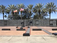
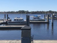
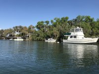
Cumberland Island National Seashore

Woke up this morning to a godzillian dead knats on C-Traveler. Guess that Active Captain review about bugs was pretty much accurate! It was a beautiful night other than that. Left there this morning and headed out to the main channel of St. John's and towards Green Cove Springs. Winds picked up out of the NE at about 15 mph or so. A little choppy. We thought we'd give the City dock a try, and continued on past the turn into Six Mile Creek. It was pretty choppy on the River, and got more so as we went under the bridge just south of Green Cove. Getting on the docks was knarly, but we managed. Would not have been comfortable to spend the night. We walked around town just a short bit to buy some groceries and since it was a little rough to eat on the boat, stopped at Ronnies for lunch. Afterward, we decided rather than going back to Six Mile, we continued just a few miles around the corner to Black Creek, and are anchored in here now. River was getting pretty choppy with 2 footers, so happy to come under the bridge into the calm creek. Tomorrow Mike will leave us as he heads back towards Hontoon for the gathering. Bill and I will continue on in to Jacksonville tomorrow. Looks like I found a new replacement prop at the West Marine near the Ortega Bridge. I'll plan to stop at one of the marinas or any docks near there, and hike the half mile or so to pick it up. Colby
 
Immediately after going under the Ortega bridge take a hard turn to starboard. There is a little pocket park with a floating dock for discharge of passengers only. Can’t speak to the depth since we anchored there overnight, in front of park but we had 4-5 feet, to get out of a 20 knot NW wind. Betty kayaked in to run and go to CVS which is just down the street from West Marine. 0.9 mile if I recall.

James
 
Black Creek provided for a beautiful night anchorage. Calm with protection from the wind, and not much other traffic. We ended up anchoring just beyond the first island you come to, at the mouth of a small stream. Bill and I departed an hour earlier than we had been, from Black Creek today, while Mike left a little later, heading back towards the Hontoon gathering. We thought maybe leaving a little earlier would beat the winds, and also allow plenty of time for me to pick up a new prop. Winds blew just as hard, and must have been blowing some all night, as the River was pretty snotty today. A lot of 2' chop with some 3' rollers. Really made those crab floats all that much harder to see! I was able to find a different brand prop at a Jacksonville West Marine closer to the River, this one close to the Ortega River just before the St. John's River turns east into Jacksonville downtown. Bill waited outside the Ortega Bridge, while we entered and found a small floating dock by a park just past the bridge. A 3/4 mile walk to the West Marine, which was also near a Publix and Pandera Bread. Rosanne went to do some grocery shopping while I went into WM to pick up the prop I had called ahead for. Even got Amazon price matching, used my rewards certificate, and got a great deal on the new prop. Stopped at Panera to pick up a quick sandwich to take back with us to the boat, and walked back. Called for the bridge to be raised again, and continued on our way to the Jacksonville Metropolitan Marina. Saw a Dolphin near the Dupree School buildings on the south side of the River. This marina doesn't seem to get much use, as only three other boats when we pulled in. One left, and another came in this afternoon. The marina is free, except when there is some large event going on at the stadium next to it. There was a big Monster Truck event going on, so while the day was pretty noisy, I guess it wasn't anything that caused the marina to charge. The thermometer while coming down the river showed 55 degrees. However I think it barely made 60 and once we were out of the wind in the marina, with the sun it felt quite nice. But cooling off again tonight to low 40's. Good thing for the Webasto heater! Think we'll spend an extra day and night here, just enjoying the calm of this marina. Not much else close by though, but a nice view of the tall buildings down town.
 
So we stayed the extra night at the Metropolitan Marina. Nice to just have the extra day to do nothing. We walked around the Park there, and just enjoyed the sun and quiet. Only three other boats in the marina, plus a large taxi pontoon. Did a Geo Virtual Cache, which actually took us thru the TIAA Bank Stadium parking lot to the local Duval County Veterans Memorial. Very nice memorial. Walked past the Jacksonville Fire Museum, which is closed. Not sure if that will open up again sometime or not. Left the marina this morning around 8:30 and cruised towards the ICW. Not much wind this morning, but it eventually came up again. Still blowing out of the NE at 10-15. The section of river between downtown and the ICW is pretty industrial with many shipping facilities loading ships. A few interesting military craft at a couple of places. I won the bet on currents coming into the Jacksonville Free Dock. :mrgreen: Bill thought 2:30p would be slack, I figured 11:30a. We arrived at 11:30a to low tide and slack current. I think that trip to Alaska two years ago gave me a little experience, or luck, at figuring out those tidal/current charts! However, I don't think the current in here ever got as bad as Active Captain made it sound and I don't think it would have been that difficult arriving at any time. So far, we are still the only two boats here at the Free dock. Enjoyed watching some Dolphins as we turned into Sister Creek (the ICW) and pretty much just out in front of us facing the ICW here on the docks. Walked around here a bit and found a Geocache, and then checked out the docks and ramp on the other side of the park. There is a small fish cleaning station that once I walked up to, all of a sudden had a number of Pelicans show up looking for a handout! Active Captain has some good reviews of both here and Metropolitan. We are finding that the Jacksonville weather is almost 10 degrees cooler than what I'm showing for Hontoon! Probably more wind too... I'll upload a few more photos. Maybe put a few in this thread, but if not here, definitely in my nested album linked to in my earlier post. Colby
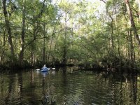
 
We ended up being the only two boats on the Free Dock last night. Perhaps the annual migration of boaters along the ICW is not in motion yet. Not seeing very many cruisers along the rivers. Mostly just fishing boats. Today we slowly made our way up to the Cumberland Island National Seashore. We are currently anchored just off Plum Orchard with one other sail boat. Was a bit surprised to find out the Fernandina Beach Marina will not have fuel available until the end of next week. I'm fine, but Bill will need some soon. He checked and Amelia Island Marina does have fuel, so we'll stop there on the way back. Coming across St. Mary's Entrance, watched 5 or 6 USCG RHI's doing some kind of training. Actually looked more like they were taking turns racing each other. :mrgreen: Almost tried to eat another prop today. Many reports in Active Captain about shoaling issues just south of Fernandina Beach entrance. I manged to hit ground in that area. I warned Bill who was right behind me and he went a little more to the north. But he was seeing shallow water too, so worked his way out. We watched two boats coming in on plane, just south of us, so aimed for that channel. As we turned in closer to that southern shore we watched another boat come out about where Bill was. Guess 50 feet left or right makes all the difference in the world. We'll watch that one carefully again when we head back. Several areas where several channels come together, and it gets tricky to figure out which set of navigation aids to go between. And then finding that they don't always keep you clear of shoaling. One other spot where we got down to about 5 feet, however that was at low tide, so should be no problem when we head back. Kings Bay had several military boats in, and saw a USCG patrol boat guarding the inlet there. Not sure what our plans are for tomorrow. Maybe walk around the island here some, or maybe head a little farther north, or maybe head back to St. Mary's. Or maybe pull into Fernandina Beach Harbor marina and walk the town some. Lots of possibilities. LOL. Been seeing plenty of Dolphins, and hope to maybe see some Manatees when we get back in the lower St. John's area around Deland again. Winds seemed to have died down some, but still breezy out of the NE. And temps made it up to 70 today. Oh yes, someone asked if we had seen the monkeys when we cruised up and back on the Oklawaha River. No, and I just remembered I think Tom and Joyce (C-Otter) telling us about them a while back. Guess I need to hear more about them. But no, I don't plan on ruining any more props going back up that river. :shock: Colby
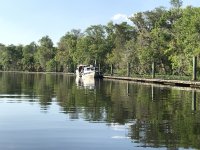
 
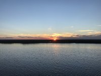
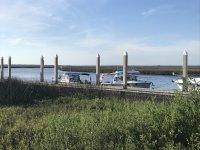
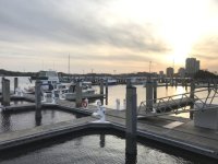
142JacksonvilleFreeDockSunset.jpg
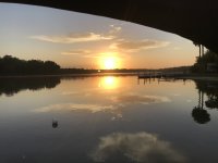
Sunset off the Jacksonville Free Dock

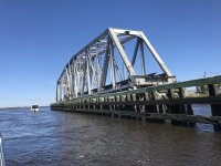
146KingsleyCreekRRSwingBridge.jpg
Kingsley Creek RR Swing Bridge

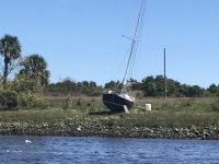
150FermandinaBoatwrecks.jpg
Just one of several boats we saw wrecked at Fernandina Beach

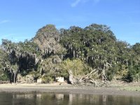
158EgretTree.jpg
This group of trees was full of birds! I'm pretty sure these were Egrets. Kind of hard to see even with Binoculars. At first thought maybe Ibis, but Ibis have a curved beak. It didn't look like these did. Also some Herons and several other small birds.

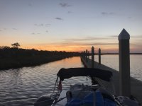
161SunsetCumberlandIslandPlumOrchard.jpg
Sunset at Plum Orchard
 
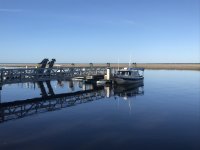
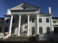
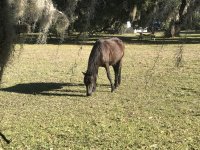
The Breckhill River just off Plum Orchard offered a beautiful and calm anchorage over night. This morning we got up, and after Bill got his Kayak down and went over to check the dock out for me, I pulled anchor and headed over to the dock. Using the current to place me squarely on the end of the dock, it brought back memories of landing aircraft. (A soft bounce and then touchdown. lol) Walked around briefly on the island, looking at the Mansion that was built for and owned by George Lauder Carnegie until his death. Also saw one wild horse. Really not so wild as she was ok with us coming up closer than we should have for some photos. Did my good deed today as well. Walking across the grounds, found a pill bottle with some pain killers. Checked with the work crew that was rehabbing the mansion, and it belonged to one of them, who was happy to get it back. After the short walk and taking some photos, returned to the boat, and then continued taking the long way around on the Breckhill River. Some really pretty scenery. Back on the ICW, and almost finding some too shallow water again, continued along our way. (There was some shoaling near marker 63 which is just north of the south entrance to the Breckhill River. I went from 15 some feet of water to only 3 feet under me. Learned a cruiser that passed us earlier in a much larger boat wasn't as lucky and ended up limping in on only one engine to Firnandina Beach Marina. Past Kings Bay Naval facility again and think I found out what that weird structure was. According to the charts, it showed Degaussing Range. Googled that and it sounds like something to de-magnetize ships... Pulled into St. Mary's this afternoon and tied up to the town dock. Only allowed to be there for two hours, and no overnighting. We visited the Cumberland Island National Seashore museum which was interesting. Then stopped at Lang's Marina restaurant for dinner. Good food. And finished that off at the Market on the Town Square for Ice Cream! Pulled off the dock and now anchored just off the dock in the small bay area south of it. Tomorrow we'll stop at the Amelia Island marina to take on some fuel, and then see if we can make it back to the Jacksonville Free Dock. Something I forgot to mention earlier. Every day for the past 5 days, we've enjoyed watching the dolphins that we frequently see.

162PlumOrchardDock.jpg

167PlumOrchardMansion.jpg
Bill and Rosanne in front of the Plum Orchard Mansion.

172PlumOrchardWildHorse.jpg

190DegaussingRangeKingsBay.jpg

197StMarysCumberlandIslandNSMuseumRosanneBill.jpg
Rosanne and Bill checking out an exhibit at the museum.

215StMarysTownDock.jpg

More images in my nested album.
http://www.c-brats.com/modules.php?...ame=gallery&file=index&include=view_album.php
 
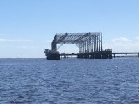
Not too much to report today. We left our St. Marys anchorage this morning, and made our way along the St. Marys River back onto the ICW and then turned in to the Amelia Island Marina to put on some fuel. Then continued along the ICW tying up on the Jacksonville Free Dock once again for the night. This time there are two other large cruisers we are sharing the dock with. Saw many more dolphins today and the usual contingent of birds. One thing that intrigued me both ways, on the southern end of Amelia Island is a Kubota Excavator sitting on top dock pilings. Guess they use it to place the pilings. Also amazed at the length of the piers going out to some of the docks. I'm guessing some could be somewhere the length of 3 football fields. At the St. Marys mouth, we did go get a close up view of Fort Clinch. We continue to enjoy the scenery, and managed to once again not ground anywhere today. Although in a couple places found some skinnier water (4') if to far out of what seemed to be some narrow channels. The one thing I was disappointed about today is a photo opportunity I missed. While coming out the St Marys River we had a formation of two military helicopters come up our stern and fly right over the top of us. Wishing now I would have grabbed the camera and taken a photo! Colby
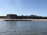
219FortClinch.jpg
Fort Clinch

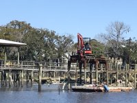
222Kubotadock.jpg
I'd be a little nervous operating that Kubota!

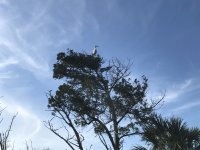
230Egret.jpg
Egret enjoying the sights from the top of this tree.

231JacksonvilleFreeDock.jpg
Jacksonville Free Dock

234JacksonvilleFreeDock.jpg
Jacksonville Free Dock
 
Think I'll just copy what Bill posted in his emails and paste it here: We left the Jacksonville Free City Dock and in less then a mile we left the ICW and were back headed up the St Johns River. Our destination was back to the Jacksonville Metropolitan Marina. It was only about 18 miles away so we were there before noon. We took advantage of the water hook ups on the dock and sprayed off the salt water that may have gotten on the boats from our travels on the ICW. I am pretty sure it made it up to about 80 today with a few high clouds early this evening. To that I'll add two exciting things today. One was being warned off by a security patrol boat. :shock: As you come out of the ICW into the St. Johns, there is a BAE Systems facility and a rather ominous looking gray military ship. At the same time we were next to that ship, a tow was turning into the ICW. I figured I'd give him plenty of room, sneaking over a little closer to the BAE facility and ship to take a few photos. As the security patrol boat starting coming towards me to defend his station, I did call him on the radio and let him know what I was doing. Also today, we watched two tugs reposition a fuel barge to ready for docking at a nearby fuel loading facility. Oh, and we met C-Play as he was returning from Hontoon. He turned around and we talked for a short bit over the radio, then he turned back on his course home. Once docked here at Metropolitan, Rosanne and I walked a little over a mile to a Harvey's Grocery Store in downtown Jax. Always good to get some fresh fruit and vegetables. Later this afternoon, it was time for me to get a hair cut, so Rosanne took care of that. Bill and I came up with a schedule for this last week Rosanne and I have here. Tomorrow Six Mile, Monday somewhere around Sisters Islands, Tuesday Salt Springs, Wednesday Silver Glen Springs, Thursday Hontoon. After that Bill will likely continue upstream on his own for another week or so. Friday Rosanne and I will likely do the Hontoon Loop and spend a few hours at Blue Springs. We have yet to see any Manatees on this trip, and hope to see some as we get closer to the Springs or Hontoon, and if not, at least at Blue Springs. We have seen a lot of Dolphins, as I saw at least one more today. Saturday morning it'll be time to pull out at Ed Stone and start heading back home. Not looking forward to our mixed weather in Wisconsin until summer finally settles in.
Some photos from today.
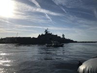
236BAESystemsFacilityJax.jpg
Not the greatest photo of the military ship at the BAE Systems facility, but already a little closer than security was comfortable with us being!

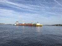
237TowStJohnsRiver.jpg
The tow we were staying out of the way of and the reason for going a little closer to the BAE Systems facility.

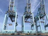
241ShipLoadingCranes.jpg
A closeup of the large container ship loading cranes.

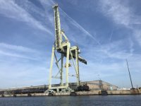
242ShipLoadingCrane.jpg
A single crane

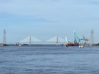
248CTravelerCPlayNapoleanBonapartBridge.jpg
C-Traveler and C-Play with the Napoleon Bonapart Bridge in the background. Bill took this photo.

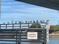
249_Pelicans.jpg
Pelicans on some bridge fenders. Another photo Bill took.

251JacksonvilleMetropolitanMarina.sized.jpg
Sun setting with Mystery Girl and C-Traveler docked at Metropolitan Marina.
 
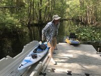
Getting kind of late, almost out of juice on the PC and need to get an earlier start tomorrow, so keeping this one a bit short. (IOW no photo uploads tonight.) Departed the Metropolitan Marina this morning and headed down to the dock at 6 Mile Creek. For the second morning in a row, was "waked" awake. (We had several fishing boats go by yesterday morning while on the Free Dock, in a no wake zone, the last one had to be plowing water!@$%.) With the weekend and more boats on the River, it was a little rocky on our docks just inside the entry to the marina, but did calm down at night. However, the River was very calm as we cruised the 30 miles today. Quite different from the chop we had coming down river last week. After arriving here at the 6 mile dock, which is falling into more disrepair, and getting the boats tied up, I got our kayaks down and inflated again. Bill got his Kayak down and then he and I kayaked down about 2.5 miles to a development near the Creek called the Trailmark at 6 Mile Creek. The HOA there had a great Kayak launch ramp with one of those facilities that you Kayak right up on and then can just step out of your Kayak. Worked better for Bill in his hard side Kayak, than it did for me with the Hobbie Inflatable. Went for a quick walk to find a Geocache I spotted with my Geocaching phone App. Bill actually spotted it first. Back to the launch and into and onto our Kayaks. Not long after launching and heading back to the boat, I managed to hit a deadfall pretty hard with the front fin of the Mirrage Peddle drive. Bent it back a few degrees. I need to reconsider what side rivers and creeks we boat or Kayak in. Two props and now a peddle drive. While I straightened it out the best I could back at the boat, I think I can straighten it out the rest of the way once I get back home and have access to my shop. No vibration at Kayak speeds, so I'm good. :mrgreen: Bill recomputed the distance to get to 7 Sisters Islands tomorrow, and found it was a bit further than first figured. So we'll get an earlier start in the morning, and then just see how far we get. We've just been traveling at displacement speeds, usually around 6mph, +/- a mph depending upon current. No dolphin sightings today. Oh, however Bill and I did see an alligator a lot closer than we cared too. He dove in front of us while we were on the Kayaks, and then splashed again between us. Nope, no time to stop and get a picture, being in an inflatable! :shock: (Besides, after the second splash, we're not sure where he went, and didn't hang around to find out!) (How close? I think Bill could have reached out and touched him with half a paddle length!) Colby
 
From yesterday.

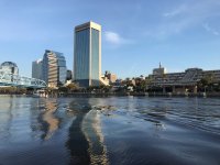
256Jacksonville.jpg
View of downtown Jacksonville as we leave, Bill and Mystery Girl heading towards the bridge.

267MysteryGirl.jpg
Mystery Girl

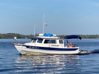
271CTraveler.jpg
Bill captured this shot of Rosanne reading on the back of C-Traveler

272_6miCreekBillAirBoat.jpg
Tour Airboat passing Bill and I on 6 Mile Creek

277TrailmarkHOAKayakLaunch.jpg
Bill just stepping off his Kayak and this cool Trailmark HOA kayak launch facility on 6 Mile Creek.

285Bill6MiCreek.jpg
Bill kayaking down 6 Mile Creek.

288_6MileCreekDock.jpg
C-Traveler and Mystery Girl at 6 Mile Dock

290BentMiragePeddalDrive.jpg
My bent peddle drive. (Front fin bent back slightly.)[/url]
 
Again this evening, just going to copy Bill's words:
Some high clouds when we woke this morning in the 60’s overnight. We left the Six Mile Creek Dock and made our way out to the St Johns River and continued up river. For the first 3 hours or so the water was like a mirror with no wind. We went by Deep Creek, under the Highway 17 bridge at Palatka and past Corky Bell’s Seafood and Steak Restaurant. We went past Murphy’s Island. This time we stayed out in the main channel instead of using Murphy Creek. Not so windy and quite a bit shorter. We went under the open Buffalo Bluff railroad bridge and turned in behind the Seven Sisters Islands where we anchored for the night. Rosanne, Colby and myself took a 1 1/2 mile kayak ride around one of the islands after we anchored. We had the high clouds most of the day and it made it back up into the 80’s. We traveled 40 miles today.
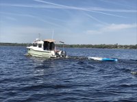

295MollyBrown.jpg
Saw Molly Brown heading towards Jacksonville (Actually he saw us first), and chatted briefly on Ch72.

296MysteryGirl.jpg
Mystery Girl with Kayak in tow.

299Anchored7SistersIslands.jpg
Mystery Girl and C-Traveler anchored behind Seven Sisters Islands
 
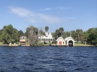
After a very serene night behind Seven Sister’s Islands, we pulled anchor and crossed the main St. John’s channel and entered the little channel around Stokes Island. There is a small ship building and repair outfit in there, St. John’s Shipbuilding. Some large boats are in behind the docks there and just seem kind of out of place this far in on the St. John’s River from Jacksonville and the Ocean. Continued south on the St. John’s River. Went behind Turkey Island to check out some of the homes near Welaka Springs. Passed by “The Palmettos at Fort Gates. Online I learned this is “a Victorian gothic home built in 1877 by the editor of the Putnam County Journal, and was purchased by a tourist cruising the St. Johns by steamboat. J. Monroe Taylor was so enamored by the sight of the property on a visit 1887 that he vowed to purchase the estate when he stepped off the steamboat. The next day, when the steam boat returned--The Palmettos had a new owner from New York. It was for sale in 1965 to the state of Florida for $125,000 but the state found that price much too high. The home and acreage were divided and auctioned. In 2001, the home and about 1 1/2 acres were purchased by a young couple intent on restoration. It appears from our view on the river that they were successful.”
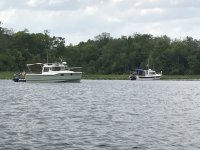
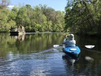
Continuing upstream, rather than cutting between Drayton and Hog Islands, we stayed on the main St. John’s River channel. Lake George was a little choppy with winds out of the south. We crossed the bar with barely 2’ of water under our hulls and entered the Salt Springs Run. When we got here around 1:30, there were already maybe a dozen boats enjoying spring break and the beautiful day. Bill, Rosanne and I found places to anchor and then enjoyed the water and some kayaking. All the other boats were gone by suppertime and looks like we’ll be the only two boats in here tonight. Still haven’t seen any Manatee, however on our Kayak ride around here today we saw plenty of turtles and a small alligator.
Colby

302StJohnsShipBuilding.jpg
St. Johns ShipBuilding

307ThePalmettosFortGates.jpg
The Palmettos at Fort Gates

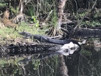
312SaltSprignsAlligator.jpg
Salt Springs alligator

322SaltSprings.jpg
Mystery Girl and C-Traveler anchored in Salt Springs
 
Colby, I’ve been following along on Bill’s shared In Reach & IPad Navionics & combined with your photos & write ups, almost like being there. I Really appreciate your sharing.

Tell Bill, I’ve not recieved any of his email sharings, but I’m liking the shared In Reach, which is actually better even than the Navionics.

Jay
 
Short travel day today, as we just traveled from Salt Springs to Silver Glen Springs. It was another serene night, with a beautiful sunrise. Just so peaceful when we have a place to ourselves. Being lazy once again, I'll just copy and paste most of what Bill wrote in his blog.

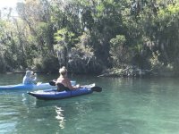
Sunny this morning and up in the sixties. It was only about four miles out of Salt Springs and another seven miles south on Lake George back to Silver Glen Springs. Within an hour of dropping anchor C-Otter, That a Way, Cat Claw, and a Cape Cruiser came into Silver Glen Springs just before lunch and spent some time with us. We passed them yesterday but did not see them while they were up Dunn Creek in Crescent Lake. That is as far north as they went after the C-Brat get together. I think they stayed at Seven Sisters or Welaka last night. They all left Silver Glen Springs after lunch and headed for the Volusia Marina up on Hitchens Creek at the South end of Lake George where they will spend the night. After some swimming Rosanne, Colby and myself kayaked down to the Springs saw lots of boats, a few turtles and gators. We will spend the night here. It stayed sunny all day and up in the 80’s. We only went about 11 miles today.

Because of all the boats in the main area of the Springs, Bill and I are anchored just outside that area in a smaller bay next to some boat docks. We are anchored with one other large cruiser, Millineum, that we met at Metropolitan Marina. Colby

329SaltSpringsSunRise.jpg
Sunrise at Salt Springs

330SilverGlenSpringsBillRosanneAlligatorTurtle_001.jpg
Rosanne and Bill checking out an alligator and turtle sitting on the same log.

339_G.jpg

347AnchoredSilverGlenSprings.jpg
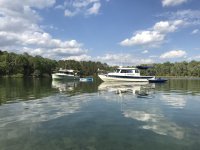
Mystery Girl and C-Traveler anchored with another large cruiser at Silver Glen Springs
[/img]
 
Back
Top