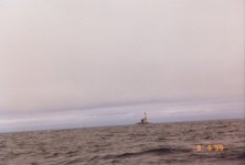
Crossing the bar.

kevrangray

New member
I'm getting ready to either go to Crescent City or Fort Brag to go do some fishing. A friend of mine was telling me that it is very dangerous crossing the bar and I was curious as to if anybody has ever crossed a bar in a C-Dory. If you have can you tell me the do's and don'ts. Thanks.
 
I haven't taken my boat to Crescent City yet (hopefully this year) but I was shore diving there last year and the harbor didn't appear to have a bar crossing.

Here is a link to the Harbor Masters Office with a map.

http://www.boatharbors.com/del_norte_co ... aerial.htm

The Noyo Harbor in Fort Bragg as well as the launch in Albion (just south of Mendocino) are in the river. However both let out into coves that are protected from the predominate north west swell.

http://www.mendocino.com/?id=469

Albion is particularly sensitive to tides. I need about a 3' positive tide to get out of the slough and into the river without having to worry.

I realize I haven't addressed crossing the bar (I have zero experience) but I hope this information is helpful.

Cheers, Jim
 
Jim, we fish out of Garibaldi, Oregon, another dangerous bar,but I don't have direct experience down your way. Yes they can be dangerous, so if the conditions are iffy, don't go. I try and ensure that I am always coming in on a high tide so that the waves are not breaking behind me. A rule of thumb is that I don't want to be out any time that it is a chore just to stand. Up here that is when the wind waves and swell start combining to around four feet or over.

I also try not to go out when it's foggy. I did that once, and it scared the yogurt out of me. When you can't see either jetty, then it's time to stay home. I was more worried about the people running around (and I mean running) without radar. You would see them on your display, then they would come zipping by, way too fast, in an open aluminum boat that clearly had minimal instruments.

So preaching aside, go for it. For starters, go with someone that you know has experience, and whose judgement you trust. Build some experience on your own. You won't regret it.

Steve
 
Bars can be crossed in any boat, it depends on the conditions at the time of crossing. We have a bar challenge up this way when entering/exiting the Merrimack River. It's a large river that enters the ocean in a narrow/shallow bar. I once entered in flat calm seas. 4 hours later when departing we crossed standing 5' waves. I watched a 24' day cruiser completely disappear (and then reappear) in the waves. When it was our turn we battened down the hatches and prepared for green water. It was the most water I have ever had spilling off the roof of Napoleon.

Don't be on the ocean with weather data older than 5 hours, keep an eye to the sky regardless of the forecast, and keep an eye on the sea state. If it does not look good - don't cross it. It might look good at the start of your day and dangerous at the end of the day when you want to return. Be weary of "get home itus". It kills a lot of people every year and has happened to all of us at some time or another.

A C-Dory as a vessel design tends to float very nicely :D As long as the sea state does not result in sharp waves that will flip you or result in large volumes of water landing inside your cockpit she will continue to float - like a cork - over the sea. Lastly, it boils down to the shape of the wave. I have been in measured 10' seas (round swells with a long period) that were no big deal. I have been in 6' seas that were scary with a high capsize risk. The salts aboard can regale you with scarier tales from their experiences but the shape of the waves is where the rubber meets the road.

With preparation and precautions enjoy your cruise!
 
Kevin,

You're getting lota of good advice. I'd emphasize one aspect which certainly applies to the many bars on the coast of Oregon: get some authoritative local knowledge before venturing across any bar, best achieved by transiting the bar alongside an experienced skipper a couple times.

The bar at Garibaldi (aka Tillamook Bay) has been mentioned as tricky already. It might be worth knowing that during large swells you need to make an abrupt trun at right angles to the main channel and scoot out near one of the jetties, a very counterintuitive move if there ever was one! I think there was a link posted here not long ago showing a large charter boat that was rolled at that spot. Someone may recall the link and post it. Very sobering.

On easy days, you can get away with ignoring stuff like that, but sometimes conditions change markedly. The USCG has improived its warning systems up here for alerting mariners about bar conditions, which I expect extends down your way, also. Call the local USCG outpost and find out how they alert boaters when things are nasty.
 
The Crescent City entrance is one of the safer ones along the west coast.

If it is not safe you most likely will recognize it and choose another day to go fishing. Associated with unsafe is Huge swell over 15 ft with short duration and waves crest outside the channel, high wind usually but not always is timed with rough seas that can break across the channel. Really conditions that we regard as unsafe for our small boats is when you should not venture out. When the bar is breaking we would consider it not safe.

The forecast information will help you choose the times to come over and go fishing. Winter conditions can be nice but you need to choose your days. And by that I also mean to know what is expected later. The red sky in the morning rule. We have a bunch of whales in our area now. The biggest problem you have now boating out of here is not running over crab gear as long as you choose to boat on nice days. Hope you enjoy our area.

Jeff
 
Thanks for all the information. I'm thinking about taking a few days off work and drive up to the Crescent City to do some fishing. I think initially I will stay pretty close to the bay and after a couple times I will shoot out for a few hours to see how the main body is. Once again, thanks for all the info.
 
Tom

Sure enjoyed that video and man o man the memories it brought back, but its rare days that conditions are such there at the Noyo River entrance to Noyo Harbor just south of Fort Bragg. In my early teen years and that was before surfboards in the area used to body surf in the cove to the right of the jetty and also many days on the jetty watching the fishing boats come and go. In those days they would even rent a open 16' boat with I think 15hp motor to my brother and me. In later years before moving to Wyoming my brother and I used to fish out of there in his 16 foot ski boat. The motor quit one time coming in right in the spot the fishing boat took the big wave and my brother also had a very close call when the bottom of the same boat came apart and it sunk. He was rescued by the Coast Guard out of Noyo Harbor in the nick of time being as his friend had already passed out from the cold water and He though close too was still able to hold on to him.

Kevin, not to minimize the dangers of crossing a bar, but anytime coming into Noyo Harbor is dangerous it would almost be equally so out in the open water in your boat. From this overview photograph you can see the entrance is actually well protected from most seas.
http://www.krisweb.com/krisnoyo/krisdb/ ... ir14lo.jpg

A possible interesting factoid to some maybe in the movie "The Russians are coming, The Russians are coming" the scene of the submarine entering a harbor was filmed in the Noyo Harbor entrance.

Jay
 
The above responses are accurate. Here in Fort Bragg, we don't generally speak of a "bar", but rather the "jaws" formed by the parallel north and south jetties at the harbor entrance. Depth there can be as low as a few feet at low tides, and there have been a few capsize accidents in the "jaws" over the past 20 years since I have lived here.

The greater hazards are usually beyond the jaws. Exercise your usual precautions regarding open ocean wind, swell, and sea condition forecasts. (There is a reason that wave energy projects have been proposed on our coast!) Additionally, regarding the jaws, you should avoid conditions where large swells are in opposition to a strong outgoing tide, and especially if that outgoing tide is accompanied by high Noyo river storm discharge. This is not typical but you should check it. Have a great time if you come here! There are many fun shore activities too!
 
A few comments on Crescent City Harbour. When we came down the coast with our sailboat, the first stop we made after leaving Neah Bay was Crescent City. It is a south facing harbour entrance, and doesn't have a bar. The north west swells don't create a bar, so the entrance is safe and certainly not tricky. That's why we chose it. The gas dock is on a pier and you moor to a couple of chained logs. It was a good and safe harbour, and we enjoyed the stay. Just look at the FREE NOAA chart, and it's a simple entry.

Just north of Crescent City is an off shore lighthouse named Castle Rock. When we first saw it, I thought it was a freighter. However, it's the only off shore lighthouse on the west coast. It actually takes you through St George Reef. Wonderful to see that thing just sticking up out of the ocean and you want to stay to seaward of it. Here's a picture:

51_Castle_Rock.jpg

Boris
 
Jouney on we do have a bar several infact but Everettes just got closed and the light house is called Point Saint George lighthouse. No big deal but boaters need to know the truth. Any time your in the area and would like a tour I would be happy to be your tour guide.

Big swells break across our entrance and I have even seen the red can at the entrance covered by swell. When we have size the entrance to our harbor is very tricky. I saw the cutter broadsided by a swell towing a fishing vessel back into the harbor. I was waiting inside the jaws to take the vessel from the cutter and dock it. Our bar is for real and shows its teeth at size. But most the time we have a safe harbor to enter.

Not to be picky but if you use Castle Rock as your light house position you will soon be at the wrong port and in need of help. We had a fishing vessel land at point st george several miles from the harbor entrance due to a similar error. Look at your charts very carefully in unknown waters. Our coast line does not offer many sandy places to park your boat. And if in doubt call for assistance on 16. We would rather meet you out in the pond and show you the way rather than have to provide rescue service. Local services come from the coast guard or an active coast guard auxiliary that operates a 25 ft safe boat.


And as I mentioned we have one of the safest harbors to enter most of the time, but when mother nature is having a fit our harbor entrance is better to view from the inside than to be trying to time the swells coming in.
 
Ocean conditions being equal throughout the tide cycle, the roughest water on the bar will occur during maximum ebb. Maximum ebb is where the flow of the river and the water from an estuary flow out at the maximum to meet the incoming waves. It usually occurs 2-3 hours before low slack. The amount of out flow can be influenced by how large the tide exchange is and the river conditions. Example is if you have a very high tide followed by a minus low tide, you are going to have rougher conditions that a small 4-6 foot tide exchange.
 
1TUBERIDER, thanks for sharing your local knowledge. That's the best kind and what I like to depend on.

Coming down the coast, we picked Crescent City because the chart did not show an outside bar, whilst (for example) the Columbia River and Humboldt Bay have marked bar channels, with soundings given in a table. When we came in, it was an easy entrance even when bar warnings were out elsewhere. Here's the chart of the Crescent City entrance, from NOAA 18605-1:

Cresent_City_Entrance.jpg


You're certainly correct in saying to use caution. I've even surfed a 7 ton sailboat into San Diego Bay on a set of south swells. A thrill I didn't need.

As to the lighthouse photo above. again thank you. For years I've been calling it by the wrong name. It's the St George Reef Lighthouse, on NW Seal Rock, west end of St George Reef. First lit in 1892, it was the most expensive light station ever built at $704,000. Restored starting in 1988, using a helicopter at $3000/day. Apparently the restoration is going well; according to the SGRLPS web site, helicopter tours are available. It's also on a postal stamp. It was a great sight when we passed by. The 1st order Fresnel lens is in a Crescent City museum.

Love cruising, you get to see a lot.

Boris
 
Back
Top