cmetzenberg":342tlzrz said:
AIS is a vhf broadcast information from vessels that broadcast AIS information. The vast majority of these vessels are commercial. The data broadcast can include vessel name, call sign, MMSI, course, speed, cargo, ect. This data should NEVER be used for collision avoidance and maneuvering purposes, it is only as good as the sensors on the vessel broadcasting it. For pleasure boaters the only useful data AIS will give you is the names of vessels near you, this is handy if you need to hail them over the radio. Asides from that, useless. As far as the AIS text messaging service goes, no one in industry uses it or ever checks it, kinda like digital selective calling (vhf-dsc).
">>>>... This data should NEVER be used for collision avoidance and maneuvering purposes, it is only as good as the sensors on the vessel broadcasting it. For pleasure boaters the only useful data AIS will give you is the names of vessels near you, this is handy if you need to hail them over the radio. Asides from that, useless."
Conrad, I could not disagree more.
Actually, AIS range is often times, greater than the radar range.
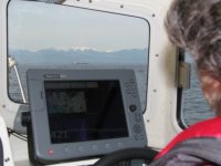
I run radar full time, and since the addition of the AIS it is also run full time. The radar runs on an overlay on the plotter, or sometimes on a separate screen, depending on condition and AOO (area of operation). AIS is provided by 2 sources, Standard Horizon GTX2150 vhf and a Vesper Marine Watchmate Vision - A stand alone B series with it's own monitor. The AIS data is also displayed on the MFD screen and defaults to the 2150 input if the Watchmate is not on.
The time it takes to run a curser on the MFD to an AIS target and touch "display AIS" button is only a few seconds. In that time I have CPA (closest point of approach) and TCPA (time to closest point of approach). In that same time, I would be half way to getting the radar only screen up, let alone setting up the MARPA.
Oh, by the way, at the same time, I also have the vessel name, MMSI#, and one button calling via DSC to that vessel. And, lets just say it is totally clear weather, BUT, the vessel is a ferry moving at 22 knots, coming around the corner at Shaw island, and there is a tug and tow approaching visible on radar and to me. I can determine speeds of both vessels, (the ferry I can't see, and the tug I can) and can see they will meet at the narrowest part of the pass, just when I would be there.) Now I can pre-determine, that I don't want to be there then, but I only know that from what I can determine with the AIS. RADAR does not see the ferry, on the other side of the point.
When crossing the Strait of Juan de Fuca, with the plotter set at 25 miles, and radar set at 12, the AIS is set on the 25 screen, I can see a string of Targets, east bound lined up from Port Angels, and in a few seconds, can get TCPA and CPA and determine if I want to maintain speed or adjust, to clear in the greatest space.
Would I use the AIS for "collision avoidance and maneuvering purposes", absolutely. Would I rely on it solely? No way. Is it a necessary tool? I guess that is a personal opinion, (and everyone is entitled to have their own), but when those little triangles are 50 times my size and traveling at 2 to 4 times my usual cruising speed, (6 or 12 knots), I will use what ever adjunct I have available to be sure I am out of their way.
You are right about the digital calling with DSC, not everyone knows how to use it, but even without, the AIS gives the vessel name, and that works almost as quick. It is nice having that info while that target is still out there 10 min or more away.
As to using a phone app for AIS info. Yes it works, HOWEVER, there can be a significant time delay, and at 20+ knots, that little triangle, can be 2-3 miles closer to you than you think when you look up from your phone. Works fine if you are sitting at the marina nad wondering what ship that is going by. More scary if you are looking up at the bow, and can't see the bridge. :shock:

:cry
Harvey
SleepyC :moon
