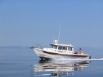
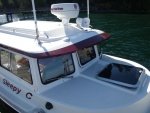
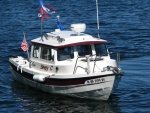
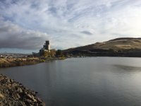
10/15 - 10/29 - 2017 Snake/Columbia River C-Dory Cruise

Colby, many thanks for the updates. If you guys go tomorrow, I’d suggest going past The Dalles and dock at Hood River. The yacht Club folks are great, and the town is good fun.
Say hello to my friends in the group, and try to keep Bernie away from the tequila.
Keep writing,,,!!!
 
Yes...thank you for sharing your adventure with us!!!!

Portland weather is looking nice on Monday and really nice on Tuesday.

Will be curious to see when you are close to the Portland/Vancouver area.

Safe travels,

John
 
Just my own prediction we probably won’t be leaving here too soon as it sounds like a wind tunnel out there and my boat is slightly rocking from the chop in this small protected cove...
 
Good morning Columbia Flotilla. Really good to be back on line and able to follow again. Colby, It looks like as of 0935 Sunday you are still at Arlington. (FYI on the internet AIS websites. They get their AIS input fixes from a shore based AIS monitor, often a private person or a business, (Rodgers Marine Electronics in PDX, that upload that to the I-net [part of what causes the position delay from a real time monitor on VHF]. My best guess is that there are very few, if any, of those service providers along the upper Columbia or Snake.

I have even talked to several of the tow boats there who do not have AIS, mostly because they know who is up river and keep in touch via VHF.

Sure glad you are trying, and I'll keep checking. Though I have tried the 2 you have listed plus the one I use "Boat Watch", and none of them are showing active AIS positioning of "Midnnight Flyer". Most recent is at Arlington Marina. I have found a couple of vessels up river from you, which may be registering via satellite as they are commercial vessels.

Wishing you a great day and a safe trip.

Harvey
SleepyC:moon

JC_Lately_SleepyC_Flat_Blue_070.thumb.jpg
 
hardee":1vss119a said:
I have even talked to several of the tow boats there who do not have AIS, mostly because they know who is up river and keep in touch via VHF.

Harvey
SleepyC[

[]


I am surprised that not all tugs have AIS--we saw one on the Miss which even in heavy fog didn't have AIS.

(1) AIS Class A device. The following vessels must have on board a properly installed, operational USCG Type-approved* AIS Class A device:

(i) A self-propelled vessel of 65 feet or more in length, engaged in commercial service.

(ii) A towing vessel of 26 feet or more in length and more than 600 horsepower, engaged in commercial service.

(iii) A self-propelled vessel that is certificated to carry more than 150 passengers.

(iv) A self-propelled vessel engaged in dredging operations in or near a commercial channel or shipping fairway in a manner likely to restrict or affect navigation of other vessels.

(v) A self-propelled vessel engaged in the movement of –

(A) Certain dangerous cargo as defined in subpart C of part 160 of this chapter, or

(B) Flammable or combustible liquid cargo in bulk that is listed in 46 CFR 30.25–1, Table 30.25–1.

There are other commercial vessels which can use AIS B.
 
thataway":kvb255ca said:
hardee":kvb255ca said:
I have even talked to several of the tow boats there who do not have AIS, mostly because they know who is up river and keep in touch via VHF.

Harvey
SleepyC[

[]


I am surprised that not all tugs have AIS--we saw one on the Miss which even in heavy fog didn't have AIS.

(1) AIS Class A device. The following vessels must have on board a properly installed, operational USCG Type-approved* AIS Class A device:

(i) A self-propelled vessel of 65 feet or more in length, engaged in commercial service.

(ii) A towing vessel of 26 feet or more in length and more than 600 horsepower, engaged in commercial service.

(iii) A self-propelled vessel that is certificated to carry more than 150 passengers.

(iv) A self-propelled vessel engaged in dredging operations in or near a commercial channel or shipping fairway in a manner likely to restrict or affect navigation of other vessels.

(v) A self-propelled vessel engaged in the movement of –

(A) Certain dangerous cargo as defined in subpart C of part 160 of this chapter, or

(B) Flammable or combustible liquid cargo in bulk that is listed in 46 CFR 30.25–1, Table 30.25–1.

There are other commercial vessels which can use AIS B.


Bob, I was surprised too. I had my AIS installed in Portland, OR, and after testing to be sure it was working at Rodger's Marine, I ran up the river to Beacon Rock, which is about 30 miles, and wanting to see if it worked, called every tug I met, (I think 5) and asked for confirmation on my signal. 2 out of the 5 did not have AIS -- not even a VHF with AIS receive capability. I have met several others on the river since then. And no, I don't know why, how they get away with it or why they would want to.

Harvey
SleepyC :moon

January_2010_344.thumb.jpg
 
When I was up at Isle Royal a month or so ago, we noticed that several of the passenger boats did not run AIS either! That last link I gave a few comments ago does show me here at Arlington. Which is where we are staying put another day. :? Winds were blowing like a good thing early this AM. Then they died down, but they are starting to pick up again. Floyd on Far C has kind of been our weather man having a good weather link. And I've been using my local station out of Madison's site, which seems to be fairly accurate also. Jim on Pounder, our fearless leader, is leading some good choices I believe. Fortunately, the forecast looks good after today. So plans are to hang tight here at the Port of Arlington, then head out to Hood tomorrow. Colby
 
Colby, one of teh thinkgs I use my AIS for is to find a vessel in an area I want to go to and call them to get "local, current" weather and condition info. you may not have much on the AIS, but you can also call the lock operators on the phone, or any of the marine traffic you can pick up on AIS as well. You probably know that as "PiObs".

And if you see the kite surfers wings over the water, you might want to just hang in the marina. There are few places to duck out of the weather and Hood River is a pretty good run. John Day river entry is one, there is a park on the Washington side close to the Biggs Bridge, I think "Peach Beach" might be the name or Mary Hill Park. Also there is a river cruise boat "American Pride" that should be close to your area now, heading to Umatilla.

Enjoy and stay safe.

Harvey
SleepyC :moon

HH_Cal_09_07_Jul.thumb.jpg
 
Good thing we stayed put. Winds are up again. These are in the photo album, but posting them here too. First one is the calm between early this morning, and now. Next one is of the entry to the Marina, looking from the Transient (A) Dock. Final one shows the waves splashing up over the dock!

IMG_8784.jpg

IMG_8796.jpg

IMG_8802.jpg
 
Interesting the different takes on usefulness of AIS for tugs and other commercial vessels on the "upper" Columbia. If it is true, as colbysmith found, that AIS locating receivers are scarce over many reaches of the upper Columbia, then it may be that commercial vessels feel an AIS unit is not worth the investment, despite language requiring their use.

As far as use on the lower Columbia, monitoring AIS on the web and intermittent field checks suggest every vessel of substantial tonnage (i.e., freighters and similar) is on AIS. I have never tried to field check tugs. They may not routinely use AIS. In any case, in practical terms, towboats, tugs, most large pleasure craft, and absolutely every vessel with a River pilot aboard, makes frequent VHF transmissions announcing its location by referencing ATON and/or river features such as points, bridges, etc. as it moves on the ship channel. Passing situations (head to head) and overtaking events are accompanied by careful exchanges of position, intentions, and vessel speed made good, to avoid hull to hull contact at narrower segments of the channel ... or at/during turning transitions from one range to another. [Those familiar with the broad, gradual turn near Skamokawa can visualize the difficulty freighters have maintaining clearance in any passing situation there.]

Finally, seems like VHF queries by "small" vessels to a freighter's bridge are very rare. Now and then, it sounds like very large vessels make minimal response, except to assert their intentions and to warn the smaller vessel to stay out of the way. There being ample depth for all but large vessels, just off the dredged channel, this seems appropriate.
 
Many thanks to Colby Smith and the others sheltering at Arlington for sharing their knowledge and showing us their boats on this very windy day. We learned so much! We just now got home after doing 330 miles round trip today and our drive was of course full of C Dory discussion. Again, thanks and safe travels to you all! Paul and Vicky
 
Paul and Vicky, very glad you guys got home ok. I still wish you would have let me given you a ride out on the Columbia today, just to see how the boats handle in "crappy water". lol. That's a long ways to drive just to see the boats. But glad I was able to share my fondness of the C-Dory with you. I kept thinking all afternoon what I don't like about them. And about the only real thing I could come up with was the condensation problem on a cold boat. Space is always an issue, but no matter what size boat you have, it becomes a problem! I love to trailer my boat all over the place, so I'm willing to give up a larger boat for that to happen.

Looks like our plans tomorrow are to take off and head down to Hood. Rumor has it, the weather is looking good for a while! Colby
 
Colby, Thanks for the new pix, and comments. Yes, you are heading into some better weather. Looks like winds will be coming from the SW, but in the river gorge, you will probably have some winds on the nose. The next few days should give you a good weather break. Hope it goes well for you and the rest of the group. Stay safe.

Astoria Dave, I have found some of the "Upper Columbia" river tugs use AIS and transmit that VIA satellite. I believe that has to do with the "Home office" being able to track their assets. If you are on the river and within their AIS/VHF range, you would be able to pick them up on a conventional AIS receiver (VHF receiver or AIS transponder unit).

Harvey
SleepyC :moon

1_10_2012_from_Canon_961.thumb.jpg
 
The weather today looks much more like a good day to move. And, it looks like it might be good for a few days. I was hoping to get back down to Portland to see the fleet, but you may be through before I can do the turnaround. Hoping all are having a good time.

I am curious how the 2 single handers are doing in negotiating the locks. Especially manning the lines and fenders.

Also, are you using a common "chat channel" on the VHF, and if so, ???

Thanks, and looking forward to your next posting.

Per Marine Traffic AIS site, Midnight Flyer is still at the confluence of the Snake and Columbia Rivers but i know it did show you at Arlington yesterday. (Really doubt you went back up river;-{

ON EDIT: Vessel Finder is still showing Midnight Flyer at Arlington from 10/21 at 2131 UTC

Harvey
SleepyC :moon

JC_Lately_SleepyC_Flat_Blue_070.thumb.jpg
 
Starting to see tows today. Passed the Cascades going up river between the two locks today, John Day and The Dalles. Lew and I are doing fine Harvey. I haven’t missed aBollard yet and Lew is doing just about as well. But I’ve had plenty of experience! First long wait for a lock as The Dalles has an ipbound Tow in there now and once he’s out we’ll go in then another upbound tow when we come out. I’m anchored in a tiny cove with a great view of a lumber mill and ant. Hood. Also we’re using ch 69 as common. Ok tow coming out, gotta get going.

FDE1C119_DD8C_48E5_973F_62D67BAEDBF4.jpg
 
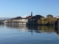
Today was a beautiful day. Relatively warm (in the 60's) and sunny. Smooth water. Pretty foliage and scenery. Short wait for the John Day lock, but we did have to wait about an hour at The Dalles lock, for a small tow. In fact, that tow was dropping his barge off at that bargedock in the photo above. He made quick work of it, and then came back and joined us in the lock for the drop. I think most of us were hoping for showers here in Port Hood River. But looks like they pretty much shut everything down October 1st. I did manage to put out my camp shower bag earlier, so with water a little cooler than I liked, I took a camp shower in the cockpit... And since the only shorepower here uses the rare 20 amp twist lock plug, which none of us have with us, looks like a night on the batteries. Still, we're in a safe haven with good dockage! Even with spending the two extra nights at Kennewick and Arlington, it looks like if all goes well the next several days, we will actually get into Astoria a day earlier than planned. (Hope my typing here doesn't jinx it...) I believe we have a good forecast for the next few days. And relatively speaking in regards to the miles we've been doing, they should be easy days. We'll do our last lock tomorrow, the Bonneville Lock. I believe plans are for Camas tomorrow (24th), Kalama Wednesday afternoon (25th), then into Astoria Thursday afternoon. (26th)
Tyboo, keep an eye on the bar for me. If it's looking good, perhaps you can come out with your boat on Friday (27th) and lead me out to Buoy 10. Or ride out there with me. :mrgreen: Actually, how much time would one need to get out there and back from Astoria West Basin? IE, would there be time to hit it if we get into Astoria early afternoon?
Of interest today was we've been seeing some interesting "platforms" along the shore. Pounder's crew informed us they are used to pull in the fishing nets from all the floats we've had to dodge along the edges of the River. Ok, on my way to upload today's photos.
Late note: guess the AIS tracking just isn't going to work well. It looks like the first link I listed in this thread shows me at Hood River, but the second link does not. Neither link seem to have good coverage of the area we have traversed so far...The tows we came across today were transponding, so it was easy to see where and who they were before we got to them.
Ok, off to upload today's photos. But before I go while I'm thinking about it, some more statistics. Fuel here has been the most expensive, at $4.99/g. Next expensive was at Lyon's Ferry at $4.59/g. Otherwise we've been paying around $3.45/g at the other stops. Lyons Ferry (KOA) Marina was the most expensive at $22.something/night. Hell's Gate, Kennewick and here (Port Hood) at $10/night. Lyon's Ferry did not have electric at the dock we stayed on. For the price and all, Kennewick has probably been the nicest marina so far in my book. Lyons Ferry probably had the best showers... Colby
 
Sounds real good!

It’s about 13 miles give or take from Astoria to Buoy 10. The tides are right for it with an early afternoon low and incoming until evening, but the wind traditionally comes up a bit in the afternoon so we will see what it is when it is. I’ll ride out there with you. In fact, if it seems like a good idea at the time I can drive your trailer out to Hammond and you can pick me up there then load up the boat afterward if you are ready. Much nicer ramp than Astoria.
 
Colby, I think you are right on the weather. From where you are on down to Astoria is the most scenic, well except for the mountains, of the trip, and there will be lots more river traffic.

And those platforms, you are half right. But the nets they use are on long poles, not floats, and the Indians have fishing rights to hand net salmon from those platforms. They do still use them, and they also have the rights for netting too. Those are the floats you have been dodging.

you should have good weather for until the weekend, so it might be worth your time to run up the Willamette to the falls, right through downtown Portland, and take some time through the Multnomah Channel or poke around in the Skamokawa wildlife area:

http://columbiariverimages.com/Regions/ ... _park.html

There are lots of neat places to spend a day or so.

Ccongrats on a great day on the river. Stay safe, and thanks again for the pictures.

Harvey
SleepyC:moon

1_10_2012_from_Canon_961.highlight.jpg
 
It looks like Friday is a great tide day, too. The exchanges are only about 2' at all of the three daylight turnarounds. The second worst water I have ever been in was coming around Tongue Point on a strong ebb. The worst water I have ever seen was between Astoria and Warrenton on a windy ebb. But if you guys can keep the wind down, I will take care of the tides and we will all have smooth sailing.
 
Tyboo, thanks, sounds good! We'll see how things are looking when we get in. If all goes well, and we do still arrive on Thursday, I'll plan to hang around Friday as well. Harvey, I'll pass that along to Jim, and we'll see what happens. How far up the river would we have to go. If only an hour or two extra, I think we probably have time, but depends upon what the group wants to do.
 
Back
Top