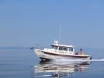
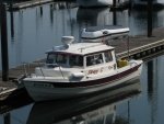
10/15 - 10/29 - 2017 Snake/Columbia River C-Dory Cruise

While I'm concerned about how this will affect our planned trip down the Snake and Columbia Rivers, I'm sad for all those that have lost homes and lives with these fires. Same goes for the hurricanes and earthquakes. The destruction Mother Nature and careless individuals is causing around the world right now, hurricanes, fires & earthquakes is astounding. Colby
 
Thanks Floyd for the fire link.

I just watched national news about the forest fire near the Oregon town of Cascade Locks in the Columbia River George area near Bonneville Lock.

We will just have to wait and see how this all evolves over the next few weeks. Our trip is over a month away and this is the last lock of our eight lock crossings.

Mother nature is in full swing right now from Oregon to Texas to Florida to Mexico!
 
I-84 will be closed through the weekend, maybe open (westbound next week) after all the burned trees are out and the rock walls are checked. The Columbia River is open for commercial traffic now.

The Washington side (Hiway 14) is open, but was using pilot cars and one ways for a while, I don't know if that is still the case or not.

Harvey
SleepyC :moon

JC_Lately_SleepyC_Flat_Blue_070.thumb.jpg
 
Some information about our trip:
1. Logistics in Lewiston:
a. WHERE TO STAY: When you arrive in Lewiston you can set in the marina, stay in the State Park campground ($25 – 30 depending on state residence), or one of the local motels. The marina in the Hells Gate State park will hold your boat for $9 per night plus $5 to park truck/ trailer. The army corps permit to the park does not allow living aboard, but if we stay just for a few nights they won’t be coming down at night and knocking on your boat door to see if you are on board. I intend to launch Monday afternoon, Oct 16 & spend the next two nights in the marina.
b. PARKING: We can leave trucks/ trailers in marina parking lot at $5/ day. It’s not secure, but the park patrols in daylight hours & city cops at night. It’s not a “hot” spot for the kids so I don’t think we need to worry if we take normal precautions.
c. CHASE RIG: or “Sag Wagon”. I have a Nissan Xterra that will seat 4 in some comfort, 5 in less. We could have a different driver each day follow the boats so that we would always have wheels nearby. If someone has a larger rig it would be better. If we get more that 5 boats we will need to rent a car to help with the shuttle. At some point renting a shuttle rig might make sense.
d. SHUTTLE: It’s a 8 hour 400+ mile drive between Lewiston and Astoria. I suggest we consider shuttling a few rigs to Arlington, Oregon which is about half way. Then we would always have a truck and trailer within a few hours of our boats. We would need to do that shuttle on Tuesday, Oct 17.
2. Locking thru: I visited with the Corps office in Clarkston and they consulted with a higher office. Since we are a group we get special attention and can pass thru anytime, but that means we need to be a “flotilla” at least at the dams. We need to call ahead and they will be ready / looking for us. The commercial tows do have higher priority, but they will know if we are going to have a conflict at least a day in advance, so we can adjust if needed.
3. Fuel & speed: I’ll be calling some of the fuel stops in the next week, as some may be down for the winter. If so, we will have a few discussions along the way on speed. I like hull speed, but to meet our “schedule” we will need to move faster than “hull” speed and that burns fuel. Also, there are a few places that I want to visit more thoroughly than just a “drive by.” How fast and when I suspect will be a joint decision made daily.

Give me a call at 208-476-3123 if you need more specifics.

Chuck
 
Thanks Chuck and Penny for the good information and kind offerings.

I agree, we will launch from the Hells Gate State Park, and those that want to can leave their truck and trailer rigs there.

Your chase rig is a windfall benefit. Please sign up my crew Kathy as a designated day driver for those days that you want her to drive. I will look forward to riding back to Lewiston at the end of the trip in your chase rig to retrieve my tow rig.

I look forward to working with you on a daily itinerary for this trip. It is challenging to lay out our schedule for a ten-day period on the water for the 500 NM expedition cruise.

On further consideration, we should all plan on leaving the dock Wednesday morning, October 18, at 8:00 AM, so we can get a full first day under our belt. I now plan to have my boat in the water for Tuesday night, October 17.

I previously suggested a Noon departure on the 18th, but we need the extra time to make headway down the Snake River.
 
My intent is to be launching sometime the afternoon of the 17th. I'm also looking into using my airline retirement benefits to fly from Portland to Lewiston after we arrive at Astoria. Still working out logistics for getting from Astoria to PDX and LWS to Hell's Gate. I thought about trying to centralize my rig, but think it probably best to just leave it at Hell's Gate for planning now. Colby
 
Latest InciWeb report on the Eagle Creek Fire:

  • The U.S Coast Guard reopened the Columbia River to all traffic last night at 8 p.m. Firefighters spent a good part of Sunday completing a successful burnout to protect the community of Cascade Locks. The fire is holding at the lower edge of Herman Creek and light winds today are predicted to blow from the east pushing the fire back on itself. Oregon State Fire Marshal (OSFM) crews finished their structure protection and assessment work in the Level One Evacuation area in Hood River County. OSFM crews will continue to operate day and night shifts mainly along Interstate 84. Due to the diminished risk to structures, OSFM has begun to reduce the number of crews assigned to the fire. The OSFM mission remains the same: to keep everyone safe and protect structures.

    Heavy smoke obscured a large part of the southern fire perimeter for most of the day yesterday preventing the use of aerial resources. Several helicopters assisted other fires in the area. With the change in winds today, fire managers should be able to get a clear look at the the fire perimeter on the east and south side above the Bull Run Watershed. Firefighters will finish mopping up along the northwestern perimeter today near Cascade Locks after completing a burnout yesterday. Firefighters are almost finished tying together roads and trails to put indirect line from Herman Creek southwest to the southernmost extent of the fire.

    The change in the winds and sunnier skies will help firefighters find and extinguish any hotspots that may have been smoldering in the low-lying smoke and moist undergrowth for the last several days. Generally, the weather will allow for increased fire behavior but extreme fire behavior is not expected.

    Resources Assigned: 24 Crews (4 Type 1, 13 Type 2, 7 Type 2 Initial Attack); 84 Engines; 11 helicopters; 38 dozers, 9 water tenders, 979 personnel.
 
Does anyone know why the US Forest service limits the water drops to 5,000 gallons? Calif. and many foreign nations have successfully used the converted 747 which will carry 19,600 gallons of retardant, and the DC 12 carrying 12,000 gallons?
 
SCHEDULE: Jim and I have put together a tentative schedule. The miles are statue river miles from the CoE shown on the Evergreen Pacific Chart book. The actual miles we boat will differ.
Night --- Place -- Day Miles
1 Lyons Ferry 84
2 Kennewick 88
3 Boardman 59
4 John Day Rvr 51
5 Hood River 50
6 Port of Camas marina 47
7 Kalama 47
8 Astoria 60

We arrived at the above schedule by deciding we needed to get down the Snake in two days, or 150 miles in two days. That will be two dams/ locks each day. Then we planned 50 miles per day and picked something close. That gets us to Astoria in 8 days and we have 10 planned, so we can work in two weather/ time out days depending on what we encounter. We should expect changes as no plan is perfect nor survives past the first day.

I have the above worked out on a spread sheet that shows the river mile of many possible stopping places. If interested send your email to me at raddon@frontier.com and I'll email the spreadsheet.

CHASE CAR / SHUTTLE: As I remarked in a previous message, I live only 50 miles from our start and have a nissan xterra that could be used as a chase car to follow us. The chase car would meet us every night and a fresh driver would take it the next day. If we have five boats with two crew, could one of the crew serve as driver of the "chase" car for 1 or 2 days on the trip. If we don't get enough drivers we'll have to leave the chase car behind and fly back to get our trucks/ trailers. Jim's wife and my wife are willing but we need three more drivers so no one gets stuck doing much of the driving.

Chuck
 
My first take on this is...um....overly ambitious shall I say? 80+ miles with two locks is questionable in my mind. My hope is that we don't plan on running more than 16-20 mph. (Somewhere between 13-18kts). If there are any no wake zones, I think it fair to figure those in at around 5-6 mph. Ideally, I would hope we are going to enjoy the river, it's cities and it's scenery, along with the camaraderie of each other, and not just speed along to get from one end to the other. To be honest, I thought 50 miles a day was ambitious, but easily doable if the weather Gods are with us. Figure about an hour for the two locks, assuming those locks are like those here on the Mississippi, and we can get right in when we arrive. Otherwise, if we have to wait for a commercial tow going through, it could be another hour or two longer. For a comparison for those of you that have done the California Delta Cruise, my charts show that was 61 miles, San Francisco to Rio Vista. I know we made pretty good time on that, but I believe we were running between 20-25mph non stop on the way back, with no locks or no wake zones.
Ok, my two cents worth. I don't know anything about the Snake & Columbia Rivers, but I have done a lot of cruising in both rivers and the Great Lakes, and just think we are being overly ambitious about 80 miles a day, with two locks included. I appreciate all the planning you guys are putting into this, and I'm really looking forward to it. But with 4000 miles round trip on the boat trailer, I like to enjoy the time on the water while there! 8) If the others feel 80 miles is very doable, I'll put my concerns aside. Colby
 
Colby, I cannot vouch for those daily goals above Bonneville, largely because I have no experience locking. However, I have quite a bit of experience below Bonneville, almost all of it below Longview (near Kalama), where daily mileage goals are substantially less. And they seem much smaller than vessels similar to CD 22s and CD 25s make all the time, with this caveat: if conditions are typical for October.

It seems to me those mileage goals for the first couple days, if ambitious, may be counterbalanced by the goals in the last few days.

On the lower River, where we run all the time, the principal obstacle downbound is the good weather afternoon NW wind, which can be substantial, forcing some boaters to run at hull speed, i.e., off plane. Ten knots is a typical top speed figure for most smaller craft such as the 22s and 25s when the headwind blows. Fortunately, most fetches above Skamokawa are relatively short, minimizing head seas to two feet.

Truly, your venture is a situation where YMMV (aka Your Mileage May Vary) ... and that is part of the fun, I suspect!
 
Colby.

The actual nautical miles are as follows:

1. Day 1 to Lyons Ferry Marina -74
2. Day 2 to Port of Kennewick - 52
3. Day 3 to Boardman Marina - 48
4. Day 4 to La Page Park - 43
5. Day 5 to Port of Hood River - 43
6. Day 6 to Port of Camas-Washougal Marina - 43
7. Day 7 to Port of Kalama Marina - 39
8. Day 8 to Astoria Mooring Basin - 52.

This trip is very manageable for a relaxing and interesting journey through a vast expanse of landscape.

The first day is the longest day, but it is still doable. It may be an eight hour plus first day, but we are leaving early Wednesday morning and we will be fresh. All the other days are very relaxing.

Chuck and I looked at this trip many different ways and we decided to set up an 8 day planning itinerary so as to leave two extra days for either wind contingencies or side trips. For example some may choose to take a side trip up the Willamette River when we get near Portland (one could go 50 miles up this river if they wanted to). The extra days could also be used to just hang out and relax. Some may want to get a hotel for the night at Hood River to refresh.

There are a tremendous number of options on this trip and we will meet and discuss each night the plan for the next day. We thought hard about where we wanted to put our trip priorities and we decided to get through the Snake River portion in two days to free up time for the Columbia. Everything is a trade off in trip planning.

This itinerary is just a plan to get us going. This plan will be modified real time as necessary to meet real world, real time conditions.

The trip will be an enjoyable cruise for all. After all we have Kath and Penny to keep happy along the way.

Colby, I can assure you both Chuck and I are planning a relaxing Expedition Cruise. No need to worry about that.
 
Thanks Jim. Appreciate your comments. They do put me more at ease! As I said, I don't know anything about the Snake and Columbia's, other than driving over them in a few places a few times. I do however have some experience on the Mississippi River and know that locking can take anywhere from 20 minutes to 3 hours or more, depending upon the commercial traffic. If the water is flat calm also makes a difference over even a 1 foot chop at fast cruise. And I'll be doing all the boat handling myself, but have done so before so know the routine with that...
The nautical miles still convert to some higher statute miles, pretty much as noted earlier. 74nm = 88sm, 52nm=62sm and 48nm=57sm. Assuming we run at 18kts, or 22mph, which is probably a good fast cruise speed for all of us, that first day alone is looking at just over 4 hours of continuous cruise. Assuming we throw in stops for lunch and maybe some slow downs for the locks and sight seeing or bit of a break, starts making for a longer day.
Anyway, as I said, I do appreciate your comments and put me more at ease about the overall trip desired experience. I am curious how the others feel about the time schedule, and if anyone else has experience with boating those kinds of distances per day. Colby
 
I tend to agree with Colby in that the mileage seems a bit aggressive. The scenery will vary from enticing to boring, but then to YMMV. The weather (wind) will be the primary factor. The evening meeting, planning for the next day is a great plan. I don't think you can get 50 miles up the Willamette, I don't believe the Oregon City Falls locks are functional. You can get up through Portland to the base of the falls about 25 miles so maybe you met a 50 round trip. I would consider a night at Beacon Rock just below Bonneville Dam. It is a pretty neat state park and an incredible view from the top (I have heard).

I had offered to do some driving, (from Astoria up river), and that is still open, but I won't be able to participate on the water. I'm sorry to miss this Epic River Flotilla.

Enjoy and stays safe.

Harvey
SleepyC :moon

1_10_2012_from_Canon_961.highlight.jpg
 
Real time report...I-5 bridge to Pendleton Oregon by car via highway 14 to the Dalles I-84 to Pendleton.
Interstate bridge to Camas WA. Wind slight water calm 67 to 70 degrees, very few boats on the water.
Camas to Bonnaville dam wind gusts to 10-15 mph blowing up river creating some whitecaps. Didn't see any boats out.
From the dam up to Pendleton things changed a lot and stayed that way. Winds really picked up to approximately to 25 to 30 mph some rain showers lots of gill nets out quite a few fishing boats out. Some commercial boat traffic, didn't see any pleasure craft,wind blowing up river creating solid white caps and waves hard to judge wave height but I tried when a barge was going downriver looks to 2 - 3 feet short spaced. Not what I would call pleasurable boating water.
Not sure where we will head today but if it's is worth a report I will let you know.
Dave
Raven Dancer
 
hardee":39p6j43p said:
I don't think you can get 50 miles up the Willamette, I don't believe the Oregon City Falls locks are functional. You can get up through Portland to the base of the falls about 25 miles so maybe you met a 50 round trip. I would consider a night at Beacon Rock just below Bonneville Dam. It is a pretty neat state park and an incredible view from the top (I have heard).

Harvey is absolutely correct on both accounts. The locks at Willamette Falls have not been operational in quite some time so that's as far as you can go. Beacon Rock is fantastic and has a very nice dock.

I don't know if the group considered it or not, but they should consider going down the Multnomah Channel on the west side of Sauvie Island instead of the main Columbia channel. It only adds about 6 or 7NM and its much more scenic. You'll go a bit slower, but it's a very nice cruise. It also gets you away from most commercial traffic. There's a nice dock on the inside of Coon Island as well.
 
beermanPDX":fz0erk5p said:
hardee":fz0erk5p said:
I don't think you can get 50 miles up the Willamette, I don't believe the Oregon City Falls locks are functional. You can get up through Portland to the base of the falls about 25 miles so maybe you met a 50 round trip. I would consider a night at Beacon Rock just below Bonneville Dam. It is a pretty neat state park and an incredible view from the top (I have heard).

Harvey is absolutely correct on both accounts. The locks at Willamette Falls have not been operational in quite some time so that's as far as you can go. Beacon Rock is fantastic and has a very nice dock.

I don't know if the group considered it or not, but they should consider going down the Multnomah Channel on the west side of Sauvie Island instead of the main Columbia channel. It only adds about 6 or 7NM and its much more scenic. You'll go a bit slower, but it's a very nice cruise. It also gets you away from most commercial traffic. There's a nice dock on the inside of Coon Island as well.

HI Rob, Good to see you here. And You are right, too, about the Multnomah Channel. It is much for fun, and I did think about it, but looking at the miles and speeds they were mentioning, I figured it might not work. If I remember right most of that is no wake speed. (Or am I miss remembering that?) But Coon Island is a great stop over. The Main Channel will get right up close and personal with some BIG Ship traffic.

Dave, Just for clarification, the I-5 and Columbia part ways at Boardman (not Pendelton), but what you are seeing is not uncommon fall weather pattern. Stay safe.

Harvey
SleepyC :moon
 
hardee":byfhgpmd said:
HI Rob, Good to see you here. And You are right, too, about the Multnomah Channel. It is much for fun, and I did think about it, but looking at the miles and speeds they were mentioning, I figured it might not work. If I remember right most of that is no wake speed. (Or am I miss remembering that?) But Coon Island is a great stop over. The Main Channel will get right up close and personal with some BIG Ship traffic.

There certainly are many spots that are no wake on the Multnomah Channel. If I had to guess I'd say about a 1/3 of it just due to the docks/marinas/homes/etc. If it were me, I'd blast through some of the boring stretches of the Columbia (Ex. the ~18NM from Camas/Washougal to Kelley Point) in order to make up the time to do the Multnomah Channel at slow speeds. You also have Marks on the Channel for a meal.
 
Camped at the Port of Arlington as I type. West wind was 25-30 miles per hour, chop was pushing 4 feet at times. Kite boarders and wind surfers were having fun, but it would have been real sloppy in a CDory😳. Wind died after dark.
 
Back
Top