Want Current Info on Columbia & Snake rivers and Chelan

hardee

New member
I am looking at doing some Central Washington cruising and am looking for ideas and current information on some of the areas on the Mid Columbia, like Hanford Reach on the Columbia, Dwarshak Reservoir in Idaho off the Snake, or up on Lake Chelan in the North Cascades.

Mostly looking for ideas to make a decision on which way to go. Have read all of El and Bill's travels, and have gone through much of the popular media stuff, Chamber and dotgov and now I'm looking for personal experience, choice motivators and the practical stuff ("like we got there and there was no dock at the ramp") sort of things.

Like, the possibility of 10ft fluctuations in river elevations below Priest Rapids Dam 51 miles up river from Tri-Cities.

Like 1/3rd of the way uplake on Chelan, there was no more Navionics charting.

If you went there, what did you use for charting? Were the destination floats in Dwarshak still there?

Would you go there, or not, and why.

Just wanting to run my boat in non-salt water for a few days :lol:

Harvey
SleepyC:moon
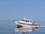
JC_Lately_SleepyC_Flat_Blue_070.thumb.jpg
 
Regarding the Hanford Reach there are local guide services out of the Tri-Cities that go up there, you might be able to get info from them.

On lake Chelan, once you get past 25 mile Creek, there aren't two many places to dock and even fewer (if any) to anchor, it's too steep of drop-off from shore. Topographic and/or USFS maps will tell you where the docks are. Also, the wind pretty much always blows down-lake in the afternoons-early evenings during the summer. You could get local knowledge by contacting the folks who run the Lady of the Lake. They run to Stehekin daily during spring-summer-fall and know the shorelines.

jd
 
The currents on the rivers will be highly dependent on things like - rainfall, temperature (in the spring in particular as it can drive snow melt), tides when your near the mouth and how much water the power companies are letting over the damn dams at the time. Bottom line, the vary from day to day and hour to hour sometimes. Since the dams are for the most part unpredictable, you just take what you get in terms of current.

I've been up Chelan a few times but not on my own boat. As was mentioned, once your up lake aways, there's not a lot of places to get out of the weather/wind or anchor. However, the north end is beautiful and there's dock space that's rarely full. The bay up there is fairly shallow and you could anchor out. There's a small store, a nice campground and some decent cabins in Stehekin. It's a great place to spend a couple of days.
 
The destination docks at Dwhorshak are there yearlong. No camping is allowed on the docks themselves, but you can overnight in the boat. We have never needed to share with another boat overnight, even on the busiest weekends like 4th of July. All of the launch facilities are great. We enjoyed a nice day there last week.

We have only been on the Snake River below Clarkston, down to the first lock. There are several nice launches between Lewiston and Clarkston area. Hope this helps. ken
 
Thanks all, for the replies. This is what I am looking for.

Ken, How are the approaches to, and the launch ramps at Dwarshak? It is sounding very appealing.

Roger, From what I can find, there is up to a 10 ft fluctuation between high and low water, but I have not been able to find if that is an annual range, or overnight. For instance, there are comments about the "riffles" about 3 miles below the Priest Rapids dam, about 50 miles up river from Richland. I have found reports of tour boats getting up to the dam, so still looking for "local info" which is why I am looking here :wink:

It looks like the tour boats are jet sled types and the literature says they are shallow draft. Wonder if their shallow draft is =/> than my preferred 2.5 feet?

nimrod jd, Lake Chelan is a special treat. Need a lllllooonnnnnnngggggggggg anchor rode for that one. I am looking for info on the "forest camps" along the shore re dock available. I have only been to one that I remember, Deer Point, and seem to remember a dock, maybe 20 feet long. Wondering if that is representative of the other camp sites, which I think there are several, along the way uplake. I know there is anchorage at Stehikin, but it is pretty exposed.

Still Researching :)

Harvey
SleepyC:moon
 
Dworshak is a long ride down the highway to get to the top of the ramp. But, that body of water is stunning. Expect some pretty hot temps in mid summer, but nights still seem to cool off. Coho Salmon are the best. Never over nighted away from the marina area, but I didn't have a boat at the time for overnighting. You will love Dworshak.
 
Harvey, This link should have the information your need. http://dworshak.org/
We typically use the Big Eddy Launch site as it is only 15 min. from Orofino on good road. All of the Corp of Engineers launches and the major state park launches are high end engineered concrete facilities. The Big Eddy Marina is the only fuel on the lake.

All of the destination docks are in deep water, 300-500 ft. There are several boat to only campsites, in addition to the regular state park campgrounds. Dwhorshak is family oriented with a Sherriffs Office boat patrol in addition to a fire patrol boat from the Clearwater Potlatch Timber Protection Association.

Lots of folks were fishing for Kokanee last week. Dwhorshak also holds the state record for bass. It is the North Fork of the Clearwter River where some of the last log drives took place. The old Disney movie, Charley the Lonesome Lion was filmed in the area.

Chuck and Penny live in the area and may chime in.
 
Harvey, IIRC our annual Washington state moorage permit covered mooring fees at the state docks at Steheken and 25 Mile campground.
The other docks such as Safety Harbor require some other sort of permit which I don't recall at this time.
Steve
 
kennharriet,

Thanks for the link to Dwarshak. WOW, lots of really good info there, and it looks like a pretty neat place.

Hope I get to see it soon.

Steve,

I knew the State Park pass would be good at 25 Mile SP, but I thought the park uplake was under National Park control. Thanks for that tidbit too.

Harvey
SleepyC:moon
 
El & Bill,

Thanks friends, for that link. This may not be a surprise, but just in case, Your site was the first place I went when I started looking for some new cruising territory. Thank you for all your wonderful information and for blazing so many trails. You two are special.

Harvey
SleepyC:moon
 
Just received my order from "FishnMaps" and they have pretty details info on the Columbia and Snake. (From the junction up to Priest Rapids dam on the Columbia and up to Lewiston on the Snake. These are fishing maps, but the are pretty details as to underwater structure, shoal etc. Also checking on the Evergreen Press's River Atlas of teh Columbia, Snake and Willamette rivers.

Curious if anyone has taken a C-Dory up the Columbia from Kennewick, Pasco or Richland to or towards the Priest Rapids dam?

Should be interesting geography and some interesting navigational challenges.

Harvey
SleepyC :moon
 
BRINGING THIS BACK IN 2014 FOR CONSIDERATION

I am thinking of spending some time in either Lake Chelan or Roosevelt this summer some time. I have been on Chelan many times, but not in the C-Dory. I'm wondering if anyone has spent time on both, and would like to hear some pros and cons for either.

Would you go back to ????? and why or why not? What was the best part and what should be avoided?

I will probably only be able to go to one this summer, so which one should it be, and why.

If I were going to Chelan, I would probably launch from 25 Mile Creek State Park, having the option to go down lake first, for a day trip, return to camp for the night, and then up lake for a few days. The weather there is pretty consistent -- the down lake blow. Is there comparable consideration to be made on Roosevelt? What other concerns are there on Roosevelt that might be different from Chelan, if there are any?

Thoughts?? Thanks :hot

Harvey
SleepyC:moon
 
I started my career living east of the mountains and have spent some time boating at both places. We preferred Lake Roosevelt and would have at least one big trip there each summer.

Lake Roosevelt is a much different experience IMO to Lake Chelan. Lake Chelan is beautiful, especially the upper lake but not as care free for boating. It is a more popular destination for vacationers/west siders so the feel is a bit more busy. As was said before, the wind always picks up in the afternoon funneling over the pass and through the canyon that is the lake. There is very few places to hide out if the eind waves pick up. Theres no anchorage and limited docks to tie off to.

Roosevelt on the other hand feels huge. Around every corner is another protective cove or inlet to explore. The beaches are beautiful white sand, so we would just pull the boat up on the beach and explore or relax. There can be water fluctuations as they let water out of grand coulee dam, so be aware. Its probably wise to overnight with at least a couple feet of water under the boat. We woke up one morning to a partially dry boat and needed the help of a couple of strong guys to push off the sand. For most of the lake I have explored, the north or western shores are on the tribal reservation and the south or eastern shores are public. There are different rules for each side. You cannot have beach fires on the tribal side, they will fine you if you are caught. You can boat camp basically anywhere you want on the lake as far as I know. We would launch at either Spring Canyon camp ground or Keller Ferry. There is a marina at Keller ferry. Both facilities are good and have plenty of truck and trailer parking. The lake is also slow to fill. Early in the season it will not have much water in it. By mid summer it is full. I am not sure when they fill it up but more than once we went and the lake was very low. Spring Canyon has the longest boat ramp I have ever seen to accomodate this. We backed down the ramp for what seemed like miles to get the boat in while the lake was still low.

Were hoping to get over there this summer for a week or long weekend to explore and relax on the those white sandy beaches. Roosevelt also has some great kokanee fishing. They are delicous!
 
Roosevelt is the best freshwater lake in Washington for multiple day excusions and camping trips in my opinion. The fishing can be incredible between Hawk Creek and Spring Canyon for rainbows while trolling a fly. It can also be fantastic by Hunters near the 74 mile mark for walleye. It does get busy too, but it is really huge. And normally has superb weather. Gas really isn't an issue as if you leave spring canyon on full you can easilly make it to 7 Bays Resort or the Spokane Tribe Casino Marina at the Spokane Confluence. I think the next gas is up near Colville, but easilly doable and isn't that far of a run. If fact, you can go way up that way and still make it back to marina on the Spokane/Columbia confluence. You will find the best fishing for rainbows near Spring Canyon for sure.

As far as Priest Rapids, I used to fish Hanford all the time and yes the water fluctuates a lot due to irrigation needs and electricity. You won't have any trouble launching though. Lots of 20 foot boats run past Vernita Bridge as there is plenty of water. My good friend ran a 22 foot Starcraft for years all through there with a prop. I don't remember ever him ever having trouble with that. In fact, all of our fishing was with downriggers as the in most places the channel is quite deep and wide. Watch for rocks as it is a river. If kings are running, the fishing can be very good upstream of Vernita Bridge where the boats are.....fish a K16 with a wrapped sardine (if they still allow it) and you will probably get into them.
 
I haven't taken my own boat to Lake Chelan but have done a few trips over there using the Lady of the Lake and Lady Cat boats to ferry me up and back. The southern and northern parts of the lake are completely different environs. The south is desert like and busy with all kinds of boats and jet skis. The north is rainforest and much quieter in terms of boat traffic. Several years ago we spent 4th of July weekend on the north end and it was pretty quiet in terms of boat traffic. I rented a little Livingston and puttered around for a day or so and I don't recall seeing more than a few other boats out and about.

It can get windy in the afternoons and as was pointed out, the long section between the S and N ends has very few places to hide out. Once you're in the N. end, there's plenty more options. I believe you're right about the dock at Stehekin being National Park as the entire N end on the E side is part of N. Cascades National Park. I really love it up there and feel that area is underused relative to what I would expect given the proximity to Seattle, the natural beauty and the availability of food, accommodations and other supplies in Stehekin. The restaurant there is quite good and there's a small store that can meet the needs of most campers. There's even a bit of fishing tackle available. Speaking of fishing, I had my best day of trout fishing ever standing on the N side of Prince Creek where it empties into the lake. I caught 15 cut throat there in a couple of hours and couldn't get one under 2lbs. The average was around 4 and a few were bigger. The fishing up stream is also quite good but after leaving the mouth, it's a 3-4 mile hike up a 8% gradient to get to a place where you can fish again. I caught and released about 70 fish up there in around 90 mins. Every rock had 4-6 fish in behind it and all I had to do was drop a bead head fly in behind the rock and pull 'em out.
 
I have spent many trips on Chelan, in other boats, from the Lady of the Lake down through the progression of Lady II and Lady Express (which is one cool boat if you like the aluminum side. {It's like an 70 foot ski boat] and it is fun for the ride.) One summer we did the full length of the lake in a 14ft Zodiac.

The Up Lake end is by for my favorite, I am liking what I am hearing abut white sandy beaches on Roosevelt, and it sounds like the PM winds are less of an issue. What navigation systems are working on Roosevelt? My Raymarine Fishing chip runs out of chart about half way up Chelan. Have not looked at Roosevelt yet. Will try that this weekend. And maybe the Garmin.

Thanks. How about parking along Roosevelt? Any places special, or to avoid? Thanks again,

Harvey
SleepyC :moon
 
Of the places I have been I would expect the truck parking is a little safer safer at Keller Ferry. We never had a break in leaving our rig at Spring Canyon but its more remote, and there were signs posted not to leave valuables. At Keller Ferry it's developed so thieves might not be as likely to be lurking around. I really have no clue though, we never had any issues while there.
 
Back
Top