Casey
New member
- Joined
- Nov 2, 2003
- Messages
- 1,094
- Reaction score
- 0
- C Dory Year
- 2006
- C Dory Model
- 23 Venture
- Hull Identification Number
- GXK23017A606
- Vessel Name
- "Dessert 1st"
Katmai arrived in Petersburg on Wednesday. Had a good ride
up from Wrangell w/ a night at anchor in the lee of Keene Island.
When we got to Petersburg we ran into Russ & Toni on the dock,
and enjoyed a great happy hour aboard 'Traveler.
Moorage here is the same as Wrangell ( <$19/night w/elec).
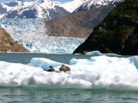
We left Petersburg yesterday and tried to get to Le Conte glacier
but ice blocked our path about 2-3mi out (but we saw LOTS of
icebergs!). ...so we headed over to nearby "Ideal Cove" to anchor
out for the night. The only other vessel in the cove brought a fresh
crab just before dinner. ...so we had fresh crab to go with our salmon.
(Life is Good!)
The next leg of this trip will be our longest; to Juneau. We hope to go via
Tracy Arm this time - but I have to recompute the mileage & fuel beforehand.
(No fuel stops on this leg.). Happily, the autopilot makes displacement (slow)
cruising Very simple, and Greatly increases our range.
Our pizza just arrived, so it's LUNCH TIME!
Best,
Casey&Mary

