PNW 2022, Columbia River and San Juan Islands

Too late to upload photos tonight. But a quick synopsis of my day. Departed Sand Island by way of the Multnoah Channel. As I left Sand Island, I let the boat drift a bit to see what the current was. According to my GPS, 1.75 kts. That was at 8am. And I was drifting down stream. I don't believe the current was as bad as it had been farther down stream, as I was able to make about 5 kts at 1800 RPM with a fuel flow around 3.4 or better. A little more sun today and a little less rain! I found the Multnoah Channel interesting with many floating homes, a few sunken boats, and quieter waters. I also stopped for a few hours at Coon Island. Searched and found a geocache and also spoke with some fisherman on a boat just yards off the dock. Learned it was free fishing weekend, and followed their advice setting up my fishing line. While they were catching quite a few fish, I didn't get a bite. Pretty much how my fishing usually goes. :( Saw a 19' C-Dory towards the upstream end of the Multnoah. Ali Anna from Santa Cruz. She was docked at one of the floating homes. At least I think it was a 19... Turned down the Willamette to go through Portland. Tonight I'm anchored just behind Hardtack Island.
 
Nice Colby. Great pix Thanks for sharing. Finally. The brakes are good.
No on to the SEVENTY48 and R2AK Safety boat service.

Harvey
SleepyC :moon

9_Sept_Seq_2019_Cal.thumb.jpg
 
Today I cruised on up to the Willamette Falls. Was definitely worth the trip. I was able to get up "very" close to them. Lots of fishing boats out on the water, but I rarely see anybody catching anything. (Except for yesterday. The three guys next to Coon Island were bringing them in fairly frequently.) While there was some current in the Willamette River, it didn't affect my fuel too much. I did stop and drift for a minute on the Columbia River when I got back on it. 2.65 kts. Looks like I'll continue running fast going upstream since I'm not getting any better mileage going slow with that kind of current. Some more photos from yesterday and today to follow. Colby
 
128SandIslandSunrise_001.jpg
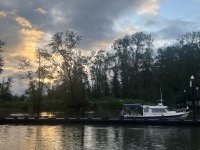
Sand Island Sunrise

138CoonIslandJJCollinsMarinePark.jpg
JJ Collins Marine Park dock at Coon Island. The fishing boat in the background was doing a good job at catching fish!
156_G.jpg
Floating homes on the Multnoah Channel.

173CDory.jpg
174CDory.jpg
Saw this C-Dory on the Multnomah Channel near where it meets the Willamette River. Guess it's not a 19 now that I look at the picture of it.

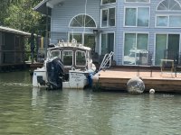
177BargeHome.jpg
This floating home was built on a barge.
 
218WillametteRiverFishingBoats.jpg
A lot of fishing boats just downstream of Willamette Falls

219WillametteFalls.jpg
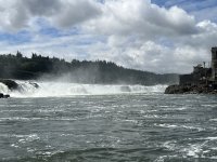
First view of the Willamette Falls as you turn the corner

231WillametteFalls.jpg
Willamette Falls. Yeah, I was pretty close!

233WillametteLocks.jpg
The Willamette Locks

239USSBlueBack.jpg
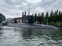
USS Blue Back at the Oregon Science Museum in Portland
 
Great pics. Ive been coming out here since around 2005 and somehow other than one or two cbrat gatherings ive not boated much except around Utsalady and Cornet Bay areas. Thanks for the travel along. Your brothers home is about 100 miles south of Mt. Vernon area. Just making sure you had a land base to do laundry, wash up the boat a bit and restock as needed.
Ill be shrimping around San Juan Iceberg Isl 9-11Jun if winds stay low with changing weather front going thru. Enjoying your vouge.
 
Great pics, Colby! I have driven along I-84 that runs just above the Columbia and quite a few of the locks many times, and have looked at the locks with Google Maps satellite view but never have seen them from water level. From above, it was puzzling where exactly they were!
 
Many years ago I and a friend took my 13' whaler down the willamette from salem to the columbia. got to go through the lock when it was operational. While in the lock a couple drunk couples were also enjoying the drop down in the lock. But failed to release the lines securing them to the wall. Tipped over and almost dumped them before the cleats tore out. It was an older wood cruiser. You used to be able to make that trip before summer low water until the corps quit dredging late 60's. I saw a 32' uniflite make it to a moorage in west salem and also used to see a 40' aluminium sloop up by buena vista parked in a slouigh.
 
Colby,
Thanks for the great boater homing shots, and river exploration. You have been to a number of places I have not, and I live here. I am looking forward to visiting some of those, thanks for sharing.

What is the duffel like object on your boat roof? Would it be your dinghy?

Tom
 
What is the duffel like object on your boat roof? Would it be your dinghy?

It's my Hobie inflatable Peddle drive kayak. I elected not to purchase an additional invasive species sticker for it, but brought it along just in case I wanted/needed to use it. And if I did, it's just an internet link to get the permit. With the current, I haven't even thought about wanting to get it down!

I'll upload some more photos later, but was unable to see my brother today. He works in Camas (although lives in Graham. Works long hours, few days and just stays in a hotel down here during the short work week.) I had hoped to pull into the Port of Camas-Washugal for the afternoon/evening, however they still have their guest dock closed for construction and no other transient slips available. So much for the beer with the bro tonight, but I'll be at his place next week for a few days. I ended up motoring on up to Beacon Rock. Worse ride I've had this trip. Between Camas and just a few miles short of Beacon Rock I had 2 foot confused chop, the current, and the wind. Abeam Camas I drifted to check out the current. 4mph! Or to be exact, 3.56 kts. The water temp is 56 degrees F if anybody cares. I estimated the winds from the whitecaps to be around 20 mph. And of course a headwind! Stats so far for this trip from Warrenton, up the Multnoah Channel, Up the Willamette River to the Falls, and back on the Columbia up to Beacon Rock is 168nm or 191.6 statute miles. I've burned 74 gals of fuel. If I remember, going back to Warrenton, staying on the Columbia River main channel, is around 120nm. I'm hoping to see 8mpg or better with the tail current! Maybe I won't have to add any marine fuel! But I don't want to leave myself short, so will probably take on enough at Kalama to get back. I'll just add what I think I'll use, and keep what I have at that point as my buffer.
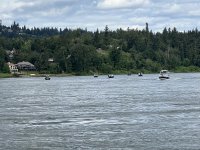
The winds and current was howling when I pulled into the docks at Beacon Rock. I was able to get on the inside of the dock, even with wind and current. The dock helped to tame it some, and it did take two tries. I'm the only one here on the dock, and the electricity is good. .70/foot + $6 for the electric. Got my exercise on the hike to Beacon Rock, and then up to the top. From the docks here, the trail says it's .75 mile to the base of the Rock. My walking app said it was 1.2! It's another mile worth of trail to climb the 600 feet. Great view of the river gorge below. Quite a few other hikers between the parking lot at the base of the Rock and the top. And a few more that hiked over from the park area here by the docks. I am surprised by all the crazy fisherman. There were probably about half a dozen I saw out in that crazy chop. Ain't no fish worth it to me to take a beating out in the chop like that. Several more fishing in the current as I entered the Beacon Rock bay. Colby
 
256BeaconRock.jpg
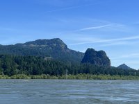
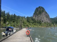
View of Beacon Rock as I approach


259BeaconRockStatePark.jpg
C-Traveler on the dock with Beacon Rock in the background. As you can see, the winds and current were howling!

261BeaconRockSP.jpg
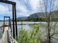
Looking back down at the docks. I'm the only boat there now.

275BeaconRockView.jpg
Looking down at the Beacon Rock state park docks from part way up Beacon Rock. You can really see the current ripping out in the River.

276BeaconRockPath.jpg
This is the pathway leading up Beacon Rock. You ascend/descend about 600 feet in a mile.

287ColbyTopBeaconRock.jpg
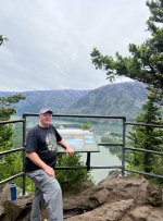
Proof I mad it to the top! 8)

300ColbyBeaconRock680Ft.jpg
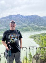
View about half way back down, with the docks and C-Traveler (if you can see her) in the background.
 
That rock climb turned you into your own personal drone!
Great pictures.
Well, it is the Colombia river...
Sorry you didnt get to see your brother this round.
Did a Columbia River Cruise last Jun or July... the other companies paddle wheeler took out the docks somewhere that we were scheduled to dock... so we were not able to and changed our itinerary. To drop off and pick up other artist for the cruise, our paddle wheeler just banked it near a parking lot/park area and let down the gang plank (?) as to let a few folks on and off with luggage. But, we were all still able to drink together during all this, but they did run out of Corona Premier (yes Im counting carbs)... Next stop one of the bar tenders personally bought 2 cases and gifted them to me. It would be illegal to sell them to me due to some kind of crazy laws where the vessel could only purchase and resale from "the proper places via WA laws",,,,
Oh well, he took care of 3-4 of us who were drinking them and that was especially appreciated. Guess who got a wonderful disembarkation tip from 3-4 folks
THanks for posting pics.
 
Fascinating, love these pics! Patty and I have stayed at the Skamania Lodge in Stevenson, a very nice place. I confess I had never heard of Beacon Rock, so I Google it! The odds of my hiking up it are less than slim to none! As are the odds of our cruising the Columbia!

Beacon Rock Wikipedia entry
 
More great photos, and adventure.

Yes, those crazy fisherman. Back at Coon Is. they would have been fishing for Shad, and I suspect that is what you are seeing at Beacon Rock. They are a lot of fun to catch when getting into a run as you saw back at Coon Is. Some of my Veitnamese friends enjoy eating them, and the way their mother prepared it for us, it was good, but bonier than I have patience for, for future table food. They are considered a premier crab bait, in the herring family, oily, and it is my go to bait for fall crabbing, though I have friends that limit out simply using chicken, and tell me you don't have to handle those stinky Shad. :lol: Each to their own.
 
Great pix Colby. And nice write up too. Sorry I didn't make it. Getting ready to launch for the SEVENTY48 and R2AK with a PIWR training session tomorrow. (PIWR = Person in the water, recovery) done on my own vessel with a 1 to 1 USCG training officer. -- I am stoked.)

Still hope to catch up at some point.

Harvey
SleepyC :moon

0_CD_Cover_SlpyC_with_Classics_MBSP_2009_288.thumb.jpg
 
Enjoyed the day at Beacon Rock, and it was a quiet night. A sail boat did show up late in the evening and docked behind me. I left there today, with a good push from the current now behind me. And of course still a head wind! But not as strong as it was when it was blowing from the east. I started out with 10mpg, but as I got farther down the River, things settled out to about 8.4mpg. I ran at 1300 rpm, and settled in at around 8 kts. I don't know what's up at Port of Camas-Washugal. I was told when I called that their Transient dock was still under construction, and they had no room for transients. Yet, when I went by there today, I could see no construction, the dock looked open (I'm pretty sure it's the break water dock), and there were some boats on the inside of it, with room for quite a few more. Saw some interesting ships go by as they were headed to the Portland Rose Festival. Several war ships, specifically 703 and 710. Then there was Ironwood (I believe). Perhaps a training ship? Saw a lot more commercial traffic today. Several large freighters and tows. And one of the American passenger ships. (American West today. Saw American Empress the other day.) Water was pretty calm, with a few what I imagine were tidal swells. I made it to Port of Kalama and relaxed listening to some music in the park here. My brother also stopped by for a short bit on his 3 hour drive back home after work. I am several days ahead of schedule, so will likely pull out Friday, and spend a few more days with my brother. Likely stop at Cathlamet tomorrow. I had 18 gals of gas left, which might be enough if I maintain the 8mpg. I'm not that daring and don't like to burn below 15 remaining, so I put 10 gallons on, which should get me back to Warrenton even with a bit higher fuel burn than I've been experiencing going down river. And still leave me with the 18 gals of buffer fuel. The price of gas here at Kalama is 5.95/gal for regular. Oh, I did see another C-Dory on the north end of the island, just before St. Helens and Sand Island. Couldn't make out the name of the boat, and since I had decided to make Kalama by 5p, I didn't have time to stop and say hello.
 
345VancouverFireBoat.jpg
Vancouvers new emergency response boat.
https://www.cityofvancouver.us/fire/pag ... ponse-boat

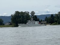
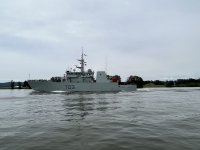
349Warship710.jpg
Canadian Warship 710 on it's way to the Portland Rose Festival
https://en.wikipedia.org/wiki/HMCS_Brandon_(MM_710)

351Warship703.jpg
Canadian Warship 703
https://en.wikipedia.org/wiki/HMCS_Edmonton

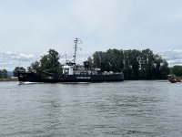
352Ironwood.jpg
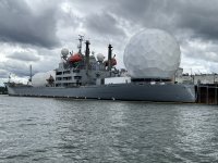
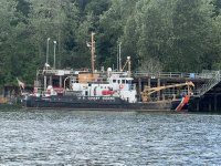
The USCGC Ironwood is now used as a training ship for Job Corps.
https://en.wikipedia.org/wiki/USCGC_Ironwood_(WLB-297)

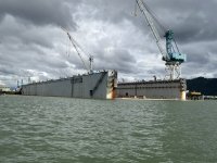
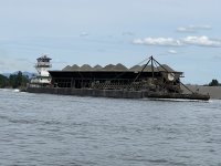
354Barge.jpg
I have not seen a barge like this before.

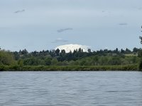
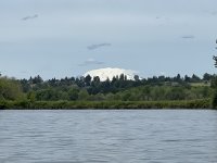
355MtRainier.jpg
A view of Mt. Rainier from somewhere between Camas and Kalama

356SeaLionUpstreamofKalama.jpg
He seems to be a little far from the ocean. He's between Camas and Kalama.

358CDoryatSauvieIsland.jpg
At the north end of Sauvie Island

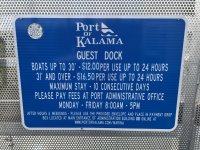
363Kalama.jpg
In case anyone was wondering...
 
I have been REALLY enjoying your account and pictures of your time on the Columbia. Thanks so much for posting. I have lived in SW Washington for more than 75 years, and have fished and traveled along the river some, but haven't spent nearly as much time there as I would like. It is one heck of a river. I am old enough to have watched dip net fishing at Celilo Falls before they were inundated by the building of the Bonneville Dam.

I think the mountain in the beautiful picture taken from the river may be Mt St Helens (or what's left of it!) rather than Rainier.

355MtRainier.jpg

Thanks again. I'm living the adventure, if only vicariously!
 
Thanks Bill! I stand corrected. I looked at a large map and that is Mt. St. Helens. I should have looked at the map earlier! Colby
 
Back
Top