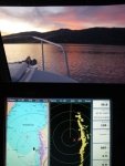
Garmin charts advice needed.

localboy

New member
We have a 740S. With our trip planned for this summer up to B.C. I need to get western Canadian charts for it, as it came w/ only U.S. coastal charts. According to the Garmin site I have two options; one just Canadian waters and one that covers the entire U.S plus Canada, Hawai'i, Bahamas etc.

Question is on the U.S./Canada charts it describes the Canadian coverage as "general coverage" vs. "detailed coverage".

What is the difference? Both cost the same, which makes me wonder if I should buy the Canadian only card.

https://buy.garmin.com/shop/shop.do?pID=37704&pvID=38990

https://buy.garmin.com/shop/shop.do?pID=37703&pvID=38989
 
I bought a chip a year ago for BC, for the same reason. I bought the one that covered the smaller area. I consulted with and purchased from Cascade GPS. They have lots of info.

PS Please delete that absurd political message from your posts. Thanks
 
Blue Gene,

thanks for the input re the charts. Cascade GPS is local and seem to be good people.

P.S. No rules, just be nice.

jd
 
Just placed the order w/ Cascade. Had to pay tax, but WTH; they're a local company.

I ordered the detailed Canada charts HXCA015R (part #010-C1019-20).
 
More food for thought on garmin charts. If you go to Lake Powell, Lake Roosevelt, the Erie Canal, or to other inland lakes you will need additional charts than those on the 740s. Garmin has renamed the charts for all of the US and it's now called "Garmin Lakes" and its #: 010 C1073-00. It is all the inland lakes in the US and it includes less well used channels off of routes on the inland water ways. The example I found was that on the Tennessee River the main channel comes on the 740 but side channels to marinas are not included. I used those side channels on our trip last fall.

On most web sites you will find "South East US" or another regional name for a chip that only includes those areas. So to get the whole US in regional charts you would need many and they are each the same price as the "one covers all". I was about to make the purchase of the old "US Inland Lakes" when the chart disapeared off web sites. The change has occured since Thanksgiving and I talked to both the Garmin hot line around Christmas and the Garmin rep at the Seattle Boat Show to figure out what was going on. It appears that techonology and marketing are working in opposite directions. As memory gets cheeper and smaller they can get more on a chip, but that doesn't bring in more sales $$ so both Garmin and retailers are pushing the regional charts and "forgetting" to show the whole US option. When I called West Marine to order "Garmin Lakes" they told me it was a "special order" chart that they would have to call into Garmin.

Chuck
 
I just ordered the Garmin lakes chart which covers all of US. Ordered from WWW.Factoryoutletstore.com Cost $99.95 with free shipping. Garmin wanted the same price plus shipping. According to the tracking information I received, it will be at my house on the 20th and was ordered on the 15th. Only 5 days transit time including the weekend.

On previous boats I've always had Lowrance equipment but just bought a 2006 23' Cape Cruiser that has Garmin equiipment so am anxious to see how it works.

Gary
 
A question for Garmin Lakes users.

On a BIG lake in north central Washington, Lake Chelan, Do you show chat navigational info for the full length of the lake. I have RayMarine and Navionics and the lake chart only gives info about half way up the lake. Anybody using something that has charting on the full lake? Garmin?

Thanks,

Harvey
SleepyC :moon

January_2010_342.thumb.jpg
 
Back
Top