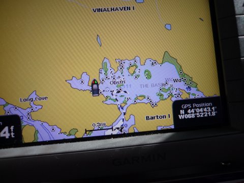
my GPS showing our route in to the basin it looks as though we should have went straight on the way in which is the way we exited more of a straight shot. The following from The Maine Guide book: "The Basin is a magnificent tidal lake cut in the west side of Vinalhaven Island. Here you will find a scattering of little islands, depths as great as 111 feet, and good swimming. The only problem is a narrow, crooked, and obstructed entrance through which the current usually rushes like a millrace. Entering the basin is not recommended except for the most daring of gunkholers. Rarely does a year go by without a grounding here. But others have done it. According to local lore, schooners used to winter over inside The Basin. The best time to enter or leave is within an hour of high slack tide. As if the current weren't bad enough, a rock sits directly in the middle of the entrance. The channel runs south of this rock and immediately branches at a small island. Once safely through the channel, you can enter The Basin either to the left or right of the small island, but the right branch is wider. Another rock lies to the southeast of the island. Head southeast past the island, keeping the rock to port, then turn slightly to port, rounding the rock and heading east into The Basin. Anchoring options are plentiful. So are the rocks. Be careful."