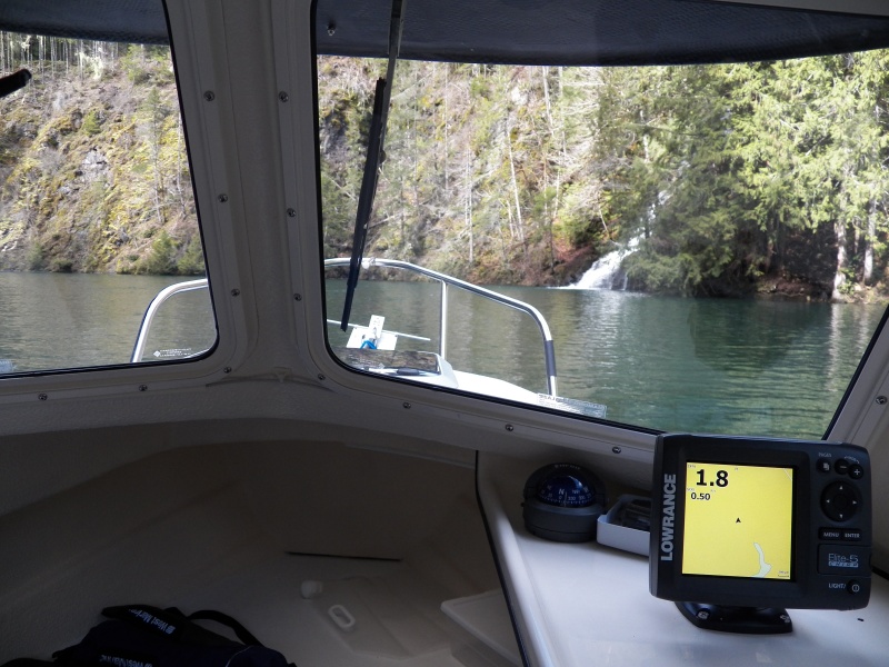
If you look at the Lowrance, you can see that the "chart" of the lake ends and I'm now on dry land north of the skinny tip of the lake. When the lake is full it continues for another half mile beyond the chart into a deep canyon. Ignore the depth reading of 1.8 feet. The canyon is so steep and narrow that the depth sounder didn't work.