| View previous topic :: View next topic |
| Author |
Message |
LesR
Joined: 05 May 2010
Posts: 162
City/Region: St. Louis
State or Province: MO
C-Dory Year: 2007
C-Dory Model: 25 Cruiser
Vessel Name: Intuition
Photos: Intuition
|
 Posted: Sat Aug 28, 2021 11:58 pm Post subject: Posted: Sat Aug 28, 2021 11:58 pm Post subject: |
 |
|
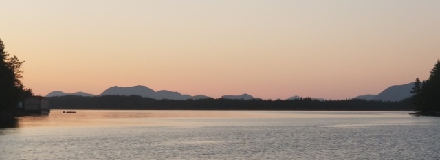
Friday, August 27
Foggy Bay to Prince Rupert
Miles today: 65
Total Miles: 2534
We woke up at 5:00 and I had just barely enough of a cell signal to get a couple light station reports. Green Island Light Station was indicating 2 foot seas, which is slightly more than Id like, but will work. Winds are expected to decrease until noon, and then dramatically increase from the southeast as a front moves in late today. There are Small Craft Advisories and Gale Warnings all over the place, but they reflect the system due to arrive this evening. We pulled the anchor and started moving just after sunrise at 5:45 am. Unless the water was very flat, my plan was to take the longer route staying closer to shore and the available bail-out options should the weather and seas turn bad quickly.
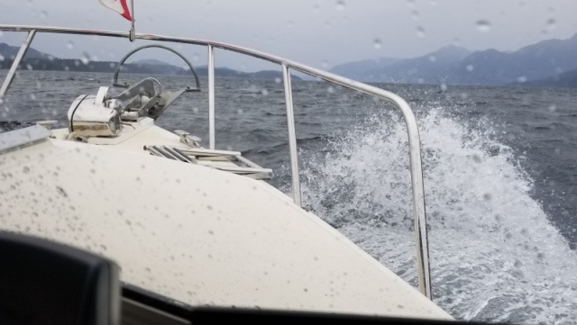
The inner part of Foggy Bay was calm with good visibility, but the fog in the outside bay limited visibility to only ¼ mile. I turned on the fog horn, and we started the slog through messy, disorganized waves heading south toward Cape Fox. We passed several fishing boats as we ran approximately one mile offshore. We couldnt see the shore, but were able to see the boats from about ¼ mile away and stay clear of their nets.
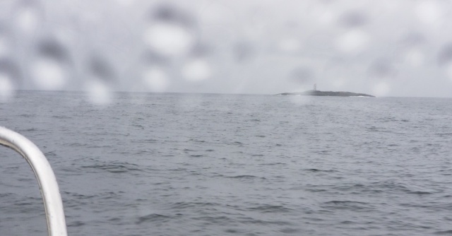
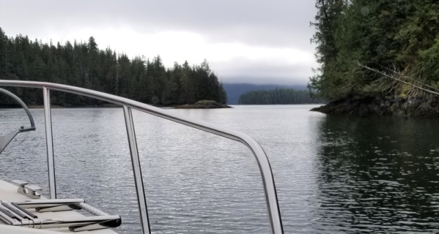
I was almost giddy when the waves subsided to long low swells with just a light chop as we got close to Cape Fox and the open waters of the Dixon Entrance. The fog relented a little and visibility increased to two miles. The 8:00 am Green Island report indicated 1-foot seas, so things seemed to be settling as I had hoped. Rounding Cape Fox, we pushed up the power and ran on plane. I decided not to get too greedy and take the shorter route toward Dundas Island, but passed just north of Lord Rock and took up a heading toward the north end of Finlayson Island. I wanted to keep a protected option rather than leave us in the shorter but more exposed Holliday Passage which runs just east of Dundas. Midway through that section of the crossing, waves became bigger again, forcing us to slow down to 7 mph for a little more than an hour until we could duck behind Finlayson Island. We also saw a lot more debris (i.e. big logs and trees) in the water through this section.
Passing Lord Rock
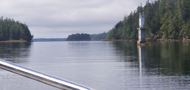
We fixed lunch while passing behind Finlayson Island. By the time we popped back out into open waters at the south end of the island, the waves were less steep and more on the nose. The sea state continued to calm and we were able to run on plane again for the last several miles before turning into Duncan Bay and north entrance to Venn Passage. We dodged the Digby Island Ferry in the last narrow section before entering the Prince Rupert harbor about 2:00 pm.
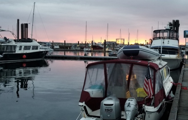
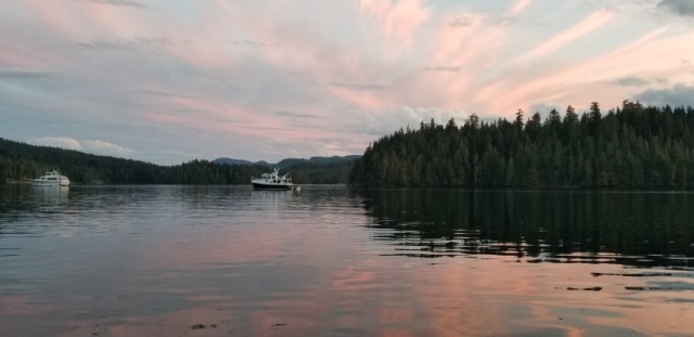
Arriving in Prince Rupert

Our first item of business upon arrival was to check in with customs. We looked for the customs dock that we had passed 2 months earlier, and couldnt find it. Apparently, its been removed, so we moved up to the Cow Bay floating breakwall, where there is a section spelling out Customs using yellow tape. We tied up there and called CBSA to report our arrival. After giving the agent all our information, she approved our entry and provided us a clearance number much easier and less stressful than our last arrival.
There was nobody at the harbormasters office and no one answered the phone, so we motored over to the gas dock to fill up. Per the marinas phone message instructions, we emailed a slip request, not certain wed get a response late in the afternoon. We tied up to the inside of the breakwall and went to Breakers Pub for some dinner. While we were there the harbormaster contacted us and met us 30 minutes later to provide a more protected slip. In retrospect, I should have made a moorage request before leaving Ketchikan; Ive become accustomed to the process at Alaska harbors where you just show up and request a spot or park in a designated transient section. Robin, the harbormaster, said that their season was rapidly winding down, and theyre now seeing very few southbound cruisers.
Its a relief to be tied up in Prince Rupert with a gale-force front arriving tonight. The weather window we had for this crossing was less than ideal, and I dont think Id want to make the crossing in worse weather. We were fortunate to have an accurate forecast and two days time to take a slower, less-direct, less-exposed route.
_________________
Les and Kel Rohlf |
|
| Back to top |
|
 |
hardee
Joined: 30 Oct 2006
Posts: 12632
City/Region: Sequim
State or Province: WA
C-Dory Year: 2005
C-Dory Model: 22 Cruiser
Vessel Name: Sleepy-C
Photos: SleepyC
|
| Posted: Sun Aug 29, 2021 5:36 pm Post subject: |
|
|
Les, Sounds like you are doing well still. Jumping through the various hoops. I'm sure is trying, but it seems like the folks you are working with are tolerant too. Just hoping that that weather continues to hold when You need it. It has really been great to follow along and you have done great in all the descriptions. Now back into Canada, I'm curious what restrictions you will see, and how consistent they are. Stay safe and keep us posted. All the best.
Harvey
SleepyC 
_________________
Though in our sleep we are not conscious of our activity or surroundings, we should not, in our wakefulness, be unconscious of our sleep. |
|
| Back to top |
|
|
LesR
Joined: 05 May 2010
Posts: 162
City/Region: St. Louis
State or Province: MO
C-Dory Year: 2007
C-Dory Model: 25 Cruiser
Vessel Name: Intuition
Photos: Intuition
|
| Posted: Wed Sep 01, 2021 1:44 am Post subject: |
|
|
Sunday, August 29, 2021
Prince Rupert to Lowe Inlet
Miles today: 68
Total Miles: 2602
Prince Rupert harbor was busy with several arrivals/departures when we left at 7:15. We experienced showers off and on all day with some occasional sunshine. Waters were generally smooth except for choppy sections in the open water south of the harbor and in sections of the Grenville Channel where the southwest wind could funnel through.
We caught up with SYBO near the north end of Grenville Channel; they were sailing into the southwest breeze and were planning to go offshore today and stay there for a couple hundred miles. Winds forecast from the northwest for the next few days should help their progress.
We were the first boat to arrive at Lowe Inlet at 4:30 pm and anchored in front of Verney Falls. You can anchor close to the falls, and the current will keep your boat from swinging. Two more boats arrived and anchored later in the day.
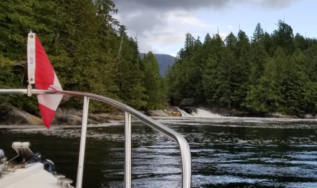
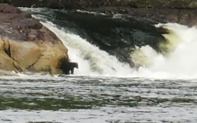
We grilled steaks for dinner, and watched as a black bear fished for Salmon jumping in Verney Falls.
 |
|
| Back to top |
|
|
LesR
Joined: 05 May 2010
Posts: 162
City/Region: St. Louis
State or Province: MO
C-Dory Year: 2007
C-Dory Model: 25 Cruiser
Vessel Name: Intuition
Photos: Intuition
|
| Posted: Wed Sep 01, 2021 1:45 am Post subject: |
|
|
Sunday, August 29, 2021
Prince Rupert to Lowe Inlet
Miles today: 68
Total Miles: 2602
Prince Rupert harbor was busy with several arrivals/departures when we left at 7:15. We experienced showers off and on all day with some occasional sunshine. Waters were generally smooth except for choppy sections in the open water south of the harbor and in sections of the Grenville Channel where the southwest wind could funnel through.
We caught up with SYBO near the north end of Grenville Channel; they were sailing into the southwest breeze and were planning to go offshore today and stay there for a couple hundred miles. Winds forecast from the northwest for the next few days should help their progress.
We were the first boat to arrive at Lowe Inlet at 4:30 pm and anchored in front of Verney Falls. You can anchor close to the falls, and the current will keep your boat from swinging. Two more boats arrived and anchored later in the day.
We grilled steaks for dinner and watched as a black bear fished for Salmon jumping in Verney Falls.
|
|
| Back to top |
|
|
LesR
Joined: 05 May 2010
Posts: 162
City/Region: St. Louis
State or Province: MO
C-Dory Year: 2007
C-Dory Model: 25 Cruiser
Vessel Name: Intuition
Photos: Intuition
|
| Posted: Wed Sep 01, 2021 1:55 am Post subject: |
|
|
Monday, August 30, 2021
Lowe Inlet to Swanson Bay
Miles today: 65
Total Miles: 2667
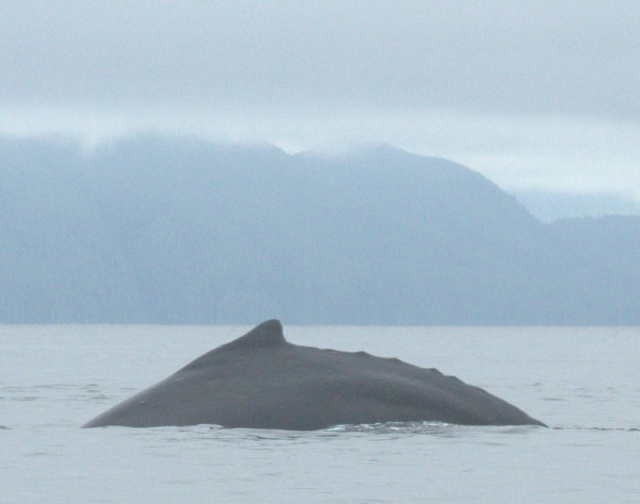
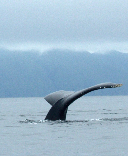
We left our anchorage at 7:00, shortly after sunrise. There were two bears at the falls as we prepared to leave. As we entered Wright Sound just south of Hartley Bay, we noticed huge fogbank the width of Douglas Channel, despite it being otherwise clear and sunny this morning.
As I commented about not wanting to have to go through that, I saw a whale breach close to the bank and just east of Cape Farewell. Several whales breached, some entirely clear of the water. Another was tail slapping as the others breached. We just watched from a mile away, enjoying the show rather than trying to get closer for photos. Several other whales appeared as we transited Wright Sound and McKay Reach.
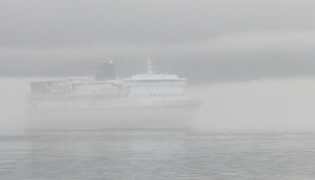
Clouds and showers closed in as we headed south in Fraser Reach and pulled into Swanson Bay about 3:30. The bay is not long or far removed from the main channel, but offers protection from the forecast northwest winds. I was unable to get the anchor to set in the northwest corner of the bay, so we moved to a point south of the old pulp mill ruins. Were anchored in 45 feet of water, with a little more room to swing.
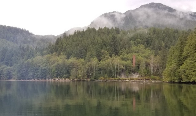
I commented that the bay is a nice place unless someone big comes along through the nearby channel. Not more than an hour later, the Northern Expedition chugged up Fraser Reach and passed little more than a half mile away. 

She was 3.5 miles away by the time her wake hit us. The wake turned out to be not bad, unlike the steep 3- to 4-foot rollers we experienced in the narrow Grenville Channel from one of her sister ships. |
|
| Back to top |
|
|
LesR
Joined: 05 May 2010
Posts: 162
City/Region: St. Louis
State or Province: MO
C-Dory Year: 2007
C-Dory Model: 25 Cruiser
Vessel Name: Intuition
Photos: Intuition
|
| Posted: Wed Sep 01, 2021 1:56 am Post subject: |
|
|
Monday, August 30, 2021
Lowe Inlet to Swanson Bay
Miles today: 65
Total Miles: 2667
We left our anchorage at 7:00, shortly after sunrise. There were two bears at the falls as we prepared to leave. As we entered Wright Sound just south of Hartley Bay, we noticed huge fogbank the width of Douglas Channel, despite it being otherwise clear and sunny this morning.
As I commented about not wanting to have to go through that, I saw a whale breach close to the bank and just east of Cape Farewell. Several whales breached, some entirely clear of the water. Another was tail slapping as the others breached. We just watched from a mile away, enjoying the show rather than trying to get closer for photos. Several other whales appeared as we transited Wright Sound and McKay Reach.
Clouds and showers closed in as we headed south in Fraser Reach and pulled into Swanson Bay about 3:30. The bay is not long or far removed from the main channel, but offers protection from the forecast northwest winds. I was unable to get the anchor to set in the northwest corner of the bay, so we moved to a point south of the old pulp mill ruins. Were anchored in 45 feet of water, with a little more room to swing.
I commented that the bay is a nice place unless someone big comes along through the nearby channel. Not more than an hour later, the Northern Expedition chugged up Fraser Reach and passed little more than a half mile away.
She was 3.5 miles away by the time her wake hit us. The wake turned out to be not bad, unlike the steep 3- to 4-foot rollers we experienced in the narrow Grenville Channel from one of her sister ships. |
|
| Back to top |
|
|
LesR
Joined: 05 May 2010
Posts: 162
City/Region: St. Louis
State or Province: MO
C-Dory Year: 2007
C-Dory Model: 25 Cruiser
Vessel Name: Intuition
Photos: Intuition
|
| Posted: Wed Sep 01, 2021 2:05 am Post subject: |
|
|
Tuesday, August 31, 2021
Swanson Bay to Shearwater
Miles today: 79
Total Miles: 2746
Low clouds greeted us this morning, but it remained dry. We headed out of Swanson Bay at 7:15 and into a choppy Fraser Reach. The good news this was the worst sea state wed see all day. I planned a little different route to Shearwater than we had taken on our way north to both allow for better protection and to see some new scenery. After breakfast we ran on plane to make time on this longer mileage day.
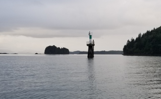
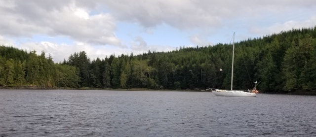
We turned into Hiekish Narrows, which leads to a point farther north in Finlayson Channel than wed previously been. After traveling south to a point abeam Klemtu, we turned east into Jackson Passage. Jackson Passage includes Jackson Narrows at its eastern end where it meets Mathieson Channel. This was a pretty passage and worth the trip. There are a couple inviting anchorage areas at the eastern end.
Jackson Narrows
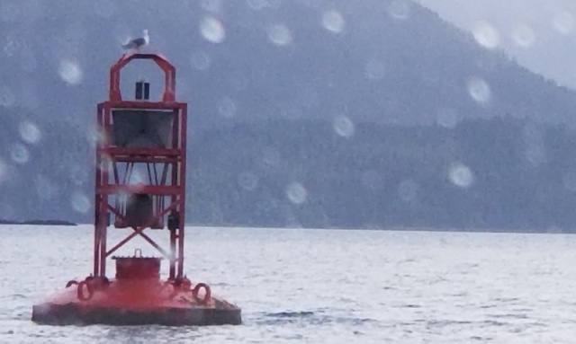
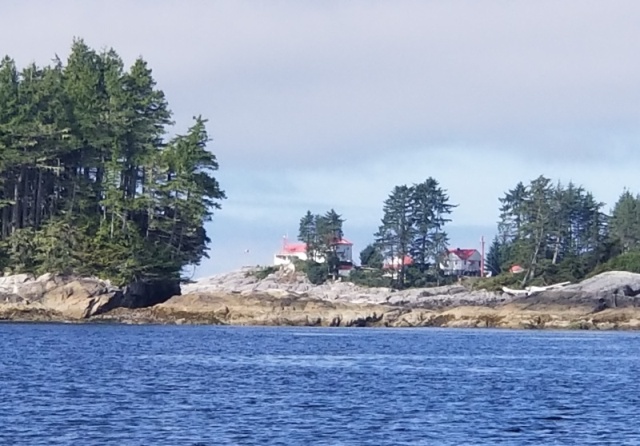
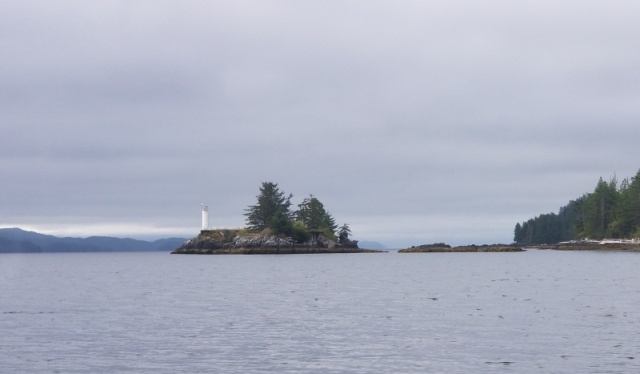
The sun finally broke through as we headed south through Mathieson Channel, a very pretty passage with very little debris in the water. At its south end we cut across to Percival Narrows, which gives a protected route to Seaforth Channel, allowing us to avoid Millbank South. We went slowly through Percival, which looks a little scary on the charts but has plenty of water (we never saw less than 27 feet on todays 10-foot mid-tide. We passed through during the ebb, but todays drop was only 2 feet, so no issues with currents.
Ivory Island Light from end of Percival Narrows
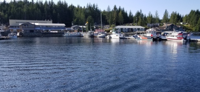
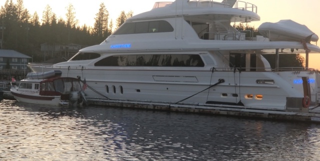
After turning into Seaforth Channel, we pushed the throttle up and ran across the big, wide swells for a few miles until their affects dissipated. The sky was clear when we passed Dryad Point and turned into the harbor at Shearwater Resort. There seems to be more happening at Shearwater than during our first visit in June. We enjoyed wandering the grounds and eating ice cream on a sunny afternoon. While not really busy, all the facilities are open. There are a few other cruisers docked here, along with 3 100+ foot mega-yachts.
We're watching the weather closely and hoping for a smooth crossing of Cape Caution and Queen Charlotte Sound in a couple days. |
|
| Back to top |
|
|
LesR
Joined: 05 May 2010
Posts: 162
City/Region: St. Louis
State or Province: MO
C-Dory Year: 2007
C-Dory Model: 25 Cruiser
Vessel Name: Intuition
Photos: Intuition
|
| Posted: Wed Sep 01, 2021 2:06 am Post subject: |
|
|
Tuesday, August 31, 2021
Swanson Bay to Shearwater
Miles today: 79
Total Miles: 2746
Low clouds greeted us this morning, but it remained dry. We headed out of Swanson Bay at 7:15 and into a choppy Fraser Reach. The good news this was the worst sea state wed see all day. I planned a little different route to Shearwater than we had taken on our way north to both allow for better protection and to see some new scenery. After breakfast we ran on plane to make time on this longer mileage day.
We turned into Hiekish Narrows, which leads to a point farther north in Finlayson Channel than wed previously been. After traveling south to a point abeam Klemtu, we turned east into Jackson Passage. Jackson Passage includes Jackson Narrows at its eastern end where it meets Mathieson Channel. This was a pretty passage and worth the trip. There are a couple inviting anchorage areas at the eastern end.
Jackson Narrows
The sun finally broke through as we headed south through Mathieson Channel, a very pretty passage with very little debris in the water. At its south end we cut across to Percival Narrows, which gives a protected route to Seaforth Channel, allowing us to avoid Millbank South. We went slowly through Percival, which looks a little scary on the charts but has plenty of water (we never saw less than 27 feet on todays 10-foot mid-tide. We passed through during the ebb, but todays drop was only 2 feet, so no issues with currents.
Ivory Island Light from end of Percival Narrows
After turning into Seaforth Channel, we pushed the throttle up and ran across the big, wide swells for a few miles until their affects dissipated. The sky was clear when we passed Dryad Point and turned into the harbor at Shearwater Resort. There seems to be more happening at Shearwater than during our first visit in June. We enjoyed wandering the grounds and eating ice cream on a sunny afternoon. While not really busy, all the facilities are open. There are a few other cruisers docked here, along with 3 100+ foot mega-yachts.
We're watching the weather closely and hoping for a smooth crossing of Cape Caution and Queen Charlotte Sound in a couple days. |
|
| Back to top |
|
|
LesR
Joined: 05 May 2010
Posts: 162
City/Region: St. Louis
State or Province: MO
C-Dory Year: 2007
C-Dory Model: 25 Cruiser
Vessel Name: Intuition
Photos: Intuition
|
| Posted: Thu Sep 02, 2021 11:11 pm Post subject: |
|
|
Wednesday, September 1, 2021
Shearwater to Millbrook Cove
Miles today: 72
Total Miles: 2818
Sunset in Shearwater
Todays leg made me a little nervous, as it assumes very good and settled weather through at least mid-day. Millbrook Cove, our planned anchorage is located very close to Cape Caution. The advantage is that it shortens the crossing of Queen Charlotte Strait as much as possible; the disadvantage is that the arrival route is nearly as exposed as Cape Caution itself. I had marked Fury Cove, a little farther north off of Fitz Hugh Sound, as an alternate destination in the event we couldnt comfortably get to Millbrook Cove.
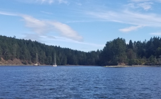
Almost There fired up her thrusters and pushed away from the dock as we were preparing to leave this morning. We backed away shortly thereafter and were headed toward Lama passage by 7:00 am. Kel finished posting updates and photos as we passed Bella Bella and still had cell coverage.
Almost There and Intuition
Pointer Island turning from Lama Passage to Fisher Channel
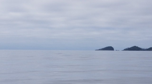
We ran on plane most of the day, with the sea state in Fisher Channel and Fitz Hugh Sound varying from smooth to choppy, but never enough to make the ride uncomfortable. I saw a whale breach from a couple miles away as we neared Fog Rock. By the time we got close, they were done with the theatrics, but we got some good photos before they dove and continued north.
It was so calm today that we even discussed whether it made sense to keep going and cross Queen Charlotte Strait this afternoon. As we neared Cape Calvert, where youre more exposed to the open ocean, we got our answer with the rising swells. We were able to stay on plan all the way to Smith Sound and the entrance to Millbrook Cove, but the big (and in some cases beamy) swells made it clear I didnt want to push through another 30 miles in these conditions.
Cape Calvert... and beyond
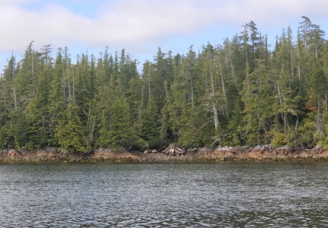
We meandered our way among the rocks and around the island that protect Millbrook Cove and anchored in 30 feet on an 8-foot tide. The inner section of Millbrook Cove is protected on all sides from any wave action in Smith Sound. This is part of the low, rocky coastline, so there arent high hills to protect from extreme winds, but it seems about as secure a spot as possible this close to Cape Caution.
Millbrook Cove Shoreline
 |
|
| Back to top |
|
|
LesR
Joined: 05 May 2010
Posts: 162
City/Region: St. Louis
State or Province: MO
C-Dory Year: 2007
C-Dory Model: 25 Cruiser
Vessel Name: Intuition
Photos: Intuition
|
| Posted: Thu Sep 02, 2021 11:23 pm Post subject: |
|
|
Thursday, September 2, 2021
Millbrook Cove to Port McNeill
Miles today: 65
Total Miles: 2883
Millbrook Cove was amazingly quiet, and we were the only ones there last night. There was just a slight breeze in the anchorage when we awoke to check the weather. It sounds as if winds in Queen Charlotte Strait will shift around to the southeast and build over the next day, but this morning should remain light. Reports from Egg Island and Pine Island indicated waves of half-meter or less, so today looks like our best opportunity to cross for the next 2-3 days.
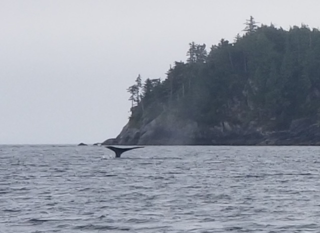
Smith Sound was fairly calm as we exited the cove and pointed southwest toward Cape Caution. The waves and chop built as we continued around Cape Caution and pointed southeast into the strait. We were able to stay on plane and make good time, but the chop on top of the low swells made for busy driving. We had no more than two miles of visibility for most of the trip around the cape. At several points we could barely see the land a mile off our port side.
My route for the southbound crossing was different from our crossing in June. We stayed close to the mainland coastline after passing Cape Caution, as opposed to heading directly south toward the Gods Pocket area off the north end of Vancouver Island. Less confident about the weather this time, I wanted to stay within a shorter distance of protected harbors and wait until we were deeper into Queen Charlotte Strait before crossing. We met the northbound Alaska State Ferry Matanuska in the narrow Millar Passage. We hugged the Millar Islands side of the passage as she passed.
We saw a whale ahead at the east end of the Millar Islands. We watched him sound, then I switched my attention to avoiding rocks/preparing for the ferrys wake/cross-checking radar and AIS when Kel exclaimed, Theres a whale right next to you! I looked to my right as a second whale that we hadnt noticed sounded within about 25 yards of us. Sorry, no photos of that one.
The sea state calmed considerably as we tuned a few degrees to starboard and pointed toward Port McNeill. The chop increased a little in the middle of the strait, but not enough to slow us down from our 15-mph pace. Arriving in Port McNeill shortly before noon, we filled up with gas and walked to the grocery to stock up for the next several days. After our gloomy morning, Port McNeill was sunny and clear this afternoon.

Not sure exactly what route well take for the next several days. Theres another blow coming tomorrow and Saturday that will bring strong winds to Queen Charlotte Strait and the Broughtons. Well head at least part way up Johnstone Strait before angling north and exploring between here and Desolation Sound. |
|
| Back to top |
|
|
LesR
Joined: 05 May 2010
Posts: 162
City/Region: St. Louis
State or Province: MO
C-Dory Year: 2007
C-Dory Model: 25 Cruiser
Vessel Name: Intuition
Photos: Intuition
|
| Posted: Mon Sep 06, 2021 8:28 pm Post subject: |
|
|
Friday, September 3, 2021
Port McNeill to Growler Cove
Miles today: 22
Total Miles: 2905
What do they say about Red Sky at morning?
We were planning to make at least Port Neville or get beyond Greene Point Rapids if the weather held. There are gale warnings up for strong southeast winds with a front due to arrive tonight. My hope was that wed have a morning of light winds in Johnstone Strait, so that we could make some time and be in a protected location in advance of the highest winds tomorrow. Unfortunately, the southeast winds had already begun by the time we pulled out of Port McNeill at 7:30 am. With the eastbound flood tide just beginning, the southeast winds created a messy chop.
Sloppy Johnstone Strait
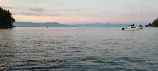
As the morning continued, so did the opposing winds, and the waves in Johnstone Strait continued to build. Not wanting to continue for four or more hours in those conditions, we pulled off the strait into Growler Cove. The opening of the cove faces west, so we anchored in 25 feet near the head of the cove for best relief from the very strong southeast winds expected tonight and tomorrow.
We had Growler Cove to ourselves all day, relaxing and catching up on a few items (and a nap) while the winds built on Johnstone Strait. It was breezy in the anchorage, but only enough wave action to gurgle against the hull. We may end up staying here tomorrow if the Gale Warning continues for Johnstone. If the wind lets up a little, we may try to make some progress once the ebb tide begins in the afternoon and were not dealing with strong winds opposing the tide.
Growler Cove looking into Johnstone Strait

Saturday, September 4
Growler Cove
Friday night was raucous with wind, rain, and noise from our front hatch rain cover rattling in the winds. Note to self dont put up the rain cover when strong winds are expected. The wind didnt seem to abate during the day on Saturday, so we stayed put. Strong winds buffeted our anchorage, but with no fetch, at least we didnt have any waves.
We thought about making a short run to Port Neville if the winds died a little in the afternoon, but didnt feel that they lessened to any practical extent by late afternoon. The wind reports at Fanny Island in Johnstone Strait were pretty consistent throughout the day at 10-11 knots. I think this is a reduced reading, given that the weather station is on the west side of the island and is sheltered from strong easterlies.
A sailboat entered the cove later in the afternoon and became our only neighbor. The wind died about 7:00 pm and became calm as night fell.
 |
|
| Back to top |
|
|
LesR
Joined: 05 May 2010
Posts: 162
City/Region: St. Louis
State or Province: MO
C-Dory Year: 2007
C-Dory Model: 25 Cruiser
Vessel Name: Intuition
Photos: Intuition
|
| Posted: Mon Sep 06, 2021 8:47 pm Post subject: |
|
|
Sunday, September 5, 2021
Growler Cove to Thurston Bay
Miles today: 64
Total Miles: 2969
Exiting Growler Cove

The water in Growler Cove was still when we awoke. Motoring toward the exit into Johnstone Strait, we could see thick fog except for the north side of the strait. As we turned eastward into the strait, we started scanning radar and AIS for any conflicts. I had about half a mile of visibility, with a clear view along the northern shore, so we continued at a slow cruise speed. A large fishing boat passed in the opposite direction, followed by the Alaska State Ferry Kennecott, both of which we saw only at their nearest point of less than half a mile. The Kennecott was the only vessel other than mine from which I heard a foghorn today.
Ghost Ship
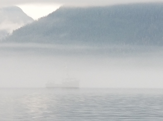
Kennecott
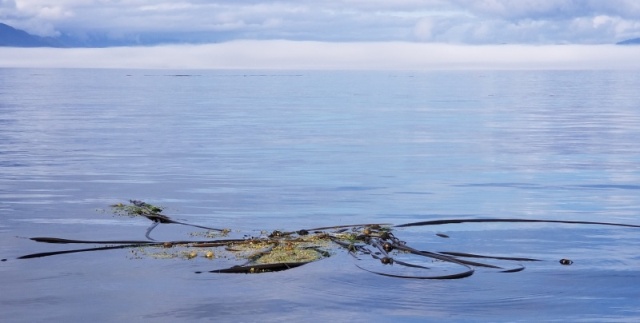
The fog was patchy for the next several miles, and we entered a thick section that lasted 8 or 10 miles until we popped out just past Port Harvey. The thick fog is spooky, since you cant see very far, but also frustrating, as its challenging maintaining a straight course with little visual aid. This is a situation where a course maintained via autopilot would allow you to focus on watching radar, AIS, and the water ahead for things like logs or kayaks. Especially when traveling slowly, I always seem to be 20 degrees from my intended course or in the process of over-correcting.
The fog bank we pushed through for over an hour and a mess of kelp - two of my less favorite things
There was some light fog as we approached Race Passage, but became clearer throughout the day. We arrived at Race Passage just after slack current in Johnstone Strait, so Race Passage was a little more placid than when we went through westbound on June 14. We caught up with Sybil and Bo on SYBO just after Ripple Point and chatted with them on the radio before they turned up Discovery Passage and we continued east into Nodales Channel.
Ripple Point in Johnstone Strait - not named after the wine
Weve anchored in the northeast corner of Thurston Bay Marine Park behind Block Island in 45 feet. Its a calm, gorgeous afternoon. I had considered the route via Greene Point Rapids; this route toward Desolation Sound is a few miles farther, but I didnt have to plan around slack at Greene Point, which is later this afternoon. We have about 12 miles to go before we arrive at the Dent-Gillard-Yuculta series of rapids tomorrow morning, where high slack begins about 10:33 am. Our plan is to stay in Lund tomorrow night before striking back across the Strait of Georgia on Tuesday or Wednesday.
 |
|
| Back to top |
|
|
LesR
Joined: 05 May 2010
Posts: 162
City/Region: St. Louis
State or Province: MO
C-Dory Year: 2007
C-Dory Model: 25 Cruiser
Vessel Name: Intuition
Photos: Intuition
|
| Posted: Mon Sep 06, 2021 10:53 pm Post subject: |
|
|
Monday, September 6, 2021
Thurston Bay to Lund
Miles today: 48
Total Miles: 3017
Thurston Bay Sunset
With low slack (Turn to Flood) at Dent Rapids forecast for 10:33, we left Thurston Bay at 8:30 to give us plenty of time to cover the 11-12 miles. A big fog bank sat at the intersection of the Nadales and Cordero channels. We fell third in line behind a sailboat and a large cruiser as we approached Dent. We maintained our spacing on the other two boats via radar, and the fog lifted during the last few miles prior to the first rapid.
Approaching Dent

The big cruiser went through a few minutes early, the sailboat hit Dent at slack, and we followed him by a few minutes in very calm water. The open water northwest of the rapids was pretty swirly as we waited for slack, but the main flow of water was smooth during our transit. The sailboat was going pretty slow and would likely be a little late for Gillard, so we accelerated and passed him in the bay between Dent and Gillard. We went through Gillard at slack time and Yuculta a few minutes early without incident. It was interesting to see the numerous resorts and fishing lodges in this area.
Dent Rapids
Sonora Resort east of Gillard Passage

After fixing lunch, we ran on plane the rest of the way to Lund and arrived here about 1:30. Shower, laundry, and someone elses cooking were this afternoons agenda. Horror of Horrors Nancys Bakery will be closed tomorrow no cinnamon rolls for me. |
|
| Back to top |
|
|
LesR
Joined: 05 May 2010
Posts: 162
City/Region: St. Louis
State or Province: MO
C-Dory Year: 2007
C-Dory Model: 25 Cruiser
Vessel Name: Intuition
Photos: Intuition
|
| Posted: Thu Sep 09, 2021 7:50 pm Post subject: |
|
|
Tuesday, September 7, 2021
Lund to Pilot Bay
Miles today: 86
Total Miles: 3103
We left Lund late this morning after adding some fuel and spending the last of our Canadian cash at the store. I added enough gas to get to Friday Harbor; Ill add enough cheaper gas there to finish the final 70 or so miles to Everett.
Having heard about the nice sandy beaches at Savary Island just a few miles southeast of Lund, we motored around it on our way out. We decided not to stop after rounding the western-most end of the island, seeing only rocky shoreline on the south side, and realizing we had passed the sandy beaches on the islands north.
We continued on to Tribune Bay at the south end of Hornby Island. Theres a nice sandy beach and park that are quite popular. A number of boats were anchored in the bay. I had thought about anchoring in Tribune Bay for the night until the latest forecast indicated winds would shift to the southeast overnight. We anchored for an hour to enjoy the sunshine and warm weather (75 degrees F) then continued southeast in amazingly calm seas.
My latest plan for the day was to spend the night at Northwest Bay. With the calm seas this afternoon and brisk winds forecast for early tomorrow, we decided to keep going. Waves became bigger and messier the closer we got to Nanaimo, forcing us to slow down. We made it to Pilot Bay at the north end of Gabriola Island at 6:30 pm, as we had missed the window late this afternoon at Dodd Narrows. This anchorage puts just a few miles from Dodd Narrows and limits our open-water exposure should winds be strong in the morning.
 |
|
| Back to top |
|
|
LesR
Joined: 05 May 2010
Posts: 162
City/Region: St. Louis
State or Province: MO
C-Dory Year: 2007
C-Dory Model: 25 Cruiser
Vessel Name: Intuition
Photos: Intuition
|
| Posted: Thu Sep 09, 2021 7:59 pm Post subject: |
|
|
Wednesday, September 8, 2021
Pilot Bay to James Bay
Miles today: 36
Total Miles: 3139
Pilot Bay was pretty bouncy all night. Its a nice bay with cute homes and cottages lining the shore and a park at its head. Its open to the east and not very long, so swells from Strait of Georgia and wakes from the BC Ferries and tows that use the nearby channel can reach the bay. The wind held the bow to the south, with the swells entering from the east and hitting us on the beam. It was rolly enough that we didnt try to cook breakfast, but relaxed and took care of a few other chores.
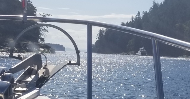
After I disengaged a small crab who had attached himself to the chain, we pulled the anchor and started toward Dodd Narrows shortly after 10:00 am, with a slack and turn to flood forecast for 11:42 am. We had rain showers overnight, but the skies began to clear as we were leaving. By the time we approached the narrows at 11:15, there was a train of ten boats starting the southbound passage. It was very orderly; the largest cruiser started through, and everyone else followed expeditiously, so that all the southbound boats had passed through during the last of the ebb flow several minutes before the flood started. Another half dozen or so boats were waiting to pass north as we finished the passage, which was still flowing south with force, but without a lot of turbulence.
Approaching Dodd Narrows
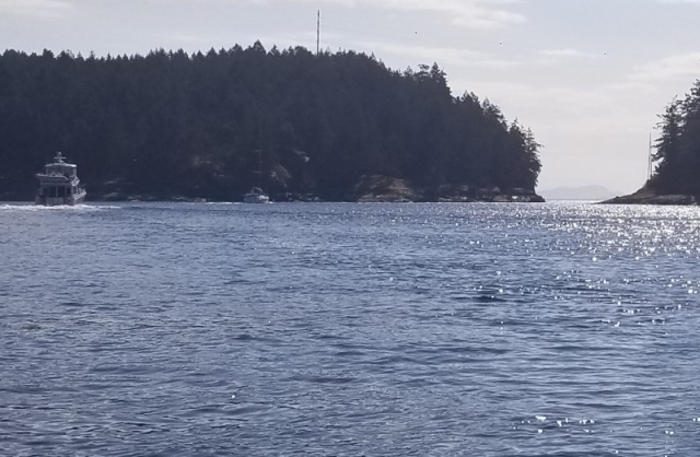
Dodd Narrows
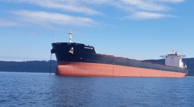
Initially the water was smooth as we headed south, but became choppy after several miles. There was plenty of fetch for the breezy southeast winds today, so we paced ourselves and bounced through at 7 mph. There were five tankers anchored in or along Trincomali Channel, and we saw one more enter the channel via Active Pass late in the afternoon. Is this standard or is there more to the story?
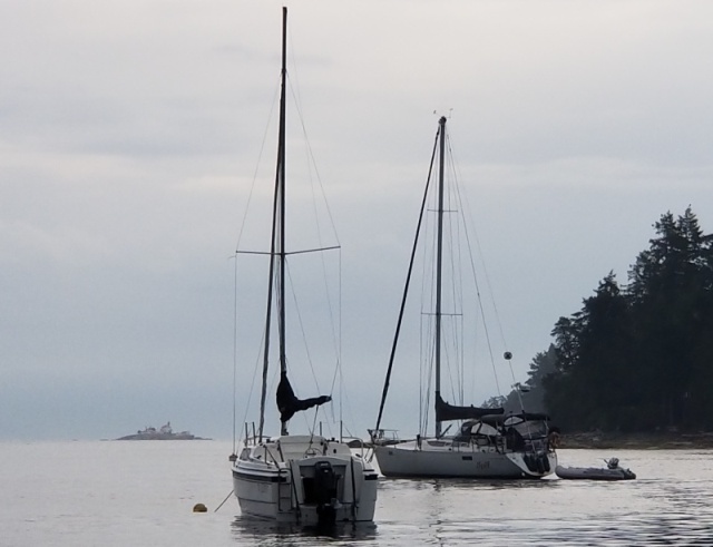
We pulled into James Bay on Prevost Island at 3:00 pm. There were already three sailboats anchored when we arrived, so we took a spot on the south edge of the bay in about 35 feet. Theres a comfortable breeze, and were protected from the waves in the main channel.
James Bay
Latest mechanical issue our freshwater pump ceased to function yesterday. It had intermittently not turned on when needed, leading me to suspect a wiring connection rather than the pump itself. I carry a spare pump, so can replace it if necessary. The pump is located in the compartment covered up with my cockpit storage box, so Im waiting until we arrive in Friday Harbor tomorrow where Ill have a little dock space to work with. |
|
| Back to top |
|
|
|
|
You cannot post new topics in this forum
You cannot reply to topics in this forum
You cannot edit your posts in this forum
You cannot delete your posts in this forum
You cannot vote in polls in this forum
You cannot attach files in this forum
You cannot download files in this forum
|
|
 Search
 Private Messages
 Profile
 Log in
 Register
 Help
Help
