| View previous topic :: View next topic |
| Author |
Message |
Discovery
Joined: 08 Dec 2003
Posts: 1239
City/Region: LOA, UTAH
State or Province: UT
C-Dory Year: 2006
C-Dory Model: 255 Tomcat
Vessel Name: Discovery
Photos: Discovery
|
 Posted: Wed Aug 11, 2021 10:21 am Post subject: Posted: Wed Aug 11, 2021 10:21 am Post subject: |
 |
|
I'm really enjoying your description of the voyage. We visited many of the same places in 2015 on our summer trip with Jay and JoLee.
_________________
Brent and Dixie,
1984 22' Classic sold 2003
2003 24' TomCat sold 2005
2006 TC255 Discovery Sold 2020
2006 CD 22' Angler Sold 2014
https://share.delorme.com/FBrentBetenson
"Free men do not ask permission to bear arms." ~ Thomas Jefferson |
|
| Back to top |
|
 |
NewMoon
Joined: 21 Dec 2008
Posts: 430
City/Region: Holladay
State or Province: UT
C-Dory Year: 1991
C-Dory Model: 22 Cruiser
Vessel Name: Cindy Sea
Photos: Cindy Sea
|
| Posted: Wed Aug 11, 2021 10:51 pm Post subject: |
|
|
| LesR wrote: | Working on my planning for the trip south. Since we didn't get to visit any of the Chatham Strait bays (Warm Springs, Red Bluff, Ell Cove), I'd like to go that direction on my way south, rather than Stephens Passage. The most direct route involves Rocky Pass, which sounds interesting and challenging. Anyone have recent experience with Rocky Pass or recommendations one way or another?
Les |
Hi Les,
Our favorite stops in Chatham would be Pavlof Harbor in Freshwater Bay, Takatz Bay, Warm Springs Bay (try for a spot on the float, and hike up to the warm pools and lake), Red Bluff Bay, and Gut Bay. All along Baranof Island the mountains are magnificent. From Chatham take Frederick Sound to Honeydew Cove in Keku Strait.
Rocky Pass is interesting and challenging. If you go that way south from Frederick Sound, be sure to time it to be at Devils Elbow at slack current on high tide. If you're interested in the W side of POW Island, El Capitan Passage, starting with Dry Pass, is fun. I'm in Craig today, heading north to Dry Pass tomorrow.
_________________
Richard Cook
Dream Catcher (Nordic Tug 37, 2016 to present)
New Moon (Bounty 257, 1998 to 2016)
Cindy Sea (CD 22 Cruiser, from 1991 to 1998)
"Cruising in a Big Way" |
|
| Back to top |
|
|
LesR
Joined: 05 May 2010
Posts: 162
City/Region: St. Louis
State or Province: MO
C-Dory Year: 2007
C-Dory Model: 25 Cruiser
Vessel Name: Intuition
Photos: Intuition
|
| Posted: Fri Aug 13, 2021 12:39 pm Post subject: |
|
|
Richard,
Thanks very much for the suggestions for places to see next week. Warm Springs Bay and the springs themselves are at the top of our list. It looks like high slack for the Summit/Devil's Elbow in Rocky Pass for late next week will be early afternoons, which should make the timing straightforward to manage. Hope you're doing well in this week's wet and windy weather.
While I prefer not to spend a week at a time in a marina (as we will have been here in Auke Bay), with the continual rain and wind this week, it's the better place for us. We took the bus into Juneau a couple times to shop and browse. Getting off the confines of the boat seems to help deal with the weather we've seen this last week.
One other regular project we've added to our schedule - bailing the cockpit. We plugged our scuppers, since they sit right at the waterline when our boat is loaded and allow water to seep into the cockpit. After a night of heavy rain like last night's, we end up with a few gallons of water that make it past the camperback. Good use for that hand-held bilge pump I bought several years ago and have been carrying around since. The new hatch covers I added to the cockpit floor seal much better than the original ones did, so less water seeps into the bilge from the cockpit.
Les
_________________
Les and Kel Rohlf |
|
| Back to top |
|
|
hardee
Joined: 30 Oct 2006
Posts: 12632
City/Region: Sequim
State or Province: WA
C-Dory Year: 2005
C-Dory Model: 22 Cruiser
Vessel Name: Sleepy-C
Photos: SleepyC
|
| Posted: Fri Aug 13, 2021 6:18 pm Post subject: |
|
|
| Quote: | | ". . . . (a) regular project we've added to our schedule - bailing the cockpit." |
Funny how water inside the boat has a way of changing motivations. Sorry that camperback is leaky. But at least you are only having to deal with some of the total fallout.
WOW, hard to believer you are heading back already. Not sure I'm ready for you to be done yet  and we aren't even to the middle of August here, but I also know you have some miles to cover. Have really enjoyed following along. and we aren't even to the middle of August here, but I also know you have some miles to cover. Have really enjoyed following along.
Thanks again for such a great story.
Harvey
SleepyC 
_________________
Though in our sleep we are not conscious of our activity or surroundings, we should not, in our wakefulness, be unconscious of our sleep. |
|
| Back to top |
|
|
Hunkydory
Joined: 28 Mar 2005
Posts: 2657
City/Region: Cokeville, Wyoming
State or Province: WY
C-Dory Year: 2000
C-Dory Model: 22 Cruiser
Vessel Name: Hunkydory
Photos: Hunkydory-Jay-and-Jolee
|
| Posted: Mon Aug 16, 2021 4:50 pm Post subject: |
|
|
Les, good list from Richard.
We went through Rocky Pass on our 2004 trip north from Prince Rupert. The cruising book had us concerned & though it challenged our novice skills & charting system at the time, it was much less difficult than anticipated. Before electronic gps navigation & no channel markers it claimed a lot of fishing & other boats. Now a great place to test your navigation skills.
Jay
_________________
Jay and Jolee 2000 22 CD cruiser Hunkydory
I will not waste my days in trying to prolong them------Jack London
https://share.delorme.com/JuliusByers |
|
| Back to top |
|
|
LesR
Joined: 05 May 2010
Posts: 162
City/Region: St. Louis
State or Province: MO
C-Dory Year: 2007
C-Dory Model: 25 Cruiser
Vessel Name: Intuition
Photos: Intuition
|
| Posted: Sun Aug 22, 2021 12:54 pm Post subject: |
|
|
August 8-17
Auke Bay
We relaxed, read, and gathered a few items to take home during our 10 days in Juneau. There was a day or two when the weather was OK, but few days without fairly high winds in Chatham Strait and Lynn Canal. It was certainly easier to deal with the sloppy weather here than anchored in a bay 100 miles south.
The big event while we were here was the Golden North Salmon Derby the weekend of 8/13-8/15. One of the reasons we couldnt get our motor serviced earlier was that so many people had last-minute service needs prior to the derby. The salmon caught are sold with profits going toward scholarship funds for local students. There was a constant line of boats coming in and going out from the double ramp at Auke Bay all weekend.
We took the bus downtown a couple times for shopping and had lunch at the Alaska Fish and Chips and Crepe Escape both were very good. A couple other places we ate that we would recommend: Donnas Restaurant near Nugget Mall and the Village Restaurant just north of the airport served very good diner/comfort food. We had very good breakfasts at both. Our last night there we had date night at the Laundromat. Upstairs in the same building is Squirez Bar, so we checked it out during the wash cycle. It has a great view looking out onto Auke Bay and includes a food vendor with excellent sandwiches and burgers. I might have volunteered to do the laundry if I had known about it earlier.
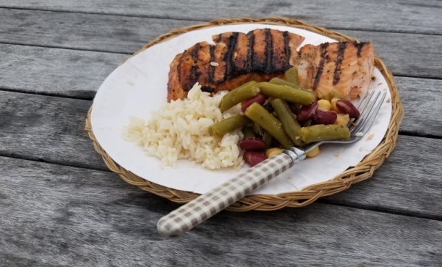
One of our neighbors in Auke Bay (Kellie on Salty Dawg) generously gave us some recently-caught salmon. We grilled it on Monday it was excellent.
Kel got the best bear photos so far when she spotted a black bear at a dumpster in downtown Juneau.
Last edited by LesR on Sun Aug 22, 2021 1:09 pm; edited 1 time in total |
|
| Back to top |
|
|
LesR
Joined: 05 May 2010
Posts: 162
City/Region: St. Louis
State or Province: MO
C-Dory Year: 2007
C-Dory Model: 25 Cruiser
Vessel Name: Intuition
Photos: Intuition
|
| Posted: Sun Aug 22, 2021 1:08 pm Post subject: |
|
|
Thursday, August 18, 2021
Auke Bay to Funter Bay
Miles today: 27
Total Miles: 2101
We passed the Statter Harbor channel markers into Auke Bay at 6:00 am. The breeze out of the east pushed us along until we turned north to pass behind Shelter Island. We turned south around Point Retreat and into the swell of the southern Lynn Canal. Wave heights were forecast to be 3 feet today in southern Lynn Canal and northern Chatham Strait, and my planned destination for today was Pavlov Harbor in Freshwater Bay.
Initially the water conditions were good, with smooth 1-2 foot swells that we could glide over. The sea and weather conditions were kind of hypnotizing with the gray water blending into the milky, indistinct horizon. The cloud level was very low this morning, with occasional fog banks. As we headed south, a float plane passed us going the opposite direction at only 200-300 feet in order to stay below the clouds.
The waves became increasingly big, bossy, and steep as we continued, causing the boat to drop off the edge of larger waves and pound, even at our torrid 6 mph speed. Not wanting to continue pushing through for another 30 miles, especially with the tide about to turn against the wind, we opted to pull into Funter Bay. Theres a state float along the south shore, so we tied up to the back side of it about 10:30 am. Theres still a pretty stiff breeze out of the east blowing through the bay, but were comfortable at the float.

We rested and read the rest of the day. Theres decent AT&T cell reception here. Rain showers and low ceilings continued throughout the day. By the end of the evening, four other fishing boats joined us on the float.
Floatplane departing after making a delivery in Funter Bay. The weather was as gloomy as it looks.
 |
|
| Back to top |
|
|
LesR
Joined: 05 May 2010
Posts: 162
City/Region: St. Louis
State or Province: MO
C-Dory Year: 2007
C-Dory Model: 25 Cruiser
Vessel Name: Intuition
Photos: Intuition
|
| Posted: Sun Aug 22, 2021 1:20 pm Post subject: |
|
|
Thursday, August 19
Funter Bay to Warm Springs Bay
Miles today: 87
Total Miles: 2188
We had very calm waters all day. We ran at slow cruise except for about 90 minutes when fighting the worst of the incoming tide. After looking ahead at the weather forecast, weve decided to prioritize Warm Springs Bay and Red Bluff Bay in our itinerary. Theres a couple weeks worth of bays to explore off Chatham Strait, but were now starting to realize our remaining time is limited. The goal (not schedule) is to get to Ketchikan by middle of next week and look to continue south into Canada at the end of that week.
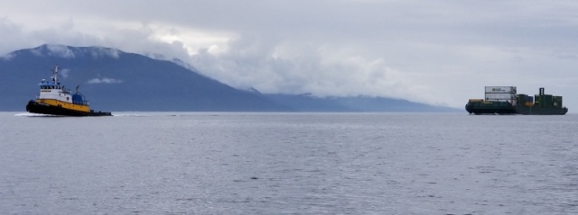
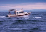
Western Mariner heading North in Chatham Strait
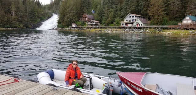
By the time we got to Warm Springs Bay at 4:30 pm, there were no spots available on the dock. Warm Springs Bay includes hot springs (duh?) above a group of homes situated to the east of a very large, picturesque waterfall. A trail leads from the public dock up to the springs and Baranof Lake, whose outflow serves as the source for the waterfall. Theres also a public bath house with three separate tubs fed by the springs, which overlooks the bay and waterfall.
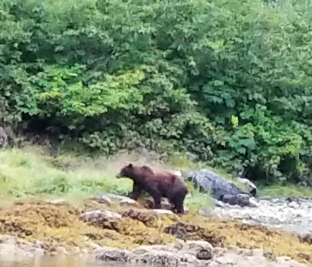
We first tried to anchor in Schooner Cove, but didnt feel there was enough swing room for the amount of rode Id need. We moved over to the head of the southwest arm and anchored against the head of the bay. As light was getting dim, a brown bear appeared at the creek feeding into the bay. After wandering back and forth along the edge, he got excited by the jumping salmon and perched on a rock at the edge of the water. He made two dives into the water after fish, but came up empty.
I ended up turning off the anchor alarm because the GPS kept losing lock and triggering the alarm. Fortunately, we had a very calm night in a well-protected anchorage. |
|
| Back to top |
|
|
LesR
Joined: 05 May 2010
Posts: 162
City/Region: St. Louis
State or Province: MO
C-Dory Year: 2007
C-Dory Model: 25 Cruiser
Vessel Name: Intuition
Photos: Intuition
|
| Posted: Sun Aug 22, 2021 1:41 pm Post subject: |
|
|
Friday, August 20, 2021
Warm Springs Bay to Red Bluff Bay
Miles today: 24
Total Miles: 2212
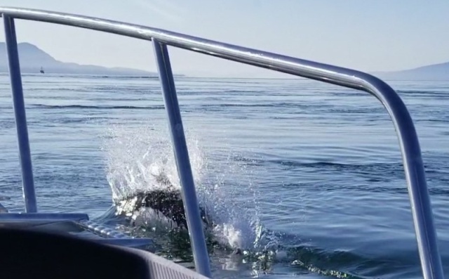
We awoke to splashing around the boat. A sea lion was fishing (hunting?) in the cove. It was amazing to watch him catch a fish and spend the next few minutes thrashing his head back and forth while holding the fish. I assume this behavior helps to rip off bit-size pieces guess I need to look that up.
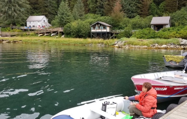
We pulled the dinghy down, gathered our stuff, and headed over to the dock to visit the hot springs. We tied up behind the float plane dock and walked up to the path toward Baranof Lake and the springs. We missed the turnoff to the springs and arrived at the lake. After returning most of the way, we met a lady going to the springs who showed us the path to the springs. When passing it the first time, we assumed it was just a path to the top of the waterfall, as it was much rougher and more difficult. It is, but thats where the springs are located. The two pools are super hot and really hot, so we soaked our feet and legs for a few minutes and headed back to the bath house.
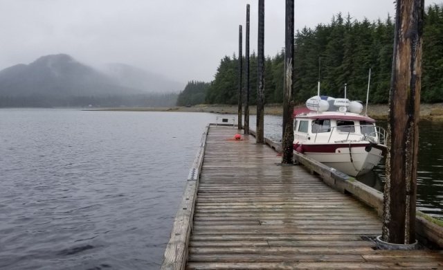
Dock at Warm Springs Bay
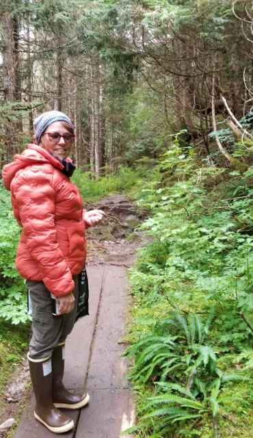
Trail to Baranof Lake and Warm Springs
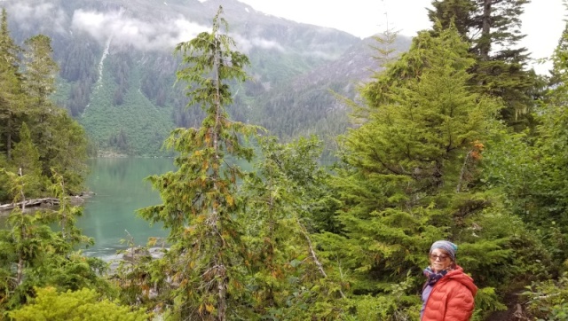
Baranof Lake
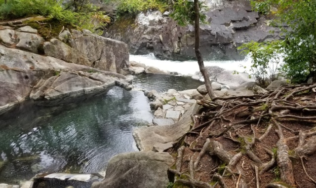
Baranof Warm (Hot!!) Springs
Bath House
The bath house was nice, because you can regulate the temperature with some cold water. We took a luxuriating soak and headed back to the boat. We set up a bridle on the dinghy so that we could tow it the 23 miles to Red Bluff Bay, then had lunch before leaving Warm Springs Bay at 1:00 pm.
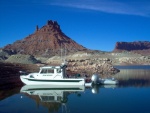
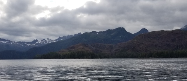
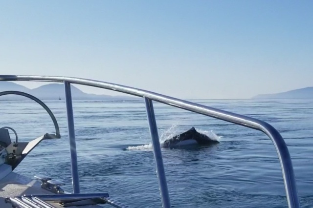
We saw a whale feeding near Point Gardner, then some Dalls Porpoises shortly after. The ride to Red Bluff Bay was comfortable, with only some long low swells. We arrived at the entrance shortly before 4:00. The rust-colored bluff that stands as a sentinel over the entrance to Red Bluff Bay is unique among the landforms Ive seen on our trip.
Red Bluff Bay Entrance
Not too many superlatives are unwarranted for Red Bluff Bay. We cruised around the striking islands that serve as a barrier between Chatham Strait and the bay, looked at the defunct cannery ruins inside the first bay, and continued the 4 miles to the head of the bay.
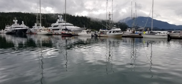
Two other cruisers were already anchored behind the spit at the far end of the bay, but we found a nice level section with about 35 feet of water just short of that point. Were able to look across at the wide meadow and creek that exits into the bay. We saw a couple bears patrolling the shore along the meadow. Its like a live version of Animal Kingdom from our dinette tonight while a smaller sea lion catches fish from around our boat.
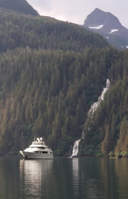
I grilled tri-tip and potatoes while Kel explored the bay and the large waterfall across from us in the tender. Just before dark, a sailboat entered and anchored between us that our two neighbors. Shortly thereafter, Serengeti, a super-yacht, pulled into the bay and anchored between us and the waterfall.

 |
|
| Back to top |
|
|
LesR
Joined: 05 May 2010
Posts: 162
City/Region: St. Louis
State or Province: MO
C-Dory Year: 2007
C-Dory Model: 25 Cruiser
Vessel Name: Intuition
Photos: Intuition
|
| Posted: Sun Aug 22, 2021 1:49 pm Post subject: |
|
|
Saturday, August 21, 2021
Red Bluff Bay to Kake
Miles today: 38
Total Miles: 2250
We left the dinghy down last night so that we could use it this morning before we left Red Bluff Bay. When we awoke, we saw two bears walking along the north shore at low tide. They eventually made it all the way around to the southeast shore near where we were anchored. After breakfast, we hopped into the tender and motored to the other side of the bay where the creek exits and watched the bears as they returned to the meadow and up the creek.


We got the dinghy back onto the roof with minimal drama and started out from the anchorage at 9:00. While less dreary this morning, we did get a shower as we prepared to leave. We enjoyed the scenery during our slow cruise out of the bay and pointed ourselves toward Frederick Sound. We ran on plane for most of the way around the north side of Kuiu Island to Kake, with smooth water almost the entire way.
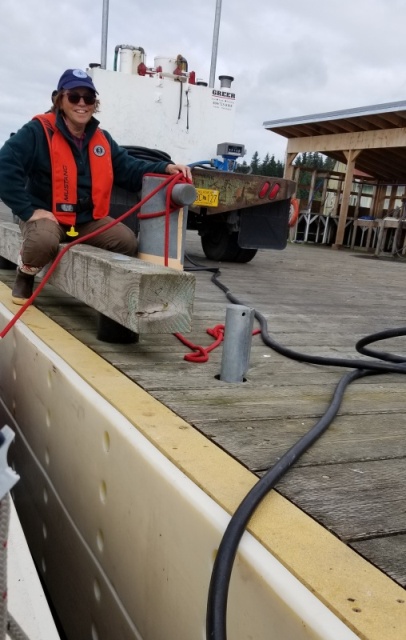
I had called Kake Tribal Fuel yesterday to check on the logistics for getting gas. Fuel at Kake is delivered via a truck on the drive-down dock, since their gas dock was destroyed in a storm five years ago. Since they close at 2:00pm on Saturdays, he asked me to arrive as close to noon as possible. I called them 30 minutes out, and arrived at 12:15. This was also the most expensive gas of the trip, even more so than Shearwater. I didnt fill up as I expected it to be more expensive, but still should have more than plenty for trip to Ketchikan over the next few days.
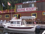
After getting gas, we continued south from Kake to their harbor a couple miles south of the main village. Were tied off to a long dock identified for transients the harbor is nice, protected, and about the size of the one in Tenakee Springs. Kake has apparently locked themselves down, with tight restrictions on both residents and potential visitors. Everyone weve met has been friendly and helpful, but its clear from all the posted notices that leadership is trying to stem any new introduction of the virus into smaller, more isolated communities like Kake. We walked slightly less than a mile to the SOS Hardware and Market to gather a few items. The store had a good selection of food items and would be a realistic resupply location if needed. |
|
| Back to top |
|
|
Discovery
Joined: 08 Dec 2003
Posts: 1239
City/Region: LOA, UTAH
State or Province: UT
C-Dory Year: 2006
C-Dory Model: 255 Tomcat
Vessel Name: Discovery
Photos: Discovery
|
| Posted: Mon Aug 23, 2021 10:56 am Post subject: |
|
|
We used to see Serengeti in Cabo San Lucas Mexico, back in the early 2000's. She was then owned by Johnny Carson and would spend the winter there.
Still enjoying the journey. |
|
| Back to top |
|
|
LesR
Joined: 05 May 2010
Posts: 162
City/Region: St. Louis
State or Province: MO
C-Dory Year: 2007
C-Dory Model: 25 Cruiser
Vessel Name: Intuition
Photos: Intuition
|
| Posted: Wed Aug 25, 2021 11:23 pm Post subject: |
|
|
Sunday, August 22, 2021
Kake to Salmon Bay
Miles today: 71
Total Miles: 2321
We werent able to make contact with anyone from the Harbormasters office yesterday or today. The only number is for the village, and nobody was there to answer on Saturday or Sunday. They were happy to take my payment information when I got in touch with them on Tuesday.
Kake Harbor at very low tide

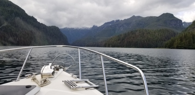
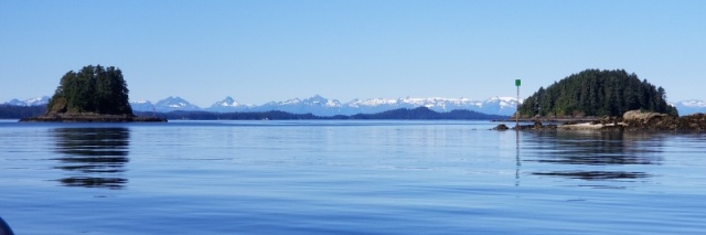
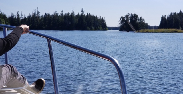
The plan for today was to transit Rocky Pass southbound and spend the night at Point Baker. Rocky Pass represents the middle section of Keku Strait, which connects Frederick Sound to Sumner Strait. The pass is a narrow often-shallow passage that winds its way through a patchwork of rocky islands between Kuiu and Kupreanof Islands. Its an absolutely beautiful and remote area. Aside from a boat we met going through the pass, we saw no one else.
Leaving Kake toward Keku Strait
At one time the shallowest sections of Rocky Pass had been dredged to a minimum of 5 feet, but recent reports are that it is much shallower. The best practice is to transit the trickiest sections (The Summit and Devils Elbow) at high slack tide. The tides from the north and south meet roughly between the two. High slack tide for today at The Summit was forecast for 2:26 pm. My plan was to arrive at the north entrance to The Summit no later than 2:00, so that we could be at Devils Elbow by 2:30. With last nights being a full moon, there was a lot of water being exchanged with the tides, so getting the timing close would be critical.
We left the Kake floats at Portage Harbor shortly after 10:00 am and meandered between the islands that separate Portage Passage from Keku Strait. Since it was a clear and sunny day, we could look across and see the snow-capped peaks of Baranof Island beyond Kuiu Island. All of Keku Strait was picturesque, especially today with light winds and clear skies. Heading south during the peak of the flood tide, we got a noticeable boost in speed through some sections. We arrived at the north entrance to The Summit at 1:50 pm. There was still just a little current at our stern, but no issues with steerage. The Summit has a couple very shallow turns, and its challenge lies in maintaining a course through the very narrow channel. With a 15-foot high tide, we saw slightly less than 18 feet a few times. I made a Securite call entering The Summit; another cruiser coming the opposite direction waited for us at the south end, as theres really not much room for two boats to pass in this section.
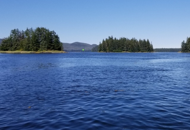
Looking into The Summit
We arrived at Devils Elbow at 2:30pm and perceived no current through that area. Having now been through that section once, the tricky aspect is that you cant see (at high slack) the two near-ninety degree turns that are required within about 100 yards of each other. The water shallows dramatically outside the channel. Todays electronic charting makes the process far easier, especially since one of the navigation aids (Green 13) was missing. I spent too much time looking for the missing green marker and slightly overshot both turns. At high slack I had a little more room for error and no pesky current trying to push me into a rock or mudbank.
Devil's Elbow

Chartplotter Course through Devil's Elbow
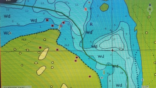
Aside from Green 13, there were two green markers north of there that were missing or damaged (33, 35, or 37), and Red 10 is either missing or we didnt see it. Todays electronic charting removes much of the uncertainty in this type of situation.
We crossed Sumner Strait and went to Point Baker. Point Baker is a small community (35 or so) in a well-protected cove on the northeast side of Prince of Wales Island. There was room on the public dock, but everything was shuttered. In better times there has been a restaurant, store, and bar there. Rather than spend the night, we decided to put in a few more miles to shorten the day tomorrow. We stopped in Salmon Bay, an inlet just south of Sumner Strait in Clarence Strait. Its fairly narrow and also shallow. Were anchored in 15 feet at low tide (it will rise 15 more tonight). |
|
| Back to top |
|
|
LesR
Joined: 05 May 2010
Posts: 162
City/Region: St. Louis
State or Province: MO
C-Dory Year: 2007
C-Dory Model: 25 Cruiser
Vessel Name: Intuition
Photos: Intuition
|
| Posted: Wed Aug 25, 2021 11:29 pm Post subject: |
|
|
Monday, August 23, 2021
Salmon Bay to Ketchikan
Miles today: 102
Total Miles: 2423
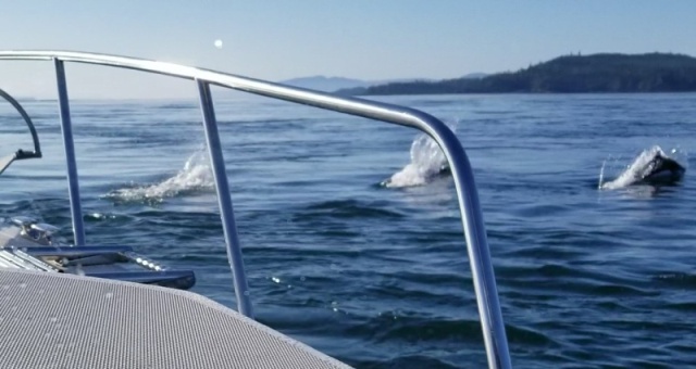
We headed east out of Salmon Bay toward Snow Passage at 7:00. It was another clear, beautiful day with light winds. We saw some whales from a couple miles away near the north end of Snow Passage, but they were gone by the time we got there. Even though we arrived at close to low slack, there were some pretty strong currents running through this narrow area. During the last section of the passage, several Dalls Porpoises popped up around the boat and flitted back and forth in front of us.
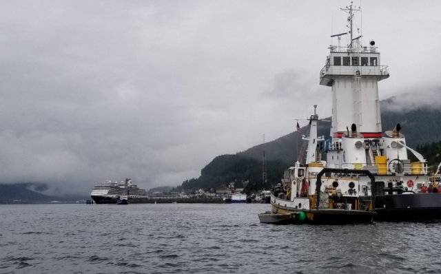
We took our time heading south through Clarence Strait, as I didnt want to arrive at the entrance to Thorne Bay during the fastest of the flood tide. Thorne Bay reminds me of both Red Bluff Bay and Rocky Pass, with a few narrow and shallow sections connecting to longer, deeper bays. These narrow passages carry faster currents except at slack. We arrived at the town of Thorne Bay about 1:30 pm and tied off to their marinas outer floating breakwall, which serves as the transient dock. Thorne Bay is a cute small town (450-ish) in a beautiful setting. There used to be a huge logging operation and pulp mill here. A lady we talked to later in Ketchikan had lived there for seven years during the logging days and said that at that time Thorne Bay was essentially a company town.
We stopped by the café (closed this week), then went to the market to grab a few impulse items. The shower at the marina was locked, and we couldnt find anyone to open it. We decided to move on and make the 40-mile run for Ketchikan tonight, rather than stay in Thorne Bay. The weather looks spicy for the next couple days, so we determined a late-day run was no worse than waiting until tomorrow.
The day continued clear when we pushed away from Thorne Bay at 3:00pm, but the waves built as we crossed Clarence Strait toward Caamano Point and the entrance to Tongass Narrows on the other side of Behm Canal. The waves were mostly on our bow and werent dangerous, but 7 mph was as fast as we could go without losing our fillings or having all our possessions end up in the middle of the cabin. A mild jab to the ribs from the dinette table when a wave hit us as I got up to fill my water bottle reminded me that moving around much in these conditions is not without risk. We joined a line of fishing boats returning to Ketchikan and entered the smoother waters of Tongass Narrows while avoiding two barge tows going the opposite way.
The sun is setting earlier now (8:30 pm), so we knew wed be running out of daylight as we approached Ketchikan. What concerned me more was the fog bank I could see farther down the narrows. I wasnt comfortable speeding up as the light faded, since I wouldnt be able to see or avoid logs in the water, so we pressed on in hopes wed get to Bar Harbor before the fog. We didnt. It was good and dark by the time we passed the airport and ferry terminals a couple miles from the marina, and the visibility dropped to less than ¼ mile after that. Thankfully, with good charts and a little familiarity from our time here two months ago, we navigated safely into the narrow south breakwall entrance at 9:00 pm. We snagged the same spot on Float 4 that we used in June and tied up for the night. |
|
| Back to top |
|
|
hardee
Joined: 30 Oct 2006
Posts: 12632
City/Region: Sequim
State or Province: WA
C-Dory Year: 2005
C-Dory Model: 22 Cruiser
Vessel Name: Sleepy-C
Photos: SleepyC
|
| Posted: Wed Aug 25, 2021 11:35 pm Post subject: |
|
|
Navigational challenges will keep you awake. It looks like you are doing well on the tidal timing. Nice to see such empty waters.
Harvey
SleepyC
 |
|
| Back to top |
|
|
LesR
Joined: 05 May 2010
Posts: 162
City/Region: St. Louis
State or Province: MO
C-Dory Year: 2007
C-Dory Model: 25 Cruiser
Vessel Name: Intuition
Photos: Intuition
|
| Posted: Sat Aug 28, 2021 11:28 pm Post subject: |
|
|
Thursday, August 26, 2021
Ketchikan to Foggy Bay
Miles today: 46
Total Miles: 2469
Took one last shower, checked out with the harbor, and grabbed a final bag of ice before we departed Ketchikans Bar Harbor South at 10:00 am. We stopped by Petro Marine on our way out of town to fill up with 91-octane fuel.
One last gratuitous photo of floatplane landing just beyond the breakwall

Our plan for the southbound Dixon Entrance crossing is to take two days with a stop the first night in Foggy Bay. We originally wanted to take this approach, and I think its the only option given the narrow weather window that appears to be available. Conditions are less than optimal for the crossing today, but will allow us to get to Foggy Bay. It looks like the weather will settle slightly overnight to allow the passage from Foggy Bay to Prince Rupert early in the day on Friday before the next ugly system arrives late that day.
Departing Ketchikan from the fuel dock
We had a nice smooth ride down the Tongass Narrows and took the passage on the north side of Bold Island. We ran on plane and the ride was pretty smooth until we passed the entrance to Behm Canal. The waves werent terribly big but were directly beam on, making the ride and steering annoying. We stayed at the higher speed, since slowing down wouldnt be comfortable, and made a left turn toward the islands on the east side of Revillagigedo Channel instead of the more direct route just east of Mary Island. We got better protection once we were against the eastern shore. As we continued south toward Foggy Bay, the waves became more disorganized, with larger swells, so we slowed down to 7 mph for the last 10 or 12 miles. The wind doesnt seem too strong, but the waves havent yet calmed from the last couple days.
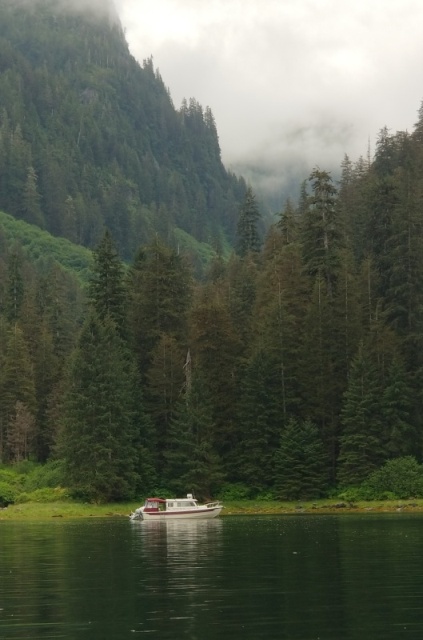
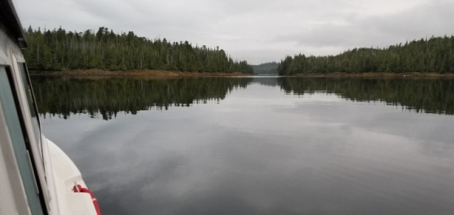
We followed the narrow channel into the inner portion of Foggy Bay. Its a very pretty and extremely well-protected anchorage. I can hear the waves crashing against the rocks in the outer bay, but theres hardly a whiff of wind and perfectly calm water here.
Inner Foggy Bay
It sounds as if the weather will become extremely nasty by late Friday afternoon. The winds wont be high early tomorrow and will be shifting from NW to SE, so hopefully well be able to run at speed directly toward Prince Rupert in the morning. |
|
| Back to top |
|
|
|
|
You cannot post new topics in this forum
You cannot reply to topics in this forum
You cannot edit your posts in this forum
You cannot delete your posts in this forum
You cannot vote in polls in this forum
You cannot attach files in this forum
You cannot download files in this forum
|
|
 Search
 Private Messages
 Profile
 Log in
 Register
 Help
Help
