| View previous topic :: View next topic |
| Author |
Message |
20dauntless
Joined: 23 Jan 2008
Posts: 879
City/Region: Mercer Island and Decatur Island
State or Province: WA
C-Dory Year: 2008
C-Dory Model: 22 Cruiser
Vessel Name: Retriever and Nordic Tug 37
Photos: Retriever
|
 Posted: Sat Feb 26, 2011 9:13 pm Post subject: Navionics PC App Posted: Sat Feb 26, 2011 9:13 pm Post subject: Navionics PC App |
 |
|
I just bought the Navionics PC app for Mac and thought I'd share my impressions in case anyone else is thinking of buying it.
It's basically the iPhone app for a computer. For planning purposes I like it better than GPSNavX for a few reasons. The biggest advantage is that all the charts are quilted together which makes navigation much more seamless. Zooming in and out and panning around does not require loading a different chart which makes looking around much quicker. The Canada charts, which include the area from the Washington/Oregon border north to SE Alaska cost $30, much, much cheaper than buying the Canadian charts for the area. The chart's appear to be identical to the iPhone charts.
Unfortunately, the app does not support a number of useful features. The biggest one missing is the ability to utilize GPS data from a USB GPS puck, so it doesn't really function as a backup when on the boat. You also can't export waypoints or routes. It's unclear whether these features will become available in later releases. For unknown reasons, even when the app takes up the full screen, the map does not on my computer. When displayed on my 27 inch monitor there's a couple inches of gray on each side and an inch or so on the bottom. On my 13 inch laptop monitor, the map displays on the full width but there's still the gray area at the bottom. Not a huge deal, but it would be nice if the map took up the whole area.
For 30 bucks, I think it's a good value for virtual cruising planning. Hopefully Navionics will continue to update and add features like they have with their mobile apps. The addition of GPS functionality and the ability to export waypoints/routes would make this the best Mac charting app, in my opinion. |
|
| Back to top |
|
 |
Walldog
Joined: 03 Jan 2009
Posts: 334
City/Region: Port Isabel
State or Province: TX
C-Dory Year: 2014
C-Dory Model: R-27 Tug
Vessel Name: Willie's Tug
|
| Posted: Sat Feb 26, 2011 11:33 pm Post subject: |
|
|
Check out Polarview NS and PolarCom from http://www.polarnavy.com/
Works with a GPS puck, download all charts as needed free, works great. Works with Active Captain. Free download for program, pay after 30 days if you like it $40 for up to 5 computers.
_________________
Walldog aka Herb Stark
2014 R31 Tug "Willie's Tug"
Port Isabel TX/Ballard WA
http://walldogsjourneys.blogspot.com |
|
| Back to top |
|
|
El and Bill
Joined: 08 Nov 2003
Posts: 3200
City/Region: Lakewood, CO
State or Province: CO
C-Dory Year: 2000
C-Dory Model: 22 Cruiser
Vessel Name: Halcyon
Photos: Halcyon
|
| Posted: Sun Feb 27, 2011 8:59 am Post subject: |
|
|
The Navionics app is great on iPhone4. The phone's built-in GPS is accurate and so are the charts, in our experience. It was our back-up on Lake Superior last summer - worked perfectly - great substitute for a backup GPS and has all the other features and apps of an iPhone (tide tables, good weather radar, location plotter for safety/search and rescue, charts, communication, - great on board piece of equipment).
_________________
El and Bill (former live-aboards)
Halcyon 2000 CD 22 Bought 2000 Sold 2012
http://cruisingamerica-halcyondays.com/ |
|
| Back to top |
|
|
Alyssa Jean
Joined: 02 Nov 2003
Posts: 2376
City/Region: Guemes Is.(Anacortes)
State or Province: WA
C-Dory Year: 2005
C-Dory Model: 16 Angler
Vessel Name: Alyssa Jean
Photos: Anna Leigh and Alyssa Jean
|
| Posted: Sun Feb 27, 2011 1:14 pm Post subject: |
|
|
I have the Navionics app on my new Droid X. Works great. Onetime cost of $16 and they have already done a update. GPS works pretty well as far s I can tell. It shows your speed but only has a course vector for course info. Be nice if actually showed the course as a number.
_________________
David and Kate
Alyssa Jean 16 Angler
Anna Leigh 22 Cruiser Sold 2005
Anna Leigh 25 Cruiser Sold 2014
K7KJR C-Brats #51 |
|
| Back to top |
|
|
thataway
Joined: 02 Nov 2003
Posts: 21356
City/Region: Pensacola
State or Province: FL
C-Dory Year: 2007
C-Dory Model: 25 Cruiser
Vessel Name: thataway
Photos: Thataway
|
| Posted: Sun Feb 27, 2011 3:13 pm Post subject: |
|
|
I am a bit confused. The Navionics app for i pad or i phone is fully functional, accurate and a great buy. The "Navionics PC app for the Mac", seems to compete with the other Navionics programs for the Mac such as
MacENC (Fugawi--which supports all of the Navionics chart software--a a considerably greater price) or the Navionics "navplanner 2, which is a planning program and does not support actual navigation?
I don't believe that Mac's will run the apps which the i pad or i phone will run (at least mine won't).
_________________
Bob Austin
Thataway
Thataway (Ex Seaweed) 2007 25 C Dory May 2018 to Oct. 2021
Thisaway 2006 22' CDory November 2011 to May 2018
Caracal 18 140 Suzuki 2007 to present
Thataway TomCat 255 150 Suzukis June 2006 thru August 2011
C Pelican; 1992, 22 Cruiser, 2002 thru 2006
Frequent Sea; 2003 C D 25, 2007 thru 2009
KA6PKB
Home port: Pensacola FL |
|
| Back to top |
|
|
20dauntless
Joined: 23 Jan 2008
Posts: 879
City/Region: Mercer Island and Decatur Island
State or Province: WA
C-Dory Year: 2008
C-Dory Model: 22 Cruiser
Vessel Name: Retriever and Nordic Tug 37
Photos: Retriever
|
| Posted: Sun Feb 27, 2011 3:45 pm Post subject: |
|
|
Bob, the Navionics PC app is indeed a different program than any of the ones you mentioned. It's appearance is very similar to the iPhone app (I assume the iPad app too, but I've never used it). Here's a screenshot:
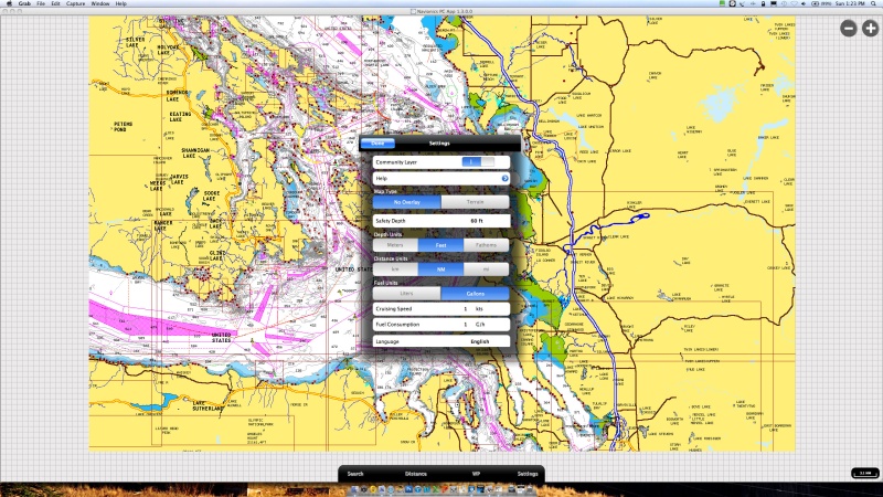
As far as I can tell this is the cheapest way to get Canadian charts on a computer. If you buy the same charts through X-Traverse, they run $250, and the Canadian government charges around $600 for their official charts, I believe. Navionics sells the 2XG region (Great Lakes, SE Alaska, Washington State, all Canadian coastal waters) for $30 through their online web store. As far as I can tell, these charts can only be used in the Navionics app which is available for Windows and Mac and included with purchase of charts. The chart files themselves have a .nv2 extension rather than the more common formats that are readable by a number of programs.
Here's a FAQ section about the app on Navioncs' website:
http://store.navionics.com/faqs
The real advantage of this app is the low cost access to Canadian charts. NOAA offers US electronics charts as a free download and then several different programs can be used to read them. This is not the case with Canada, but Navionics offers this low cost (and low feature) option. |
|
| Back to top |
|
|
JamesTXSD
Joined: 01 Mar 2005
Posts: 7481
City/Region: from island boy to desert dweller
State or Province: AZ
C-Dory Year: 2007
C-Dory Model: 25 Cruiser
Vessel Name: "Wild Blue" (sold 9/14)
Photos: Wild Blue
|
| Posted: Sun Feb 27, 2011 5:49 pm Post subject: |
|
|
All of US and Canada charts is available as an iPad app for $34.99. With the 3G model iPad, you have a built-in GPS (that absolutely does NOT need a cell connection to function, once the app is loaded); all the charts are contained in the app.
Compared to our MacBook Pro and iMac, there is a lot of things the iPad cannot do, but when it comes to a chartplotter app (and also for the iPhone and Droid, but at 25% the size of the iPad), this is pretty amazing bang for the buck.
I also bought the charts on disk from Managing the Waterways, that WILL replace the paper charts in our collection. We have always bought paper charts for any area we cruise in, but with the availability and function of: a laptop (with full charting), the iPad, the Droid, the Raymarine chartplotter, and a Garmin portable chartplotter as back up to the backup to the backup, I don't intend to spend another dime on paper charts. A cruising guide or two for any future trips, and we will call it good. Free updates on the Navionics apps... the cost of one or two paper charts is more than the cost of the app for ALL of the US and Canada.
The iPad app is so good for trip planning, that it is my go-to choice - beyond that of any of the PC software. A year ago, I would not have made that statement. The Blonde has always been "gotta have the paper charts" kinda navigator, and she is also completely good with all our electronic redundancy (that's quite an endorcement, btw).
Best wishes,
Jim B.
_________________
Jim & Joan
CD-25 "Wild Blue" (sold August 2014)
http://captnjim.blogspot.com/
 |
|
| Back to top |
|
|
starcrafttom
Joined: 07 Nov 2003
Posts: 7932
City/Region: marysville
State or Province: WA
C-Dory Year: 1984
C-Dory Model: 27 Cruiser
Vessel Name: to be decided later
Photos: Susan E
|
| Posted: Mon Feb 28, 2011 1:28 am Post subject: |
|
|
just loaded it and learning how to use it. figured out the routes saved and it will compute fuel burn for planning. that's neat. enter your mph and mpg and then go to your route and it will give you total time and fuel used. very cool. how do you export and can i export to a navionics chip?
_________________
Thomas J Elliott
http://tomsfishinggear.blogspot.com/ |
|
| Back to top |
|
|
thataway
Joined: 02 Nov 2003
Posts: 21356
City/Region: Pensacola
State or Province: FL
C-Dory Year: 2007
C-Dory Model: 25 Cruiser
Vessel Name: thataway
Photos: Thataway
|
| Posted: Mon Feb 28, 2011 5:34 pm Post subject: |
|
|
| Thanks for the link and the explanation. I'll probably stick to my i pad--and my feeling is very similar to Jim's. I have both the DVD's and the down loads on the i pad. But I can see if you don't have an i pad, that this gives the same charts at about the same price without the cost of an I pad. (i suspect that there will be a lot of gen 1 i pads for sale when the next gen comes out--and this may be a good buy for those who want the chart plotting/navigation features. |
|
| Back to top |
|
|
JamesTXSD
Joined: 01 Mar 2005
Posts: 7481
City/Region: from island boy to desert dweller
State or Province: AZ
C-Dory Year: 2007
C-Dory Model: 25 Cruiser
Vessel Name: "Wild Blue" (sold 9/14)
Photos: Wild Blue
|
|
| Back to top |
|
|
nlester
Joined: 20 Mar 2012
Posts: 1
City/Region: Wylie
State or Province: TX
C-Dory Year: 1986
Vessel Name: Gamefisheer
|
| Posted: Wed Mar 21, 2012 12:05 am Post subject: Navionics PC Apps |
|
|
I think the Navionics PC APPS is a great buy for the money and interesting to use. For stand alone use, it should work great. As far as it's ability to exchange information with the plotter on my boat, instructions for use and ease of use, I don't think it is ready for prime time yet. It seems like it is still in development and it has a ways to go.
Right now, I am leaning toward Lakemaster's Contour Elite. I downloaded the trial version of the Elite software. It seems easy to use and does everything that I need for way point selection and management. It seems intuitive. It is primarily intended for fishing. The trial verision of the software only includes one lake so I don't know how well it will function once I install a full version of the software. The people at SFS and Lakemaster were responsive to my questions, even with the trial version.
Last edited by nlester on Wed Mar 21, 2012 12:12 am; edited 1 time in total |
|
| Back to top |
|
|
Walldog
Joined: 03 Jan 2009
Posts: 334
City/Region: Port Isabel
State or Province: TX
C-Dory Year: 2014
C-Dory Model: R-27 Tug
Vessel Name: Willie's Tug
|
|
| Back to top |
|
|
|
 Search
 Private Messages
 Profile
 Log in
 Register
 Help
Help
