|
|
|
 Search
 Private Messages
 Profile
 Log in
 Register
 Help
Help
|
||||||||||||||||||
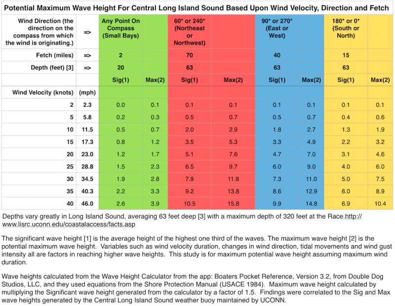
Potential Maximum Wave Height, customized for Long Island Sound, based upon wind velocity, direction and fetch. I no longer rely on the NOAA for predicted wave heights in my area, using them only for wind velocity and direction. I can also assess the Sea State easily based on a methodology from the following link: http://www.wdcs.org/submissions_bin/WDCS_Shorewatch_Seastate.pdf
|
||||||||||||||||||
